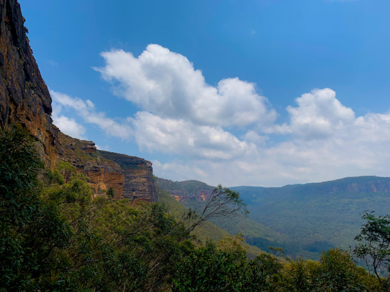
Castle Rock Trail, Nova Scotia
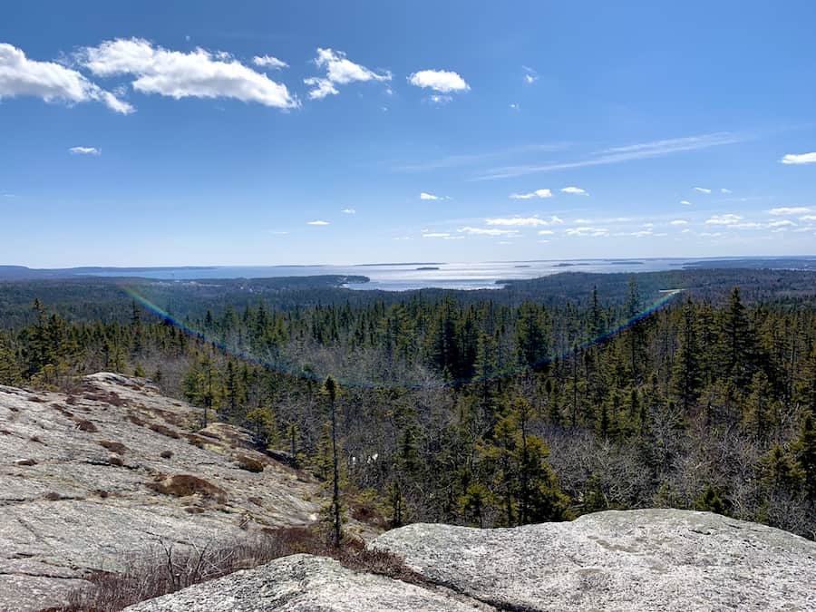
The Castle Rock Trail is a superb loop near East River, Nova Scotia. Extending from the Rum Runners Trail along a former rail bed, this hike takes hikers to the top of Castle Rock, offering a panoramic view of the Nova Scotian forest, East River, Mahone Bay, and the Atlantic Ocean.
The multi-use Rum Runners and Castle Rock Trails make these paths perfect for hiking, biking, and ATVs. In this article, we’ll focus on the enjoyment to be had when choosing to hike these awesome Nova Scotian trails!
Difficulty: Easy to Moderate
Length: 8.2 km
Suggested Duration: 2-3 hours
Signage: Signage and markers throughout
Facilities: Parking lot and benches
Disclaimer: This article includes affiliate links. If you click one of them, we may receive a small percentage of the sale at no extra cost to you. Thank you for your support!
Key Features Of Castle Rock Trail
- Offers stunning views of Mahone Bay and the Atlantic Ocean
- Passes through a mix of forested sections and rocky terrain
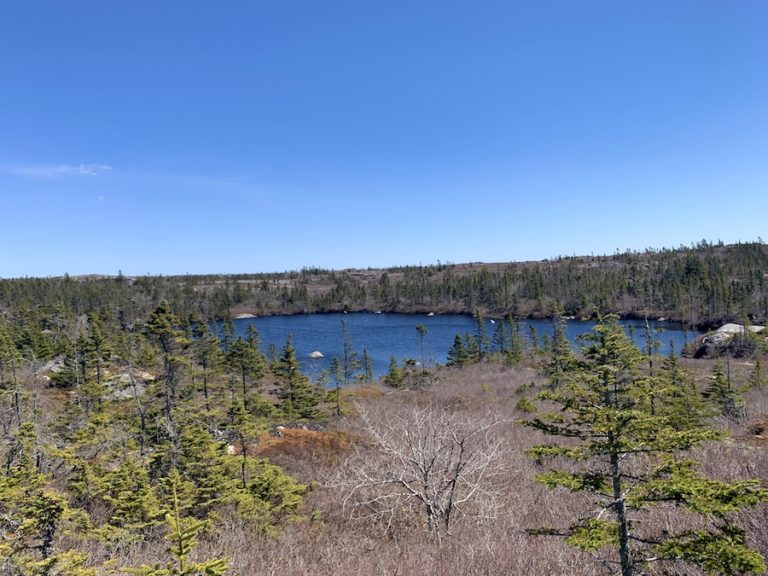
- Along Labrador Lake
- Great trails for snowshoeing in the winter
- Can be used for cycling and ATV’s
- Dog-friendly
Facilities And Services
- Small Parking Lot
- Picnic Tables / Benches
Before You Start Hiking Castle Rock Trail
As always, there are a few things to note before you begin hiking the Castle Rock Trail to better prepare for your hike.
The Castle Rock Trail begins on the Rum Runners Trail on the Chester Connection Trail segment. You can either park alongside the road next to the Chester Connection Trail trailhead or at a small parking lot located a short distance further on the Aspotogan Trail (which is where we parked). You can see the parking lot and the route we took by clicking on the trail map located at the beginning of this post.
If you choose to start at the Aspotogan Trail parking lot, you will need to cross two roads before reaching the Chester Connection Trail, which the Aspotogan Trail turns into once you cross Highway 3.
From the parking lot near the junction of Highways 3 and 329 in East River, hikers will walk along the Chester Connection Trail for just under 2 kilometres before reaching the Castle Rock Trail trailhead. Don’t worry; there’s plenty of signage to show the trailhead!
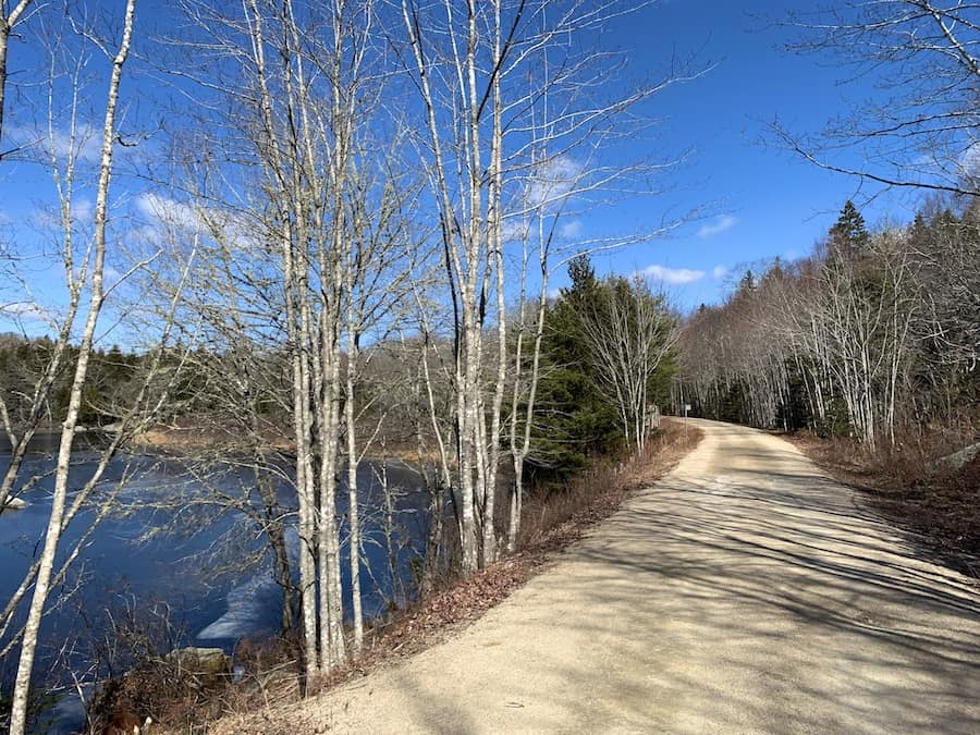
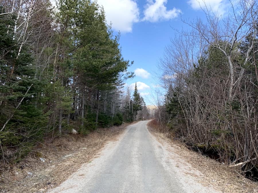
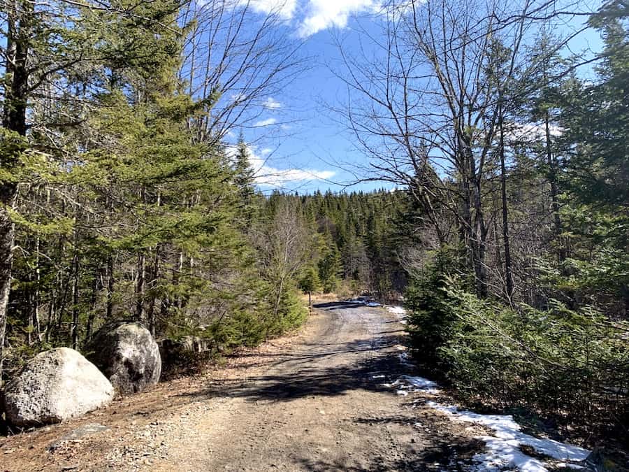
The Chester Connection Trail is groomed and easy to follow. This trail is accessible and stroller-friendly. However, the Castle Rock Trail is not.
This part of the hike is popular for dog walkers. It also makes for a great warm-up for the uphill climb to the top of Castle Rock.
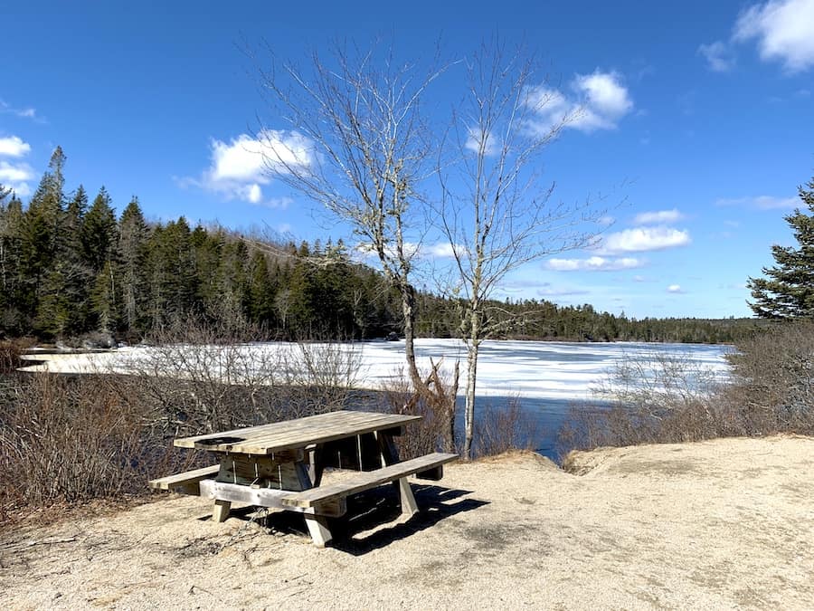
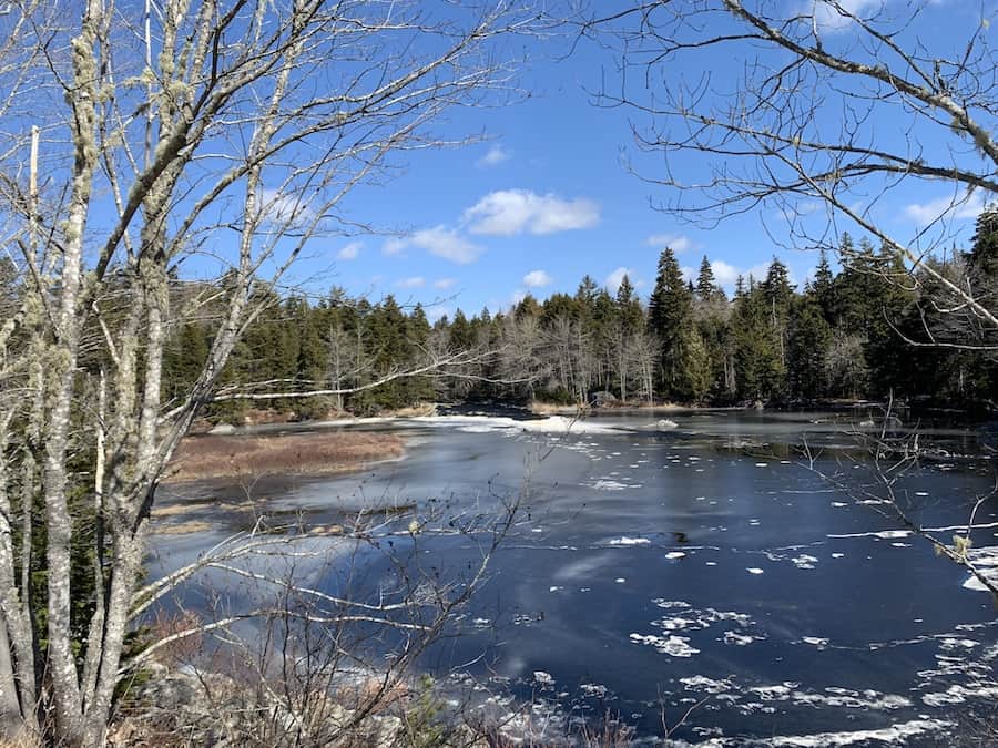
Further down the trail, you will reach Labrador Lake, where you can find benches that make for a great rest spot to take in the beautiful views.
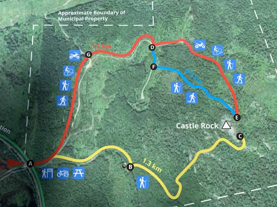
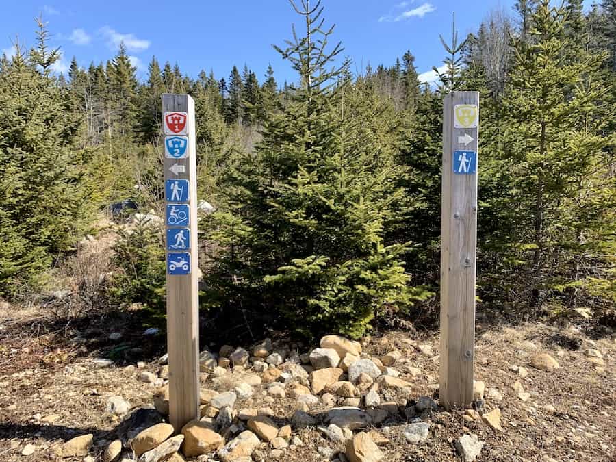
Finally, once you have reached the breakoff point to Castle Rock Trail, there will be a large sign with a map to help guide you along.
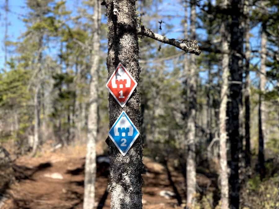
Here, you will have three options of trails to take to the top of Castle Rock. All three of the trails are colour-coordinated and well-marked throughout the trail.
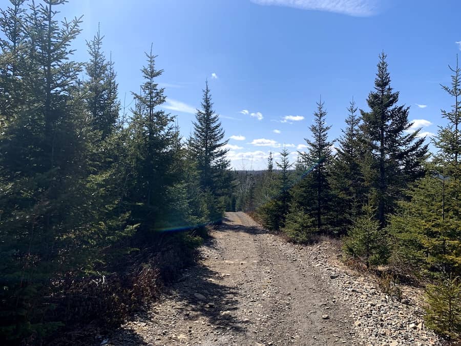
The Red Trail is the easiest of the three. It features a gradual incline up to the top with crushed rock terrain.
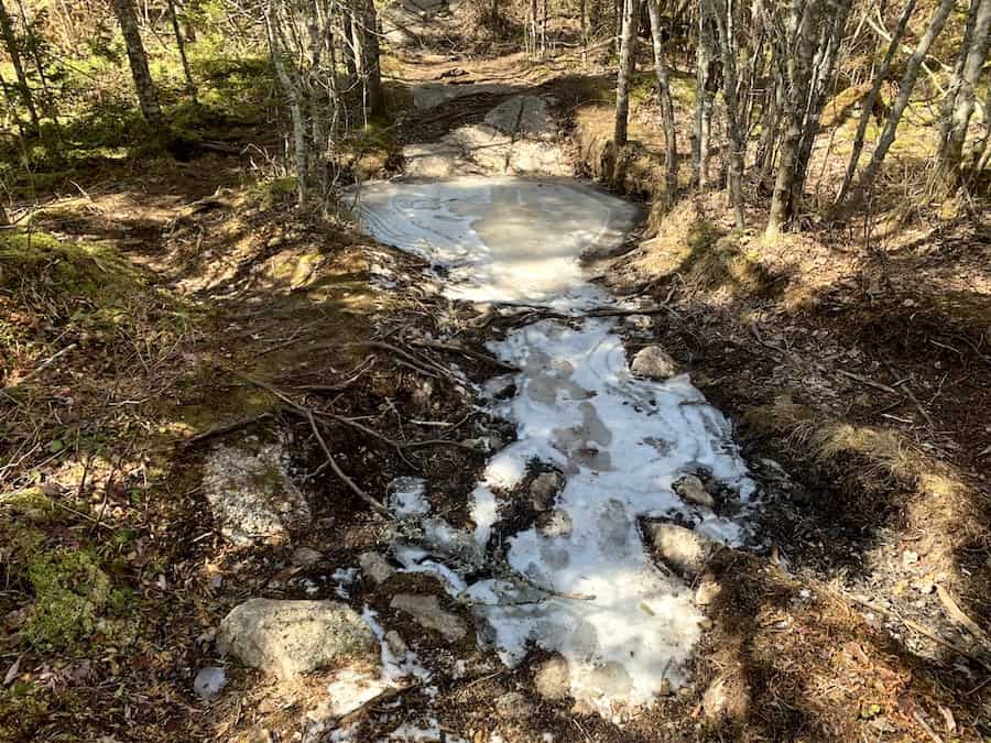
The Blue Trail is moderate. This takes you along the crushed rock trail and then through the woods. We found this trail, in particular, to be quite muddy and icy in places (more so in the winter months). It does appear to have a bit of flooding along the trail, and hikers should ensure they have water-friendly shoes if they choose this route (especially after rainfall).
Both the Red and Blue Trails are meant to be shared with hikers, mountain bikers, ATVs, and snowshoers in the winter months.
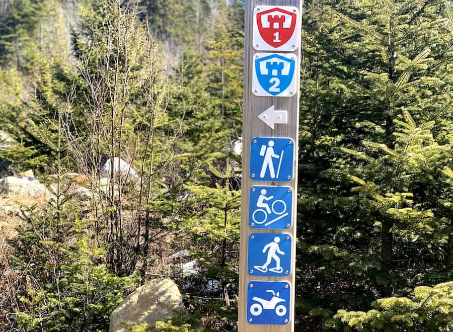
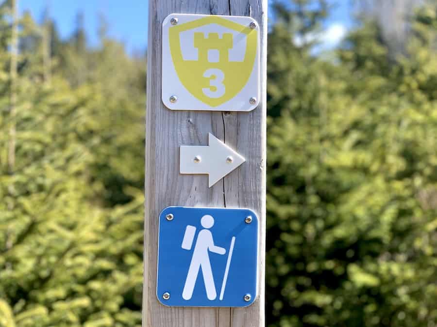
And lastly, the Yellow Trail is the hardest of the three. This trail goes through the woods and poses a bit of a challenge with varying terrains and inclines (in our opinion, this is the most scenic and fun trail to take)! The Yellow Trail is only meant for hikers.
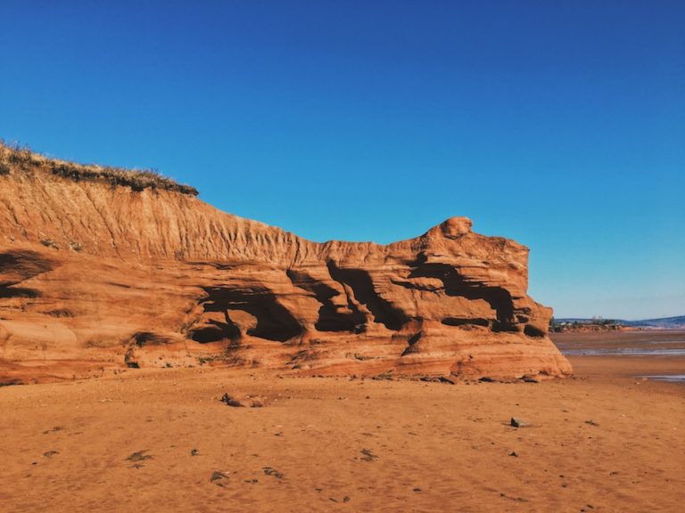
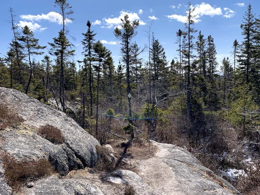
Another thing to note is once you get closer to the top of Castle Rock, you will need to scramble a bit over some larger rocks. The view from the top is absolutely worth the little bit of extra elbow grease it takes to get there.
Our Experience Hiking Castle Rock Trail
We made hiking the Castle Rock Trail a day trip from Dartmouth. It only takes about 45 minutes to drive from the city to the parking lot near Highways 3 and 329 in East River. It was a bright and sunny day in late March, and the weather was pleasant.
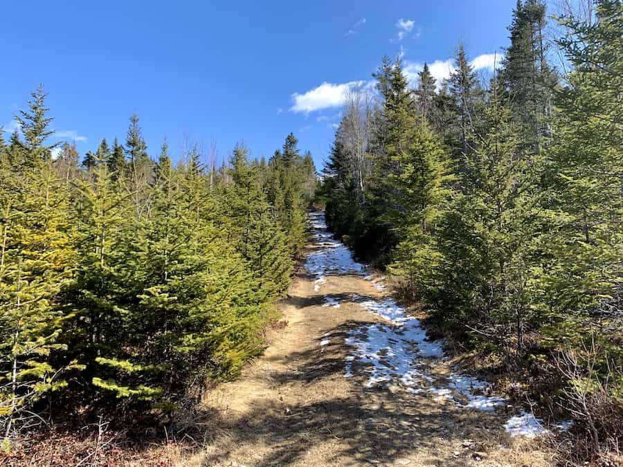
The parking lot was easy enough to find. We parked the car, grabbed our gear, and made our way toward the Castle Rock Trail via the Rum Runners Trail.
Starting on the relatively flat crusher dust trail was a great warm-up for the climb to come.
The Rum Runners Trail is part of the Rails To Trails System. We’re familiar with the BLT Trail portion, which happens to connect one of our favourite hikes (the Bluff Wilderness Trail) to its respective parking lot. The Rum Runners Trail was very similar.
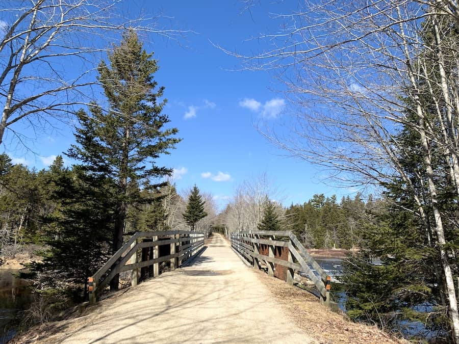
Between the parking lot and the Castle Rock Trail trailhead, we would cross Highway 3, walk under Highway 103, pass several bodies of water and cross one bridge. Though the terrain is simple to navigate, there’s plenty of scenery to take in on this first portion of the hike!
At the Castle Rock Trailhead, we came upon a large map that indicated the three different routes. It shows the rated difficulties, the lengths of each, and which trails are ATV, bike, and snowshoe friendly (see map below for reference).
Naturally, we gravitated towards the Yellow Trail as it is the most difficult of the three, and we love a challenge! Before our outing, we heard that this was the best and most scenic trail, so we had to see it for ourselves.
That plan was to hike up the steeper, more difficult trail and come back down on the gentler trail. That way, we could get the most challenging climb and the easiest descent, all while completing as much of the trail as would be practical.
All the trails begin on a groomed dirt pathway that eventually splits into a fork where you can select which route you want to take to the top.
The Red Trail is fairly easy and wide (certainly wide enough for ATVs). As to be expected, there were a few muddy patches along the way that were easily side-stepped.
Upon reaching the fork, we continued on the Yellow Trail to the right to begin the ascent.
The beginning of the trail started with a relatively steep incline that definitely got our hearts pumping. Though relatively steep, the terrain was easy. The trail is wide, and there are few rocks and roots to watch out for.
Before long, we reached the denser part of the trail. The narrow paths and exposed rocks that would follow are quintessential of Nova Scotian hikes. We were right at home!
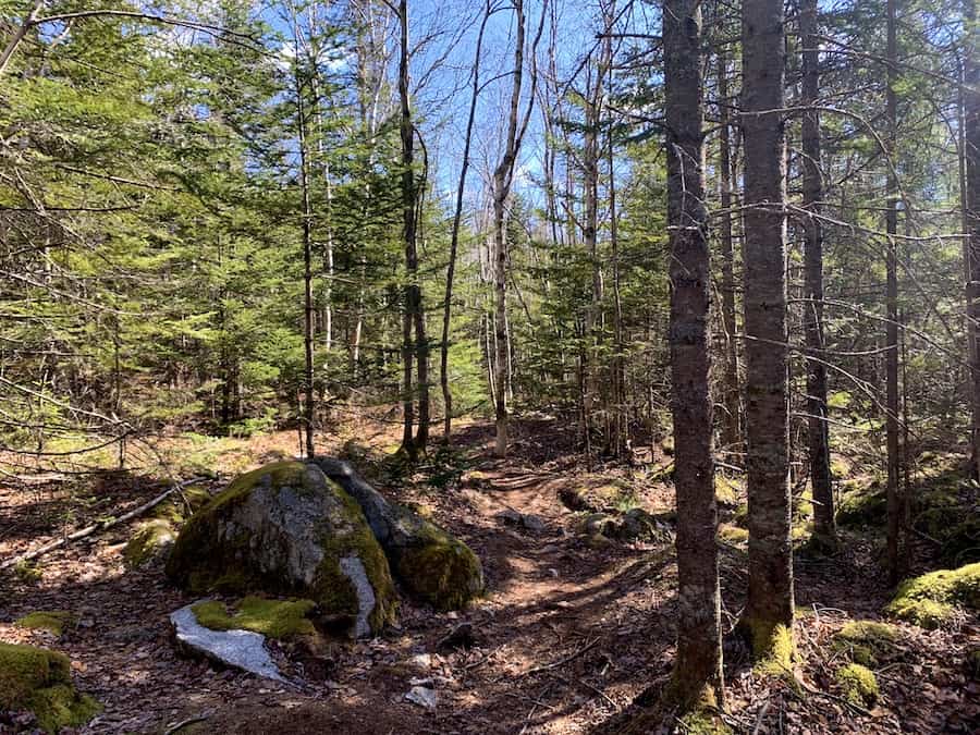
The trails are easy to follow and well-marked. Even in the densest part of the Yellow Trail, the path forward is obvious.
After roughly 1 km of uphill hiking, we could see the summit. Following the trail would bring us to a relatively simple scramble to the top.
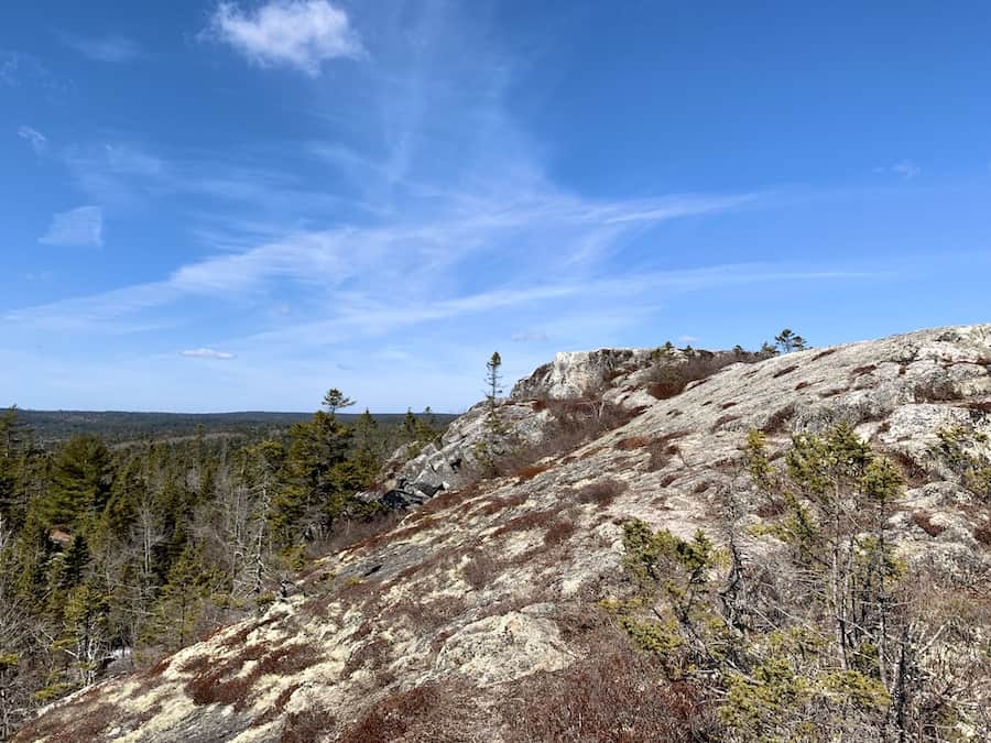
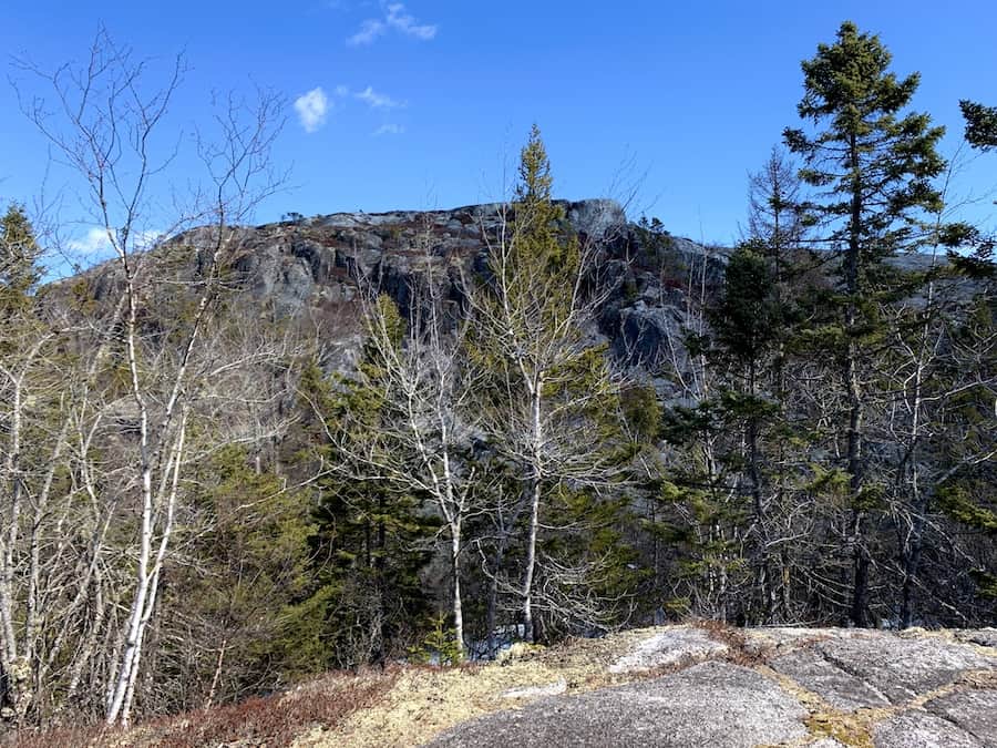
The lookoff point from the top offered an incredible panoramic view of the area. We took in the views of the wilderness around us and, of course, the ocean to the south.
For the length of the trail, this is an awesome payoff. We highly recommend this hike.
For the descent, we decided to start on the Blue Trail and connect to the Red Trail. The trails are conjoined for a short distance near the summit before splitting apart. There were plenty of markers to tell us which trails we were on.
Though there was little snow to be found by this time of year, the Blue Trail was remarkably icy. What would be ice in the winter months may very well be flooding and puddles during the warmer months. Be sure to bring proper footwear for the Blue Trail if you decide to take this path.
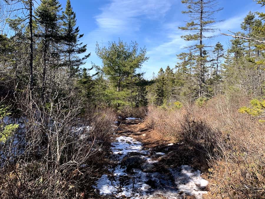
The Red Trail was certainly the easiest and most gentle of the three trails. Its crushed rock terrain was similar to the Rum Runners Trail / Chester Connection Trail, though there is more of a slope. This portion of the trail is wide, dry, and suitable for hiking, biking, and ATVs.
As we got back to the Chester Connection Trail, it was only a short walk back to the car. We got back safely with another excellent Nova Scotian hike completed!
Checklists And Recommended Gear
While Castle Rock Trail is not an overly strenuous hike, due to the length and changing terrain, we suggest bringing some gear with you.
- Water bottle
- Hiking Shoes – Women’s // Men’s
- Camera/Phone to take photos
- Sunscreen
- Hat
- Insect repellent
- Cascade hiking poles
- Atlantick tick removal tool kit
- Snowshoes (seasonal)