Hiking The Crowbar Lake Trails In Nova Scotia
The Crowbar Lake Hiking Trails are an excellent series of trails within the Waverley Salmon River Long Lake Wilderness Area. The trailhead is accessed by a small parking lot just off Myra Road in Porter’s Lake. The trails take visitors through the thick Acadian Forest, around beautiful Nova Scotian lakes and glacier rock, and up/down some decent inclines/declines.
Combining all the trails together gets us about 18 kilometres of total hiking. Choose from a short loop, an out-and-back hike, or an in-and-out with one of two loops at the far end.
Difficulty: Difficult
Length: 18 km total (4 interconnecting trails)
Suggested Duration: 0.5 to 7 hours
Signage: signage at break-off points, trail markers throughout
Facilities: small parking lot
Disclaimer: This article includes affiliate links. If you click one of them, we may receive a small percentage of the sale at no extra cost to you. Thank you for your support!
Crowbar Lake Trails
- Porters Lake Loop (2.2 km roundtrip)
- Spriggs Brook Trail (4.9 km one way)
- West Lake Loop (14.2 km via Spriggs Brook Trail)
- Salmon River Loop (17.1 km via Spriggs Brook Trail)
Key Features Of The Crowbar Lake Trail
- Located within the Waverley Salmon River Long Lake Wilderness Area
- Offers various trail options with different lengths and difficulty levels
- Ideal for hiking, mountain biking, snowshoeing, and cross-country skiing
- Passes through a mix of forested areas and diverse terrain
- Opportunities for birdwatching and wildlife sightings
- Dog-Friendly (on-leash)
- Outback camping
- Lake and river access points for swimming
Facilities And Services
- Small parking lot
Before You Start Hiking The Crowbar Lake Trail
Before you make your way to the Crowbar Lake Trail for your own adventure, there are a few things worth noting.
The parking lot is rather small, which means you may have to park elsewhere if the lot is full. Myra Road is fairly narrow, so park at your own risk!
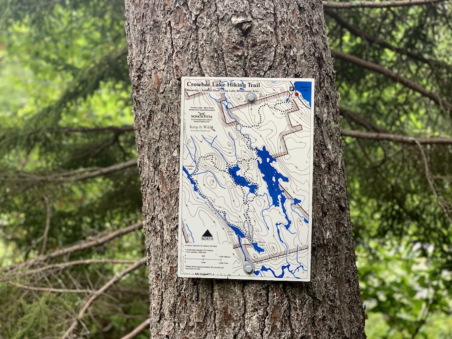
You’ll find a map of the Crowbar Lake Hiking Trail in the parking lot.
Note that there is another road that reaches the Salmon River Loop near Otter Lake. However, this is a private dirt road with a sign stating, “Private Road|Absolutely No Tresspassing|Owners And Guests Only.”
Therefore, the parking lot off Myra Road is the way to go. We want to mention this to avoid confusion if you make your way through the largest loop and come across an access road. It would be nice to start the hike on a loop, but I digress.
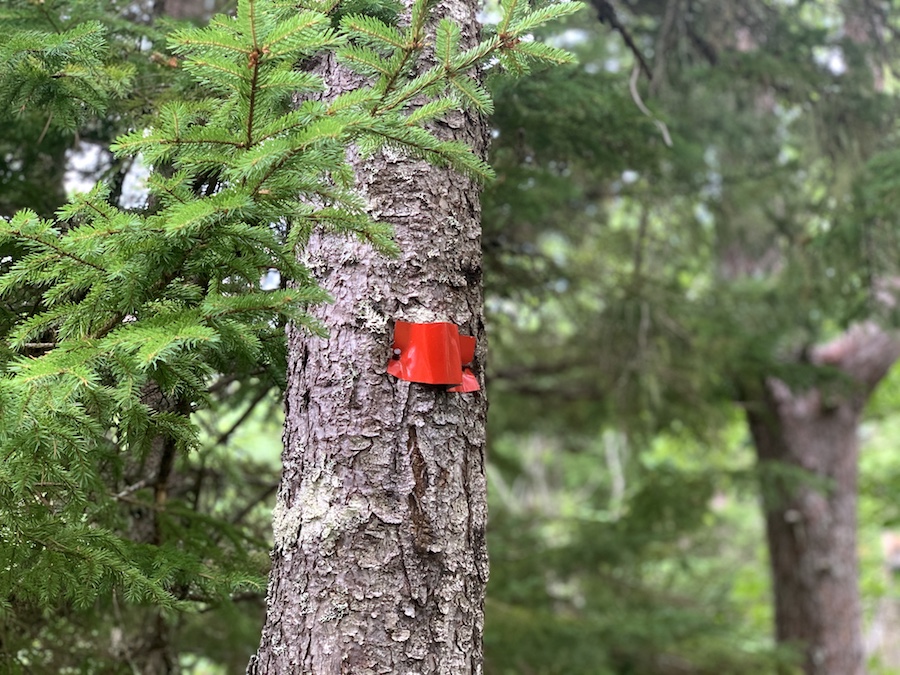
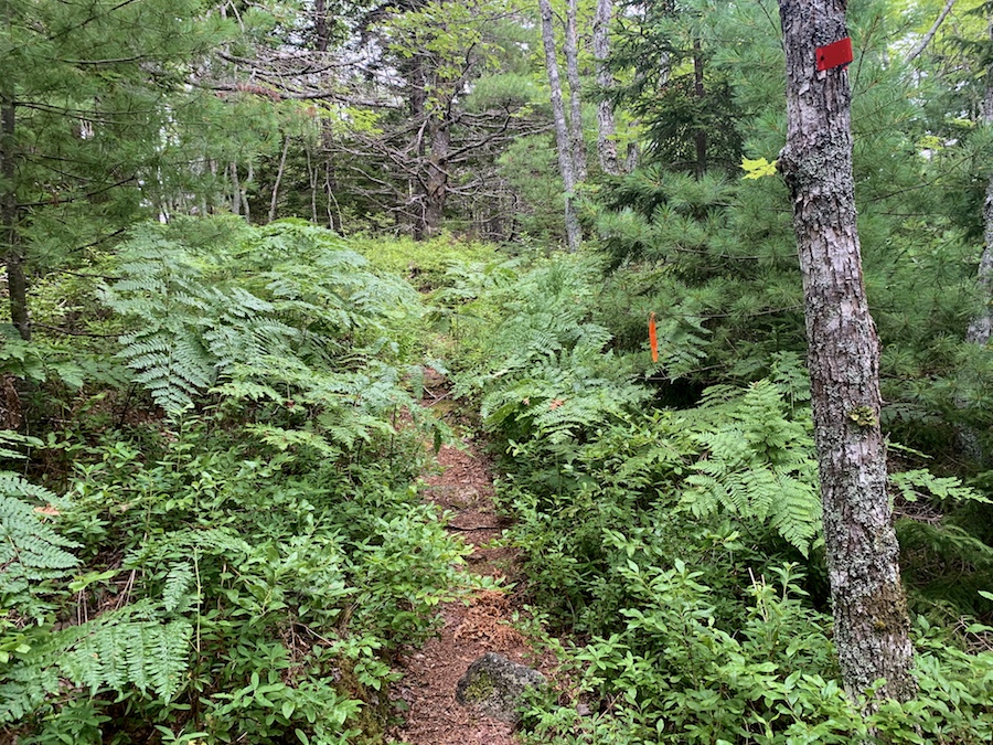
The trail is well-marked with tree markers, as shown below. It’s a fairly easy path to stay on.
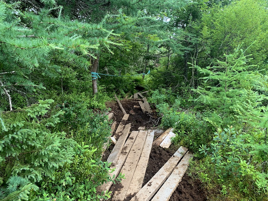
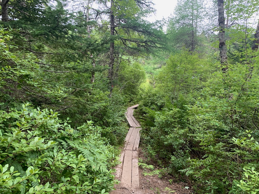
There is a fair bit of “front-country” or manmade planks and ropes to help hikers out. Some of the structures are in better shape than others, but they all make the hike a bit easier, especially in the muddier parts early on in the Spriggs Brook Trail.
The largest of the loops, called the Salmon River Loop, is quite overgrown and can be quite a challenge to get through.
Remember that ticks are present in Nova Scotia, so it’s important to practice tick checks, especially in bushier trails (like the Salmon River Loop). We highly recommend bringing a tick removal tool. For more information on tick prevention, check out our article How To Avoid Ticks When Hiking.
Camping is permitted in the wilderness area. The length of the trail makes it a great choice for an overnighter.
Other than that, expect to see plenty of beautiful scenes along the trail. The trails pass by several lakes, so if the weather’s nice enough, it may be a great day to go for a mid-hike swim!
Our Experience Hiking The Crowbar Lake Trail
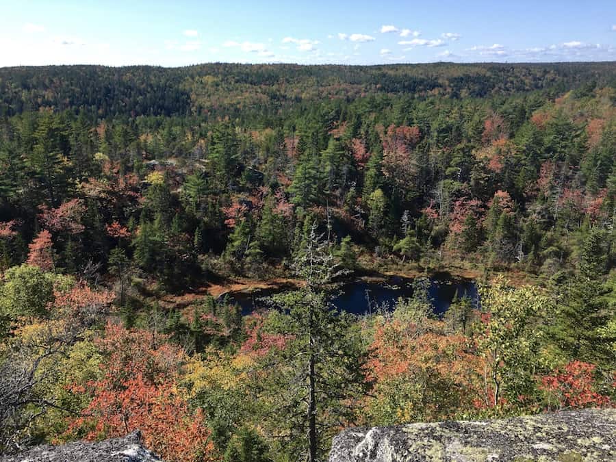
We’ve actually hiked through the Crowbar Lake Trails several times. It’s one of our favourites near Halifax/Dartmouth, especially in September and October when the leaves start to turn colour.
The pictures you’ll see in this article were taken before most of the trees began turning. You’ll spot a few red ones, but, for the most part, it was a green hike.
Fortunately for us, each time we made it out to the Crowbar Lake Trail, there was space in the small parking for us to park.
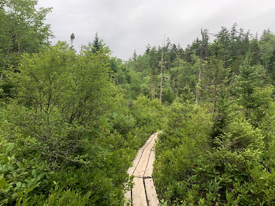
The trail begins with a pretty decent incline and features a small pond with wooden planks around its edge. What a perfect way to start a hike!
Here’s a photo of the trailhead:
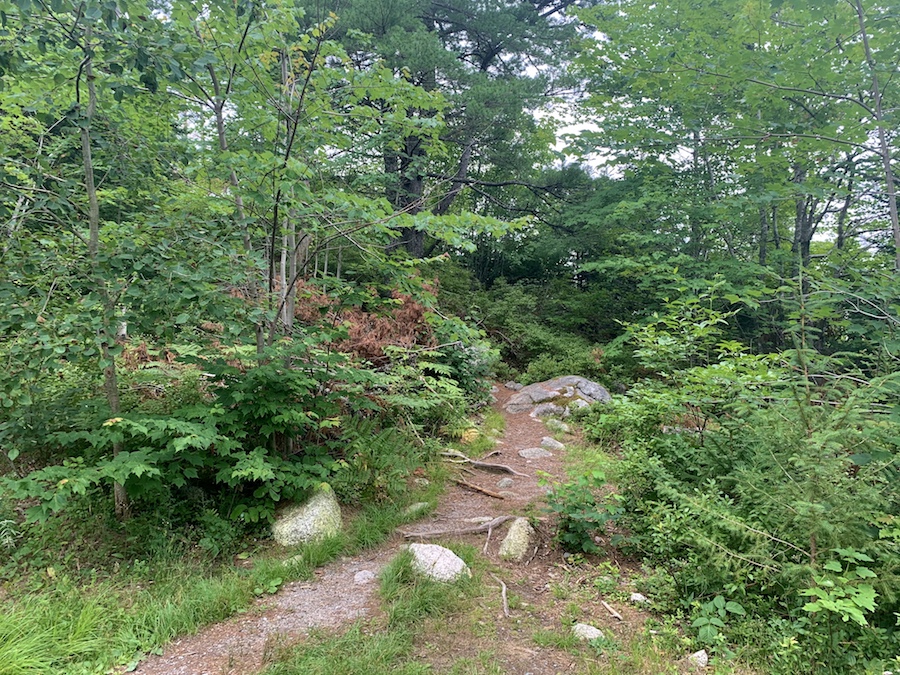
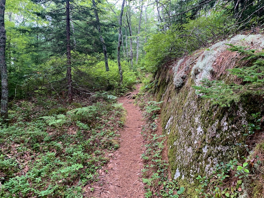
We can see that the earlier parts of the hiking trail are nice and wide. The incline is made easier with the rocks.
Here are a few photos to show the early pond and planks:
About half a kilometre in, just past the pond, there is a split in the trail. This offers hikers two ways to continue on the Spriggs Brook Trail, though both options connect to continue on the main trail.
The choice to the right connects back to the main trail in 0.6 km, while the left choice takes 0.8 km.
These options make up the 2.2 km Porters Lake Loop, a popular option for those looking for a shorter hike. We prefer to take one path on the way in and the other path on the way out.
At the junction where the trail meets up, hikers will have gone from about 15 m elevation to 100 m elevation. That’s enough to get the heart pumping, and the body warmed up!
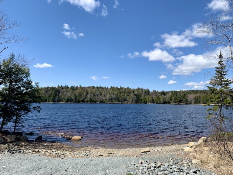
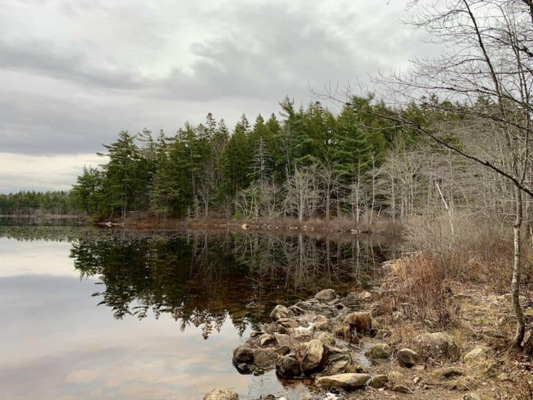
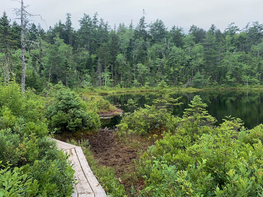
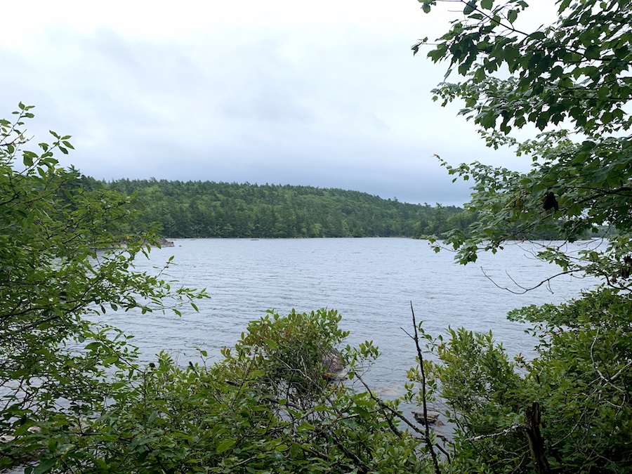
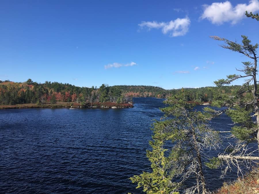
It would be just over 3 km until we reach Granite Lake, the first large lake we would feel comfortable swimming in.
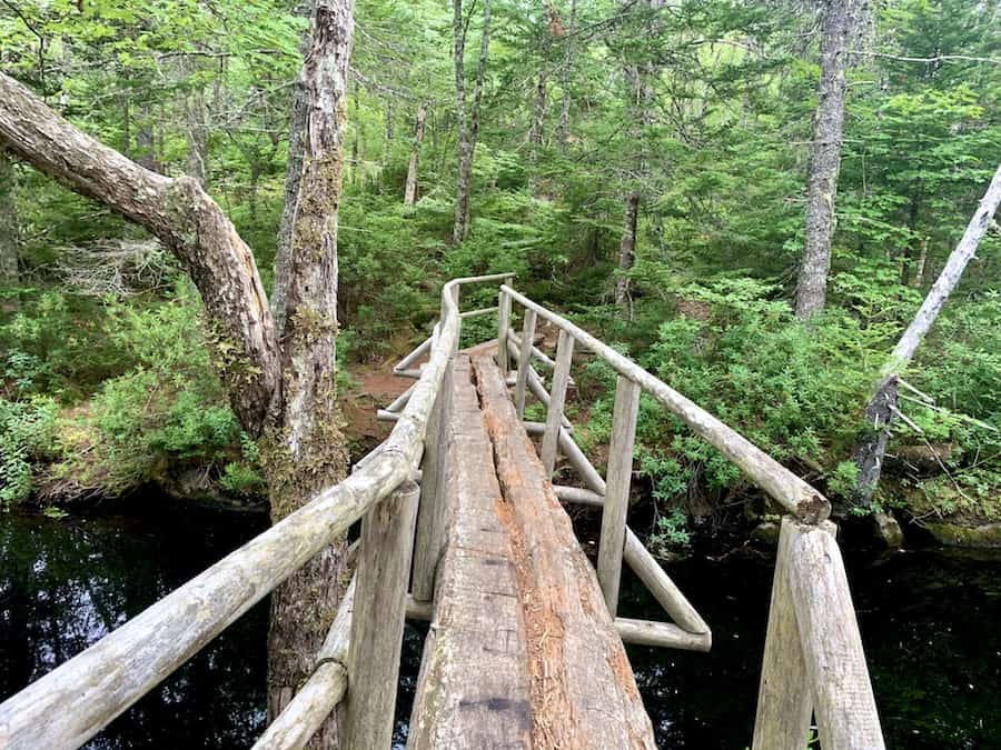
Before getting there, we would hike through wide forest trails and cross a brook via a man-made wooden bridge (pictured below):
Personally, we don’t like swimming during day hikes. However, this would be a nice spot if we were ever to camp out along the trail.
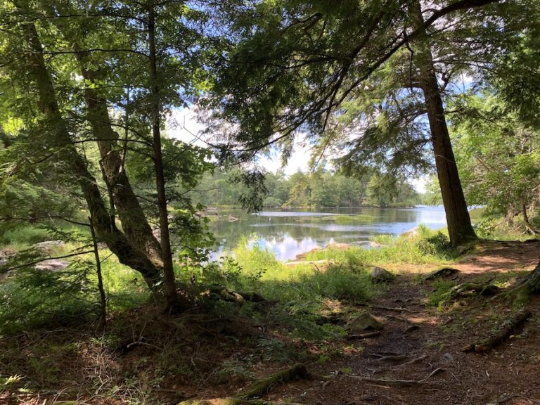
A short incline west of Granite Lake brought us to another split in the trail. This is where the larger loops begin and a great point to either continue or turn back.
Both the West Lake Loop and the Salmon River Loop share the same paths from this crossroads. The West Lake Loop cuts through on the other side of West Lake (a total loop of 4.5 km to bring hikers back to the split). The Salmon River Loop continues to Barren Lake to the south and follows the Salmon River between Otter Lake and Crowbar Lake before returning to the split (a total loop of 8.9 km to bring hikers back to the split).
We have yet to do the West Lake “shortcut,” though we have completed the entire Salmon River Loop. How could we hike the “Crowbar Lake Trail” without getting to Crowbar Lake?
On this day, we decided to do the loop clockwise, starting south toward West Lake.
The shared portions of the trail are narrower than the earlier sections. This is likely due to fewer hikers making it this far. There are plenty of markers in any location where there could be confusion about the right way to go.
Once we got to the West Lake/Salmon River split and continued to the Salmon River Loop, the trail got a bit narrower and even overgrown in some locations.
The hike was still enjoyable. However, there were a few instances (perhaps about a kilometre in total) where the trail looked like this:
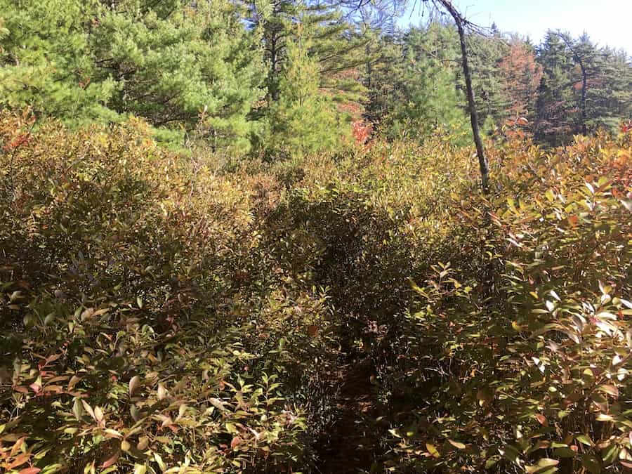
If you’re not into hiking through dense bushes, perhaps the West Lake Loop would be the best option for you.
We quickly made our way to Otter Lake. Here, the trail gets somewhat confusing. There is a private road nearby called River Drive (as mentioned in the Before You Start Hiking The Crowbar Lake Trail section of this article).
Well, there are several access points on that road. We took a wrong turn and wound up on River Drive, confused, having not heard about an alternate place to park. Unfortunately, as was discussed, the road is private, and the owners do not want the end of the road to be a parking lot for hikers.
Fortunately, we had a map handy, and we found our way back to the main trail.
The hike along Salmon River was an odd mixture of sensations. The river made it cool, the sun and lack of shade made it hot, and the thick bush of the trail kept our attention off the temperature!
By the time we made it to Crowbar Lake, the trail was opening back up.
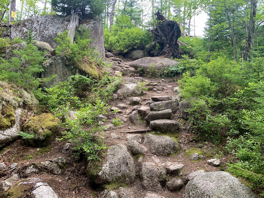
After Crowbar Lake, continuing clockwise, there’s a great incline of about 80 meters over 1 kilometre. This is about as challenging as the beginning of the hike.
The return to the parking lot took us back through the Spriggs Brook Trail. We made sure to take the second path near the trailhead to complete more of the overall hike.
That last decline on the way out makes the end of the hike a breeze. We got back to the car and drove home, having completed another awesome day hike!
Checklists And Recommended Gear
Depending on the trails you decide to hike through, this could be a short or a long hike. We recommend bringing some supplies with you regardless of how long you’ll be there.
- Water bottle
- Hiking Shoes – Women’s // Men’s
- Camera/Phone to take photos
- Snacks and/or lunch
- Sunscreen
- Hat
- Insect repellent
- Cascade hiking poles
- Atlantick tick removal tool kit
- Swimwear (seasonal)
- Snowshoes (seasonal)