Elephant Rock Loop In The Valley Of Fire State Park, Nevada
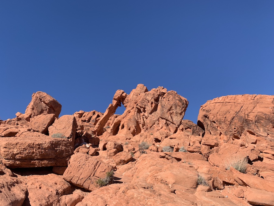
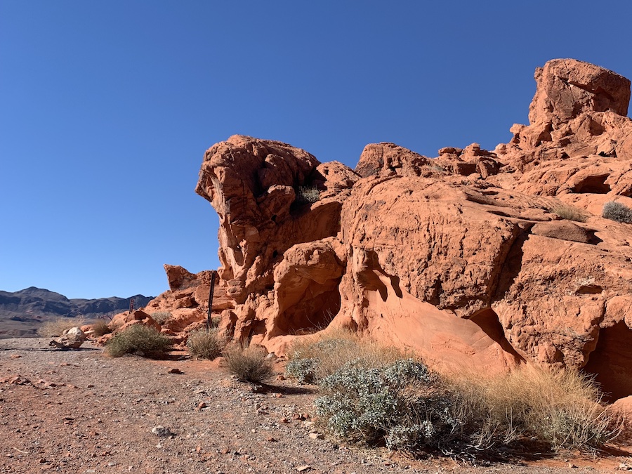
The Elephant Rock Loop is a short hike in the Valley of Fire State Park that features a unique sandstone arch formation that resembles an elephant (hence the name). There are two hiking route options: a 0.4-mile out and back or a 1.2-mile loop that also includes a section of the Old Arrowhead Road Trail. Enjoy the spectacular views of red sedimentary rock formations in the distance as you make your way to Elephant Rock.
Difficulty: Easy
Length: 1.2 mile / 1.9 km (loop) or 0.4 mile / 0.6 km (out & back)
Suggested Duration: 15 to 30 minutes
Signage: Some signage throughout
Facilities: Visitors center, restrooms, water refill stations
Disclaimer: This article includes affiliate links. If you click one of them, we may receive a small percentage of the sale at no extra cost to you. Thank you for your support!
Key Features Of Elephant Rock Loop
- Located in Valley of Fire State Park, the oldest state park in Nevada
- Features the iconic Elephant Rock formation
- Passes through stunning red sandstone landscapes
- Offers striking desert vistas and photo opportunities
- Suitable for hikers of various skill levels
- Connects to Old Arrowhead Road Trail
Facilities And Services
- Parking at the East side entrance
- Restrooms
- The visitor centre is a short drive away (restrooms and water fill stations are located here)
Before You Start Hiking Elephant Rock Loop
Although Elephant Rock is a relatively short trail, there are a few things to know prior to arrival. First, there are two entrances to the Valley of Fire State Park, one on the west and one on the east side. Elephant Rock is located directly past the entrance gate on the East side. You are required to pay a fee at both entrances to enter the Valley of Fire State Park.
As of November 2022, the fees are as follows:
- US$10 for Nevada Vehicles
- US$15 for non-Nevada Vehicles
- US$2 for bikes
While you can see Elephant Rock from the road, you cannot stop or park there. You must park in the parking lot and walk over. For those wanting a short hike, you can complete the out-and-back trail that is only 0.4 miles (0.6 km). If you want a longer hike, you can continue onto the Elephant Rock Loop, which connects to a section of the Old Arrowhead Road Trail.
It is important to stay on the designated trail and watch for scorpions and snakes. Please remember to follow the Leave No Trace Principles whenever you are out enjoying nature. Whatever you take in, be sure to take out. Do not feed any wildlife or leave any trash. In addition, please refrain from trying to climb the structure.
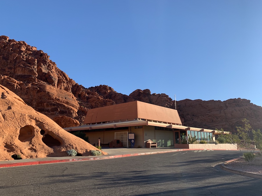
There are restrooms located at the Elephant Rock parking lot. In addition, there is a visitors’ center within the park that features souvenirs, restrooms, water refill areas, and a help desk, where you can see which trails are open (some trails may be closed due to extreme heat). We highly encourage bringing lots of water and reusable water bottles to refill at the visitor center when needed.
You can download digital park maps for free on the Avenza Maps App. We recommend you download the app and map before hiking, as the service can sometimes be spotty within the park.
To learn more about the Valley of Fire State Park, click here!
Our Experience Hiking Elephant Rock Loop
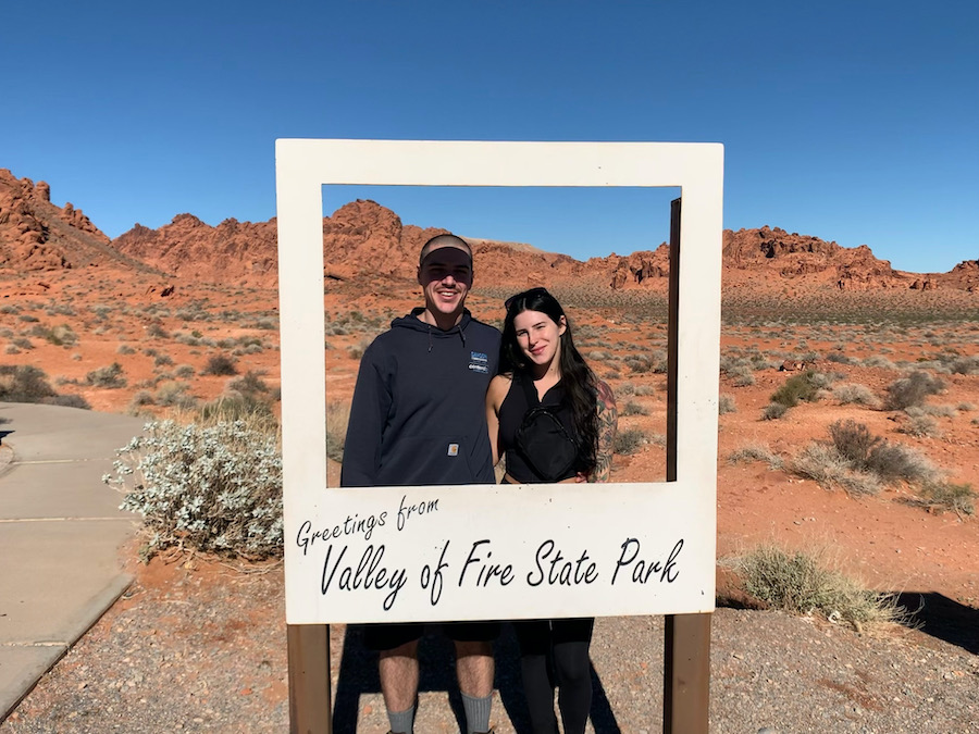
We explored the Valley Of Fire Park from West to East, leaving the Elephant Rock Loop the last hike we completed for the day. When we arrived at the parking lot, we saw a little Polaroid photo spot – which, of course, we had to snag a photo of before we started hiking.
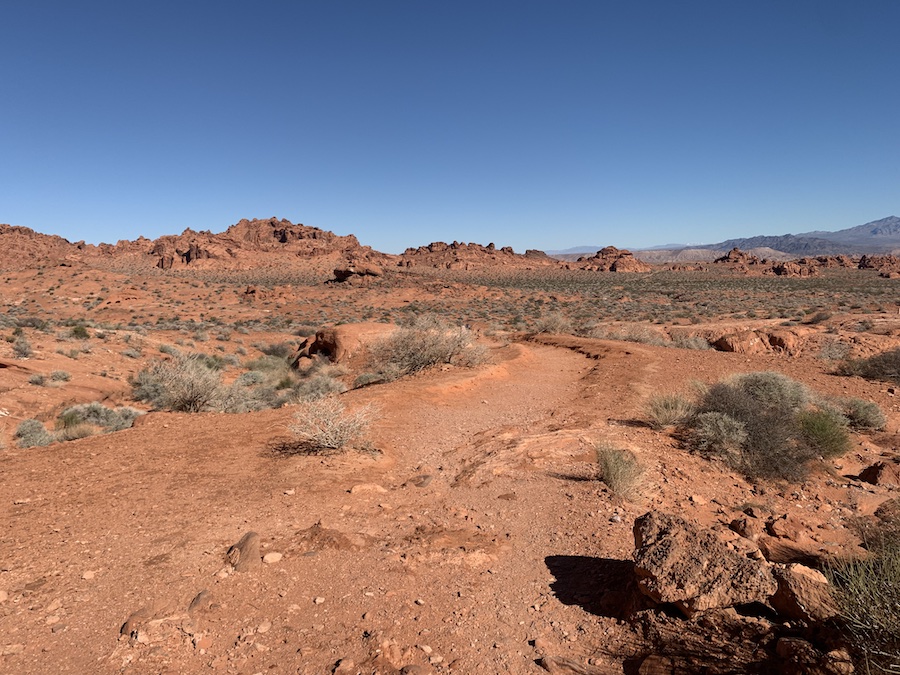
From here, we found the sign that pointed to the Elephant Rock Trail and began hiking. Now, this trail is directly in the sun with no shade. On a warmer day, this could have been more challenging with the added stress from the sun. But, due to the cooler weather and shortness of the hike, it was relatively easy.
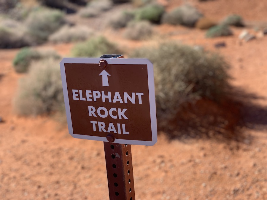
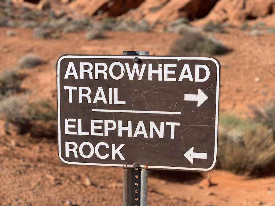
Other than a few signs indicating which way the Elephant Rock Trail and Arrowhead Trail were, there were not many other signs or trail markers along the way. While the trail seemed defined initially, we lost it a few times and had to look around to get back on it. Nonetheless, this is a beautiful, flat trail that looks out onto large red sandstones.
When we reached Elephant Rock, we were a little surprised to realize it was directly beside the highway. If you were allowed to stop on the road, you would literally be right beside it – but where is the fun in that? The trail offers hikers a great way to stretch their legs and also makes for a fantastic spot to catch a sunset.

A portion of the hike will take hikers onto the Arrowhead Trail. This is a wonderful trail, with picturesque rock formations in the distance. If you have free time and want to extend the Elephant Rock trail, we highly suggest completing the full Elephant Rock loop that gives you a sneak peek at the Old Arrowhead Road Trail.
Checklists And Recommended Gear
While the Elephant Rock Loop may be short, it is important to prepare accordingly, as the desert heat is no joke. The following is our recommended gear list.
- Jacket (weather-depending)
- Water bottle
- Hiking shoes – Women’s // Men’s
- Camera/Phone to take photos
- Sunscreen
- Hat
- Insect repellent
- Cascade hiking poles
Related Hikes
Other Hikes In The Valley Of Fire State Park
- Fire Wave Trail
- Pastel (Pink) Canyon Trail
- White Domes Trail
- 7 Wonders Loop
- Arrowhead Trail
- Rainbow Vista
- Balancing Rock
- Charlie’s Spring
- Natural Arches
- Mouse’s Tank
- Pinnacles Loop
- Prospect Trail
Other Hikes In Nevada
- Red Rock Canyon National Conservation Area
- Mount Charleston Wilderness Area