Hikers Guide To The Valley Of Fire State Park In Nevada
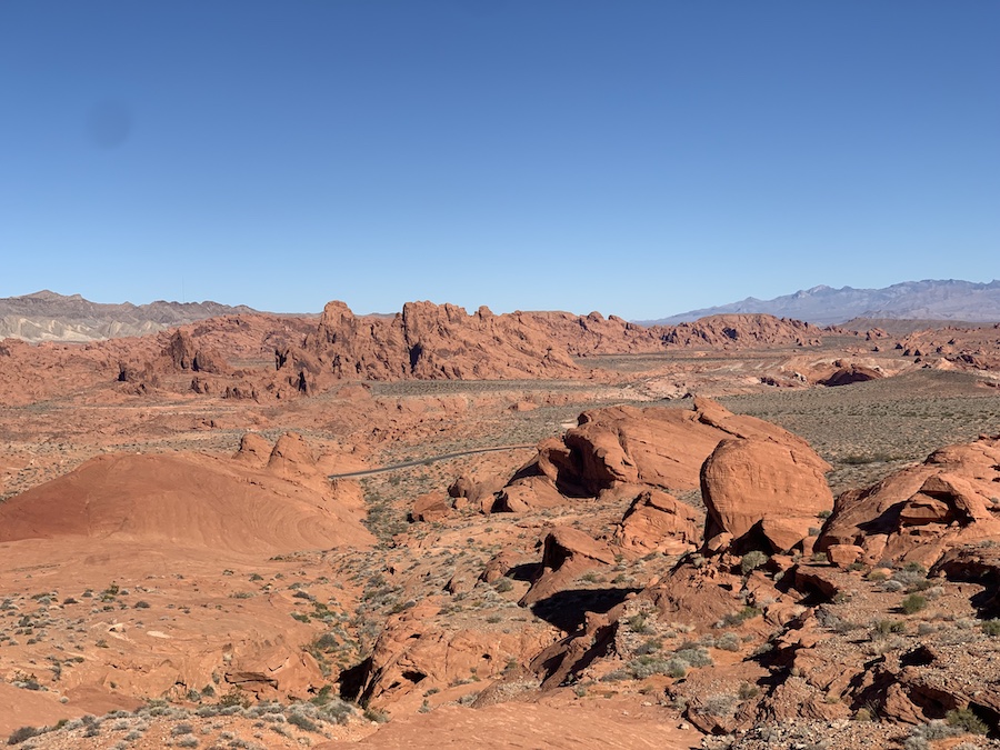
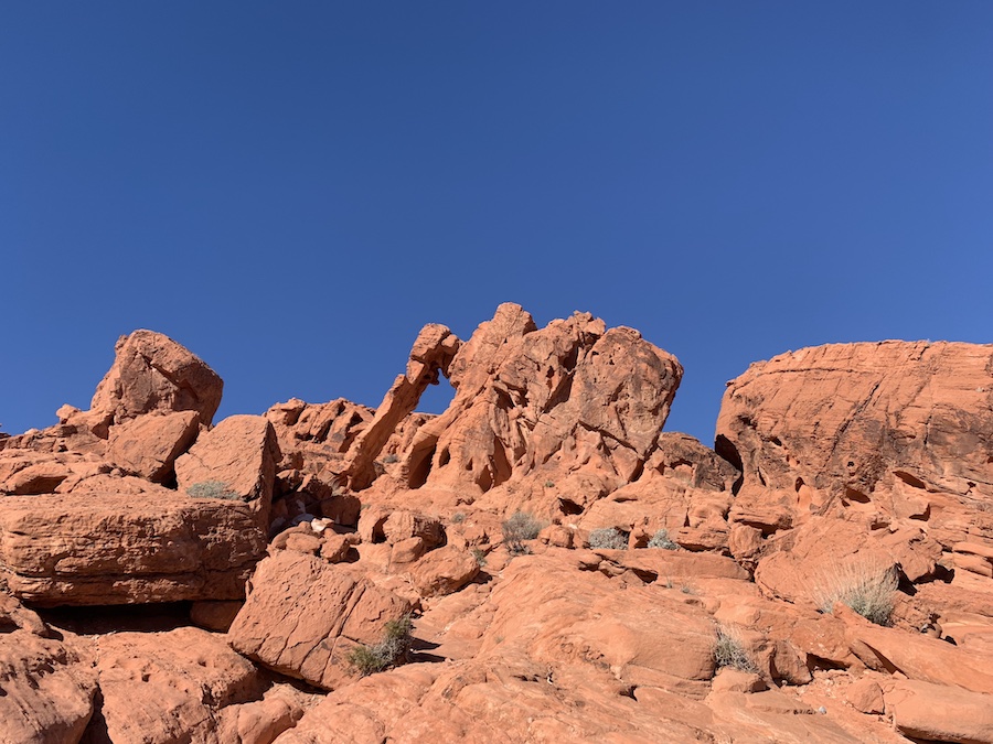
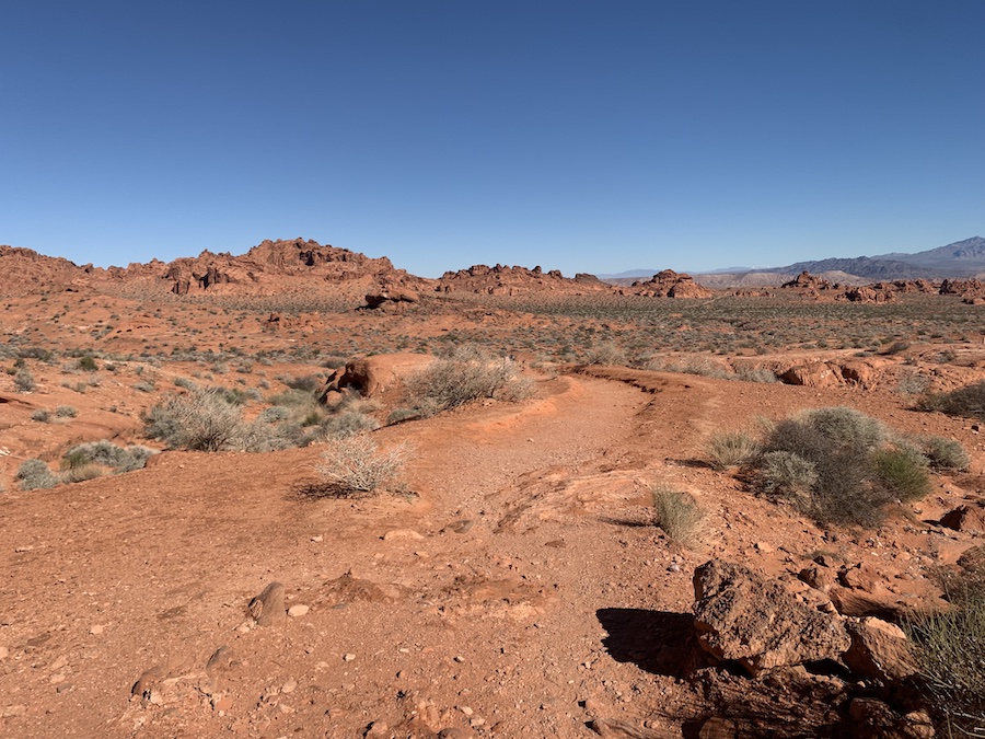
The Valley of Fire State Park is the oldest state park in Nevada and offers over 40,000 acres of red Aztec sandstone, campsites, hiking trails and lookouts. Located just under an hour from Las Vegas, the Valley of Fire is an excellent escape from the busy city for a day or overnight trip. The hiking trails are not overly long, and you can complete multiple within one day trip. If you travel through the park for sunset, you will see where it gets its name, the Valley of Fire.
Difficulty: Easy to moderate
Suggested Duration: full day
Signage: Maps, signs and markers throughout the trail
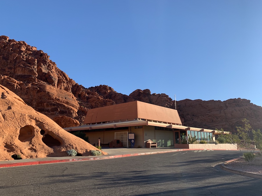
Facilities: Visitor center, washrooms, water fill station, parking
Disclaimer: This article includes affiliate links. If you click one of them, we may receive a small percentage of the sale at no extra cost to you. Thank you for your support!
Key Features Of The Valley Of Fire State Park
- Nevada’s oldest and largest state park
- Over 40,000 acres of vibrant desert landscape
- Known for its stunning red sandstone formations
- Offers diverse hiking trails with unique geological features
- Home to iconic landmarks like Elephant Rock and Fire Wave
- Has camping facilities and recreational opportunities
- Features ancient petroglyphs and a visitor center with educational resources
- Rich in desert flora and fauna, including bighorn sheep
Before You Start Hiking The Valley Of Fire State Park
Before hiking the Valley Of Fire State Park, there are a few things to note. There are two main entrances to the park, one on the west and one on the east. There is a toll at each entry. For day use, it costs US$10 for Nevada vehicles, USD 15 for non-Nevada vehicles and USD 2 for bikes.
To camp at the Valley Of Fire, reservations need to be made. There are only three group campsites. The cost is USD 20 for Nevada vehicles and USD 25 for non-Nevada vehicles per vehicle/night. Camping is only permitted at designated camp areas.
If you’re travelling from Las Vegas to the Valley Of Fire, it will take you just under an hour to drive. Even if hiking is not your thing, you can still enjoy the beauty of the State Park by driving through it. You can either admire the breathtaking views from your car or make a stop at one of the many parking lots to take in the scenery.
If you’re interested in hiking, there are separate parking lots available for each trailhead. Some of the trails also interconnect with each other, allowing you to complete multiple hikes in one go. For instance, the Fire Wave Trail extends to the Seven Wonders Trail, Pastel (Pink) Canyon Trail, and White Domes, enabling you to finish a large loop.
There is a visitor center which includes information about the state park, souvenirs, restrooms, water bottle refill areas, and books. Its hours of operation are 9:00 a.m. to 4:00 p.m. Digital park maps can be downloaded for free on the Avenza Maps App. We encourage you to download the app and map before hiking, as the service can be spotty at times within the park.
Pets are welcome on leash only. It is important to follow the Leave No Trace Principles whenever you are out enjoying nature. Whatever you take in, be sure to take out. Do not feed any wildlife or leave any trash. In addition, please stay on the designated trail.
Hiking Trails In The Valley Of Fire State Park
Valley of Fire State Park boasts numerous hiking trails of varying difficulty, all featuring spectacular views of sandstone formations.
Fire Wave Trail
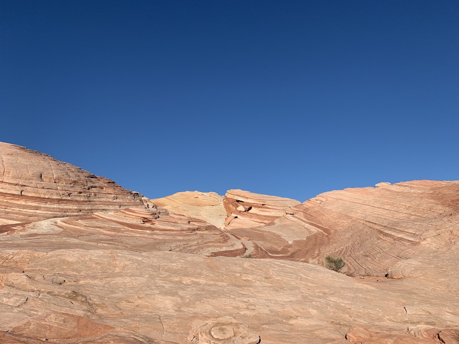
The Fire Wave Trail is a relatively new trail to the Valley of Fire State Park, which is why it may not appear on some of the older maps. It has a unique rock pattern that resembles the iconic Wave Trail. The Fire Wave is a 1.5-mile (2.4 km) round-trip hike with the option to continue onto the Seven Wonders Trails, Pastel (Pink) Canyon and White Domes for those looking to complete a longer hike.
o read more about the Fire Wave Trail, check out our article “Fire Wave Trail In The Valley Of Fire State Park, Nevada.”
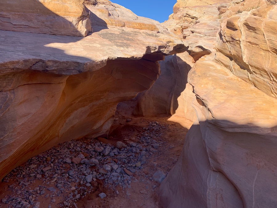
White Domes Loop Trail
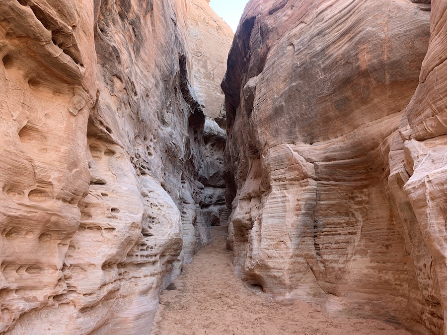
The White Domes Loop Trail is a 1.1 mile (1.8 km) loop that offers various terrain, including sections of hiking through a narrow sandstone slot canyon and open desert. The terrain is sandy, and you will be in the direct sun for the majority of the hike. Although it is a short hike, the scenery is incredible. This hike also connects to the Pastel (Pink) Canyon and Fire Wave Canyon.
To learn more about the White Domes Loop Trail, check out our article “White Domes Trail In The Valley Of Fire State Park, Nevada.”
Pastel (Pink) Canyon Trail
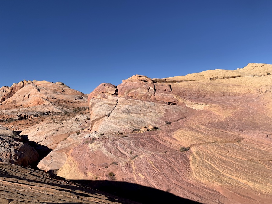
Pastel (Pink) Canyon Trail is a short (under 0.5 miles) yet beautiful hiking trail featuring swirls of pink sandstone. You are not allowed to park along the side of the road to access this hike as it is not a designated parking area. Therefore, the best route would be to hike in from the Fire Wave Trail or 7 Wonders loop, as it is located in between both of these.
To learn more about the Pastel (Pink) Canyon Trail, check out our article “Pastel (Pink) Canyon Trail In The Valley Of Fire State Park, Nevada.”
7 Wonders Loop Trail
7 Wonders Loop is an unofficial trail that connects to various other trails and features incredible views of Fire Wave, Pink Canyon, Crazy Hill, Striped Rock, Kaolin Wash, Thunderstorm Arch and Fire Cave. Note that portions of this trail are unmarked and can be difficult to follow at times. If you plan on hiking through Fire Wave Trail to the Pastel Canyon, continue on towards White Domes. Instead of continuing onto White Domes Trail, take a right and head towards the three lookouts to complete the look back to the Fire Wave parking lot.
To learn more about the 7 Wonders Loop Trail, check out our article “7 Wonders Loop In The Valley Of Fire State Park, Nevada.”
Elephant Rock Loop
Elephant Rock Loop is another short yet worthwhile hike in the State Park. It is only 1.2 miles (1.9 km) for the loop or 0.4 miles (0.6 km) for the out-and-back trail. This is a good all-levels and ages trail. Though Elephant Rock can be seen from the road, it is much better seen outside of the car. If you are looking for a longer hike, continue onto the Arrowhead Trail, which connects to Elephant Rock Loop.
To learn more about the Elephant Rock Loop, check out our article “Elephant Rock Loop In The Valley Of Fire State Park, Nevada.”
Old Arrowhead Road Trails
Old Arrowhead Road Trail is a 6.8-mile (10.9 km) trail. It is a historical marker that was built in 1915. It is a long hike that connects to the Elephant Rock Loop. This trail is great for hiking, horseback riding and mountain biking.
Unfortunately, the hikes mentioned below do not have any photos, as we were unable to complete them during our one-day trip to the Valley of Fire State Park. However, we are planning to finish the remaining hikes on our next visit!
Rainbow Vista
Rainbow Vista is a 1.2-mile (1.8 km) hike that gets its name from its colourful rock formations. It is a popular out-and-back trail that leads to an overlook of Fire Canyon.
Balancing Rock
Balancing Rock is a short and easy trail that takes hikers to a beautiful balancing rock formation. It is only a 0.3-mile (0.5 km) out-and-back trail that takes around five to ten minutes to complete.
Charlie’s Spring
Charlie’s Spring is a 4.7-mile (7.6 km) hike that leads to springs in the middle of the desert. The trail is unmarked with the expectation of the trailhead. Follow the wash downhill until you reach the springs. The trail ends here.
Natural Arches
Natural Arches is a 2.5 mile (4 km) trail located near the trailhead of Charlie’s Spring (except you go in the opposite direction). This trail is unmarked, and hikers should use precautions as there are a few areas that may require scrambling. Similar to Charlie’s Spring, follow the main wash all the way to the arches. There is no designated trail end.
Mouse’s Tank
Mouse’s Tank is a 0.7-mile (1.1 km) hike that offers a unique experience with petroglyphs all over the rocks along the trail. The trail is mainly sand and leads to Mouse’s Tank, which is the turnaround point.
Pinnacles Loop
Pinnacles Loop is a 4.5-mile (7.2 km) hike that is rated intermediate and involves some light scrambling. It features large picturesque scenery and towers of sandstone. The trail is not marked well, and hikers should use a map to help keep them on the designated trail.
Prospect Trail
Prospect Trail is a 4.6-mile (7.4 km) out-and-back hike that connects to the White Domes Trail. The trail is not marked, and hikers will need to follow the wash to stay on course – a map or GPS device is encouraged. There are quite a few areas where hikers may need to scramble over large boulders. This is an incredible hike, especially for those looking for a challenge.
Petrified Logs Loop
The Petrified Logs Loop is a 0.3-mile (0.5 km) trail. It gets its name from the fossilized wood found along the fence located on the trail.
Checklists And Recommended Gear
The trails at the Valley Of Fire State Park do not have a lot of shade. Therefore, preparing for the weather is important. The following is a guide to recommended gear.
- Water bottle
- Hiking Shoes – Women’s // Men’s
- Camera/Phone to take photos
- Sunscreen
- Hat
- Sunglasses
- Jacket (weather-dependant)
- Cascade hiking poles
Related Hikes
Other Hikes In Nevada
- Red Rock Canyon National Conservation Area
- Mount Charleston Wilderness Area