Liscomb River Hike, Nova Scotia
The Liscomb River Trail is an awesome 9.6 km trek that takes hikers through a loop along both sides of the Liscomb River (hence the hike’s name). This trail is relatively easy in terms of inclines and declines but rated moderate due to the length and terrain.
The trail offers plenty of access points to take in the river’s beauty and see the massive boulders left by the ancient glaciers, which are staples of the Nova Scotian wilderness. The trail includes a suspension bridge overlooking a wonderful waterfall and runs along a nearby fish ladder, which helps restock Atlantic salmon.
Difficulty: Moderate
Length: 9.6 km (loop)
Suggested Duration: 2-4 hours
Signage: Signs and markers throughout the trail
Facilities: Parking lot and lodging area nearby
Disclaimer: This article includes affiliate links. If you click one of them, we may receive a small percentage of the sale at no extra cost to you. Thank you for your support!
Key Features Of The Liscomb River Trail System
- Along the Liscomb River
- Ample signage/markers
- Trailhead at the Liscombe Lodge resort (yes, “Liscombe” and “Liscomb” are spelled differently)
- Map (may be obtained at the front desk of the resort)
- Suspension bridge overlooking a waterfall
- Passes through mixed gravel and forest terrain
Facilities And Services
- Parking lot
- Lodging at Liscombe Lodge nearby
Before You Start Hiking The Liscomb River Trail System
We’d like you to know a few things before going on your own adventure along the Liscomb River Trail.
First, the Liscomb River Trail, like most of the Liscomb Lodge, is pet-friendly. This off-leash trail is a great choice for well-trained dogs. Because the trailhead is on the same plot of land that hosts chalets of the Liscombe Lodge, parking for a day trip should be found elsewhere.
There is a parking lot on the other side of the bridge on the other side of the road. Note that the other entrance to the Liscomb River Trail is also on the other side of the bridge so hikers could choose to start the hike on the east side of the river rather than the west side (where the trailhead is just behind Chalet #10).
We also saw a few cars parked on the side of the road. Of course, do this at your own risk.
Here is a picture of the trailhead behind the Chalets on the west side of the river.
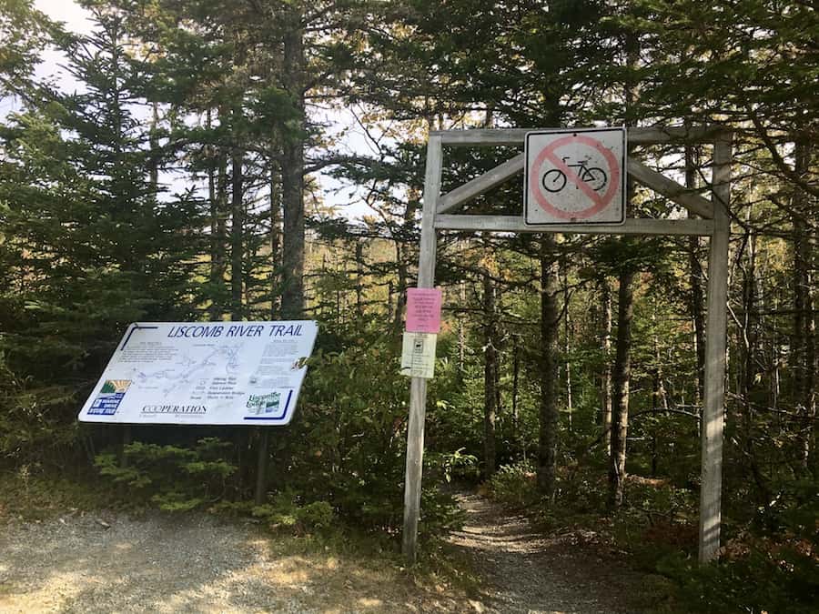
As you can see from the picture above, the trail is meant for hiking and not for cycling.
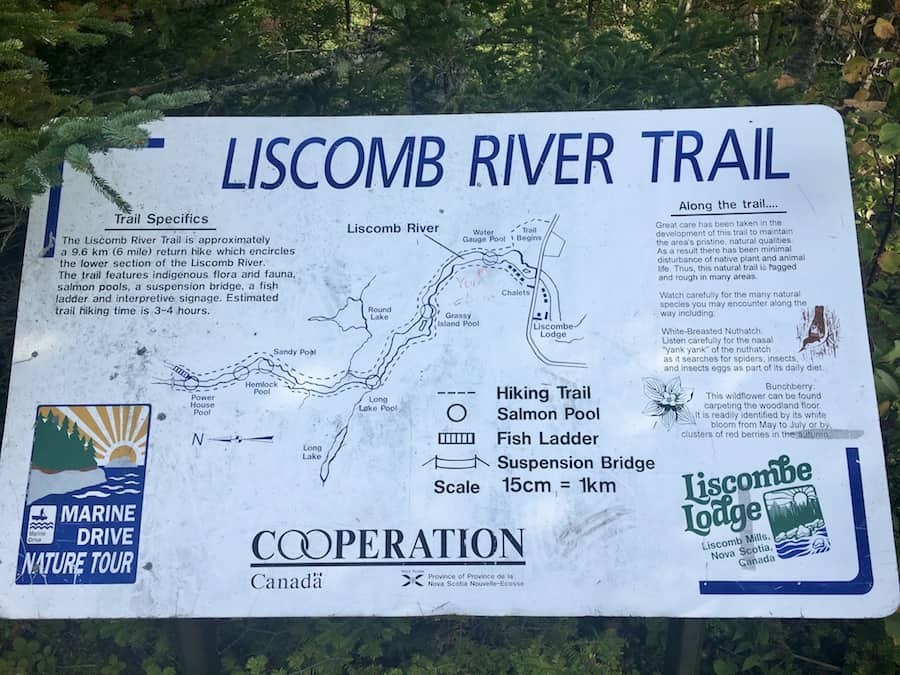
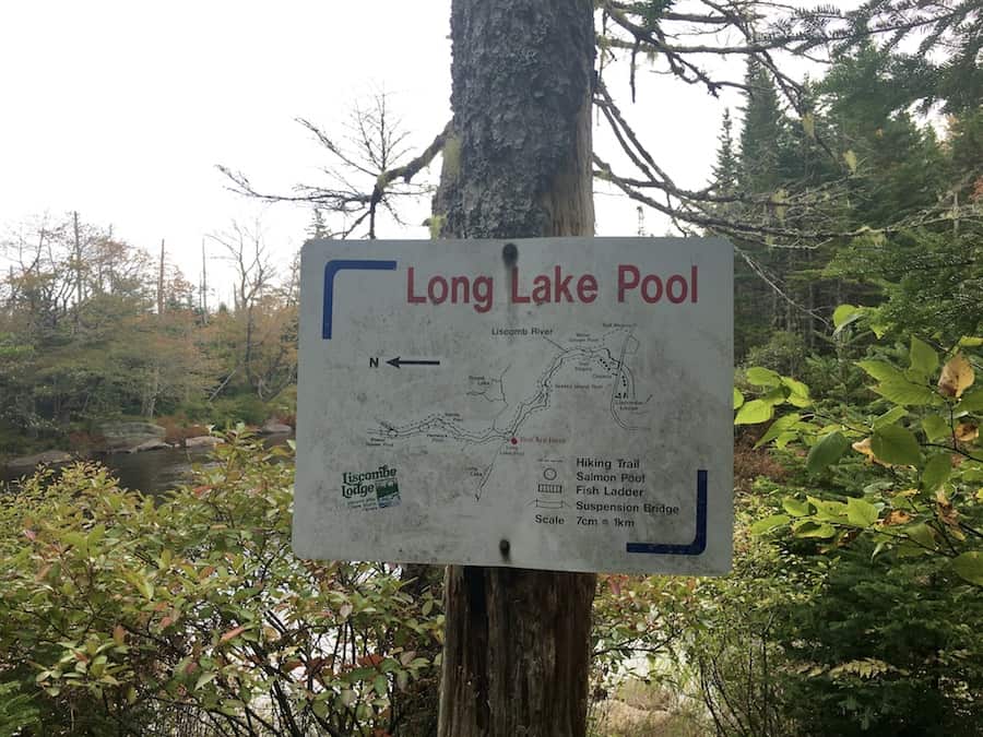
We can see that there’s also an informational map at the trailhead. This map (pictured more clearly below) offers a detailed map of the trail, complete with a scale and compass. It shows the locations of the salmon pools, the fish ladder, and the suspension bridge. It also offers information on the trail along with flora and fauna.
The trail can get rather muddy in some spots and is a bit rugged (with tree roots and rocks) at a few points. We recommend bringing appropriate waterproof/water-resistant footwear!
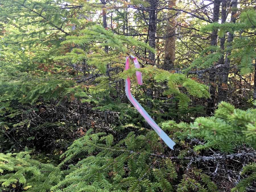
The trail is easy to follow with markers.
Other than that, we’d like to reiterate that the trail is a 9.6 km trek with very little elevation difference, making it a great trail for experienced and beginner hikers alike!
Our Experience Hiking The Liscomb River Trail System
Though the Liscomb River Trail is considered “out-of-the-way” in rural Nova Scotia, hiking the trail can be made a day trip when travelling from the city of Halifax (the trail is actually just outside the border of the HRM). It’s about 170 km from downtown Halifax when taking Highway 7.
So we made this hike a day trip, leaving at a reasonable hour on a sunny October morning. It took just over 2 hours to get there from our home in Dartmouth. It was our first time out in this part of the province.
Upon arriving, we initially drove up to the trailhead and saw there was no designated parking for day visitors. Rather than parking next to a Chalet, which would be inconsiderate to guests of the lodge, we found the parking lot at the other side of the bridge.
Note that this parking lot has a trailhead to the Mayflower Trail, which is a short but rugged 2.9 km coastal along the mouth of the Liscomb River.
But we were set on the Liscomb River Trail, and after making our way across the bridge and back to the trailhead, we began our adventure!
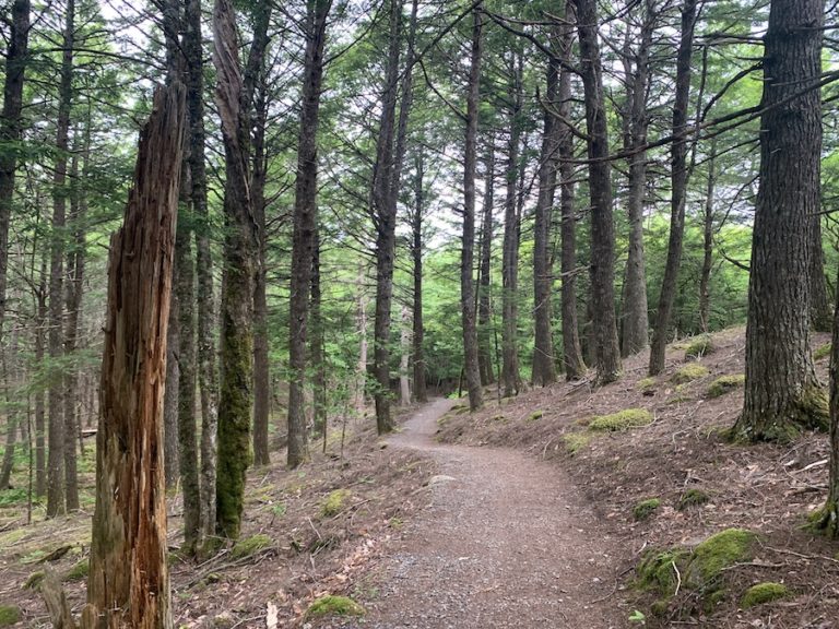
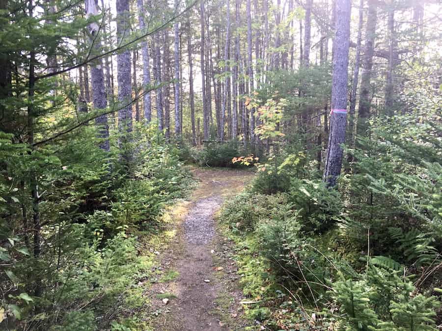
For the first 2 kilometres, the trail is largely gravel-covered and well-groomed. This makes for a great warmup after having spent some time in our car.
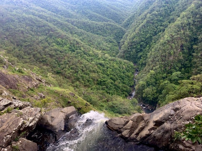
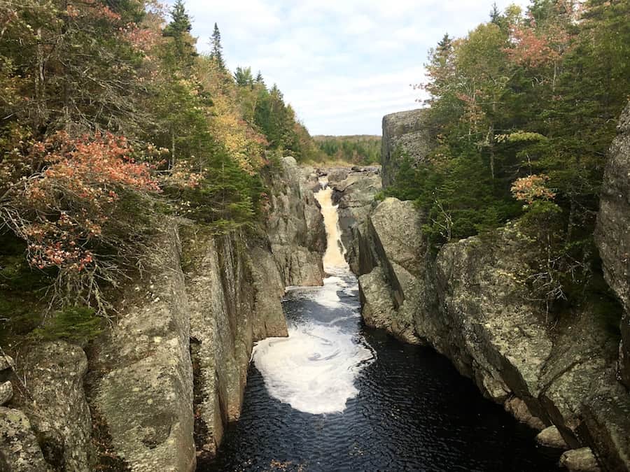
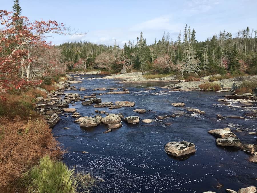
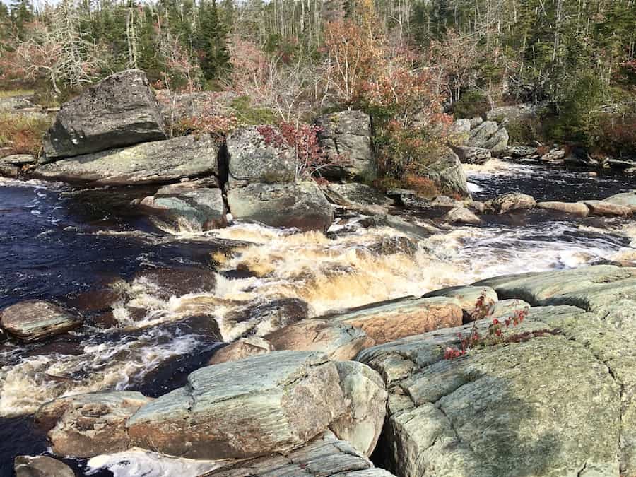
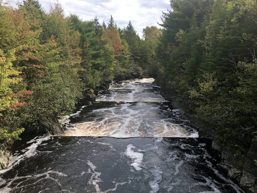
Crooked Falls is the first of many river lookoff points you’ll encounter on the trail. Each lookoff is marked with a sign. Of course, there are plenty of other access points to the river. These are simply the best and easiest to access.
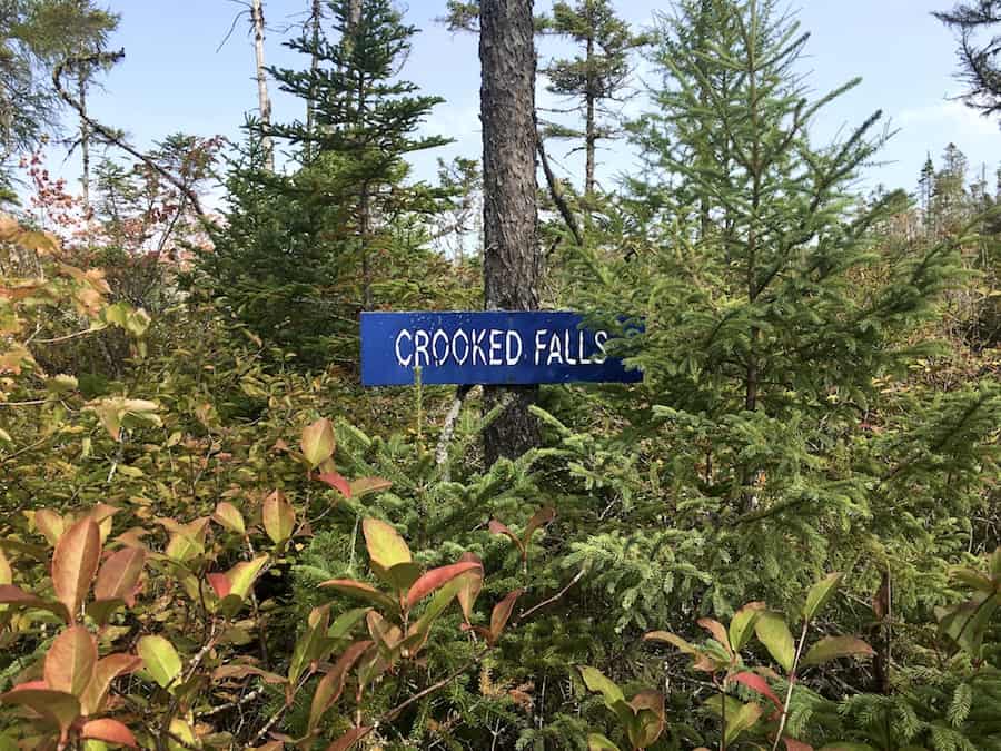
Here are a few pictures of the beautiful deep blue water and rapids of the Liscomb River from the Crooked Falls lookoff:
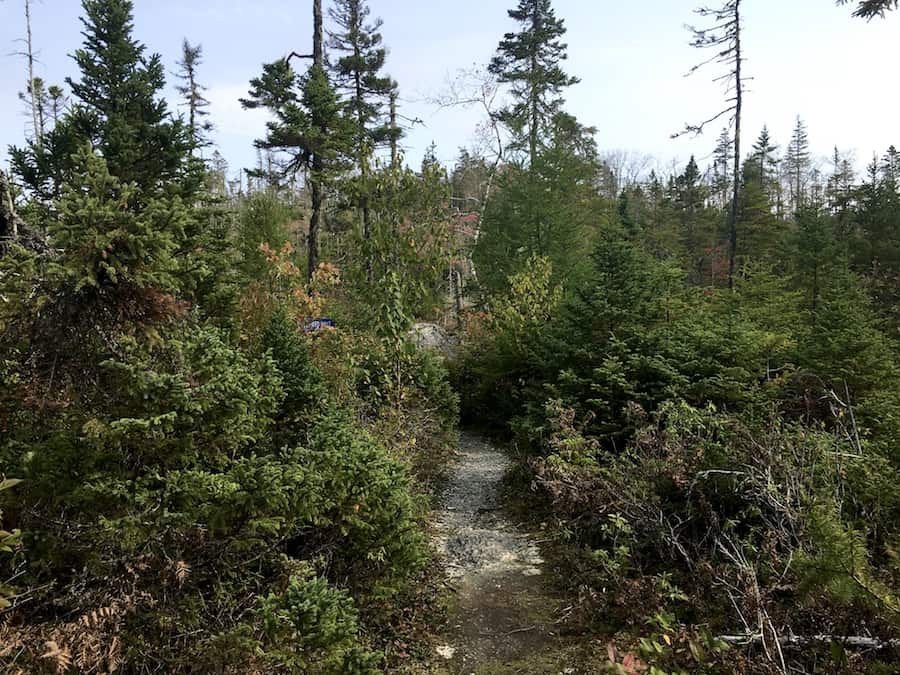
Continuing onward, the terrain becomes more “backcountry-like”. The groomed, gravel-topped walking trail turns into a typical Acadian forest hiking trail. There are roots throughout the rest of the trail to keep an eye on to avoid rolling ankles. However, the trail is still easy to hike.
There is a minimal elevation on the trail as it traces the river banks. Some parts are a bit muddy, but on the east side, the trail is pretty dry.
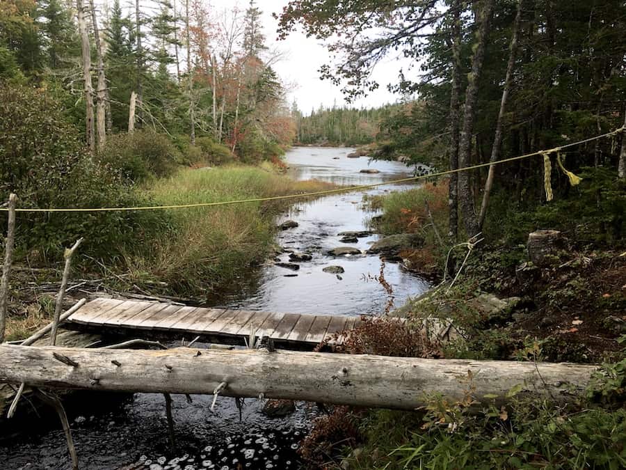
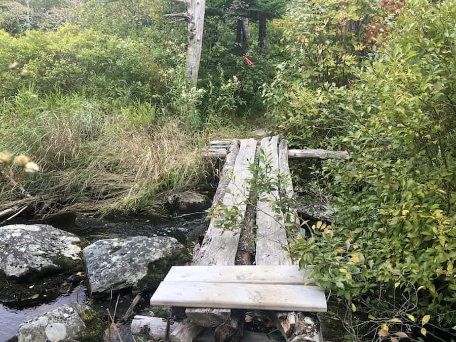
There are several locations where a short bridge is necessary to cross waterways. Here are a few pictures to show these small bridges.
At the time, we did not have a map from the reception desk, nor did we have the All Trails app to track our location. Not to worry, though. The trail has maps placed throughout to keep hikers aware of their location. By taking time-stamped pictures of each map we encountered, we could easily see that we kept a good pace.
The most picturesque parts of the trail come at the turning point where the path crosses the river on the suspension bridge.
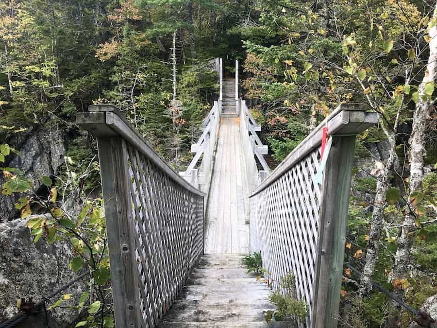
The view from the suspension bridge is the featured image of this post (how could it not be?). So I’ll add it again here:
Looking from the south (opposite direction) bridge, we can see the river flowing downstream toward the Atlantic Ocean.
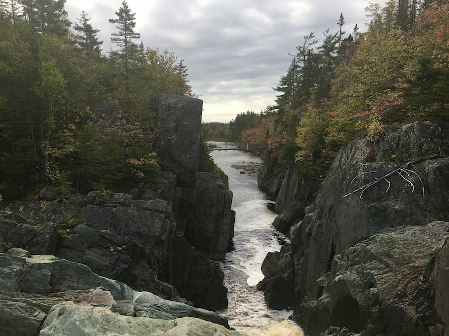
Better yet, just a short distance down the trail, we can climb across a few dry rocks in the middle of the river and get a vantage point from the top of the waterfall. Here’s a shot of that view with the suspension bridge in the centre of the frame:
Continuing onward, the trail took us across a dam that doubled as a bridge. At the dam, we saw that the river actually split before the waterfall. One part of the river would go on to the falls, and the other would flow to the old dam.
A 15-step salmon ladder is built on the other side of the dam, and the trail traces this ladder back down to the point at which the split rejoins at the main river. In other words, there’s a dam salmon ladder to help salmon avoid the waterfall.
It’s around this point, as well, that a service road (Jacobs Road) connects to the trail.
On the way back, we got to see the river from the other side. By this time of the day (early afternoon), the trail was getting busier on the east side, but the west side was clear.
We found that the trail on the west side of the river is much muddier than the east side. Though we’re of the mindset that the trail isn’t complete unless we hike it in its entirety, we believe that an in-and-out approach would be just fine for most hikers, especially those with improper footwear!
After making our way down the river’s west side, we came out at the main road just opposite the parking lot with another great day of hiking completed!
Checklists And Recommended Gear
The following is our recommended gear list for Liscomb River.
- Water bottle
- Hiking Shoes – Women’s // Men’s
- Camera/Phone to take photos
- Snacks and/or lunch
- Sunscreen
- Hat
- Insect repellent
- Cascade hiking poles
- Atlantick tick removal tool kit
- Water filter
Related Hikes
Other Nova Scotia Waterfalls
- Baxters Harbour Falls & Black Hole Falls (Baxters Harbour, Nova Scotia)
- Victoria Park (Truro, Nova Scotia)
- Phantom Falls (Fantum Falls) (Nova Scotia, Canada)
- Dawson Brook Falls (Ellershouse, Nova Scotia)
- Uisge Ban Falls (Cape Breton, Nova Scotia)
- Horse Pasture Brook Falls (Wentworth, Nova Scotia)
- Egypt Falls (Scotsville, Nova Scotia)