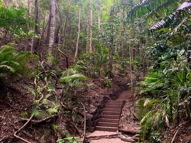
Top 11 Must-Do Hikes In Arizona, USA
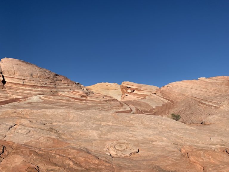
With its appropriate slogan, “The Grand Canyon State”, Arizona is home to a plethora of beautiful hikes. Being the sixth largest state in the USA (113,990 sq mi or 295,234 km2), this land is host to hikes through a wide variety of terrain.
Hikers can opt to hike through various mountains and plateaus, four different deserts, pine-covered Mountain forests, and, of course, the Grand Canyon. The Grand Canyon National Park was actually one of the first national parks in the United States.
Most of Arizona will experience scorching hot summers and mild winters. Therefore, hiking may be best saved between October to June. Also, note that the monsoon season extends from June to September. Whether you’re visiting the state for the first time or you’re a permanent resident, we’ve assembled a list of the 11 must-do hikes for your enjoyment (and challenge).
Antelope Canyon
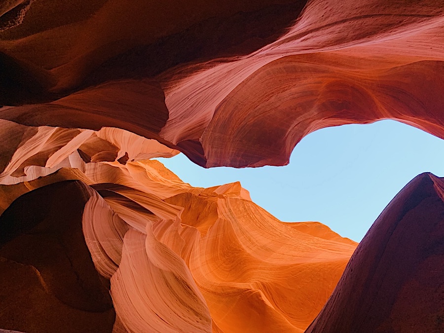
Navajo Park – Page, AZ
Distance: 1km // 0.62 miles (round trip)
Time: 1-hour tour
Difficulty: Easy
Antelope Canyon is one of the most-visited slot canyons in America. This popular hike brings in not only hikers but also tourists and photographers from around the world. Remember the old Windows 7 wallpaper on your computer? This is where it was taken. You’ve probably seen the iconic Antelope Canyon before you even knew what it was
Antelope Canyon is located in Navajo Park. It is mandatory to book a tour in order to enter. There are a few tour options depending on which company you choose to go with and the canyon you want to explore, the lower antelope canyon or upper antelope canyon.
The Upper Antelope Canyon is the most popular and expensive option of the two canyons. This canyon is much deeper and wider, making it better for those who are claustrophobic. It also features the famous “light beam,” a natural light beam that cuts through the canyon (best spotted in the mornings between April and September).
The Lower Antelope Canyon is the longer of the two canyons and is more affordable. This canyon is tighter, making it pretty fun if you enjoy twisting around the canyon walls. Since this is the lower antelope canyon, there are metal stairs that you will have to descend and ascend to get inside the canyon. We decided to take this tour, and it was an unbelievable experience!
To read more about Antelope Canyon, check out our article “Hiking Antelope Canyon In Arizona.”
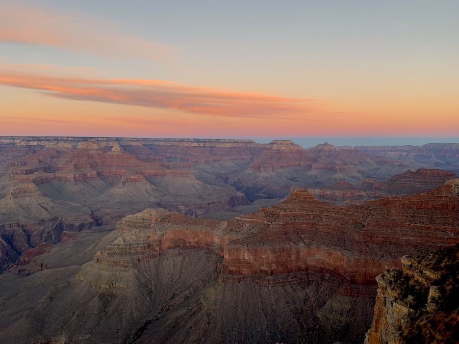
Bright Angel Trail
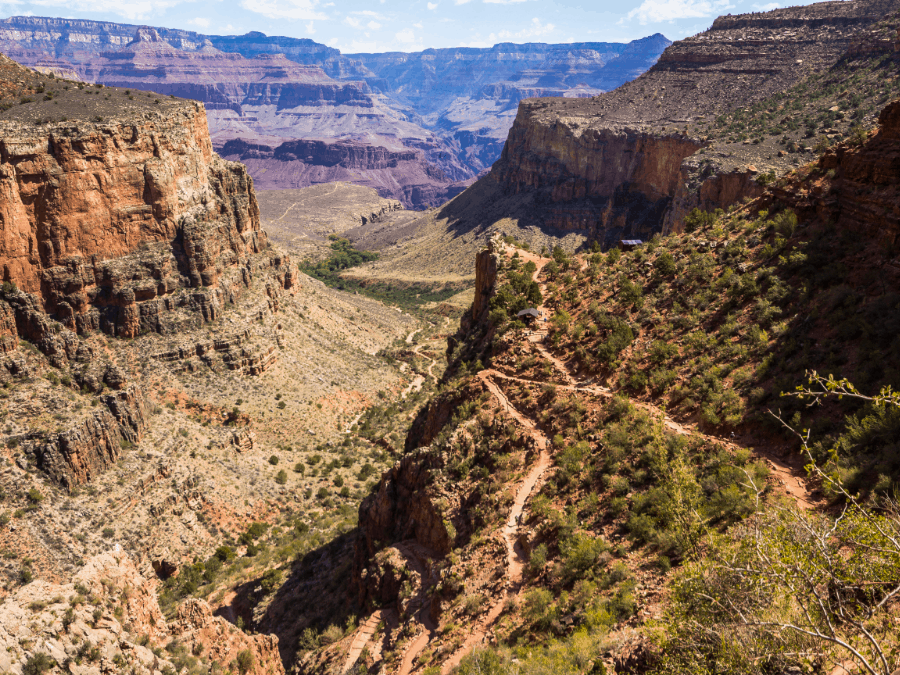
Grand Canyon National Park, AZ
Distance: 14.96 km // 9.3 miles (oneway)
Time: 4-5 hours (oneway)
Difficulty: Difficult
The Bright Angel Trail is a beautiful yet challenging hike through the Grand Canyon National Park. This strenuous hike leads to the Bright Angel campground, where hikers can spend the night before completing the return hike.
Along the way, there are a few rest houses you can stop at for clean water, emergency phones, and washrooms (at select resthouses). Rest stops along the trail include: Mile-and-a-Half Resthouse, Three-Mile Resthouse, Indian Garden, Plateau Point, and River Resthouse. Indian Garden is also a campsite. You do not need to complete the entire hike. If you only have a few hours at the Grand Canyon, you can hike to one of the numerous resthouses or lookout points to experience some of the Bright Angel Trail and the magnificent views.
There is a river along this trail, though it is highly recommended that hikers come prepared with enough water as well as a water filter. All the resthouse stops do have clean water available unless stated otherwise on the entrance sign. Water is turned off in the winter months (typically at the end of October).
It is not necessary to bring trekking poles though it is highly encouraged. Using trekking poles can take some of the stress off of your joints, making it easier for you to hike for longer durations.
While we did not have time to complete the entire trail, click here to read our experience hiking the Bright Angel Trail.
Horseshoe Bend Trail
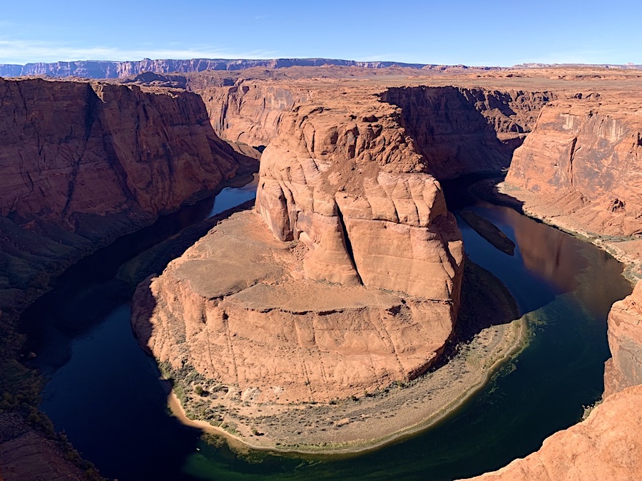
Glen Canyon National Recreation Area, Page, AZ
Distance: 2.3 km // 1.42 miles (out and back)
Time: 30 minutes to an hour
Difficulty: Easy
Moulded by the Colorado River, the Horseshoe Bend trail is an easy and groomed trail that is great for all-level hikers. Whether you are an avid hiker or a newbie, this is one view you do not want to miss!
There is an entrance fee to enter the trail. The trail begins in the parking lot, which involves a slight hill. At the top of the hill, you will reach the gazebo. This is a great spot to take a moment out of the sunlight. Except for the gazebo, the rest of the trail is in direct sunlight. We recommend bringing comfortable footwear and having enough water. There is no place to purchase or fill water at the Horseshoe Bend trail.
The trail itself is wide and well-groomed; it is both accessible and strollers-friendly. Making it a great experience for the entire family to enjoy!
To read more about Horseshoe Bend, check out our article “Hikers’ Guide To Horseshoe Bend In Page, Arizona.”
The Wave
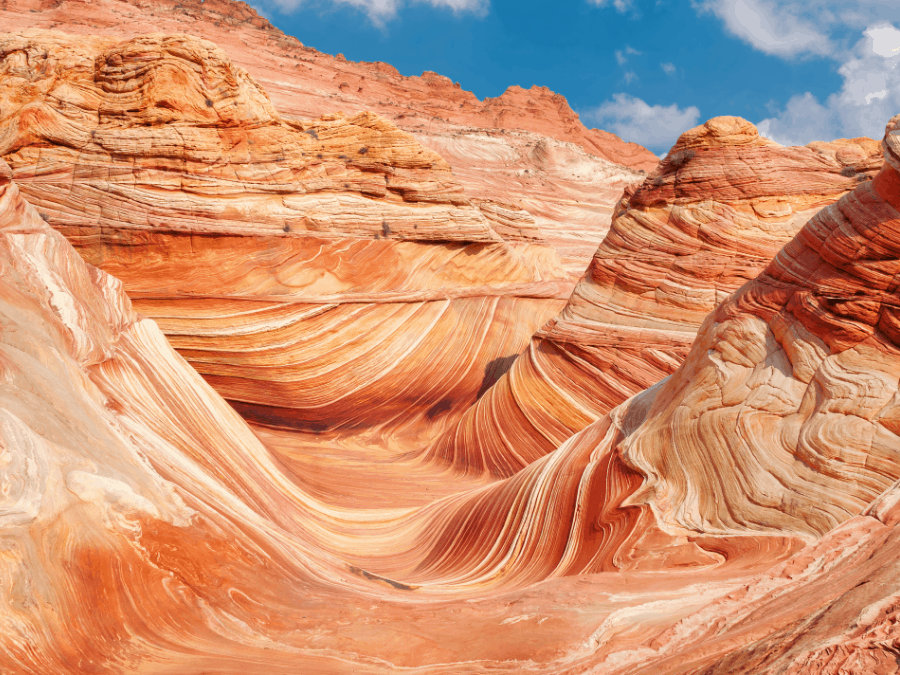
Coyote Buttes North Area, Border of Utah and Arizona
Distance: 8.85 km // 5.5 miles (round trip)
Time: 2-4 hours
Difficulty: Moderate
The wave is one of the most spectacular, photographable spots in Arizona. It’s located in Coyote Buttes North near the Utah border. Now, before you pack your bags and head over to hike the Wave, it is important to note that you need a permit to enter. Only twenty permits are issued per day by the US Bureau of Land Management (BLM).
There are no trails or distinct pathways to follow as this is a low-trafficked hike due to the daily limitation of permits. The BLM provides a map and instructions to the Wave when you receive your permit. It is advised to bring either a compass or GPS to help guide you along, as it is easy to get lost or go off route. If possible, hike in pairs or a group. Hiking alone on the Wave is not recommended.
Due to the limited amount of daily hikers allowed, permits can be quite difficult to obtain, especially during the popular months of April, May, September, and October. The best months to try and visit the Wave are December, January, and February.
While the hike to the Wave is over 5 miles long, the view is one of a kind and well worth the journey.
Treasure Loop Trail
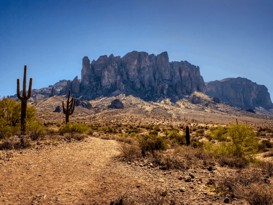
Lost Dutchman State Park, Apache Junction, AZ
Distance: 3.8 km // 2.4 miles (loop)
Time: 1.5-2.5 hours
Difficulty: Easy to Moderate
The Treasure Loop Trail is known for its unique rock formations, cacti, and beautiful spring flowers. It is located at the west base of the Superstition Mountains. There is a fee to enter the park. However, it is waived if you are camping.
While hiking the Treasure Loop Trail, it is important to stay on the trail at all times. While it is well maintained and marked, it can be easy to stray away from the trail. If you venture off the trail, you may become a casualty of the Jumping Cholla cactus. The Cholla can latch onto you even if you are passing by. If you do encounter the Cholla, use pliers or another tool to remove them. Please do not touch them with your bare hands.
There is a steep incline to reach the summit. However, it is quite rewarding. You get to overlook the Superstition Wilderness and the Tonto Forest. Once you reach the summit, there is a picnic table and bench where you can relax and take in the views before heading back down.
Tom’s Thumb Trail
Scottsdale, AZ
Distance: 6.4 km // 4 miles (out and back)
Time: 2-3 hours
Difficulty: Difficult
Tom’s Thumb Trail is a difficult trail with a steep incline ending with a rewarding view of the Mcdowell Mountains and Phoenix.
Named after local rock climber Tom Kreuser, this hike will definitely get your heart pumping. Be sure to bring plenty of water with you as there are no spots to refill your water along the trail, and you will be hiking in direct sunlight.
There are numerous signs marking the trail and some off-shot signs to other trails and rock climbing areas. Lookout points are also well marked, so be sure to take advantage of the rest stops and the views of rock formations and open desert.
If you want to make a full day out of hiking from Tom’s Thumb Trail, you can also hike the Lookout Trail and East End Trail. If you do all three, plan accordingly with enough water, comfortable hiking boots, and trekking poles. It will take you around 7 hours to complete all three.
Pinnacle Peak Trail
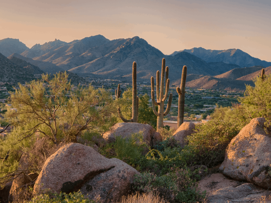
Scottsdale, AZ
Distance: 6.1 km // 3.7 miles (out and back)
Time: 1-2.5 hours
Difficulty: Moderate
The Pinnacle Peak Trail is a moderate out-and-back hike that is great for avid hikers or beginners. Do not let the tall-shaped mountain intimidate you. Hikers do not actually climb to the top. The highest peak you will reach is 2,889 feet. While there are still plenty of inclines, it is easier than it looks.
The trailhead features an office, restrooms, water, and an atrium. Since this is a regulated trail, it is not dog or bike-friendly. Though this trail has facilities, it is free. There are maps available and tours on-site for those who would prefer a hiking guide.
This trail is very popular with locals, so you may come across many trail runners and joggers. The best times to go hiking are in the early mornings or on the weekdays. This also helps you avoid the larger weekend crowds.
Hieroglyphic Trail
Superstition Wilderness, Gold Canyon, AZ
Distance: 4.5 km // 2.8 miles (out and back)
Time: 1.5-3 hours
Difficulty: Moderate
The Hieroglyphic Trail is a beautiful in-and-out trail located in the Superstition Wilderness. The terrain is filled with cacti leading up to the Hieroglyphic River, surrounded by petroglyphs (rock carvings).
The petroglyphs are dated back from 1 A.D. to 1450 A.D. by the Hohokam, an ancient Native American culture. When exploring, do not touch or carve anything into the rocks. It is important to leave the petroglyphs how they are to preserve them.
The trail is easy to follow and well-marked, with a few inclines. It is recommended to wear proper hiking boots rather than regular athletic shoes, as the trail can become rocky at times.
The best time of year to visit is in the spring when all the flowers are blossoming, and the water is flowing through the canyon. The trail has little to no shade so bringing enough water is a must. The summer heat can be quite intense. We recommend going in the early mornings before the sun is at its strongest.
Brown’s Trail
Tonto Basin, AZ
Distance: 7.6 km // 4.7 miles (out and back)
Time: 3-5 hours
Difficulty: Difficult
Brown’s Trail to Brown’s Peak is a difficult hike that is not recommended for beginner hikers. This hike has a variety of challenging inclines and can become quite rocky after the saddle. Brown’s Peak is the highest point of Maricopa County at 7,659 feet.
From the saddle, you will look up and see the ultimate task. The chute goes straight up. Take your time and go slow. The hardest part of this hike will involve you scrambling up a rock wall. The rocks can become loose or slipper. Hikers should wear proper footwear to optimize grip and support.
There is a range of terrains on Brown’s trail, including forest, desert, snow-covered bushes, and numerous lakes. The trail is full of wilderness, including black bears. Hikers should be cautious and leave no trace behind.
It’s important to note that the road leading up to the trailhead is long, bumpy, and rough. Other hikers have suggested that either a truck or SUV would be better suited for the drive there.
Cathedral Rock Trail
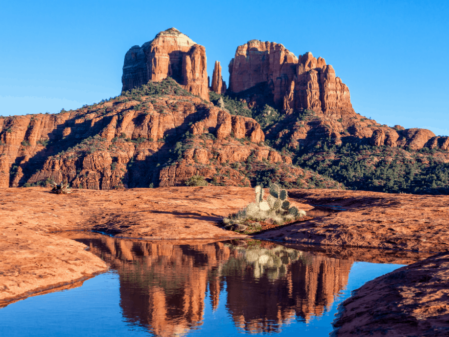
Sedona, AZ
Distance: 2.1 km // 1.3 miles (out and back)
Time: 1-1.5 hours
Difficulty: Moderate
The Cathedral Rock Trail is a breathtaking hike that offers views of spectacular red rock formations. It is one of the most popular spots to visit in Sedona, Arizona. The best time to hike this trail is at sunset. The sunset at the top of Cathedral Rock Trail is unlike any other. If you choose to do this, we recommend bringing a headlight or other light source, as nightfall tends to happen quickly.
While this is a relatively short hike, it does turn into a steep climb that will require you to be more hands-on. Wearing good hiking boots is a must for this hike to help you through the steeper areas. Though the trail is easily marked, hikers should be careful of steep drop-offs and be cautious of other hikers as this is a heavily trafficked trail.
Havasu Falls
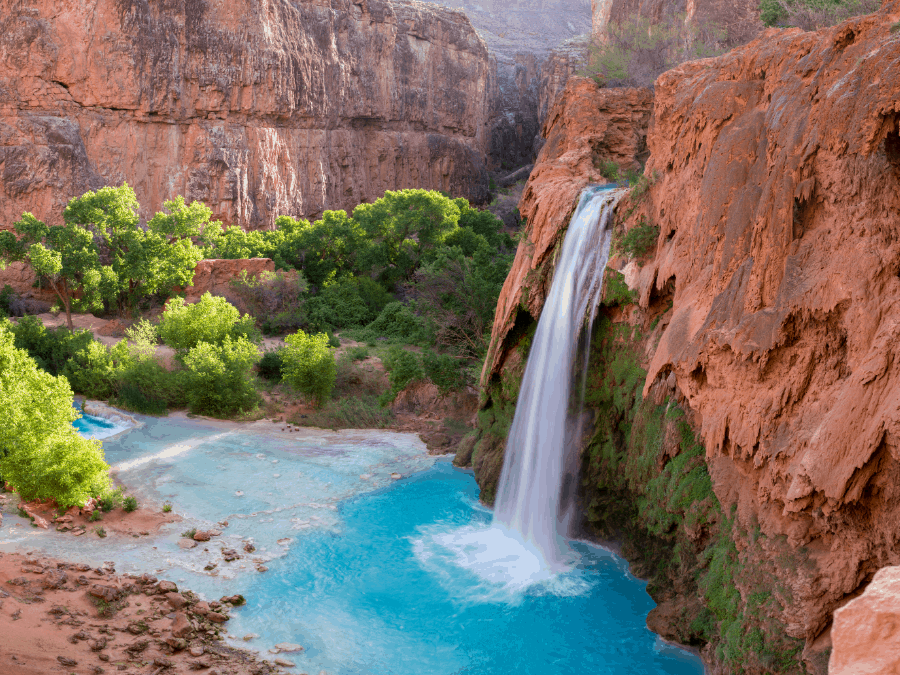
Havasupai Reservation, Supai, AZ
Distance: 16.1 km /// 10 miles (oneway)
Time: 3 days (6-9 hours per trail)
Difficulty: Moderate to difficult
Havasu Falls is the ultimate challenge for avid hikers. It is located within the Grand Canyon and features beautiful blue and green water against the red rocks.
With over 10 miles (oneway) worth of trails and five different waterfall adventures: Fifty Foot Falls, Lower Navajo Falls, Havasu Falls, Mooney Falls, and Beaver Falls, this trail has days worth of hiking to offer.
Before you begin hiking to the spectacular Havasu Falls, you will first need a three-day permit. The permits sell out quickly. It is recommended to get one early. Permits are sold online and do not allow day hikers or any permits longer or shorter than three days.
Prepare to have a few nights’ stays at the Havasupai Falls campground, where you can find fresh water to refill your bottles. If you plan on refilling water bottles at the falls, we suggest bringing a water filter as the water is high in minerals.
You will have to carry all your gear, including your camping gear. Hiking poles can help reduce the stress of the weight on your joints and make it a bit easier to hike longer distances. There are mules for hire to take your gear and food down for you. We suggest packing lightly and enjoying the challenge of hiking Havasu Falls.