Blue Mountain/Birch Cove Lakes Trails, Nova Scotia
The Blue Mountain/Birch Cove Lakes Wilderness Area is an expansive, 1,767-hectare wilderness area that offers various interconnecting trails for casual and avid hikers alike. The area is about the size of the Halifax peninsula and is located close to the city between Bayers Lake Business Park, Kingswood, and Tantallon.
In addition to the six main/marked trails, the wilderness area offers plenty of lesser-known paths, along with a variety of natural terrain. From woodlands, barrens, lakes, watercourses, and wetlands, the Blue Mountain/Birch Cove Lakes Wilderness Area is a hiker’s dream and is only a short distance from the urban centre of Halifax.
Difficulty: Moderate
Length: Over 15 km of trails
Suggested Duration: 1 to 6 hours
Signage: Maps throughout and markers on trails
Facilities: Parking area
Disclaimer: This article includes affiliate links. If you click one of them, we may receive a small percentage of the sale at no extra cost to you. Thank you for your support!
Blue Mountain/Birch Cove Lakes Trails
- Whicky-Whack (1.9 km)
- Hobsons Lake Trail (3.7 km)
- Ash Lake Loop (3.4 km)
- Fox Lake Trail (1.2 km)
- Mike’s Trail (0.9 km)
- Maskwa Trails & Charles Lake Loop (4.3 km)
Key Features Of The Blue Mountain/Birch Cove Lakes Trails
- A network of hiking trails in the Blue Mountain/Birch Cove Lakes Wilderness Area
- Access to Ash Lake, Fox Lake, Hobsons Lake, Kearney Lake and Charlies Lake
- Offers various trails of different lengths and difficulty levels
- Scenic routes pass through forested areas and feature many lakes
- Dog-Friendly
Facilities And Services
- Parking area
Before You Start Hiking The Blue Mountain/Birch Cove Lakes Trails
As is the case with all Hikers’ Movement articles, we’d like to share a few key pieces of information we think you should know before embarking on your own hiking excursion. Let’s discuss a few noteworthy points before you hike the Blue Mountain/Birch Cove Lakes Trails for yourself.
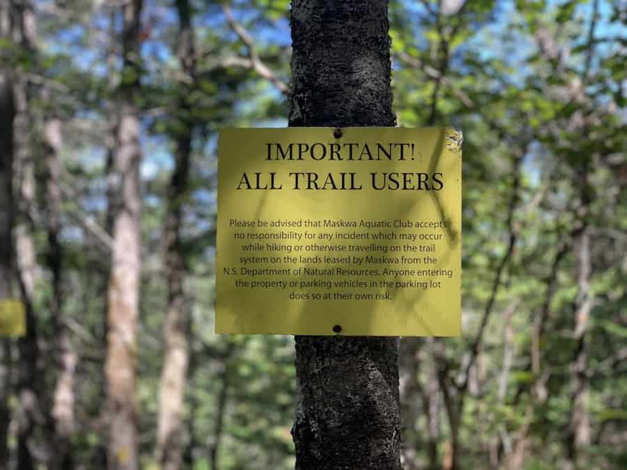
The first thing to note is that although many sources state there are two parking lots to enter the wilderness area (this was even shown on the maps within the park during our many visits), the lot of Saskatoon Drive is technically now a part of the Maskwa Aquatic Club.
Therefore, we suggest parking at the end of Collins Road to access the trails (starting on the Whicky-Whack, Charles Lake Loop, and Hobsons Lake Trails). At the very least, read the signage if you’re planning on parking on Saskatoon Drive (access to the Maskwa Trails & Charles Lake Loop Trails), as there may very well be restrictions.
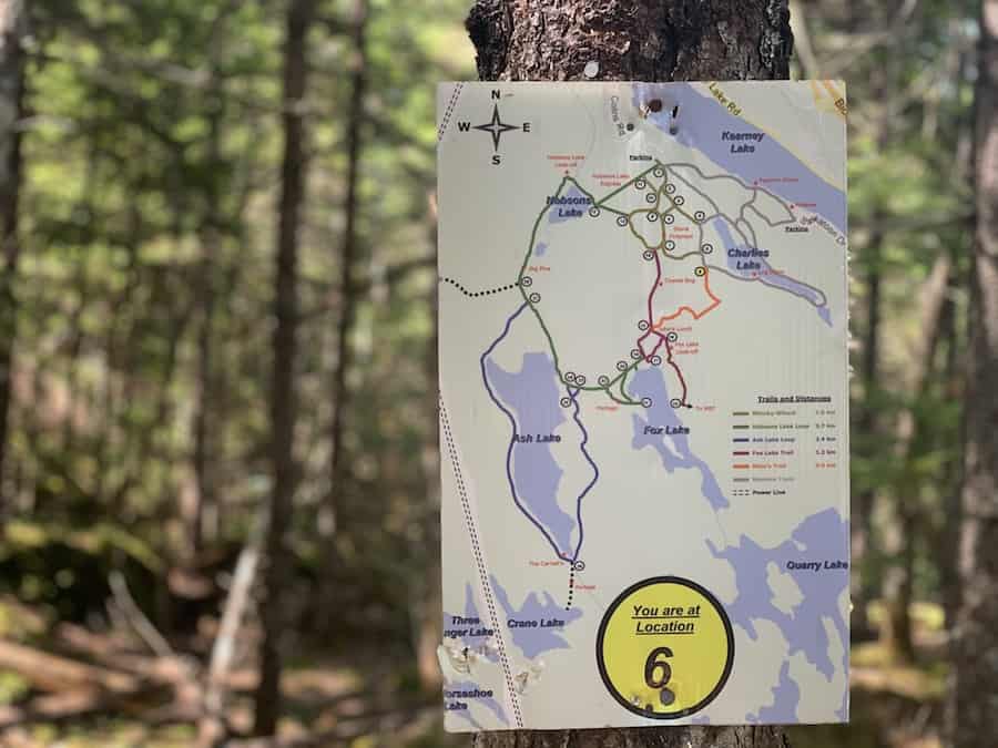
There are many interlinking trails in this park. There are also many maps located throughout the park to help hikers find their location, particularly at crossroads.
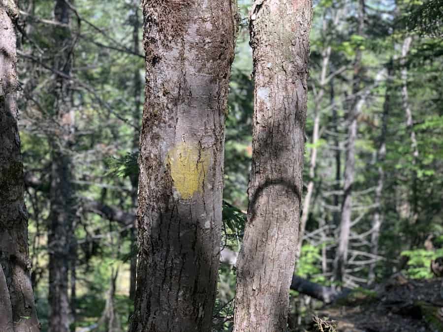
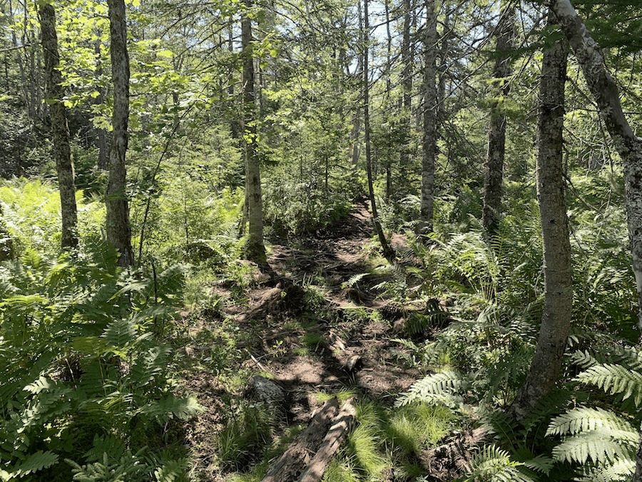
The marked trails are, for the most part, well-trodden and semi-easy to follow. The many interconnected trails of the Whicky-Whack may take you in circles, and there are a few sparse areas in the woods where the trail may become less obvious.
Other than that, the marked trails (those mentioned on the official maps) are relatively easy to follow but be cautious of your intended route as there are quite a few off-trails throughout the main trails.
Additional trails extend beyond the main trails that have become largely overgrown and difficult to navigate. These can be more challenging and less enjoyable (hiking through the thick bush), and we’d definitely recommend a map or GPS of some sort that has these extra trails listed.
It’s likely best to bring a map, compass, and/or GPS with you, even on the main trails. We also recommend bringing a cell phone and whistle in case you or a fellow hiker gets lost. There is cell reception throughout the trail.
In addition, hikers should keep an eye out for ticks and bring a tick removal tool.
It’s also worth knowing that the wilderness area is also used for the following:
- Wilderness Recreation
- Camping
- Sport Fishing
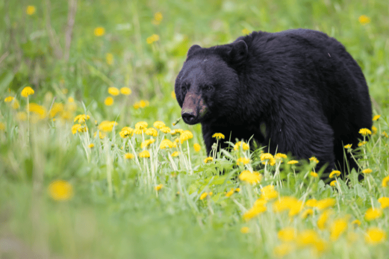
- Hunting
During hunting season, it’s best to practice extra precautions.
This area is a popular spot for dog walkers as well, where our canine friends can explore off-leash.
Our Experience Hiking The Blue Mountain/Birch Cove Lakes Trail
Our experiences hiking through the Blue Mountain/Birch Cove Lakes Trails are plentiful. We would frequent these hiking trails for both long and short hiking excursions during the summer we spent living in Clayton Park. That being said, the bulk of our experience of these trails happened in the warmer months of July and August.
We had heard of the wilderness area from a good friend of ours who mentioned what a great hiking spot it was. Upon our first visit, we quickly learned just how expansive the area was and planned out how we would complete the entirety of the hiking trails on several different hiking days.
On the first day, we hiked the Charles Lake Loop, beginning at the end of Collins Road. There are several interleaving trails in this section. Some extend to the Maskwa Aquatic Club, and others are more straightforward, heading directly to Charles Lake.
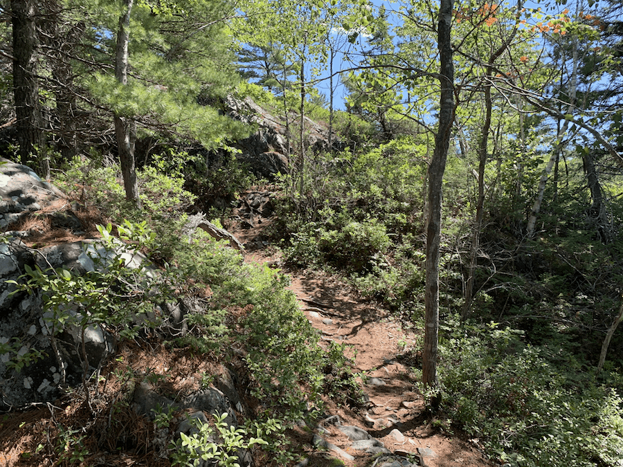
These trails are rugged and wide but are easy to follow. After dipping downhill to Kearney Lake, we were immediately impressed, and we came back up the hill to circle Charles Lake.
We noticed, near the far end of the lake, that the trail split into two directions. One trail would lead around the lake and take us back toward the entrance. This is the main trail and the one we took that first day. The other trail leads to a relatively unmarked trail, which we would save for another day.
We did end up taking a wrong turn at one of the junctions to the Whicky-Whack trails upon our return. We easily found our directions with the help of our phones and the trail maps we would come across at the upcoming intersections.
As we got back to our vehicle, we were determined to come back to complete the other trails.
The second time we hiked through the Blue Mountain/Birch Cove Lakes Trails, we decided to complete the Hobson Lake Trail. Again, we began at the end of Collins Road, this time taking an immediate right as we entered the park.
The terrain was largely the same. There are portions of significant roots and rock where we had to watch our step and portions of open area where the trail is big ambiguous. Parts of the trail are shaded under the trees, and others are more open to the sun.
Though the Hobson Lake Trail is a bit more straightforward than the Whicky-Whack Trails, we were still sure to bring a map and GPS with us to avoid any wrong turns.
There’s actually an important turning point between Hobson Lake and Ash Lake to be aware of (that leads to the power lines) just before the split between the Hobson Lake and Ash Lake Trails.
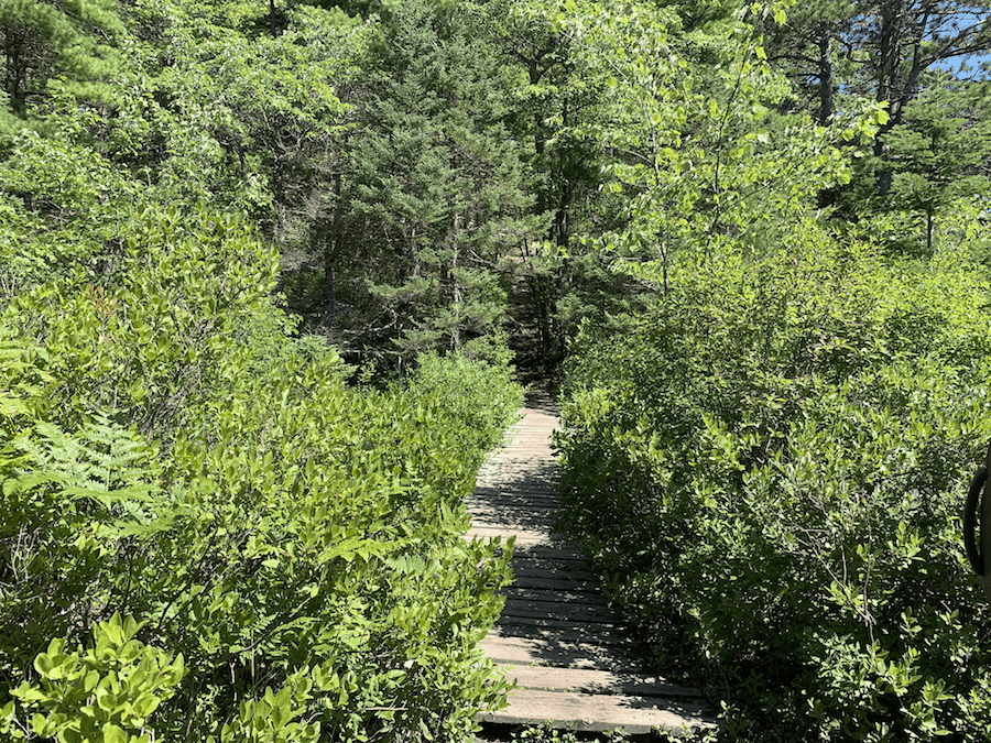
There is are some boardwalks and bridges along this trail to help hikers cross brooks and streams.
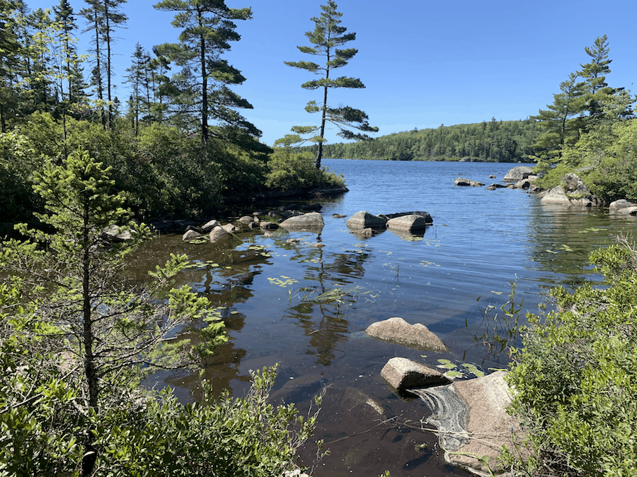
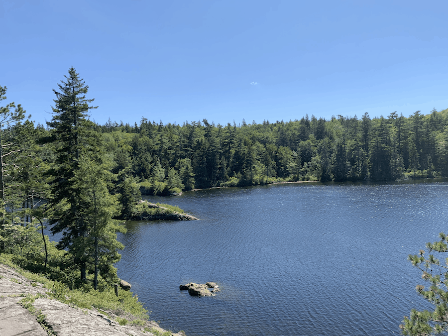
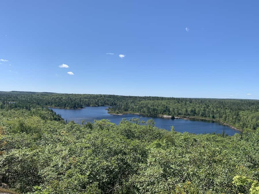
Hobson Lake offered a few nice views, as did Ash Lake, which the Hobson Lake trail also passed. We stopped for a break at Ash Lake to take in the beautiful surroundings. This would be a great spot to take a mid-hike swim. However, we held off and, after hydrating ourselves, were off to continue the trail.
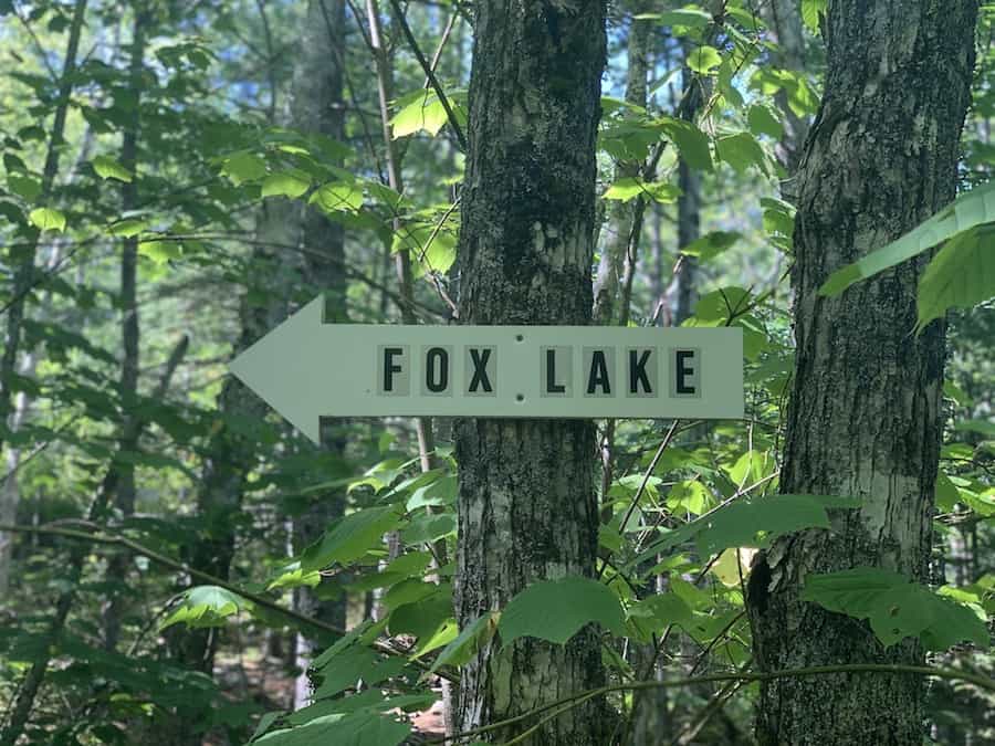
Just after Ash Lake, the Hobson Lake Trail has a series of break-off points (two that lead to the Ask Lake Loop, several that lead to Fox Lake, and a few more that extend to the Fox Lake Trails that eventually lead back to the Whicky-Whack Trails and, ultimately, to the entrance).
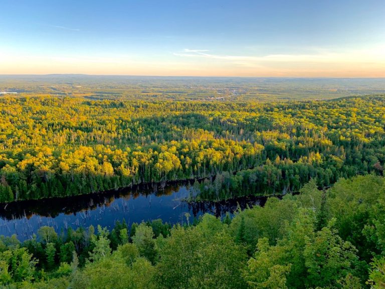
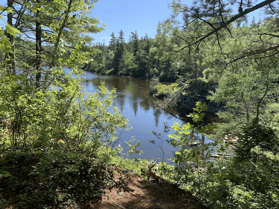
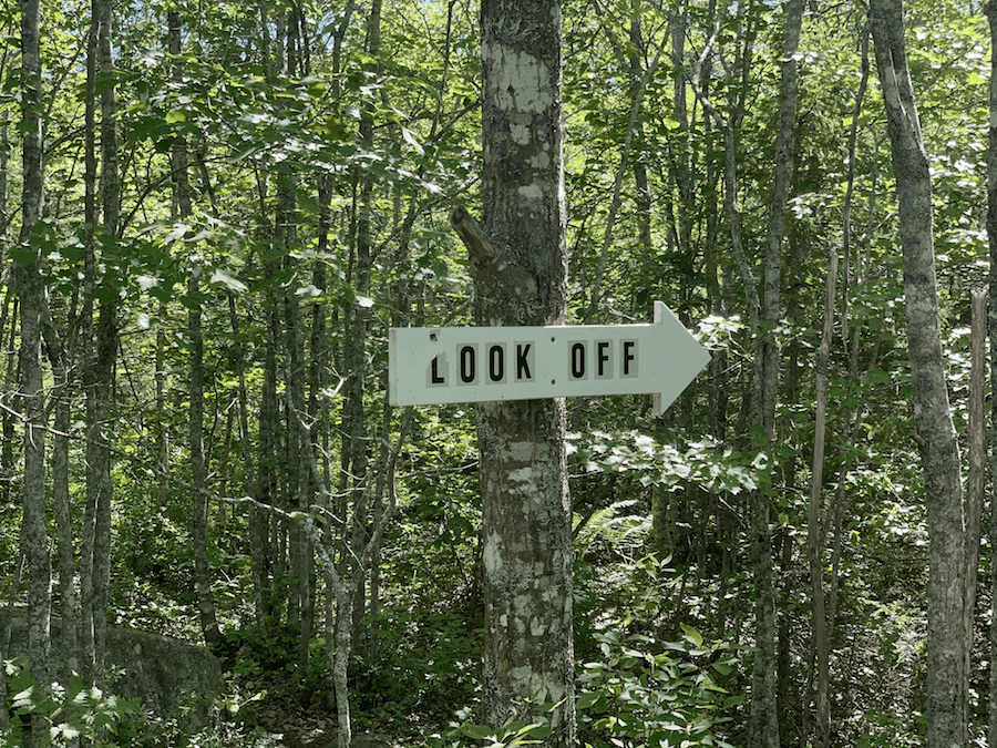
So we stopped regularly at the crossroads to read the maps and ensure we knew which direction we were going. We caught a few glimpses of Fox Lake, but the best view was to be had at the Fox Lake Lookoff point (on the Fox Lake Trail).
Using the maps and signs, this lookoff is relatively easy to locate, and after a bit of a climb, the view is great.
After taking in the view, it was time to head back. We’re fairly certain we took the most straightforward and optimal path back, but it’s hard to say with the plethora of interconnecting trails that made up the journey back to the entrance.
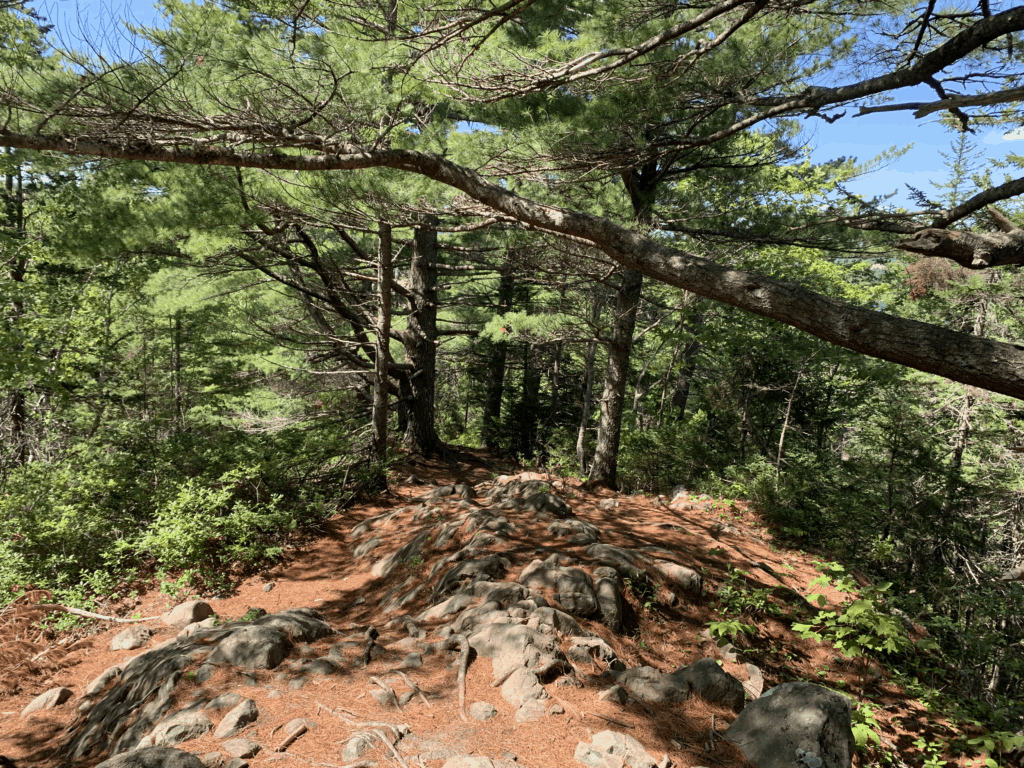
On the third visit, we spent a good amount of time in the park. This trek began on the Charles Lake Loop, but we kept going past the lake onto the aforementioned unmarked trail (rather than looping back).
During our experience, this trail was technically marked with ribbon but very overgrown and difficult to navigate.
For reference, here’s a picture of said “trail”:
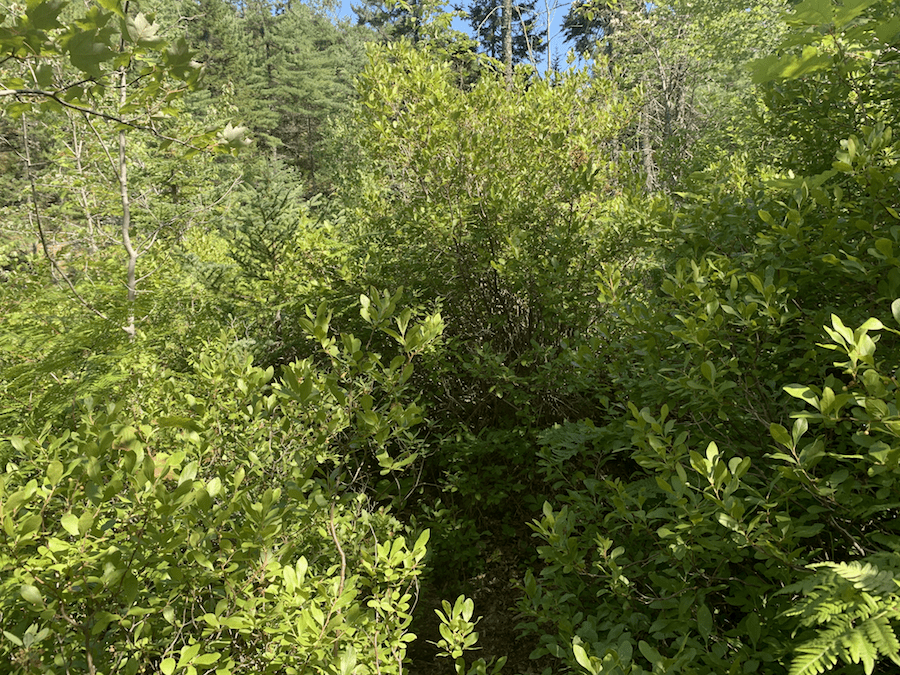
As we can see, it wasn’t the most enjoyable part of the hike! This trail is between 1.5 and 2 km but felt much longer as we relied heavily on GPS to find our way and pushed through thick brush to get to where we were going.
Eventually, this trail ended at a connection to Mike’s Trail. It was nice to be back on the relatively groomed backcountry trails.
From there, we made our way west, passing the many (now familiar) offshoots of the Fox Lake and Hobson Lake trails.
Before we reached Ash Lake, we dipped off the Hobson Lake Trail to hike the only main trail we had yet to complete: the Ash Lake Loop.
This trail was rather enjoyable and took much less time than we had anticipated. The trail offers multiple views of Ash Lake as it circles around its west side and is relatively flat in elevation.
The end of this loop reconnects with the Hobson Lake Trail. We followed this trail back (in the opposite direction of our second trip). Before long, we were back at the entrance with another fantastic Nova Scotian hike completed!
Checklists And Recommended Gear
Depending on the trails you decide to hike through, this could be a short or a long hike. We recommend bringing some supplies with you regardless of how long you’ll be there.
- Water bottle
- Hiking Shoes – Women’s // Men’s
- Snacks and/or lunch
- GPS, compass, and/or map
- Camera/Phone to take photos
- Sunscreen
- Hat
- Insect repellent
- Cascade hiking poles
- Atlantick tick removal tool kit
- Swimsuit (optional)
- Camping gear (optional)