Fairy Hole Hike, Cape Breton
The Fairy Hole/Cape Dauphin Hiking Trail is a relatively short and moderate in-and-out hike through the forest along the east coast of Cape Breton. This hiking trail is accessed at the end of New Campbellton Road. It takes hikers through the wilderness before culminating at a short yet picturesque waterfall that leads into the Atlantic Ocean.
Being roughly 60 km away from Sydney, this trail makes for a great day trip from the main municipality.
Difficulty: Moderate
Length: 2.7 km (out and back)
Suggested Duration: 1-2 hours
Signage: Sparse markers throughout
Facilities: Limited parking
Disclaimer: This article includes affiliate links. If you click one of them, we may receive a small percentage of the sale at no extra cost to you. Thank you for your support!
Key Features Of Fairy Hole
- Leads to the picturesque waterfall known as Fairy Hole
- Accessible via a relatively short and moderate hiking trail
- Passes through a mix of forested sections and streams
Facilities And Services
- Unofficial parking (The trail is beside private property. Hikers should avoid parking in front of residential homes and driveways. You can park further down the road and walk to the trailhead).
Before You Start Hiking The Fairy Hole/Cape Dauphin Hiking Trail
If you are a fan of chasing waterfalls, then Fairy Hole is a must to add to your list!
Before you begin hiking this trail, we highly recommend downloading or printing off a copy of the trail map. We personally use AllTrails to download our trail routes ahead of time (and to record our hikes), which came in handy to find the trailhead and when we reached a fork in the road.
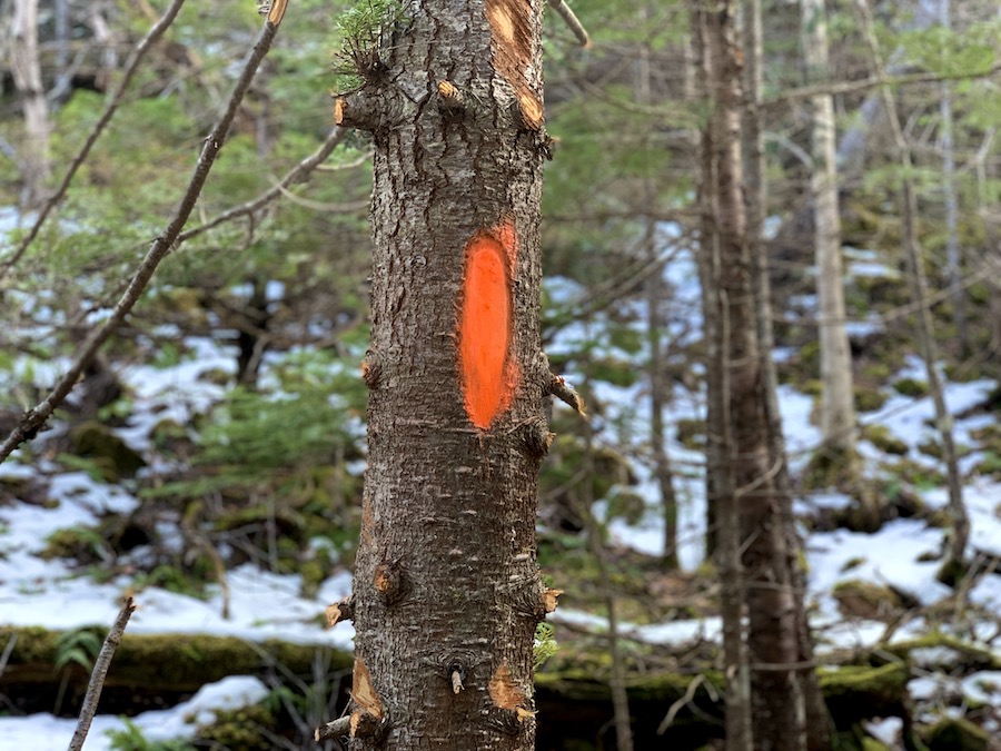
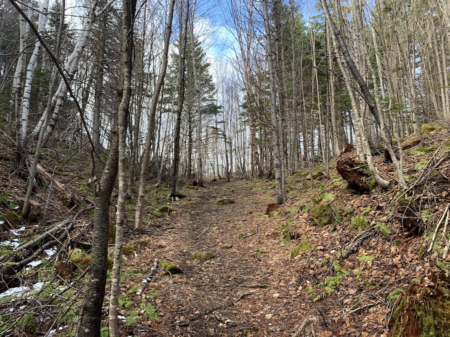
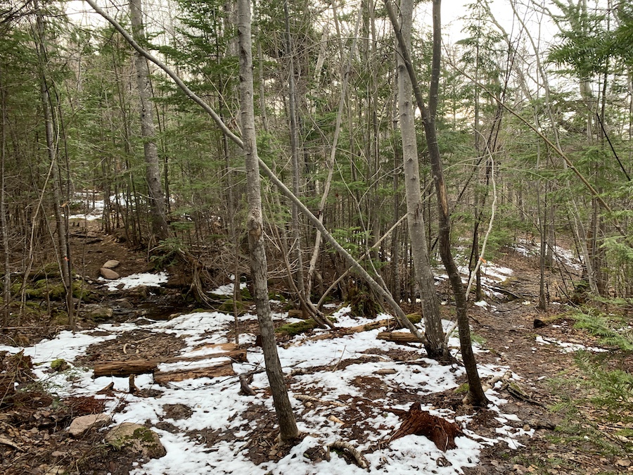
For the most part, the trail is easy to follow. There are sparse markers throughout on trees (picture below for reference). When in doubt, either check your map or look out for orange paint on the trees.
When you reach the trailhead, there are no parking signs in the area. Please respect private property in the area, and hikers should not park on these properties or block their driveways.
The trailhead is located directly next to a shed. Being respectful of private property, we did not take any photos of the shed. However, when you arrive, it should be very apparent where the shed is. The trailhead is a path on the left-hand side along a narrow brook.
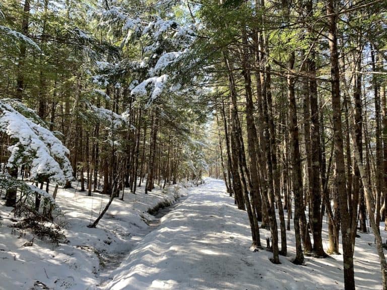
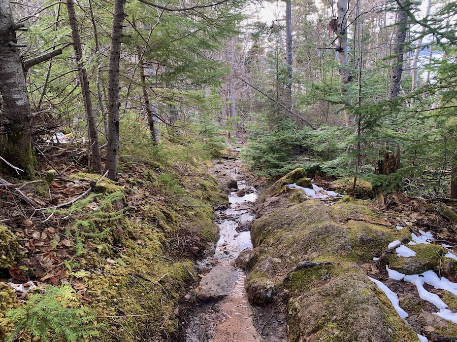
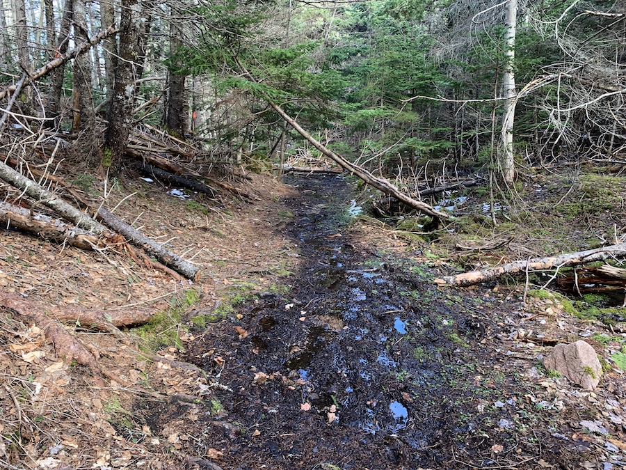
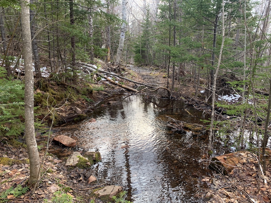
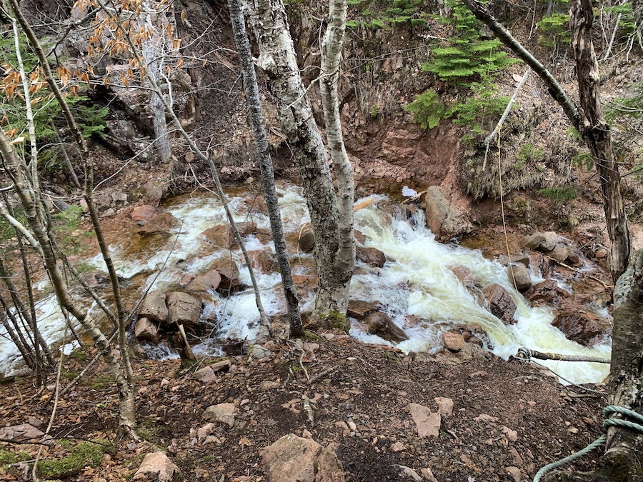
We visited the trail as the snow was almost melted and found that most of the trail had been washed out and flooded. This could be due to the season. However, during numerous parts of the trail, streams were cutting through, bringing us to conclude that this trail is likely very wet all year round (except maybe during the dry season).
For this reason, we suggest wearing waterproof shoes.
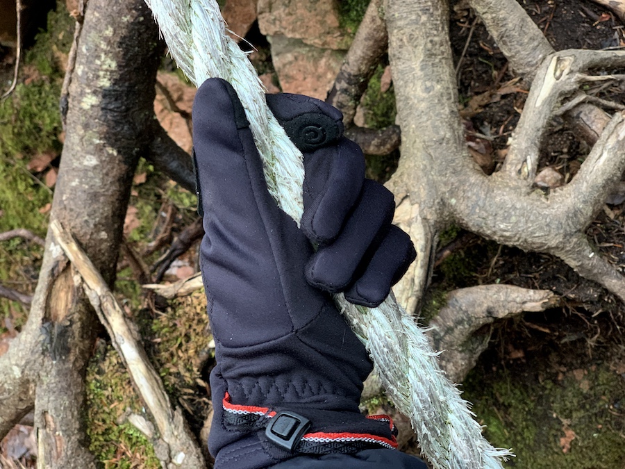
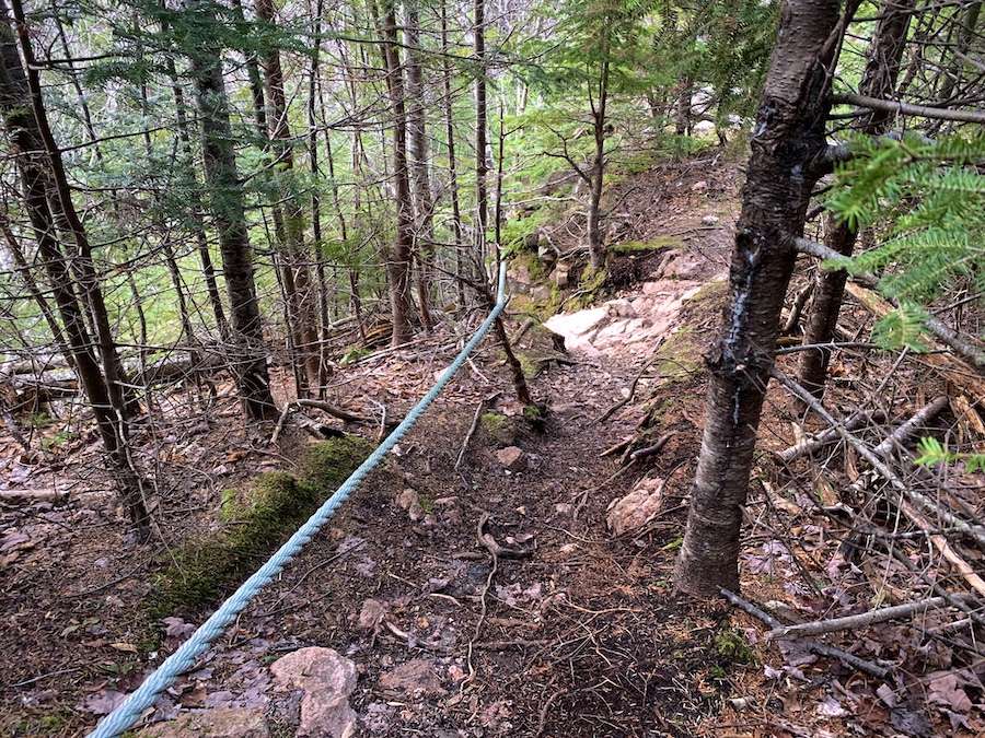
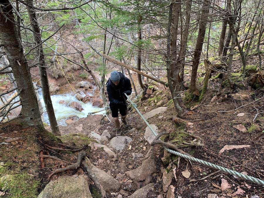
Once you get closer to the falls, there is a steep decline. Luckily, a rope has been installed to help hikers descend and ascend. This is a pretty unique part of the hike!
While the rope was able to handle both of us, we were unsure what the weight restrictions were. It might be best to go one at a time when using the rope.
In the winter months, there is a chance that this may be covered in ice and snow. Hikers should descend at their own risk.
And lastly, hikers should leave no trace behind when exploring the great outdoors. If you pack it in, pack it out.
Our Experience Hiking To Fairy Hole
Our experience hiking to Fairy Hole came in late April as the spring thaw was happening. We were staying nearby in New Harris and fancied a late afternoon hike in the vicinity of our rental.
As was previously mentioned, this meant that a large portion of the trail was washed out.
As we arrived, we were a bit confused by the No Parking signs and obvious private property. We ended up parking a bit further from the trailhead, ensuring we were not blocking the road. Once parked, we double-checked our map to ensure we were on the right path and made our way toward the falls.
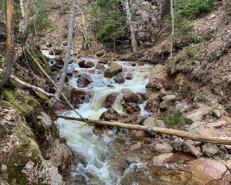
The entrance to the trail became obvious as we approached. At this time of year, there was quite a bit of running water over the trail and puddles where the softer terrain allowed. This truth was made apparent immediately and would be a common theme throughout the hike.
Here are a few photos from the early parts of the trail:
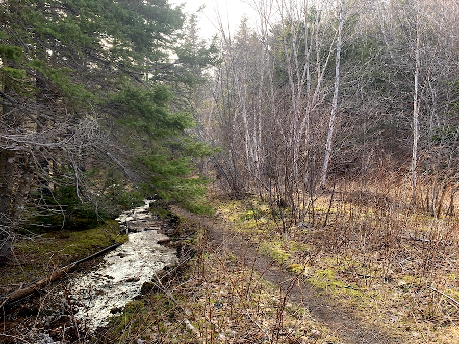
Though the trail is relatively flat, we trekked through rather slowly to avoid water-logging our boots. We would hike to the top of Franey Mountain the following day and didn’t want wet boots in doing so. Avoiding puddles was relatively easy, though it took some additional time.
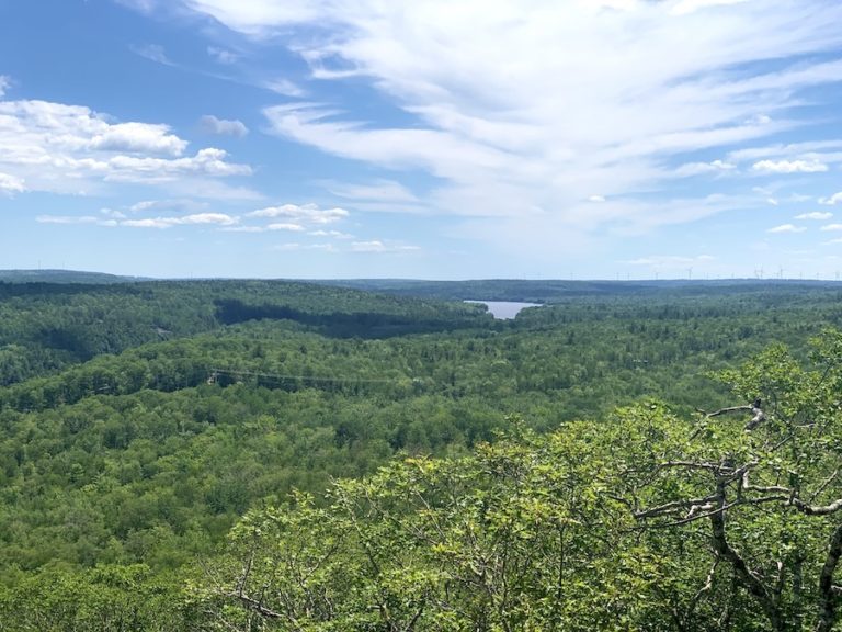
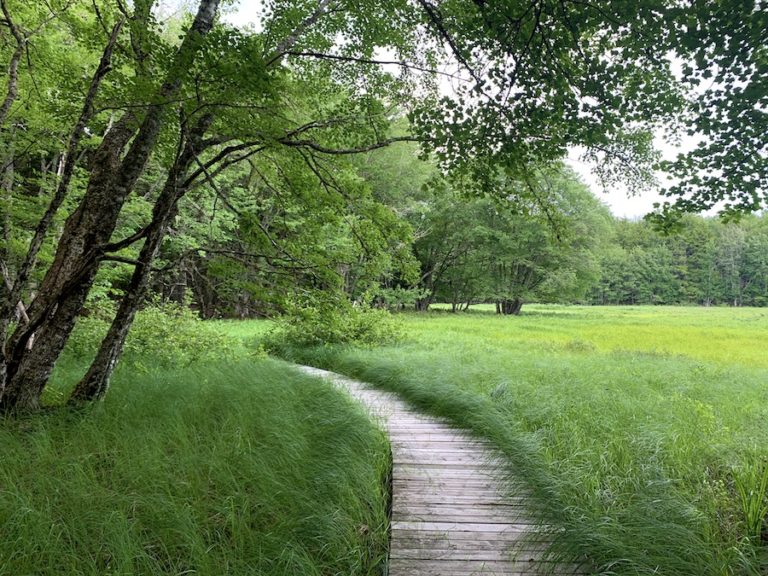
All in all, we enjoyed being in nature. The trail was quiet and offered a peaceful time in the wilderness.
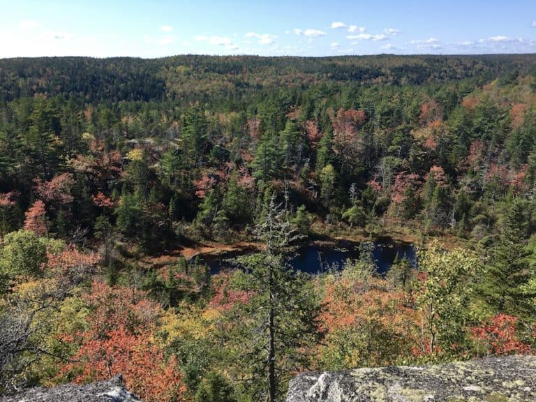
Eventually, we came to a split in the trail. At this point (pictured below), we took the righthand path to get to the falls.
As we began to walk down this path, we startled a couple of nearby grouse (and they startled us). The birds would be the only wildlife we would encounter on this adventure.
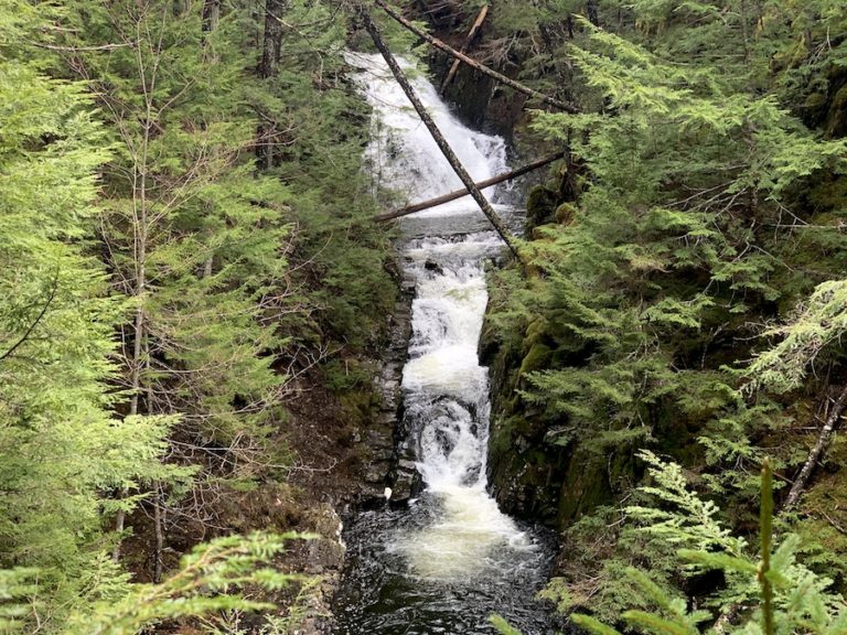
When we approached the Big Brook and Fairy Hole, we began to descend. As was previously discussed, this steep decline is made easy with the help of a sturdy rope. We made our way, one at a time, from each of the anchor points of the long rope.
Safely, we reached the water, where we would enjoy our time admiring the powerful flow of the Spring thaw as the water travelled to the ocean.
Here are a few pictures from our time at the bottom:
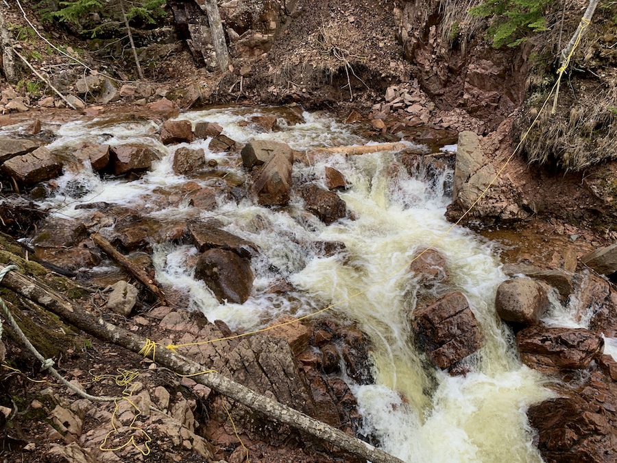
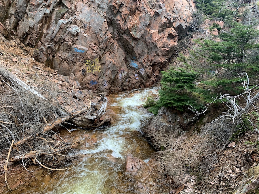
Of course, this is not the tallest waterfall in Nova Scotia (it’s North River Falls), but as a quick hike, the Fairy Hole/Cape Dauphin Trail was a perfect way to spend the second half of a spring day.
We climbed back up to the main trail and got back to our vehicle without issue, happy with another hike to write to you about!
Checklists And Recommended Gear
- Water bottle
- Hiking Shoes – Women’s // Men’s
- Camera/Phone to take photos
- Sunscreen
- Hat
- Insect repellent
- Cascade hiking poles
- Atlantick tick removal tool kit
Related Hikes
WATERFALLS IN NOVA SCOTIA
- Baxters Harbour Falls & Black Hole Falls (Baxters Harbour, Nova Scotia)
- Liscomb River Trail (Liscomb Mills, Nova Scotia)
- Victoria Park (Truro, Nova Scotia)
- Phantom Falls (Fantum Falls) (Nova Scotia, Canada)
- Dawson Brook Falls (Ellershouse, Nova Scotia)
- Uisge Ban Falls (Cape Breton, Nova Scotia)
- Horse Pasture Brook Falls (Wentworth, Nova Scotia)