Exploring The Cape Byron Walking Track In NSW, Australia
Byron Bay is one of the many beautiful small towns on the east coast of Australia. The Cape Byron Walking Track is a superb front-country walk accessible from the town that takes its visitors along the coast, by the Cape Byron Lighthouse, and to the eastern tip of the Australian mainland.
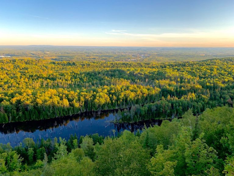
This walk takes place in the Cape Byron State Conservation Area, a national park effectively landlocked by the town. The Walking track passes through multiple terrains, including the beach, grasslands, and clifftops. It features plenty of opportunities to take in the incredible views of the Pacific horizon and the coastal line of Australia.
The main walking trail is a relatively short 3.7-kilometre stroll (full loop) and is fairly accessible due to the excellent man-made walkway. Other trails extend this hike, such as the backcountry Tallow Ridge Track (about 1 km total length) and the short Palm Valley Loop (a 270 loop near one of the car parks).
Difficulty: Easy to Moderate
Length: 3.7km
Suggested Duration: 2 hours
Signage: Some signs along an easy to follow the trail
Facilities: Parking, cafes, and garbage bins are located throughout
Disclaimer: This article includes affiliate links. If you click one of them, we may receive a small percentage of the sale at no extra cost to you. Thank you for your support!
Key Features Of The Cape Byron Walking Track
- A scenic coastal walking trail in Cape Byron Reserve
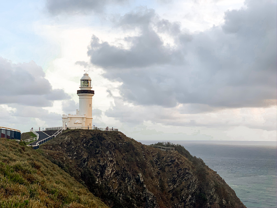
- Features the iconic Cape Byron Lighthouse at the easternmost point of mainland Australia
- Offers stunning panoramic views of the Pacific Ocean
- Passes through rainforest, eucalyptus forest, and coastal terrain
- Ideal for hikers and nature enthusiasts
- Well-maintained front-country track
- Accessible year-round with moderate difficulty
Before You Start The Cape Byron Walking Track
Before you get to the Cape Byron Walking Track, there are a few things we think you should know!
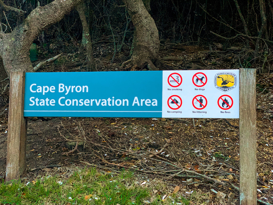
To begin with, this walking track is within the Cape Byron State Conservation Area (national park). This inherently comes with some rules to follow. Notable regulations include:
- No dogs
- No camping
- No littering
- No fires
- No smoking
The next valuable piece of information to know is parking.
Although there are many parking spaces near the entrances of the Cape Byron Walking Trail, it’s best to get there early as the free spaces fill up quickly. Car parking is available along the streets and at the following spots:
- Kostenpflichtiger Parkplatz
- The Pass Parking Lot
- Lighthouse Road Parking Lots
For up-to-date information on parking fees at the Cape Byron State Conservation Area, click here.
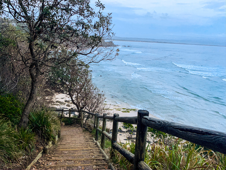
As we’ve mentioned, the actual trail of the Cape Byron Walking Track has been built magnificently and is very well maintained.
Though the path does have a difference of about 85 metres from the lowest to highest elevation (and some climbing in between), we’d argue that this trail is suitable for people of all ages and fitness levels.
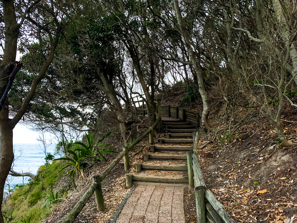
Note that there are well-constructed steps throughout the climbs and descents in the main trail. However, there are no wheelchair-accessible ramps.
Below are pictures of steeper inclines in the trail made easier by the addition of stairs into the track and a railing along the cliffside:
There are additional things to do in the park before, after (or even rather than) walking the track in the Cape Byron State Conservation Area (though we obviously recommend doing the walk). These include:
The Cape Byron Information Centre is open from 9:30 a.m. to 4:30 p.m. daily (except Christmas).
The Lighthouse tour (Cape Byron Lighthouse precinct is open from 8:00 a.m. to sunset except for Christmas).
The Maritime Museum (in the former Lighthouse Keeper’s office at the lighthouse base) is open from 10 a.m. to 4 p.m. daily (except on Christmas).
There are multiple cafes, including the Pass Cafe, Rae’s on Wategos, and the Cape Byron Lighthouse Cafe.
Other than that, we think you should know that the Australian sun is powerful (though you likely already know). It’s always advised to wear sunscreen and stay hydrated during your walk. Please stay safe and enjoy the excellent walking track and the breathtaking views it offers!
Our Experience Hiking The Cape Byron Walking Track
Our Cape Byron Walking Track experience actually started well before the exact walking track at our Air BnB just outside of the town centre. With the sunrise happening just after 06h00, we were out the door at 04h45 to walk through the town and embark on a sunrise walk along Cape Byron.
By 05h30, we were on the walking track, and the skies were starting to brighten. We were eager to get to a good look-off point for the sunrise over the horizon at this point in the hike, so we stopped taking any pictures for the first little while.
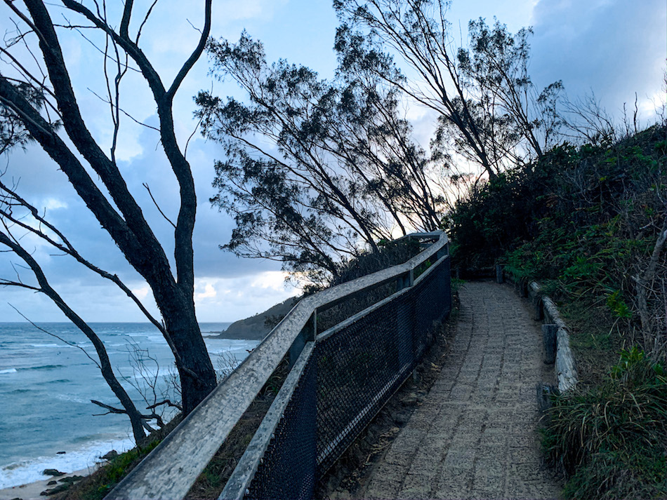
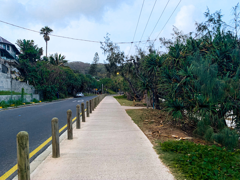
As mentioned, the front-country path is well-maintained and easy to traverse. As we see below, the path is laid with brick and has a cliffside fence and another boundary hillside. The ocean and beach to the left of the photo give you an idea of the view on the north side of the walking track.
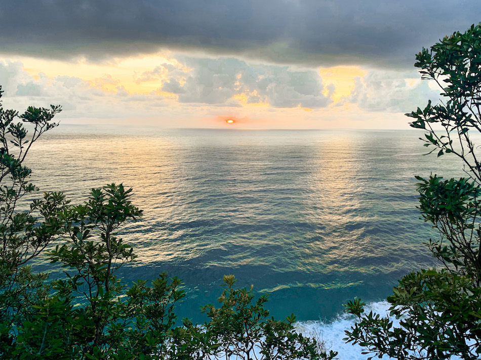
The initial sunrise, when the sun broke the horizon, was largely eclipsed by dark clouds. These clouds soon broke, and so we were able to catch a shot of the low sun to the east.
Speaking off the eastern direction, the Cape Byron Walking Track has a wonderfully laid breakoff trail (one-way) that will take trekkers to the eastern point of mainland Australia. This is certainly something remarkable about the track.
Below is a view of the most eastern point from the main track above:
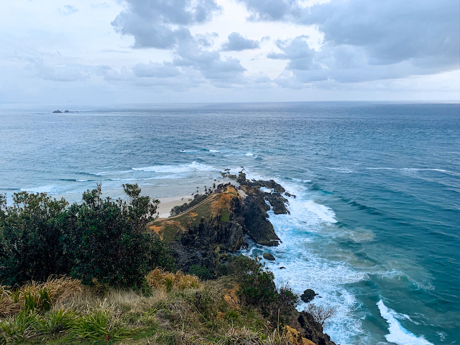
Note that it is hazardous near the rocks, and it is not advised to get too close or swim here. Save the swimming for the beaches!
We quickly made our way up the incline to the highest point of the track, where the lighthouse was located.
Construction of the Cape Byron lighthouse finished in 1901, and this lighthouse is still active. We saw its light shining through the dark skies before sunrise on our way to the walking track.
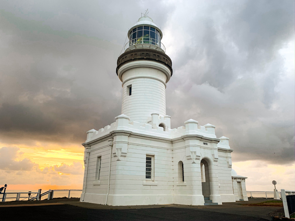
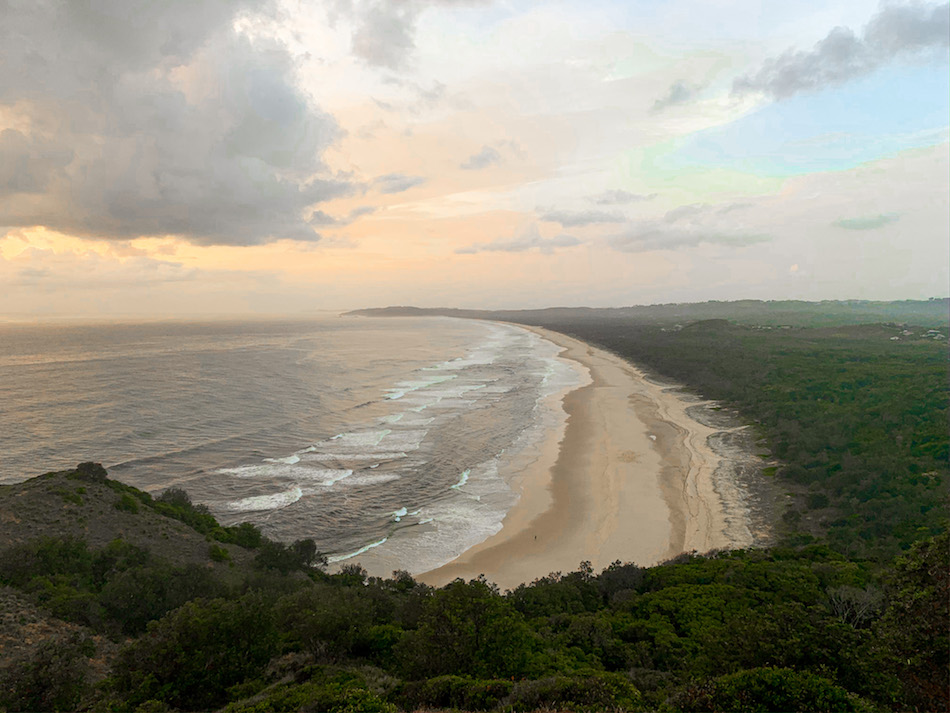
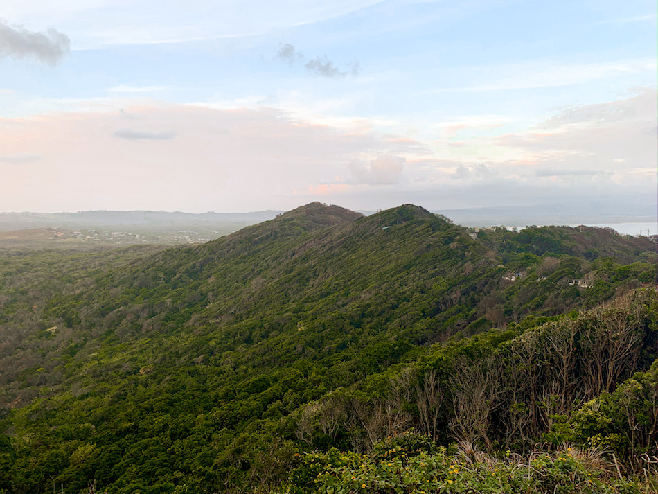
In addition to the stunning architecture of the lighthouse. This is the best part of the hike for views of the Australian hinterland, Pacific Ocean, and coastal beaches. It’s also a great spot for photos, which we took plenty of! Below is a picture of Tallow Beach and the hills/rainforest of the Australian hinterland.
After some fun with the camera, we made our way out of the walking track. Before long, we came across the entrance to a secondary trail known as the Tallow Ridge Track. This mostly backcountry trail added some wilderness hiking flair to our groomed walk, which was a perfect way to end our time in the national park.
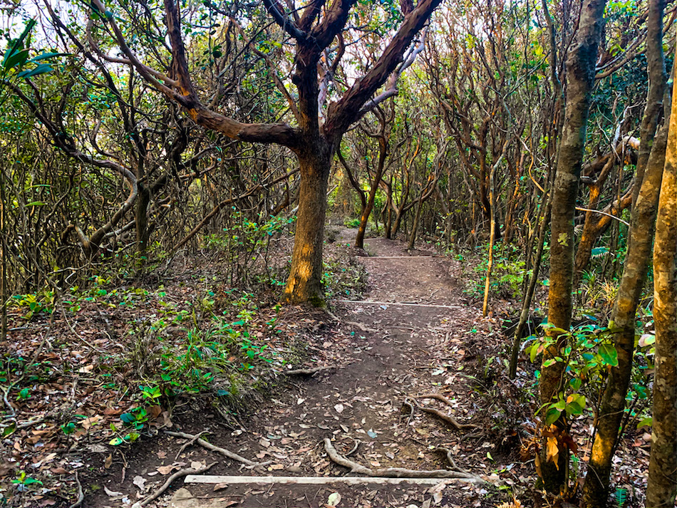
We encountered many more locals going for morning runs on this trail than on the Walking Track. This alternate way out ultimately leads us to the Lighthouse Road, where we would have come out had we continued on the Cape Byron Track.
Upon exiting the Tallow Ridge Track onto Lighthouse Road, we made our way back to our hostel through the quieter parts of Byron Bay.
Recommended Gear
Although this is a relatively short walk, we do recommend taking some gear with you. The following is our suggested gear list for the Cape Byron Walking Track.
- Water bottle
- Comfortable walking shoes
- Camera/Phone
- Sunscreen
- Insect repellent (spray or cream with a high percentage of DEET)
- Snacks or lunch
- Binoculars (for watching turtles, dolphins, stingrays, and whales – depending on the season)