Centennial Glen Reserve Hiking Trails In The Blue Mountains, Australia
The Centennial Glen Reserve circuit is one of many beautiful but challenging hikes in the Blue Mountains of New South Wales, Australia. This particular track is just west of the small town of Blackheath and actually includes a few of the town’s streets in the circuit.
This lesser-known track offers a relatively quick and inspiring 7-kilometre hike (if you decide to hike all the tracks). It takes hikers on a journey through the bush, along cliff edges, down steep descents, and, of course, to amazing lookoff points.
Difficulty: Moderate to Difficult
Suggested Duration: 3.5-5 hours
Signage: Maps and signs throughout
Facilities: Parking and vault toilets
Disclaimer: This article includes affiliate links. If you click one of them, we may receive a small percentage of the sale at no extra cost to you. Thank you for your support!
Centennial Glen Reserve Trails
- Fort Rock Track
- Centennial Glen Clifftop Track
- Walls Ledge Track
- Colliers Causeway
- Centennial Pass
- Porters Pass Track
Key Features Of The Centennial Glen Reserve Circuit
- Located within the Blue Mountains
- Multiple trails within the Centennial Glen Reserve Circuit
- Walks along the top and bottom of cliff faces
- Rock climbing walls along the trail
- A mixture of front-country and backcountry
- Multiple access points from/to the town of Blackheath
Before You Start Hiking The Centennial Glen Reserve Circuit
Although the Centennial Glen/Porters Pass circuit happens to be within the Blue Mountains, it is not, contrary to popular belief, part of the Blue Mountains National Park.
Fun Fact: Porters Pass is one of the oldest tracks in the Blue Mountains, dating back to 1888!
This means there are no official opening or closing hours, although we’d recommend doing this day hike during daylight hours. It also means the tracks are dog-friendly!
If you’ve been to the Blue Mountains, you’ll know that the ambient temperature shifts quickly within a day, especially if the sun is shining. We recommend bringing layers of clothing to switch into/out of when hiking these tracks appropriately.
Another thing to note is that there are several interlinking tracks within the Centennial Glen Reserve. It is ultimately up to you which track(s) you’d like to hike. As for topography, the tracks weave up and down through mountainous terrain. This means there are some climbs to complete regardless of the direction in which you hike the track. Considering the land, the ascents and descents are not overly gruelling.
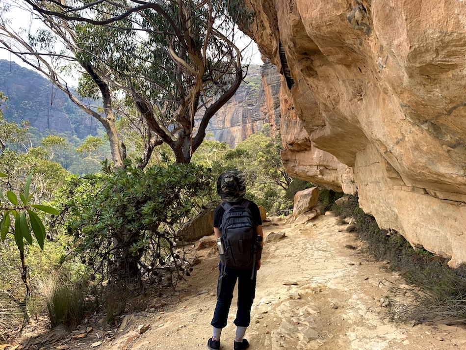
Here is a picture of the Centennial Glen Reserve map, taken from the Centennial Glen Car Park at the south end of the Reserve (and of the town of Blackheath):
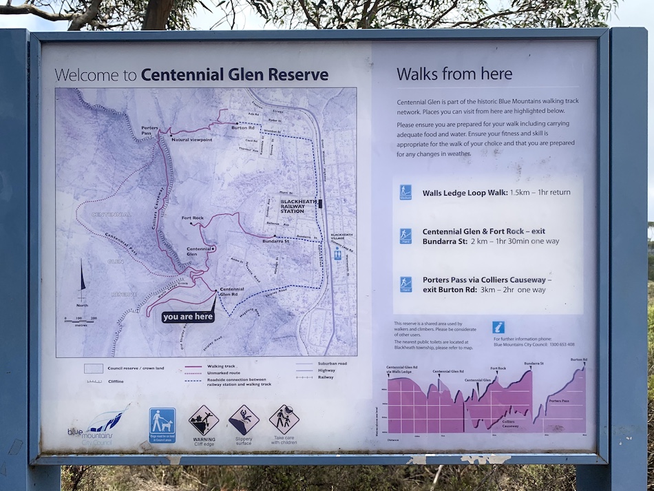
These tracks include:
- Walls Ledge Track
- Centennial Glen Track
- Colliers Causeway Track
- Centennial Pass (unmarked/ungroomed)
- Porters Pass
- Fort Rock Track
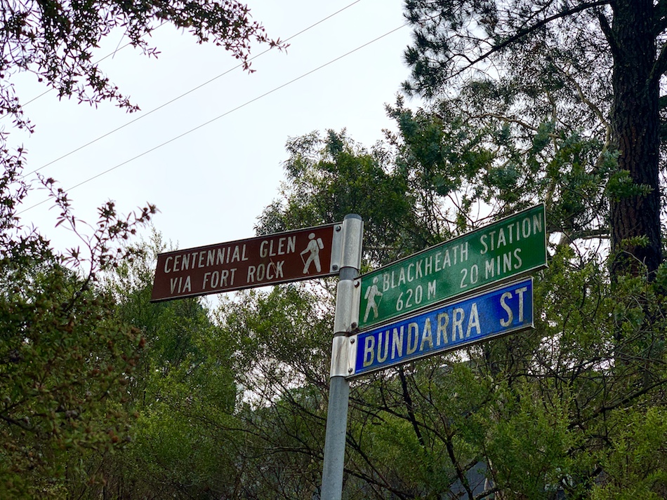
Although the picture above is taken from the Centennial Glen Car Park, there are multiple ways to enter the tracks from the town of Blackheath. Entrances include:
- Centennial Glen Car Park
- Bundarra Steet
- Burton Road
Because the tracks are so close to the town of Blackheath, there shouldn’t be any issues with cellular reception throughout the track, which helps tremendously in case of emergency (and to check your location on a maps app if you’re unsure of where you are). That being said, we always recommend unplugging from your phones (unless to take pictures) and enjoying nature and hiking!
Other than that, it’s important to note before you go that there are definitely inclines and declines in this trail. Hiking poles are always encouraged to reduce the impact on your joints.
There are also some wetter spots and mud around the waterfalls. So, as always, bring appropriate footwear.
Our Experience Hiking The Centennial Glen Reserve Circuit
As we’ve discussed, the Centennial Glen/Porters Pass circuit is actually made of 4 separate hikes connected at certain geographical changing points.
We stayed at a hostel called No.14 Lovel Street in Katoomba the night before and after our hike in the Centennial Glen Reserve. From here, we took the train to and from Blackheath, so our “hike” really started and ended at the train station.
We entered the walking track from Bundarra Street and made our way to Fort Rock first. We hiked south on the Centennial Glen track before completing the Walls Ledge track and followed that by making our way through the Colliers Causeway. We ended our hike with the ascent through Porters Pass, exiting the trail at Burton Road and making our way back to the Blackheath Station.
This gave us a 7.2 km hike with 186 m of elevation difference between the highest point (1067 m) and the lowest point (881 m). Of course, there were many climbs and descents between these two elevation points.
Through Blackheath & The Fort Rock Track
We got off the train and headed to Station Street. Immediately, there was a sign pointing us toward the Centennial Glen hiking tracks. We followed the signs leading us to the entrance at the end of Bundarra Street. These signs have both distance and estimated times posted. Though the distance is hard to argue, the times on these signs are very conservative (if you’re a seasoned hiker, it should take you much less time).
After a brisk walk through town, we made it to the end of Bundarra Street and began hiking the first track.
Our initial reaction to the track was that it was well-groomed and taken care of. When we hiked Centennial Glen Reserve, it seemed like there was a plan to develop the beginning of the trail toward Fort Rock further. Materials for stairs and landscaping were scattered throughout the beginning leg of this trail.
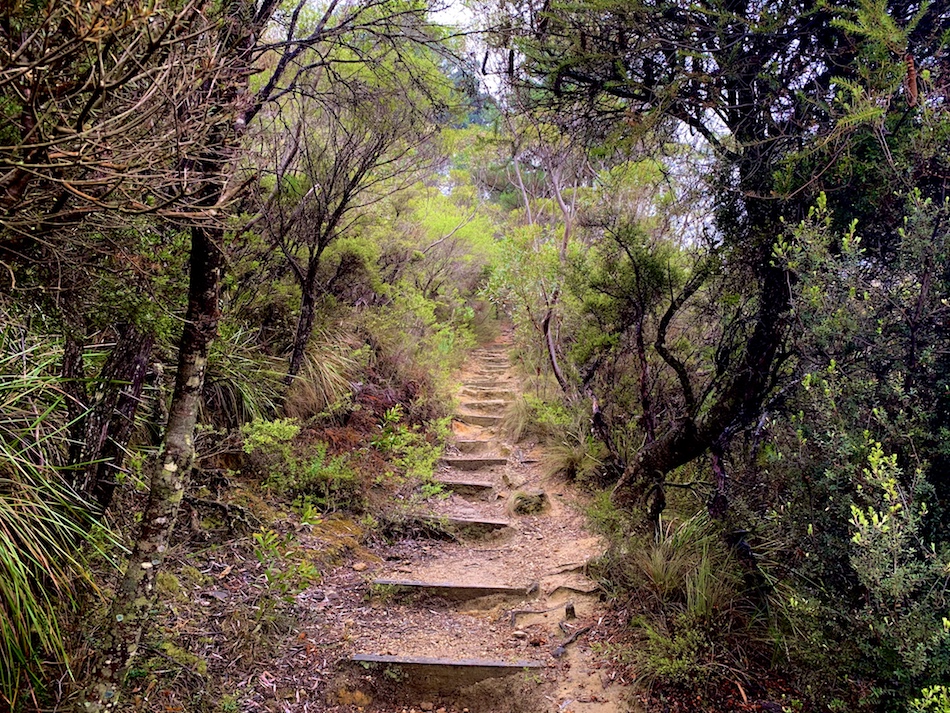
As usual, we started slow on our hike to warm up our legs and get our cameras prepared (we always overdo it on photos in the early stages of a hike!).
Coming from Nova Scotia (a relatively flat part of the world), we were thoroughly impressed with the viewpoints at the beginning of the track. Ultimately, these look-offs wouldn’t even compare to what we would see further into the tracks!
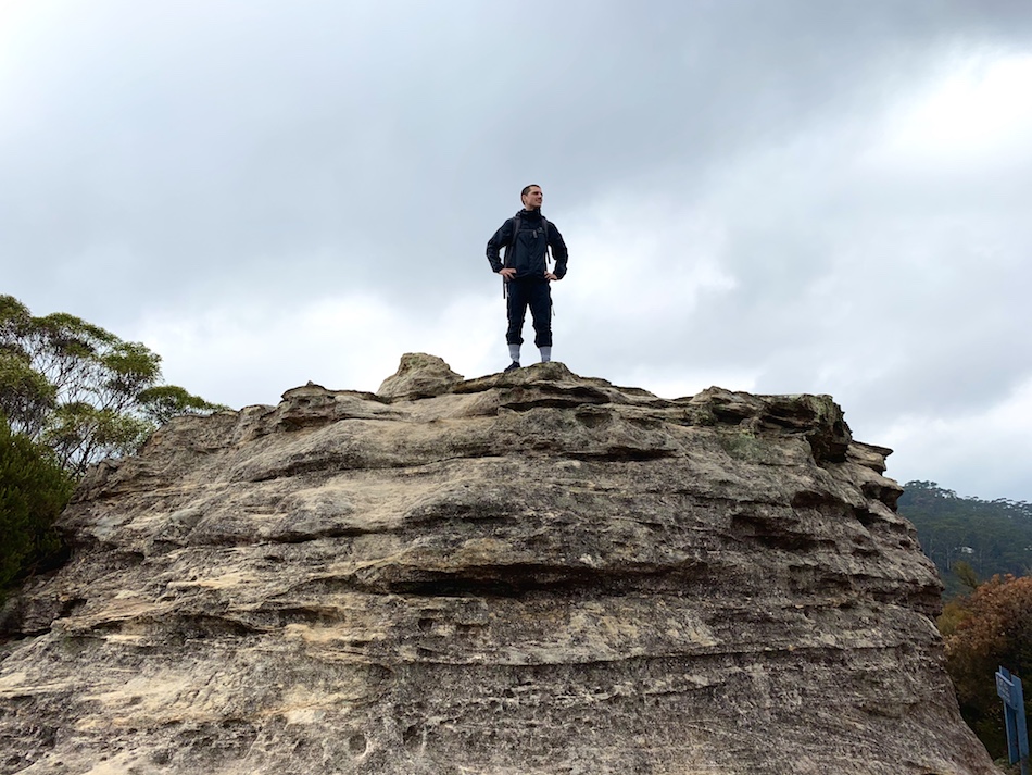
Before long, we reached the first landmark of the Centennial Glen Reserve: Fort Rock (of course, Arthur had to climb to the top). From the top of the rock, there are impressive views of Megalong Valley and Kanimbla Valley.
From here, we hiked to the end of the Fort Rock Track (a one-way trail) and headed back to the split to continue on the Centennial Glen Track, heading south.

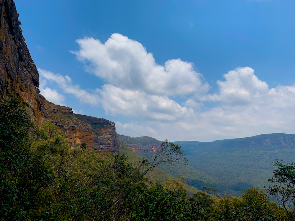
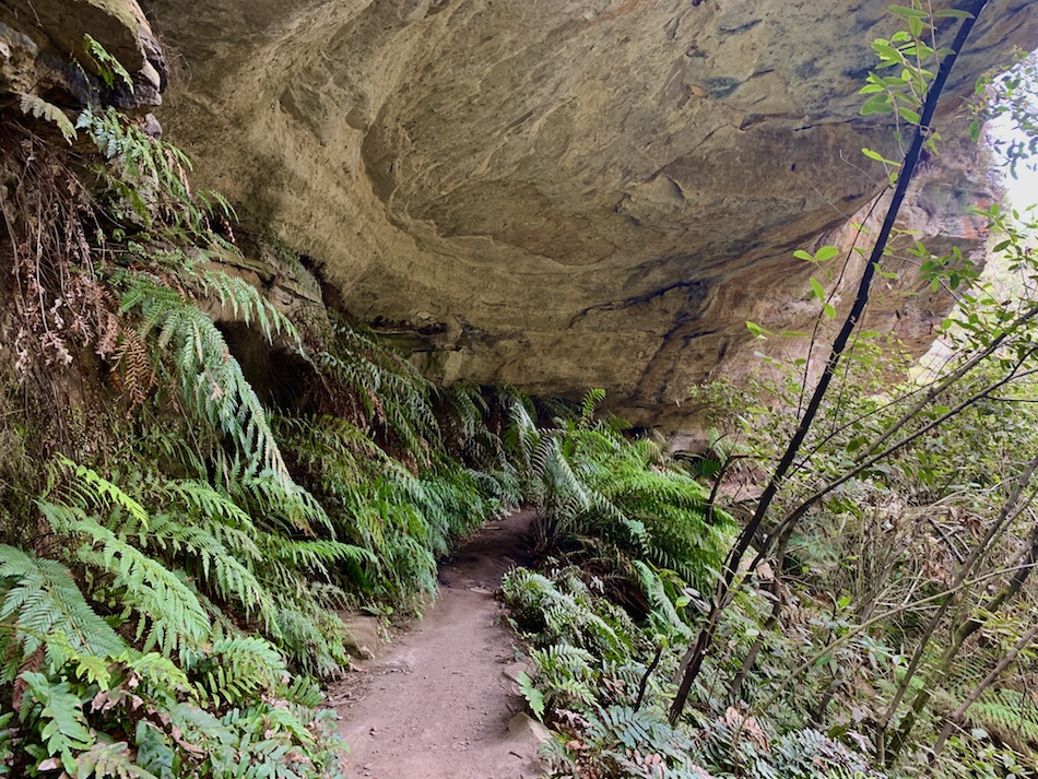
Clifftop Track Toward Walls Ledge Track
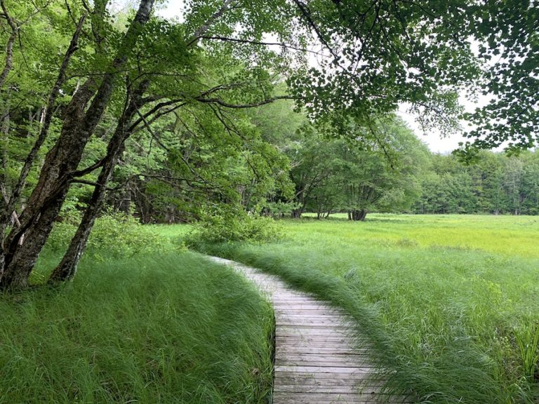
The Clifftop Track is where we really fell in love with this hike. However, we were stuck wondering why this track was called the Clifftop since the walking path was closer to a cliff bottom than the nearby cliff ledge.
Either way, this part of the hike featured some incredible views. It was well-maintained, relatively flat, and a joy to traverse.
Here are a few pictures from this portion of the hike:

In this section, we saw the first waterfall of our track. As it would turn out, small waterfalls would be common along this hike.

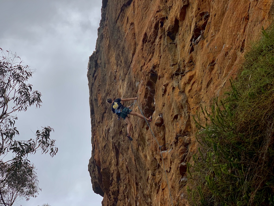
It’s also in this section of the trail that we began seeing cliff faces for rock climbers to enjoy. Though no climbers were present as we passed by.
After a brisk walk along the Clifftop pathway, we reached the Walls Ledge Track.
Walls Ledge Track
The Walls Ledge Track was an optional extra loop we decided to include in our hike. We were starting to warm up, and we were feeling good about adding the extra 1-2 km to our trek. The Walls Ledge featured some close-to-the-edge hiking and incredible views.
Though the Walls Ledge Track was narrow, with cliffs to either side, it was still safe. Safety railings are put into place to prevent accidental slips down the cliffside.

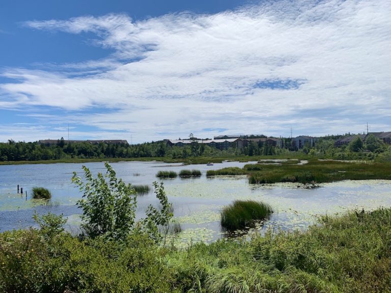
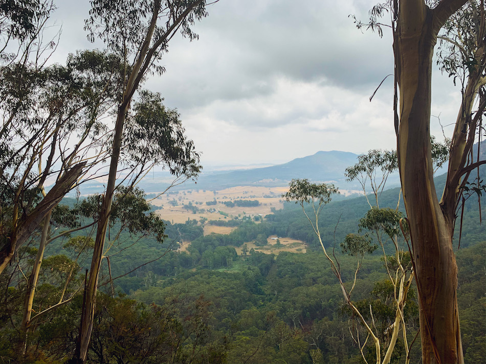
From the Walls Ledge Track, we could see far into the distance, overlooking farmland along with the Megalong Valley and Kanimbla Valley.
At this point, we stopped and listened to the immense reverberation and echoes of the bid calls as the sound bounced throughout the cliff faces. This was a major highlight of the hike for us.
In the key features listed in this article, we mentioned the popularity of rock climbing on the cliff faces of these tracks. It was in the Walls Ledge section that we began to see rock climbers regularly. One climber was kind enough to let us take photos for the blog:
The Walls Ledge Track led us along some beautiful cliffs and brought us to a second entry point to the trails: the Centennial Glen Car Park.
At this car park, we changed clothing layers to adjust to the emerging sun (and the increasing temperature that came with it). We applied sunscreen and made our way back to the trail, finishing the Walls Ledge loop and entering the Colliers Causeway.
Colliers Causeway
Colliers Causeway offered the first remarkable decline of our hike. Shortly after starting this track, we found ourselves walking down a front-country set of stairs carved out of the natural rock.
Though steep and wet, the descent was safe due to the cutaway steps in the rock and the handrailings placed throughout.

At the bottom of the descent, the track took us along the bottom of the cliff we had previously been on top of.
Shortly after reaching the bottom, there is a sign that marks the directions of the Centennial Glen Track and the Colliers Causeway. We thought it was odd to have a sign on a one-way. Little did we know at the time that this sign was actually at a trail split for the beginning of the unmarked Centennial Pass Track.
The Centennial Pass Track would have added an extra kilometre or so to our hike. This unmarked track is fully backcountry and takes hikers away from the cliff bottom and into the valley’s forest. We continued on Colliers Causeway.
In the early afternoon, the sun shined directly on us. The cliff did not offer any sun coverage. This would have been welcomed at the relatively cold beginning of the track. However, it wasn’t long after hiking under the sun that we were hot and sweaty.
The causeway offered excellent views up the cliff wall to the east and lovely views of the valleys to the west.
The southern half (which was the first half for us) of the Collier Causeway was well-groomed and easy to traverse. However, the northern half was a bit muddier and more difficult to get through while keeping the same pace. This added difficulty would ramp up to the beginning of Porters Pass, which was the most difficult incline of the hike for us.

Near the beginning/bottom of Porters Pass, there is a sign to show the Colliers Causeway and Porters Pass directions. It is near this point that the unmarked Centennial Pass Track connects to the marked trails. Again, we did not know about this track when we began hiking, so we regret to say we do not have any experience.
Porters Pass
Porters Pass is the zig-zagged incline that would bring us back to the town of Blackheath. The climb proved to be the most challenging part of the hike for us.
Much like the descent into the Causeway, the ascent of Porters Pass has front-country stairs that help hikers make the trek upward. Much of the Pass has ample sun coverage, which was welcomed in the Summer heat.


We took our time climbing up Porters Pass and felt proud of ourselves once we reached the top, knowing we had completed the most difficult part of the hike. We like to blame the added arduousness on not being accustomed to the relatively low oxygen levels and high humidity (though this was said jokingly as a bad excuse).
Fun fact: at sea level (which we’re used to), oxygen makes up about 21% of the atmosphere, while at an altitude of 1000 m above sea level (like at Porters Pass), the oxygen percentage is around 18.5%.
Returning To The Station Through Blackheath
After the most difficult climb of the hike, we exited Porters Pass onto Burton Road, making our way back into Blackheath.
We took a few minutes to stretch, drink some water and enjoy the refreshing breeze before making our way back to the Station for our return train to Katoomba.
Checklists And Recommended Gear
The following is our recommended gear list for hiking the Centennial Glen Reserve trail.
- Water bottle
- Hiking shoes – Women’s // Men’s
- Sunscreen
- Camera/Phone
- Insect repellent (spray or cream with a high percentage of DEET)
- Hiking poles
- Snacks or lunch
- Different layers of clothing (the temperature of the mountains shifts quickly)
Related Hikes
Nearby Hikes
- Grand Canyon Walking Track
- Pulpit Rock Lookout
- Lockleys Pylon