Sugarloaf Mountain Hike, New Brunswick
Sugarloaf Mountain is a must-do hike if you’re planning any hike on the North Shore of New Brunswick, Canada. It’s short and intense, but the view is well-earned once you reach the top.
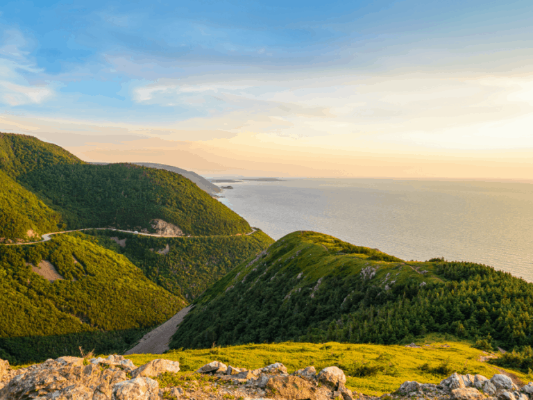
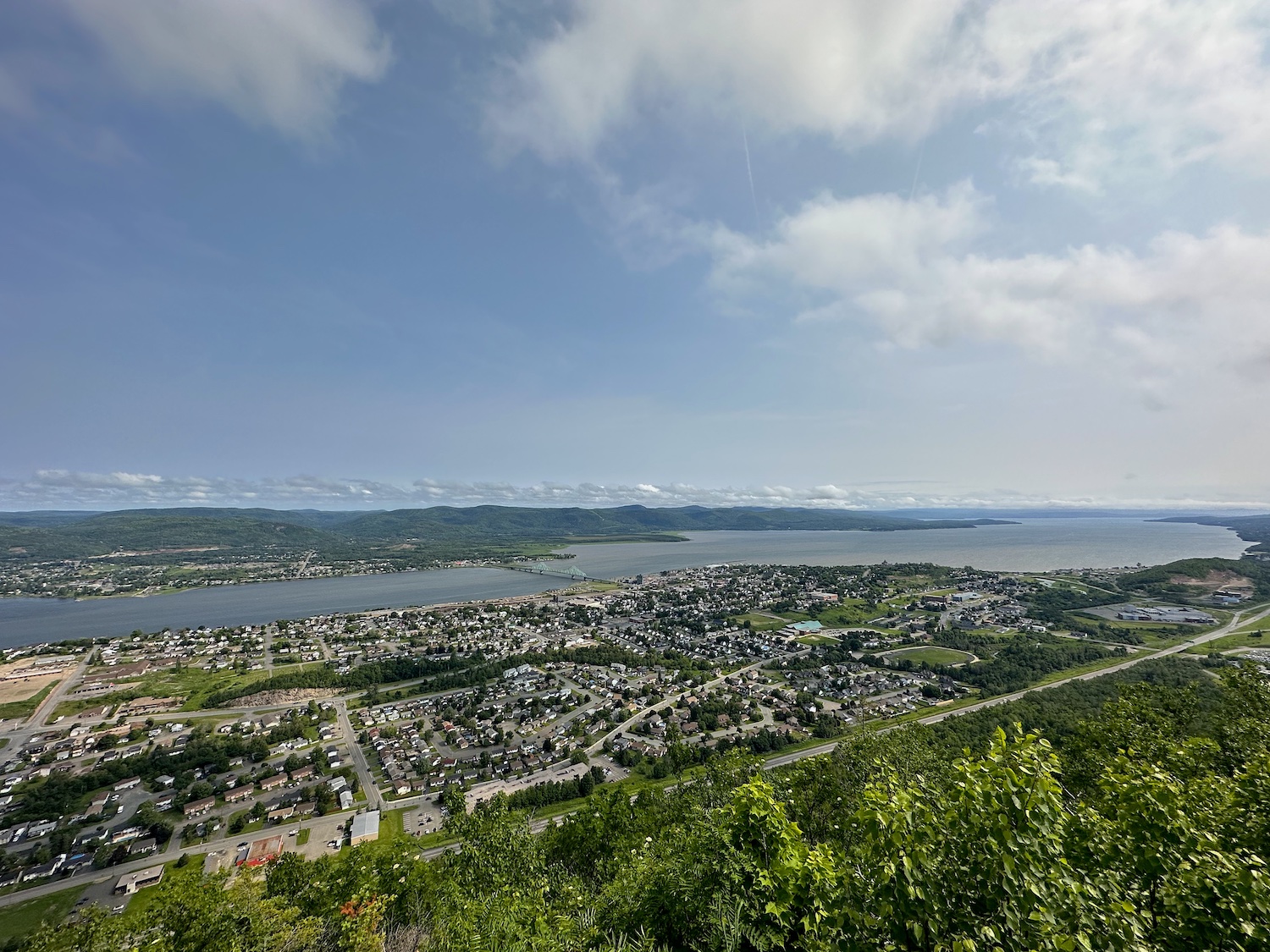
The peak of Sugarloaf overlooks the city of Campbellton, the Restigouche River, and Quebecois hills in the background. It’s an awesome look-off and a great workout for those up to the task! To access the Sugarloaf Mountain hike, you’ll first have to walk a portion of the Terry Fox loop.
Difficulty: Difficult
Length: 0.9km each way (plus 4.2km via the Terry Fox loop)
Suggested Duration: 2 to 3 hours
Signage: maps and signage throughout
Facilities: Campground, ski/snowboard/bike park, vault toilets
Disclaimer: This article includes affiliate links. If you click one of them, we may receive a small percentage of the sale at no extra cost to you. Thank you for your support!
Sugarloaf Provincial Park Trails
There are a few additional trails that surround Sugarloaf Mountain. The following are trails located in the Sugarloaf Provincial Park.
- Terry Fox Trail – Trail #8 (4.2km loop)
- Sugarloaf Mountain – Trail #9 (0.9km oneway)
- Trail #10 (3.5km)
- Trail #7 (2.3km)
- Trail #11 (1.7km)
Click below to view the Sugarloaf Provincial Park trail maps.
Key Features Of Sugarloaf Mountain
- Located near Sugarloaf Provincial Park
- Offers several hiking trails with varying degrees of difficulty
- Panoramic views of Campbellton, Restigouche River and the surrounding landscape
- Ideal for hikers, nature enthusiasts, and outdoor recreation
- Opportunities for birdwatching and wildlife sightings
- Great for snowshoeing in the winter
Facilities And Services
- Welcome centre
- Lodge
- Campground
- Vault toilets (within the provincial park)
- Picnic tables
- Parking lot
- Ski/snowboard/bike park
Before You Start Hiking Sugarloaf Mountain
There are a few things we think you should know before you head off on your adventure up Sugarloaf Mountain.
First things first, the mountain is located in the Sugarloaf Provincial Park. That means there are a few basic rules to follow, including:
- Leave No Trace principles.
- Respect wildlife.
- Leave what you find.
- Be considerate of others.
- Pack out all your trash.
The New Brunswick Parks Act also states:
- No cutting, damaging or removing of any plant, shrub, flower, or tree.
- No removing of any artifacts or natural objects.
- No hunting, trapping, snaring, injuring, or destroying of any animals.
These rules are easy to follow and ensure a safer, more enjoyable hike.
The next thing to note is parking. For the longest time, I would park just off of Val D’Amour Road. It turns out that this was either always private property or has become private property. Either way, there’s a sign that states this. Therefore, it’s best to park within the park.
There’s no entrance fee to hike up Sugarloaf Mountain, though fees may be associated with other activities within the park.
It’s worth noting, as well, that the mouth of the incline trail (Sugarloaf Mountain Trail) is actually on the other side of the mountain from the parking lot. Hikers must walk around the mountain via the beautifully groomed Terry Fox Trail before reaching the trail that climbs the mountain.
The incline hike is short (listed as 0.9 km or about 3000 ft). However, the incline is rather steep and challenging. The summit is 281.1 m (922 ft) high, and the Sugarloaf Mountain Trail starts at about 85 m (278 ft) above sea level.
That’s a climb of about 195 m along a 900 m trail (~644 ft along 3000 ft). It’s not the steepest climb, but it does make for quite the workout. It’s possible to do it even if you’re not in the best shape. Just take your time, and you’ll get to the top!
The park is open year-round. There are plenty of ski/snowboarding hills and snowshoe/cross-country trails to explore. Hiking the mountain when it’s icy may not be the best of ideas.
Lastly, it is important to keep an eye out for ticks and bring a tick removal tool with you. To learn more about tick prevention, check out our article How To Avoid Ticks When Hiking.
Our Experience Hiking Sugarloaf Mountain
Arthur here.
Having grown up on the north shore of New Brunswick, my experience with Sugarloaf Mountain is plentiful.
I’ve been to the top on school trips and with family members. There were a few Summer seasons when I worked nearby, and climbing Sugarloaf was a weekly activity (even 2 or 3 times a week).
I’ve gone several times with Julia, and the most recent time (as of this writing), we decided to take pictures for the blog! This was a beautiful early September day, just before the colour of the leaves began changing on the trees.
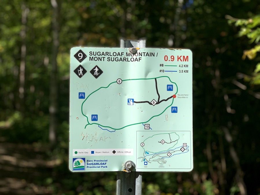
As always, we began the hike on the west side of the mountain. The map pictured below shows the starting point (as the red dot).
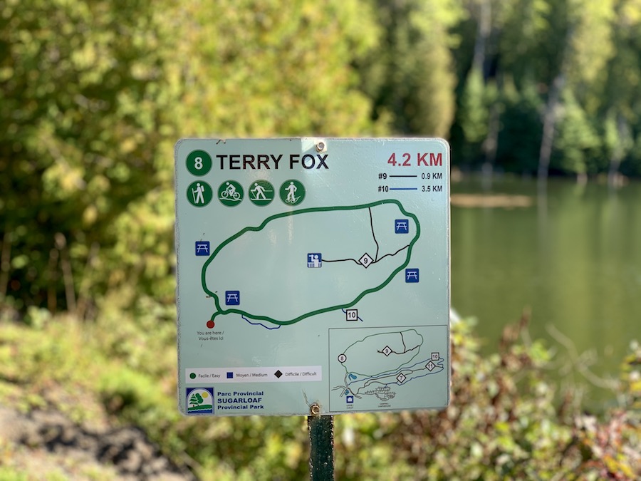
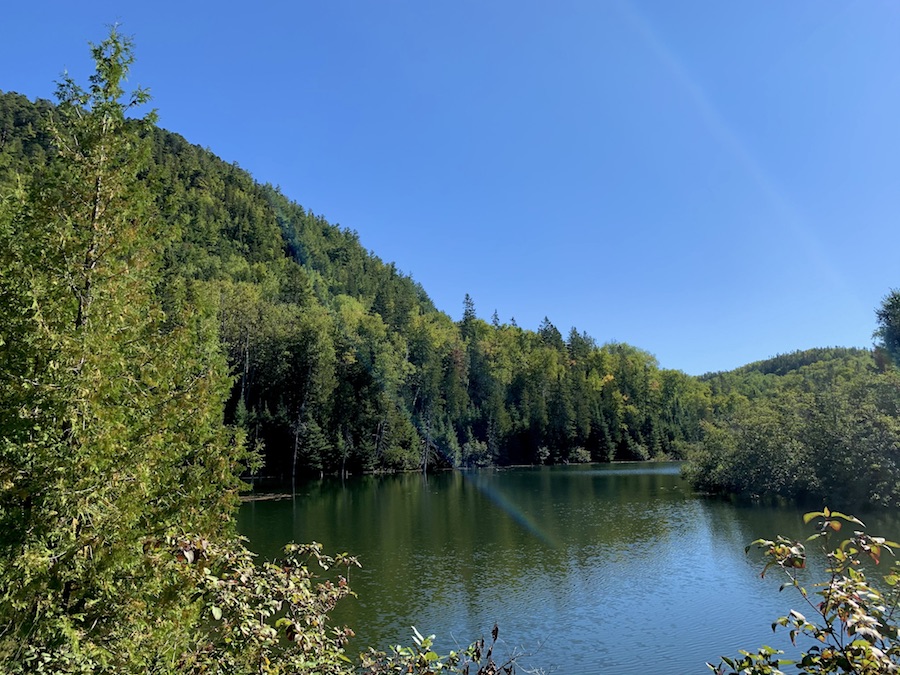
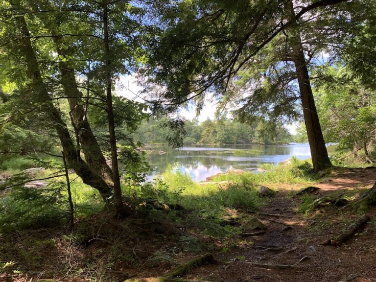
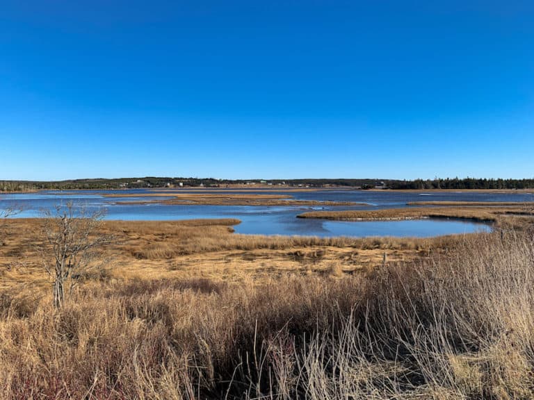
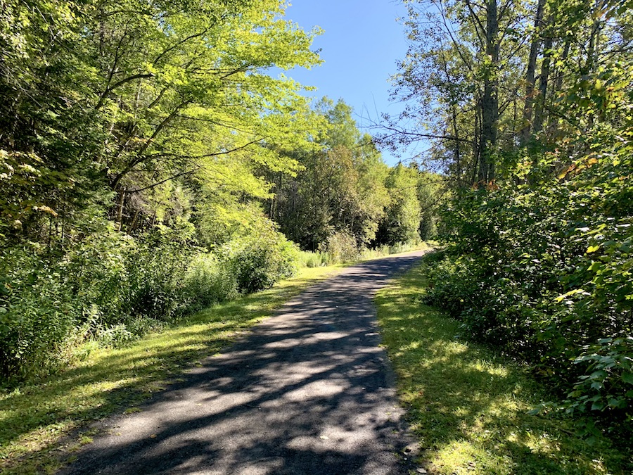
The Terry Fox Trail, which circles the base of Sugarloaf Mountain, is a great warm-up trail. It’s wide and well-maintained, easy on the feet, and offers just enough elevation difference to get the heart pumping. We went counterclockwise on this particular day.
Of course, we knew what to expect once we got onto the Sugarloaf Mountain Trail (much steeper terrain), so we got a good warm-up on the first trail.
Before long, and after passing a few friendly people and a few loud squirrels, we reached the trailhead for the Sugarloaf Mountain Trail.
After a quick stretch and a drink of water, we began our ascent.
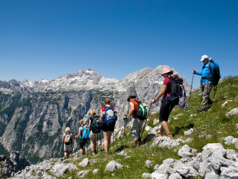
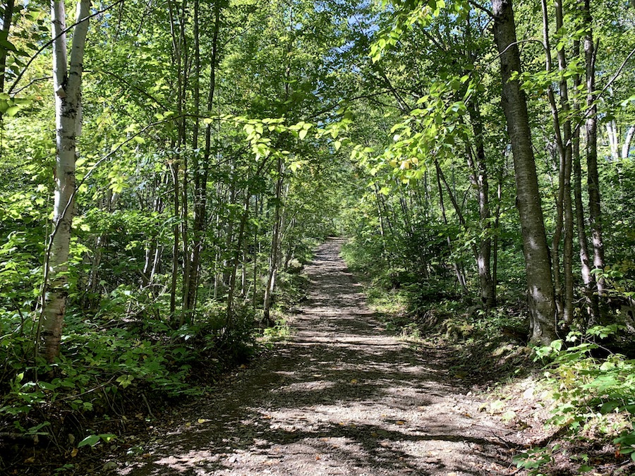
The slope gets rather steep rather quickly. However, remember that the trail is relatively short, given its length.
The first half of the trail is wide, leaving plenty of room to pick out the best foot placements to ascent with the most ease. There’s also plenty of room to take breaks!
I remember jogging up the mountain in previous years with a friend of mine who was deep into CrossFit. I had the best cardio I’ve ever had that Summer. We used to do Sugarloaf as a twice-a-week warm-up for our Mount Carleton and Sagamook hikes on the weekends.
Depending on your cardio or the “collective cardio” of the group you’re with, you may want to take breaks to stay out of your heart rate red zone.
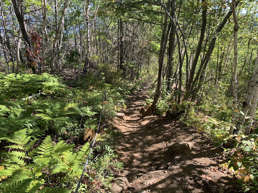
Most of the trail up goes through a wooded area. As mentioned, the trail is relatively wide, and so the sun still beams down on hikers. Bring sunscreen if you burn easily!
Though the trail is mainly surrounded by trees, there are a few look-off along the way where you can get a glimpse of what’s to come from the view at the summit.
Toward the top of the Sugarloaf, the trail terrain becomes much rockier. This felsic rock is to be expected in the northern Appalachian Mountains. Rocky summits are fairly universal atop mountains in general.
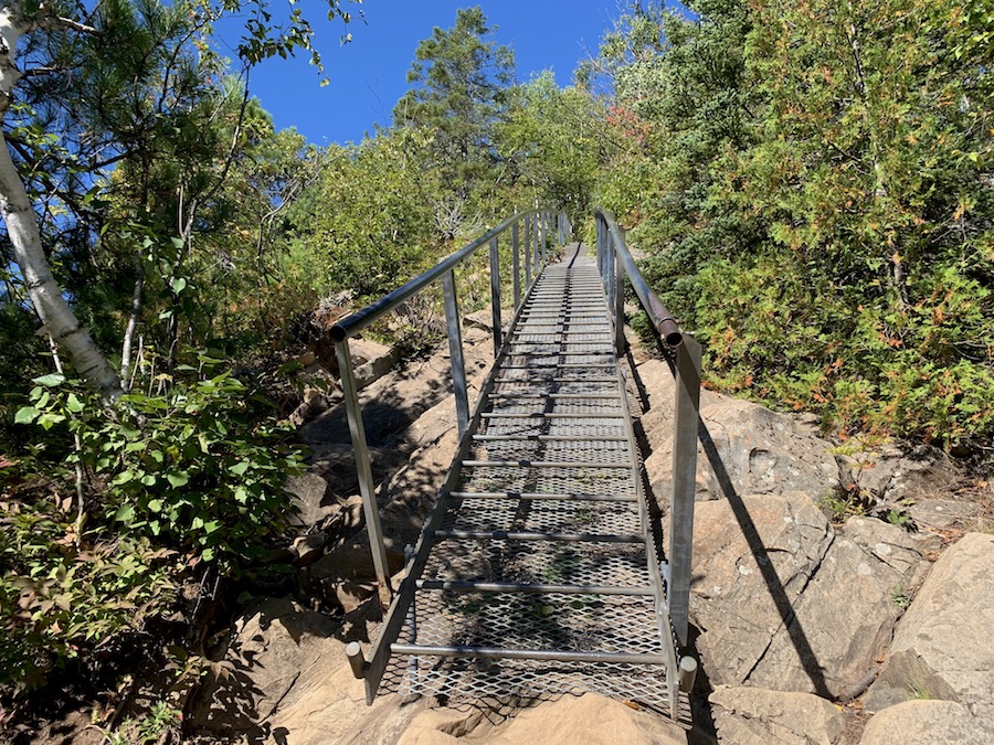
There are a few instances where staircases are carved out of the rocks. In other cases, the park decided to build cases to help hikers traverse the terrain.
Pictured below is a staircase-like ramp with stepped bars and hand railings to bring hikers up and down a particularly unfriendly portion of the trail.
The trail narrows out a bit near the top. Before long, we reached the summit!
There are a few informational signs and a flagpole on top of the mountain. The summit has plenty of space for people to gather and take in the awesome view.
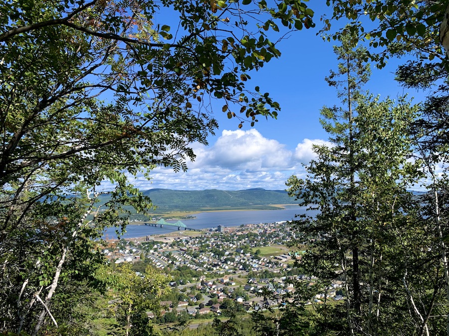
In the picture below, we see the city of Campbellton, Restigouche River, J. C. Van Horne Bridge, and Quebec (including Listuguj Mi’gmaq First Nation and the municipality of Pointe-à-la-Croix).

The peak also has a platform look-off with a chin-up bar below. As you may have guessed, my cross-fit friend pointed that one out to me.
The way down the mountain is always faster than the way up.
Around the halfway point of the Sugarloaf Mountain Trail, the trail splits northward and eastward (when going down the mountain). Both trails lead to the circumferential Terry Fox Trail, but it’s nice to change up the scenery and take the path not taken on the way up.
The north-south trail is a bit denser and shaded. It’s also a bit less rocky, which can help with knee pain (a common issue I have, personally, when descending).
Here are a few pictures from this portion of the hike.
We soon got back to the Terry Fox Trail, continued counterclockwise around the mountain, and back to our vehicle. Another successful hike up Sugarloaf Mountain!
Checklists And Recommended Gear
Depending on the trails you decide to hike through, this could be a short or a long hike. We recommend bringing some gear with you regardless of how long you’ll be there.
- Water bottle
- Hiking Shoes – Women’s // Men’s
- Camera/Phone to take photos
- Snacks and/or lunch
- Sunscreen
- Hat
- Insect repellent
- Cascade hiking poles
- Atlantick tick removal tool kit