Salt Marsh Trail: Hike Part Of The Trans Canada Trail
The Salt Marsh Trail of Cole Harbour, Nova Scotia, is a popular walk within the Halifax Regional Municipality, and for a good reason. This well-maintained multi-use trail offers wonderful views of the salt marsh as visitors walk along a former railway-turned-walking track that cuts through Cole Harbour.
The trail is accessible and has multiple parking lots. It’s part of a larger Trans Canada Trail system that includes the Atlantic View Trail (extending north to Lawrencetown) and the Shearwater Flyer (extending south to Shearwater). The 6.5 km stretch between Bissett Road and Lawrencetown Road that crosses the salt marsh is appropriately called the Salt Marsh Trail.
This is a great hike for locals and those visiting the city of Halifax. If you find yourself in the Cole Harbour area and are looking for an easy-going walk, we definitely recommend checking out the Salt Marsh Trail!
Difficulty: Easy
Length: 6.5 oneway (13km round trip)
Suggested Duration: 1 to 3 hours
Signage: maps throughout
Facilities: parking lot, garbage cans and picnic tables
Disclaimer: This article includes affiliate links. If you click one of them, we may receive a small percentage of the sale at no extra cost to you. Thank you for your support!
Key Features Of The Salt Marsh Trail
- A multi-use trail that follows a former rail bed
- Offers scenic views of the salt marshes and coastline
- Dog-friendly (on leash)
- Ideal for hiking, cycling, and birdwatching
- Opportunities for wildlife sightings, including various bird species
- Shoeshoeing in the winter
- Accessible friendly
Facilities And Services
- Parking lots
- Picnic tables and benches
- Garbage cans
Before You Start Hiking The Salt Marsh Trail
Before you head out for your own experience of the Salt Marsh trails, there are a few things we think you should know.
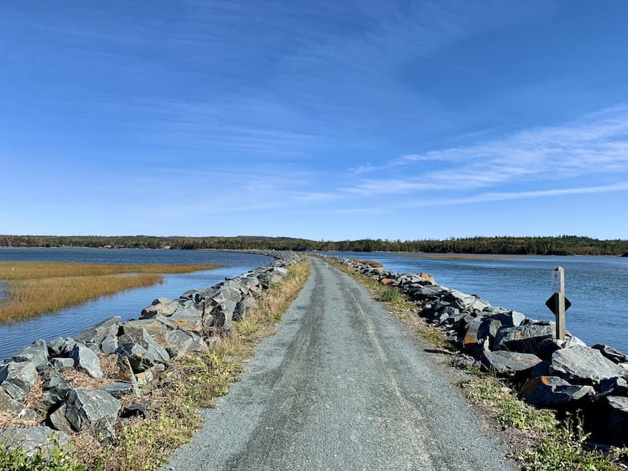
This trail is multi-use and accessibility-friendly. Whether you’re on foot, biking, pushing a stroller, or in a wheelchair, you can enjoy this flat and wide compacted crusher dust trail.
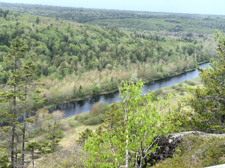
The beginning and end parts of the trail take visitors through a wooded area, while the middle of the trail passes across the salt marsh of Cole Harbour.
The trail is well-maintained during Spring, Summer, and Fall. There are distance markers to help us keep track of our position on the trail, and there are plenty of informational panels to help explain the surrounding habitat and the history of the area.
Though the trail is open year-round, there is no winter maintenance. This makes it a great spot for snowshoeing or cross-country skiing after a snowfall.
The Salt Marsh Trail is part of the abandoned Musquodoboit railroad that has been transformed into a part of the Great Trail (formerly known as the Trans Canada Trail). Nova Scotia has many “Rails-To-Trails” multi-use trails that were formerly railway lines.
The trail can get pretty busy, so practicing proper trail etiquette is important. This means a few things:
- Keep pets on leash.
- Stay to one side of the trail while walking, snowshoeing, skiing, etc.
- Cyclists should use a bell.
The wind can pick up, and there’s little shelter from it on most of the trail. We recommend wind-resistant clothing.
There’s also a great variety of wildlife in the area. Keep an eye out for the many birds and also for other animals. Watch out for poison ivy along the edge of the trail in some parts.
In addition, it is important to keep an eye out for ticks and carry a tick removal tool with you. To learn more about tick prevention, check out our article How To Avoid Ticks When Hiking.
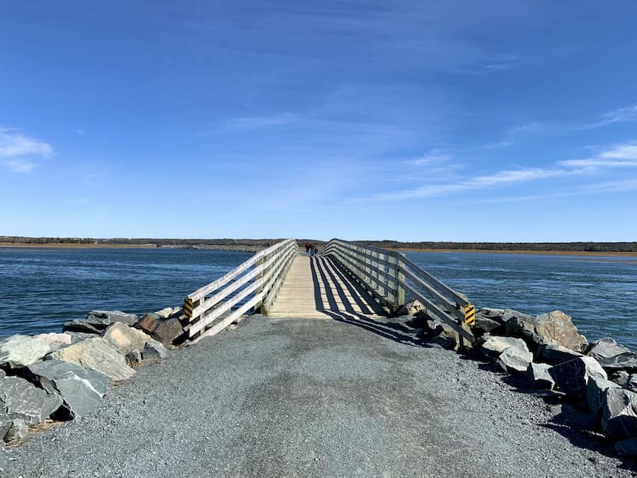
There are two access points to the Salt March portion of the Great Trail. The more popular parking lots are on Bissett Road, which attaches the Salt Marsh Trail to the Shearwater Flyer Trail. The other parking lot is off Lawrencetown Road, which is also the beginning of the Atlantic View Trail.
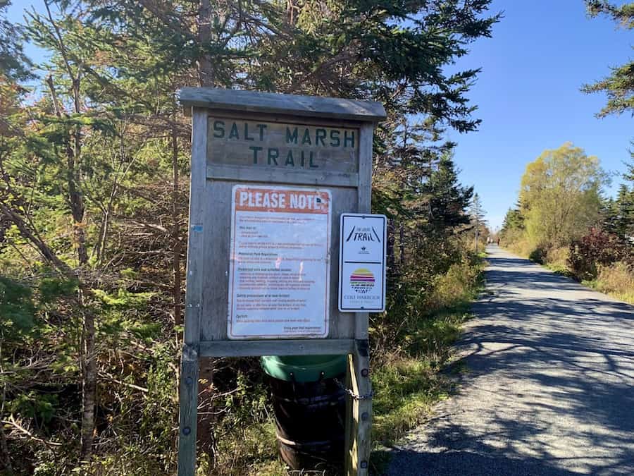
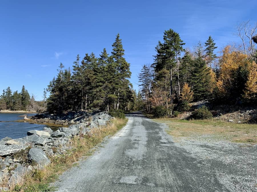
Below is a picture near the entrance of the Salt March Trail via the Bissett Road parking lot:
Other than that, we’d like to reiterate that the trail is a 6.5 km one-way trek rather than a loop, making the entire in-and-out walk 13 km. With practically no elevation, this hike can be done relatively quickly, given its distance.
Our Experience Hiking The Salt March Trail
We’ve spent quite a bit of time living in Dartmouth, so we’ve become quite familiar with the Salt Marsh Trail. It’s a great, easy hike to get out and enjoy some fresh air any time of year.
The first time we went hiking the Salt Marsh Trail, we actually parked near the Cole Harbour Heritage Park and walked through the Jerry Lonecloud Trail (unknowingly) before reaching it.
Though the Salt Marsh Trail is part of the Great Trail, we usually stick to one trail per hike (either the Salt Marsh, Atlantic View, or Shearwater Flyer Trail) rather than going for multiple in a day. Of course, this is totally possible depending on how much time we’d want to spend.
The pictures used in this article come from a mid-October walk through the Salt Marsh Trail. At this time of year, the leaves of the trees turn beautiful hues of red, yellow, and orange.
The sun was shining down on us, and the temperature was in the high teens (Celcius). The wind wasn’t particularly strong than any other day. However, we made sure to bring hats to cover our ears to avoid the dreaded wind earache.
On this day, we parked in the Salt Marsh/Shearwater Flyer parking lot off Bissett Road and were on our way.
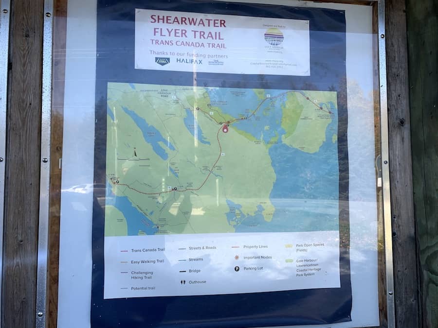
Here’s a map at the beginning of the Shearwater Flyer Trail that shows both the Shearwater Flyer and Salt Marsh Trails (the Salt March Trail is in the upper righthand quadrant of the map):
Here are a few pictures to show the aforementioned changing of the leaves. This is what the very beginning of the hike looked like before we reached the marsh.

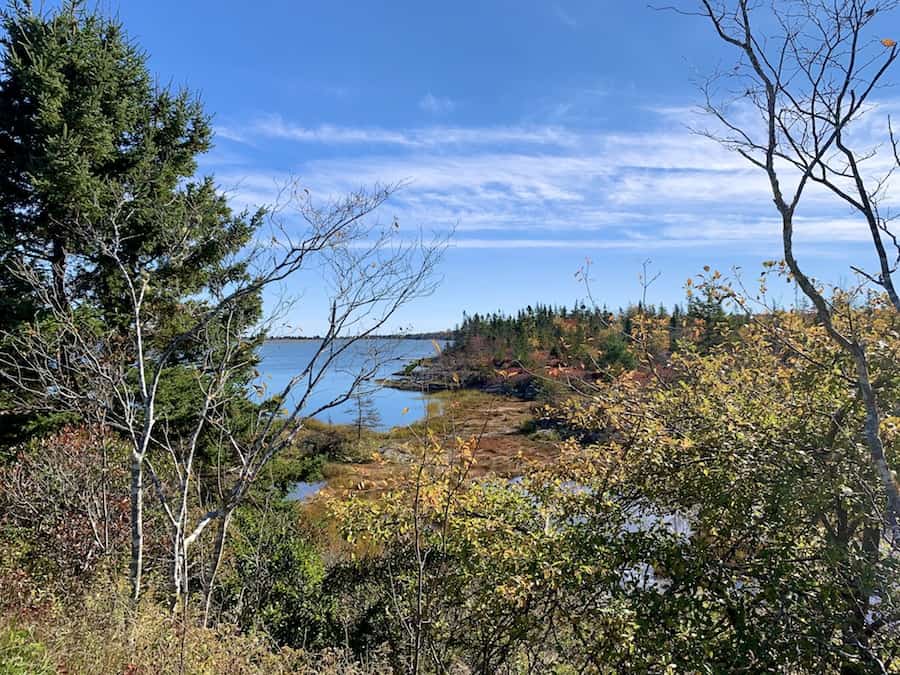
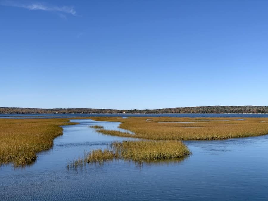
Before long (approximately 600 m), we were out of the wooded area and into the wide-open marshy portion of the trail.
Most Nova Scotian hikes we go on are either deep in the woods or along the coastline with woods nearby. Hiking across the Salt Marsh Trail is a treat, offering a full 360º open view.
It’s also nice not to have to watch for rocks or roots below our feet and really take in the view.
The trail was fairly busy on this beautiful Autumn day with cyclists and young families. We still managed to get some photos without too many people in the frame.

We saw plenty of birds in the distance while walking the trail that day. There are too many to count and identify properly. If you’re into birdwatching, we certainly recommend bringing binoculars. Perhaps we’ll try our hands at this hobby!
We took our time to take in the different views along the trail. That being said, it wasn’t long before we crossed to the other side of the marsh and were back in the woods.
It actually took a surprisingly long time to get to Lawrencetown Road once we were back in the shelter of the trees. We weren’t complaining, though. It was a nice break from the wind!
We did eventually reach the Lawrencetown Road parking lot. We took a short break and headed back the way we came.
We personally prefer loops over one-way hikes for the variety. One would think that the return walk on such a flat and open trail would be pretty much the same either way. We were pleasantly surprised that that wasn’t the case.
We saw more wildlife on the way back and caught different sights we had missed on the walk-in.
All in all, it was a great walk on this day and on every other day we’ve ever done the Salt Marsh Trail!
Checklists And Recommended Gear
The following is our recommended gear list for the Salt Marsh Trail.
- Water bottle
- Comfortable walking shoes
- Camera/Phone to take photos
- Snacks and/or lunch
- Sunscreen
- Hat
- Insect Repellent
- Cascade hiking poles
- Atlantick tick removal tool kit
- Binoculars (for birdwatching)
- Bike
- Snowshoes
Related Hikes
CRUSHED ROCK TRAILS IN HALIFAX REGIONAL MUNICIPALITY
- Shubie Park (Dartmouth, Nove Scotia)
- Hemlock Ravine Park (Halifax, Nova Scotia)
- Point Pleasant Park (Halifax, Nova Scotia)