The Shearwater Flyer Trail In Nova Scotia
The Shearwater Flyer Trail, as the name would suggest, is a trail that begins in Shearwater in the Halifax Regional Municipality, Nova Scotia. With a trailhead at Corsair Street near Halifax Harbour, it is the very beginning of this portion of the Great Trail.
The Great Trail is the most extensive recreational trail globally, with 27,000 kilometres of trails that spread through Canada’s 13 provinces and territories. The 8.6 km portion known as the Shearwater Flyer takes hikers, cyclists and others along a former railway through the woods from the aforementioned Corsair Drive trailhead to the beginning of the more popular Salt Marsh Trail trailhead at Bissett Road. This trail is a great choice for cyclists, dog walkers, runners, and snowshoers.
Difficulty: Moderate (length)
Length: 17.1 km (out and back)
Suggested Duration: 3 hours
Signage: Signs and maps throughout
Facilities: Parking and garbage cans
Disclaimer: This article includes affiliate links. If you click one of them, we may receive a small percentage of the sale at no extra cost to you. Thank you for your support!
Key Features Of The Shearwater Flyer Trail
- A scenic coastal trail in the Shearwater area.
- Part of the Great Trail
- Connects to the Salt Marsh Trail
- Passes through a mix of coastal terrain and forested areas
- Opportunities for birdwatching and wildlife sightings
- Dog friendly (on-leash)
Facilities And Services
- Parking
- Garbage cans
Before You Start Hiking The Shearwater Flyer Trail
There are a few things to note before you begin hiking the Shearwater Flyer Trail.
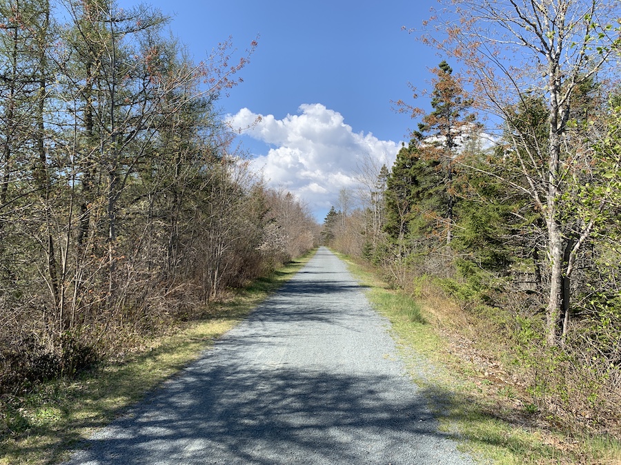
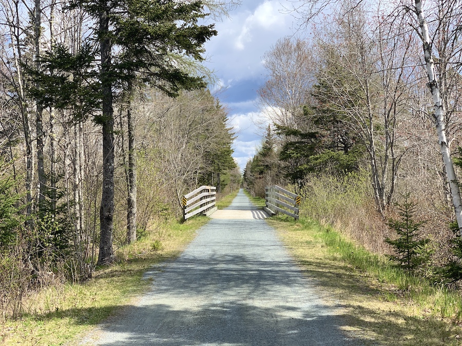
The Shearwater Flyer trail is a popular trail for both walking and cyclists. It is important to share the trail and be aware of those around you. The terrain is crushed gravel, making it both wheelchair and stroller-friendly.
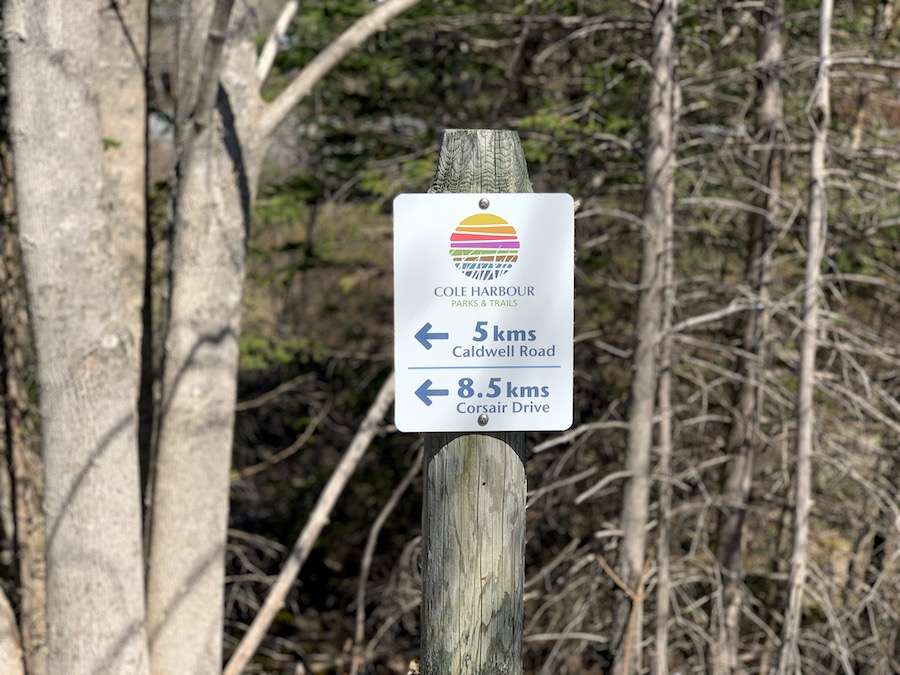
While the trail itself is easy, it is rated moderate due to its length. You do not need to hike the entire 17.1 km and can turn around at any point if you need to. There are distance markers throughout to let people know how far along the trail they are, as shown in the picture below.
As this is an unsupervised trail for reactional use, there are a few rules in place.
- All dogs must be on a leash
- Clean up after your dogs
- No camping, fires or tree cutting permitted
- No hunting
- No ATVs between the hours of 12:01 am and 6:00 am
- No swimming or diving from bridges
- Cyclists must signal to others on the trails when passing.
There is no sun coverage, so be sure to wear a hat and pack sunscreen, especially in the warmer months. In addition, be sure to wear insect repellants and check for ticks. We recommend bringing a tick removal tool with you and checking yourself and your pets before getting into your car.
Note that although the trail is open year-round, there is no winter maintenance. This makes it an excellent spot for snowshoeing or cross-country skiing after a snowfall.
Lastly, there are signs that indicate poison ivy is in the area near the Corsair Drive trailhead. Keep an eye out, especially if you have pets and children with you.
Our Experience Hiking The Shearwater Flyer Trail
Though we’ve lived in Halifax for quite some time, it took a few years before we even stepped foot onto the Shearwater Flyer. We had walked/hiked the Salt Marsh Trail plenty of times before but had neglected to check out this continuation of the Great Trail.
This wasn’t without reason, though. The Salt Marsh Trail is quite picturesque, taking visitors across Cole Harbour on a man-made causeway. Conversely, the Shearwater Flyer takes its visitors through the forest, offering less diversity in terms of sightseeing.
That being said, we enjoyed our walk on the Shearwater Flyer. It’s far from strenuous, being a well-maintained wide crushed gravel trail with little elevation gain. For a morning walk, this trail is perfect.
On this warm spring day, the parking lots at Bissett Road were packed. However, the vast majority of those on foot chose the Salt March Trail for their morning activities. We passed very few walkers and joggers on the Shearwater Flyer on this day, though plenty of cyclists were taking advantage.
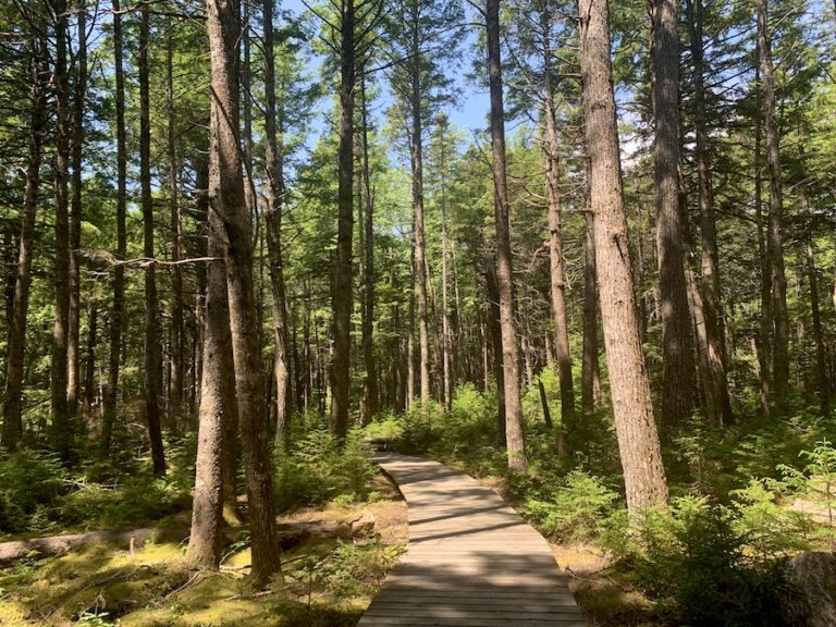
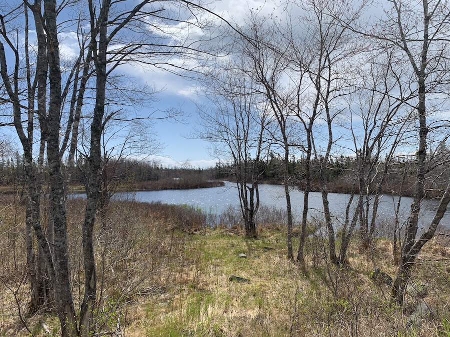
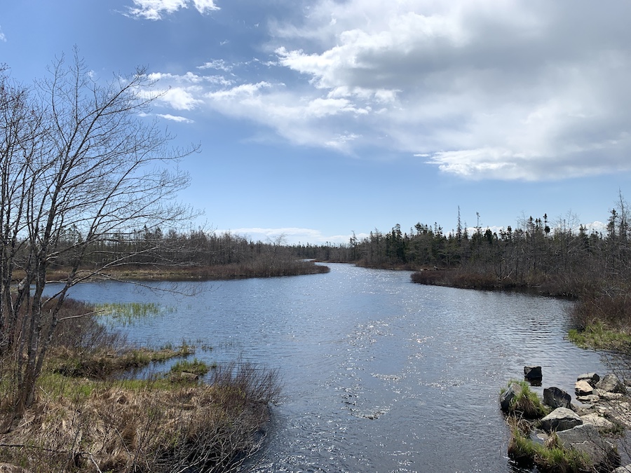
Other than the trees, a few river crossings, and passing by Morris Lake, the Shearwater Flyer is relatively unremarkable. The easy terrain made for a quick pace and a great conversation, though we wouldn’t call it the most exciting hike. As we walked along the trail, we remarked how fast someone could cycle from Shearwater to Bissett Road and beyond.
Note that the Great Trail continues beyond the Salt Marsh Trail to the Atlantic View Trail. It eventually turns into the Musquodoboit Trailway (which hosts several trailheads of superb wilderness trails). It ultimately ends at Upper Musquodoboit, near a short but sweet hike at Phantom Falls.
Here are a few pictures of Morris Lake. The Morris Lake bridge, completed in 2005, is a project of the Cole Harbour Parks & Trails Association, which maintains this well-groomed and cherished trail system.
We’d certainly recommend this hike for a long-distance walk or an easy stroll through nature.
Checklists And Recommended Gear
Although the Shearwater Flyer trail is fairly easy, we still recommend bringing some gear with you.
- Water bottle
- Hiking Shoes – Women’s // Men’s
- Camera/Phone to take photos
- Sunscreen
- Hat
- Insect repellent
- Cascade hiking poles
- Atlantick tick removal tool kit
Related Hikes
TRANS CANADA TRAILS
- Salt Marsh Trail (Nova Scotia, Canada)
- Atlantic View Trail (Nova Scotia, Canada)
- Blueberry Run Trail (Nova Scotia, Canada)
CRUSHED ROCK TRAILS IN HALIFAX REGIONAL MUNICIPALITY
- Shubie Park (Dartmouth, Nove Scotia)
- Hemlock Ravine Park (Halifax, Nova Scotia)
- Point Pleasant Park (Halifax, Nova Scotia)