Hiking Sorrow’s End Trail In Nova Scotia
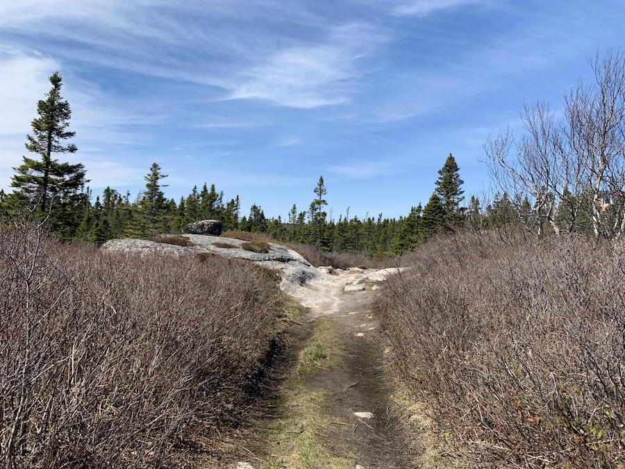
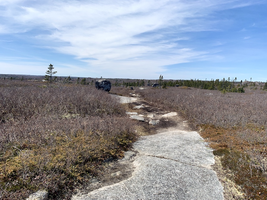
Sorrow’s End is an excellent 4.3 km hiking trail located in the Terence Bay Wilderness Area. The hike offers stunning views and features a combination of solid ground, granite rock, bush, and bog. Although many of the trails are interlinked, they are unmarked and double as ATV trails. This makes the path wide and muddy, and in some cases, tricky to follow. However, the hike is not too strenuous, and the natural sights of eastern Nova Scotia, including the Atlantic Ocean at the high points, make it well worth the effort.
Difficulty: Easy
Length: 4.3 km (loop)
Suggested Duration: 1.5 to 2 hours
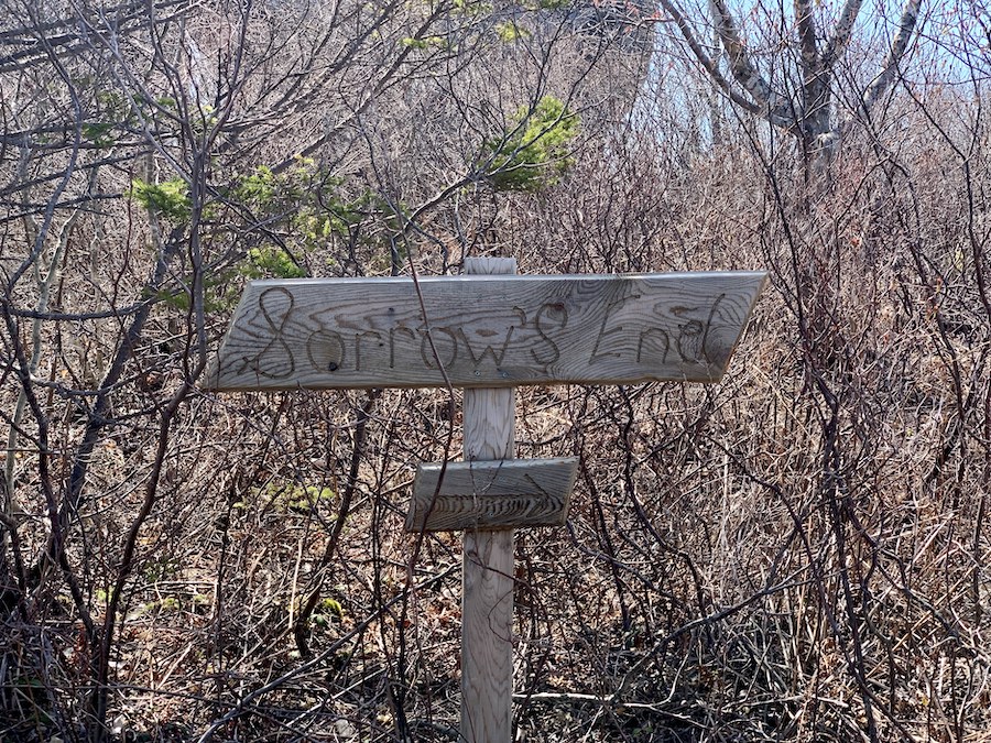
Signage: Little to none
Facilities: limited roadside parking
Disclaimer: This article includes affiliate links. If you click one of them, we may receive a small percentage of the sale at no extra cost to you. Thank you for your support!
Key Features Of Sorrow’s End
- Located in the Terence Bay Wilderness Area
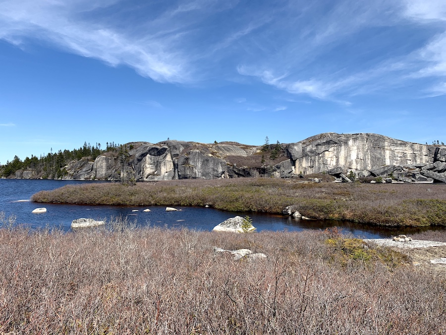
- Lookouts of Dadies Lake, Shellbird Lake and Black Duck Lake
- Passes through a mix of solid ground, granite rock, bush, and bog
- Offers opportunities for birdwatching and wildlife sightings
- Dog-friendly
Facilities And Services
- Limited roadside parking
Before You Start Hiking Sorrow’s End
Before you head to Sorrow’s End, it is essential to note that there is only enough parking for 2-3 cars. We suggest heading over earlier in the day as there are limited spaces.
Sorrow’s End is a popular spot for hikers, rock climbers and ATVs. Share the space and be cautious when on top of the rocks for people rock climbing below.
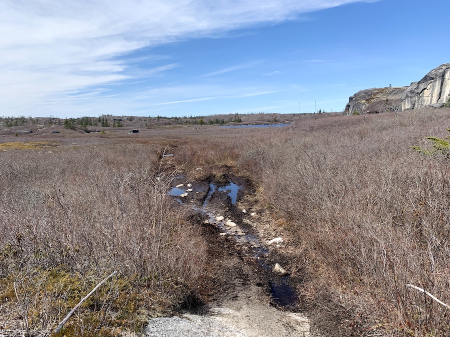
There are areas of the trail that are covered in mud and water. For this reason, wearing waterproof hiking shoes is encouraged! However, there are a few off-trails to help avoid the overly muddy portions.
Although the trail is quite straightforward, there are no signs or markers (other than the entrance sign). We suggest downloading or printing off a trail map before hiking, especially if this is your first time here.
There is little to no sun coverage, so be sure to pack some SPF and a hat to help protect you from the rays. In addition, insect repellent and a tick removal tool are things you should always pack with you. To learn more about tick prevention, check out our article How To Avoid Ticks When Hiking.
Our Experience Hiking Sorrow’s End
Our experience hiking Sorrow’s End was in the springtime, just after the winter thaw. The sun was shining, and the temperature was 10 degrees Celsius. Other than the muddiness that comes as a result of the melting snow, this is our preferred weather for hiking.
We managed to show up at Sorrow’s End early enough to find space to park. Upon our leaving, the limited spots had been filled by rock climbers, so we were indeed fortunate to have a place to park to enjoy this great hike.
Following the largely one-way Nice View Road, we made our way to the marked trailhead, parked and were on our way.
Much like the Quarry Lake Fall/Brophys Run Loop (also near Terence Bay), there were many sections of the Sorrow’s End hike that were ATV trails.
Another notable similarity is that there are plenty of off-shoot trails. Be aware that while some trails split and converge onto one single main path, some others lead to dead ends. The trails are unmarked.
Because of this fact, our All Trails map came in handy throughout the hike. While we usually keep the app running on a phone in our backpack, we made sure to keep the phone on hand throughout this hike to help us navigate the trails.
The ATV trails are wide and make walking side-by-side easy.
However, this also produces sections of muddy terrain, much of which is more than ankle-deep (as was pictured in the section Before You Start Hiking Sorrow’s End). Hiking poles came in handy in these parts to judge the depth of the mud and puddles and help keep balance as we carefully traversed such terrain.
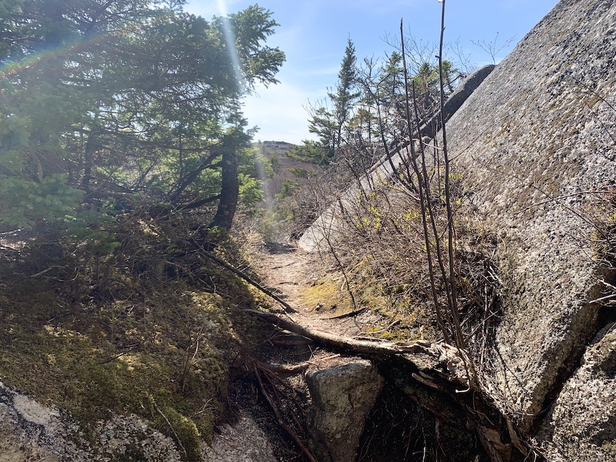
Continuing on the in-and-out portion of the trail, we switched back and forth between dry ground, bush, mud/puddles, and granite rock, characteristic of Nova Scotia.
We eventually got to the split of the loop portion of the trail. The right/counterclockwise direction looked more like a typical narrow hiking trail through a wooded area. The left/clockwise direction, which we started on, resembled more of the terrain we had already done. We decided to continue with the relatively open yet muddy terrain and enjoy the wooded trail later in the hike.
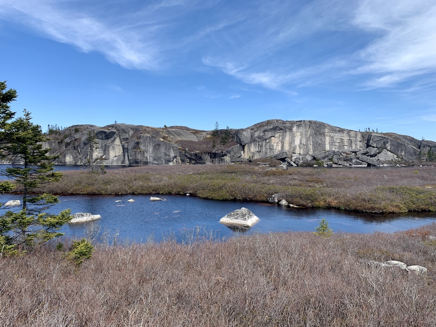
This loop portion would take us around Shellbird Lake, offering a view not only of the lake itself but also of the picturesque rock face on its east side. This cliff is a fairly popular spot for rock climbers (we would see a few as we would pass further on into the hike).
Here are a few pictures from the west side of Shellbird Lake:


Just as we passed Shellbird Lake, we began the most notable ascent of the hike: a quick 20-meter incline. Not exactly a mountain, but the short climb does offer a remarkable panoramic view of the wilderness, featuring the Atlantic Ocean to the south and windmills to the east.


As we came back around the lake, the trail’s elevation maintained good vantage points of the area, eventually leading to the rock face pictured above.

At the top of the rocks, the trail (or lack thereof) becomes difficult to navigate. We wound up slowly making our way down a steep but manageable slope of the rocks at the far (south) side and jumping down a few drops to connect back to the trail.
The rest of the loop portion, as we had expected, was a narrow, solid ground path, which makes for great hiking terrain.
Before long, we reconnected at the split and doubled back toward the trailhead. Avoiding the overly muddy areas and periodically double-checking the map, we made our way back to our vehicle with yet another great Nova Scotian hike completed!
Checklists And Recommended Gear
The following is a recommended gear list for hiking Sorrow’s End.
- Water bottle
- Hiking Shoes – Women’s // Men’s
- Camera/Phone to take photos
- Sunscreen
- Hat
- Insect repellent
- Cascade hiking poles
- Atlantick tick removal tool kit