South Granite Ridge Hike, Nova Scotia
Similar to the North Granite Ridge Trail, the South Granite Ridge Trail offers a wonderful day hike with notable changes in elevation, several superb look-offs, and varied terrain. The trail is challenging at times, giving hikers the perfect amount of heart-pumping cardio followed by rewarding lookouts.
This trail is between the North Granite Ridge Trail (to the north) and the Admiral Lake Loop Trail (to the south) and shares entrances with each of these trails. This is one of the many hiking trails located off of the well-groomed Musquodoboit Trailway (a former railway).
Difficulty: Hard
Length: 20.1 km (loop)
Suggested Duration: 5.5 – 6.5 hours
Signage: Maps, signs and markers throughout the trail
Facilities: Large parking lot and vault toilets in the parking lot
Disclaimer: This article includes affiliate links. If you click one of them, we may receive a small percentage of the sale at no extra cost to you. Thank you for your support!
Key Features Of The South Granite Ridge Trail
- Located in Musquodoboit Harbour
- Part of the larger Trans Canada Trail network
- Offers opportunities for birdwatching and wildlife sightings
- Various lookout points
- Dog-friendly (on-leash)
Facilities And Services
- Parking lot
- Benches throughout Musquodoboit Trailway
- Restrooms at the entrance/parking lot
Before You Start Hiking South Granite Ridge Trail
As per usual, we’d like to share a few things we think you should know before embarking on your own hiking excursion. Let’s discuss a few things to note before you hike the South Granite Ridge Trail for yourself.
The first thing worth noting is that the actual trailhead of the trail is not immediately at the parking lot. The South Granite Ridge Trail has two entrances, and they’re both on the main Musquodoboit Trailway. From the south side parking lot of the Musquodoboit Trailway, this hike is 20.1 km (including the groomed Trailway)
Hikers will have to walk about 2.7 km on the groomed Musquodoboit Trailway (from the south side parking lot on Park Road) before reaching the entrance of the wilderness trail.
This entrance is shared with the Admiral Lake Loop Trail, which has another entrance at about 1.7 km. You’ll pass that trailhead and the trailhead for Bayer Lake Loop Trail before reaching the closest entrance to the South Granite Ridge Trail.
If you’re interested in getting the lengthier “easy walk” out of the way first, then the other entrance is about halfway down the main Trailway (7.5 km from the parking lot).
Of course, nothing stops you from adding in the Admiral Lake Loop (or any of the other trails) with the North Granite Ridge Trail. We only offer this info because this article is dedicated to the South Granite Ridge Trail.
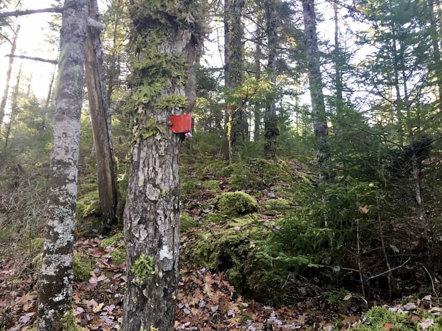
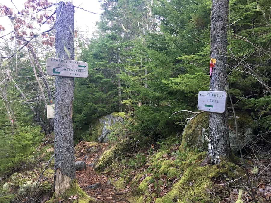
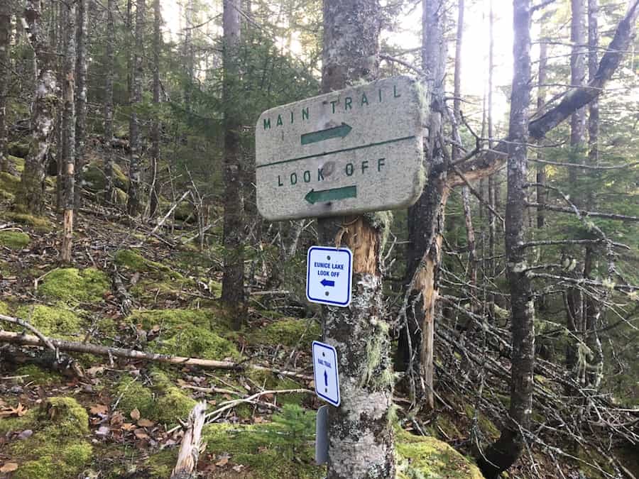
Worry not about going in the wrong direction. The signage is plentiful and clearly marked to point you in the right direction and on the correct trail.
Here are a few pictures of the signs and markers:
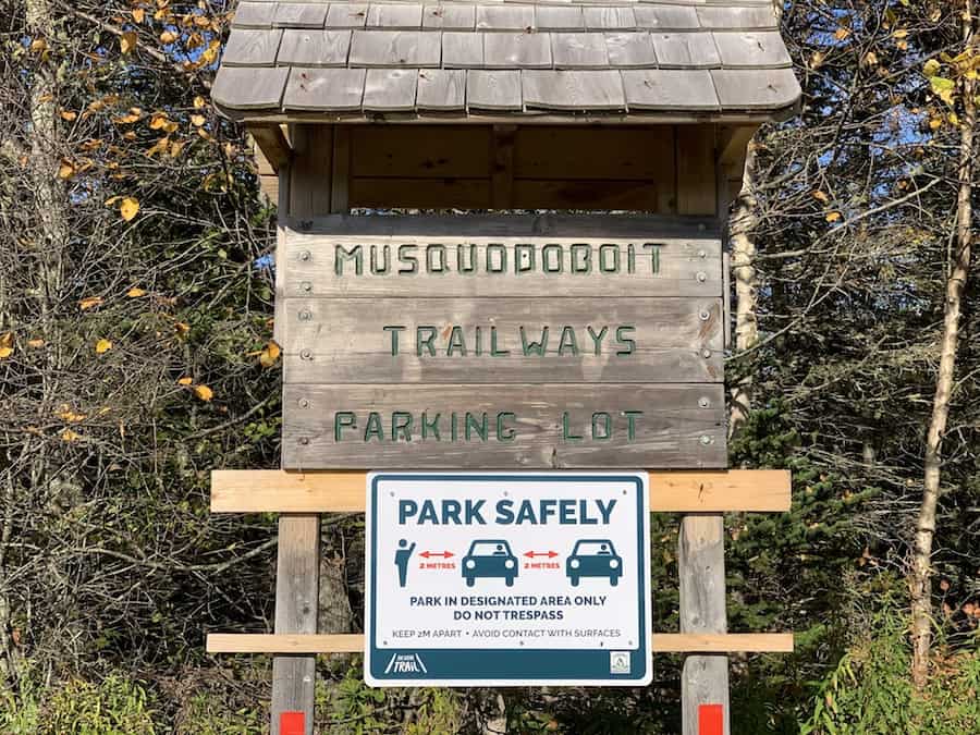
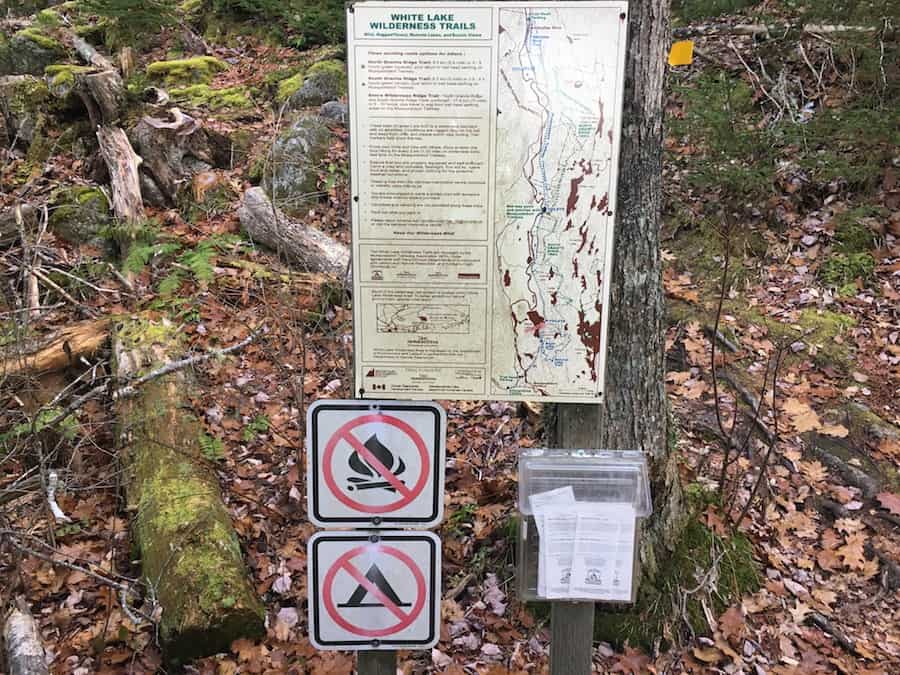
And here’s a picture from the south side parking lot:
Note that the main trail will cross Bayers Mill Road closer to the Loop entrance than the main parking lot. However, there are No Parking signs all along the end of the road to discourage parking there. We suggest parking at the main lot.
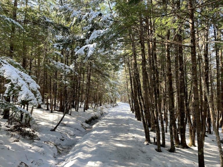
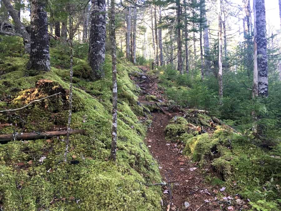
The main Trailway is nicely groomed with little difference in elevation. It provides a great warm-up (and cool-down) for the more rugged inclines of the backcountry trails!
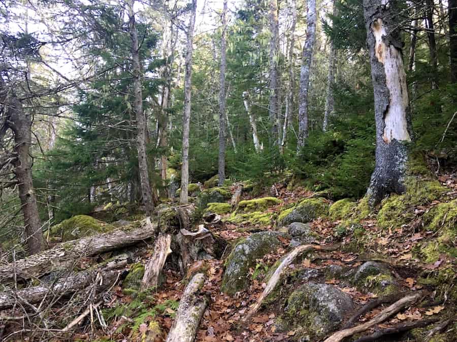
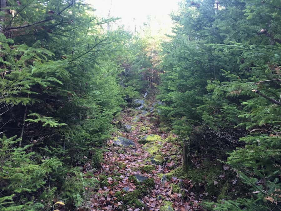
Here’s a shot of the trail to exemplify the typical ruggedness of the trail:
Next, let’s discuss a few rules and practices to follow:
The trail is dog-friendly though it’s asked that dogs remain on a leash. It’s also important to practice pack-in/pack-out principles to keep the trail clean and free of litter. It helps the environment and makes it a more beautiful hike for everyone.
There are also signs stating no fires and no camping.
There’s quite a bit of rugged terrain on the trail. We recommend proper hiking footwear and hiking poles if you benefit from them.
There is wildlife in the area to be conscious of. We’ve never seen any dangerous animals while hiking, but it’s good to be aware. Check out our article Wildlife Safety While Hiking In Atlantic Canada for more information on this matter.
Other than that, we wish you the best as you make your way through a superb wilderness hike with excellent views and challenging terrain!
Our Experience Hiking South Granite Ridge Trail
It was mid-November, the first time we hiked the South Granite Ridge Trail. Though it was late in the year and most of the leaves had fallen, the weather was warm enough to do the hike in shorts and a sweater. The sun was shining, and the sky was clear.
Our first experience of the Admiral Lake Loop Trail took place a month before. We were so impressed by that hike that we wanted to complete the other wilderness hikes in the system.
We parked at the main Musquodoboit Trailway parking lot on Park Road and walked the 2.7 km groomed Trailway before coming to the first entrance of the South Granite Ridge Trail.
The entrance is easy to find. Look for the “White Lake Wilderness Trails” map on the side of the Trailways. Note that there are paper maps for hikers to take on the trail if they so choose.
As is the case with all the trails in the system, the Sound Granite Ridge Trail begins with a notable incline. The flat Trailway got us nice and warmed up for the ensuing climb.
The terrain at the beginning of the hike was relatively tame compared to the rocky nature of the Admiral Lake Loop. The trail was easy to follow, and the signage was plentiful to ensure we were on the right track (and not heading onto the Admiral Lake Loop instead of the SGRT.
Just in the first incline, the terrain and immediate environment changed rapidly. We went from an open and relatively tame path to a rocky and closed-in trail, all within the first 2 kilometres.
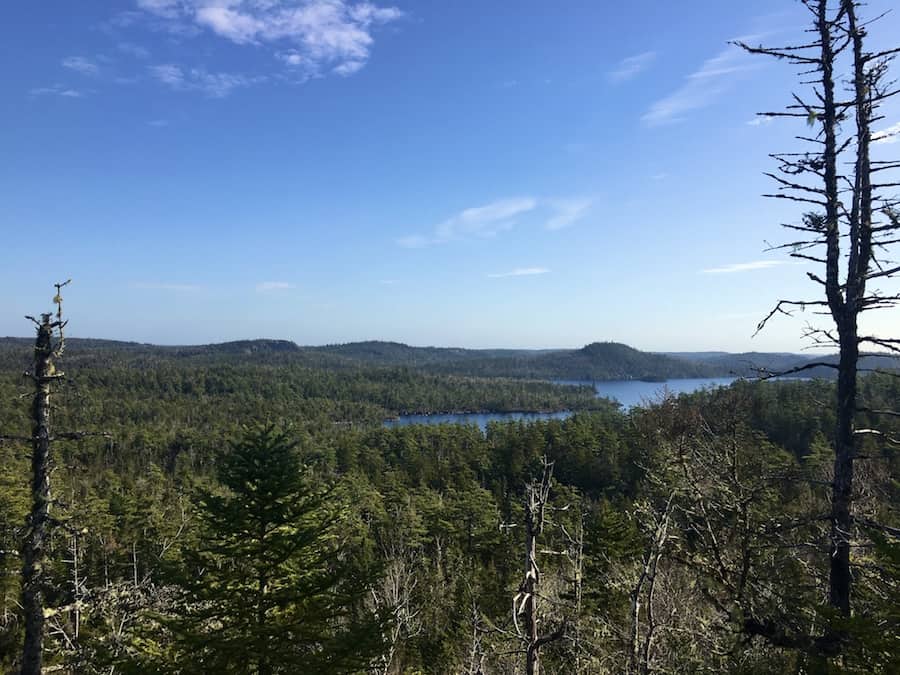
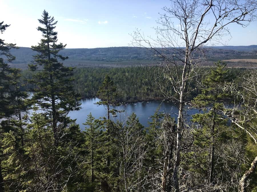
The first look-off point (overlooking Eunice Lake) comes only 2 km into the hike. This look-off is a great spot to take in the view, catch your breath and have a drink of water before continuing.
Note that the Eunice Lake look-off is also just off the Admiral Lake Loop Trail. After this point, we headed on the SGRT and continued on a new (to us) path!
Here’s an example of the signage on the trail:
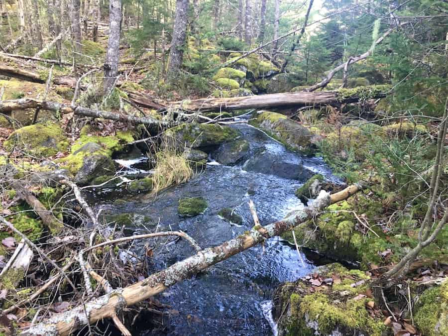
There are plenty of brooks that cross the trail, bringing water to and from lakes and ultimately to the Atlantic Ocean. Though the trail is relatively short (we’d argue it’s a half-day hike), hikers could certainly bring a water filter to refill their water containers if need be.
We’ll be bringing our filter when we do the trail system in its entirety (roughly 40 km) in a single day in order to refill our bottles along the way!
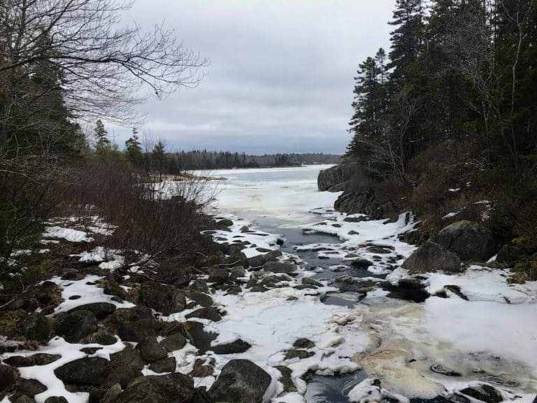
Here’s a shot of Turtle Lake Brook, which is near the beginning of the trail (before the Eunice Lake Look-off):
After the first look-off, the trail takes a dip down before coming back up for the second look-off. The trail is a bit narrow but certainly not overgrown. Staying single-file will get you through without brushing into the trees.
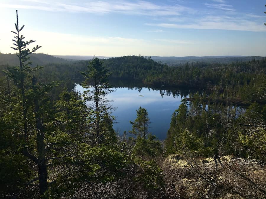
The second look-off is aptly named the Admiral Lake Look-Off and overlooks the large Admiral Lake to the East. Here’s a picture taken from the look-off:
Each of the look-offs has a sign to tell hikers the name. These signs also have a QR code that can be scanned to show where the hikers are along the trail.
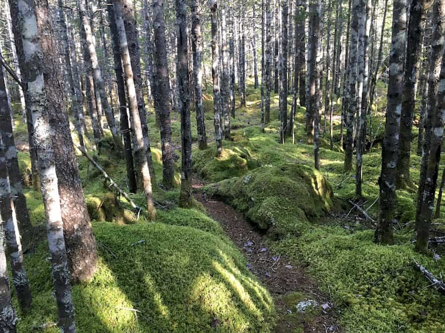
From there, the trail took us through the moss-covered forest. The terrain was fairly rocky but easily traversed.
Before long, we made it to the Granite Lake Look-off point. Here’s a shot from that location:
Continuing, we passed a tree that had been struck by lightning. The fallen tree was completely hollowed out, and the surrounding area (probably a 30-metre radius) was all blackened. Of course, being on the east coast, we see fallen trees regularly (especially during the Atlantic hurricane season), but this was the first time we had seen a lightning-struck tree.

Yes, you can even see a red marker still attached to the fallen tree in the photo above.
Moving past that, we entered a denser part of the trail with a mossy bed and tightly packed trees. We found this to be quite picturesque and a joy to hike through:
Shortly after Granite Lake, there is a junction. The Portage Trail will take hikers back to the Musquodoboit Trailway. To continue on the SGRT, we took our right (to continue northward).
There’s still quite a bit of trail to go from this point, and we came across 5 more look-off points: Ridge View, Cliff Top, Valley View, Sparrow Lake Look-off, and Clear View. We’ll forgo pictures of these look-offs to encourage you to get out there and experience them firsthand!
We stopped to have a lunch break at Valley View before continuing on. By that time, we welcomed the chilly November breeze from a high point to help us cool down.
Just after the final look-off at Clear View, we came to Kelly Junction. This is where the South and North Granite Ridge Trails connect and share a common path to the main Trailway.
It was mid-afternoon by this point, and continuing onto the NGRT would have been pushing it. The daylight hours are short in November. We decided to play it safe and head out to the main Trailway and return to the parking lot.
The last part of the trail is actually the steepest slope of the SGRT. We dropped 100 metres in elevation in just under a kilometre of the trail as we descended to the main Trailway.
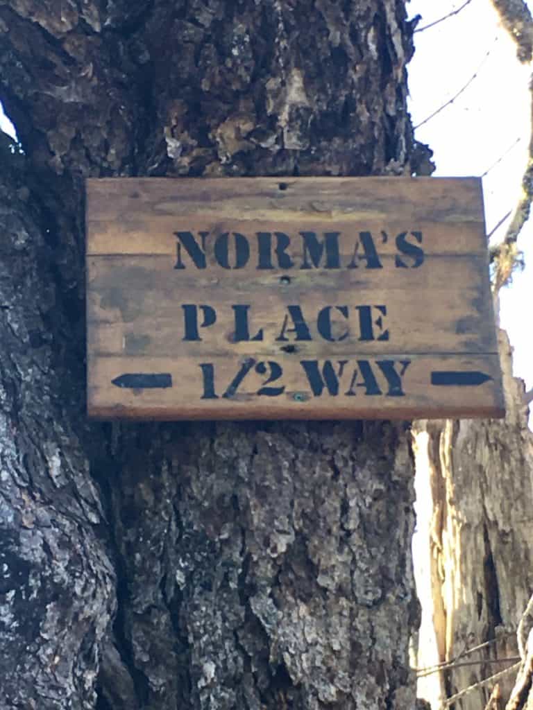
Once on the trail, there is a roofed picnic table labelled “Norma’s Place” that marks the halfway point of the Musquodoboit Trailway between the aforementioned main (south-side) parking lot and the secondary (north-side) parking lot.
After a relatively easy 7.5 km walk on the flat ground back to the parking lot, we hopped in the car and headed home with another successful hike in the books!
Checklists And Recommended Gear
We recommend bringing some gear with you regardless of how long you’ll be there, as the South Granite Ridge hike is difficult.
- Water bottle
- Hiking Shoes – Women’s // Men’s
- Camera/Phone to take photos
- Snacks and/or lunch
- Sunscreen
- Hat
- Insect repellent
- Water filter
- Cascade hiking poles
- Atlantick tick removal tool kit