North Granite Ridge Hike, Nova Scotia
The North Granite Ridge Trail is an awesome day hike through the forest in Musquodoboit, Nova Scotia. It features a decent number of inclines and declines, several superb look-offs, and varied terrain. Whether you’re an experienced hiker or a beginner looking for a challenge, this trail is an excellent option.
Unlike most others that connect to the Musquodoboit Trailway, this trail is best accessed by the north side parking lot of the Trailway. By hiking the trail and returning to the flat, groomed Trailway, the loop will be about 20 km. Of course, you can choose to do an in-and-out and backtrack through the trail, or you could continue to the South Granite Trail (and even to the Admiral Lake Loop Trail) if you please.
Difficulty: Hard
Length: 19.8 km (out and back)
Suggested Duration: 5.5 – 6.5 hours
Signage: Maps, signs and markers throughout the trail
Facilities: Large parking lot and vault toilets in the parking lot
Disclaimer: This article includes affiliate links. If you click one of them, we may receive a small percentage of the sale at no extra cost to you. Thank you for your support!
Key Features Of North Granite Ridge Trail
- Located in Musquodoboit Harbour
- Part of the larger Trans Canada Trail network
- Offers opportunities for birdwatching and wildlife sightings
- Various lookout points
- Dog-friendly (on-leash)
Facilities And Services
- Parking lot
- Benches throughout Musquodoboit Trailway
- Restrooms at the entrance/parking lot
Before You Start Hiking North Granite Ridge Trail
There are a few things we should point out before you hike the North Granite Ridge Trail.
The first thing worth noting is that the north side parking lot (on NS-357) is closest to the trailhead. The south side parking lot (on Park Road) is much further away.
The actual trailhead of the North Granite Ridge Trail is not immediately at the parking lot. Rather, the Gibraltar Rock Loop Trailhead is pretty well at the parking lot. This short trail will lead into the North Granite Ridge Loop and is worth doing if you’re there to hike in the first place. It will give hikers about 1.4 km of backcountry trail rather than 1.3 km of the groomed Trailway before the actual North Granite Ridge Trail begins.
The North Granite Ridge Trail has two entrances, and they’re both on the main Musquodoboit Trailway. The other entrance is about 7.5 km from either parking lot and is a shared entrance with the South Granite Ridge Trail.
You could choose to warm up for 7.5 km on easy terrain before taking the North Granite Ridge Trail back if you wanted to.
You could even add the other trails in the system (South Granite and Admiral Lake) if you wanted to extend the hiking adventure. That being said, we’ll keep this article focused on the North Granite Ridge Trail.
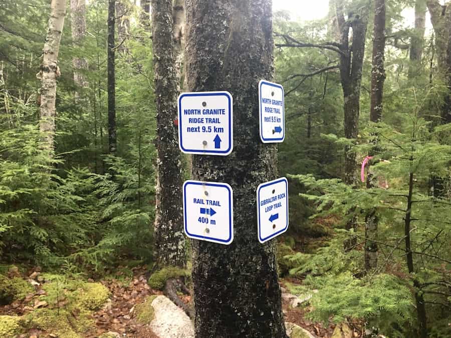
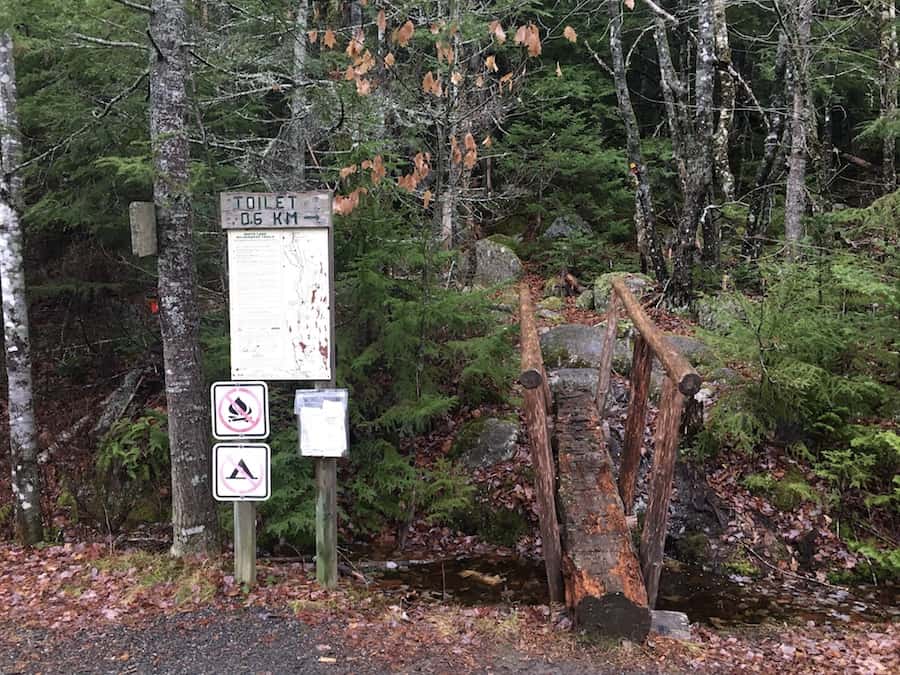
The signage is plentiful and clearly marked through all the trails in the area, making it easy to find your way and stay on the trail you intended to hike!
Here are a few pictures of the signs and markers:
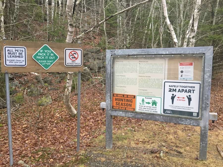
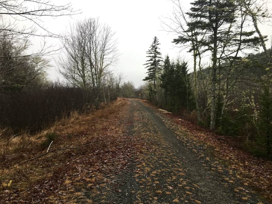
And here’s a picture from the north side parking lot. Note that it was hunting season at the time of this photo:
Speaking of hunting, there is wildlife in the area to be aware of. We’ve never seen any dangerous animals while hiking in Musquodoboit, but it’s good to be conscious of wildlife while hiking. Check out our article Wildlife Safety While Hiking In Atlantic Canada for more information on this matter.
There are a few more best practices to follow:
The trail is dog-friendly, though it’s asked that dogs remain on a leash. It’s also important to practice pack-in/pack-out principles to keep the trail clean and free of litter. It helps the environment and makes it a more beautiful hike for everyone.
There’s also signage saying no fires and no camping.
There’s quite a bit of rugged terrain on the trail. We recommend proper hiking footwear and hiking poles if you benefit from them.
Other than that, we’d like to wish you a fantastic hike on a beautiful yet challenging trail!
Our Experience Hiking North Granite Ridge Trail
The first time we hiked through the North Granite Ridge Trail was in last November. Fortunately for us, it was a warm day, and any snow that had fallen previously in the month had melted away.
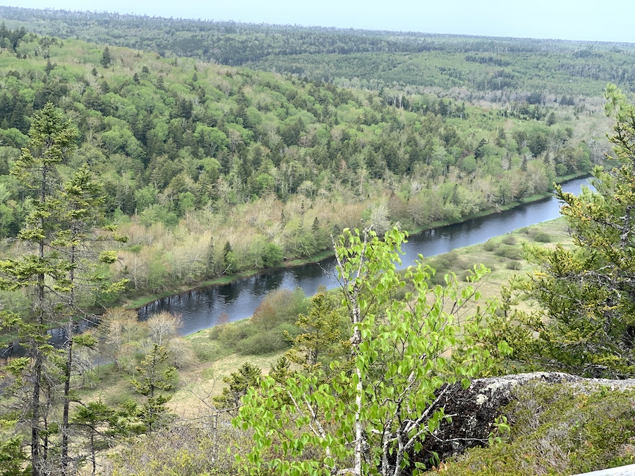
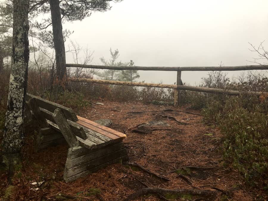
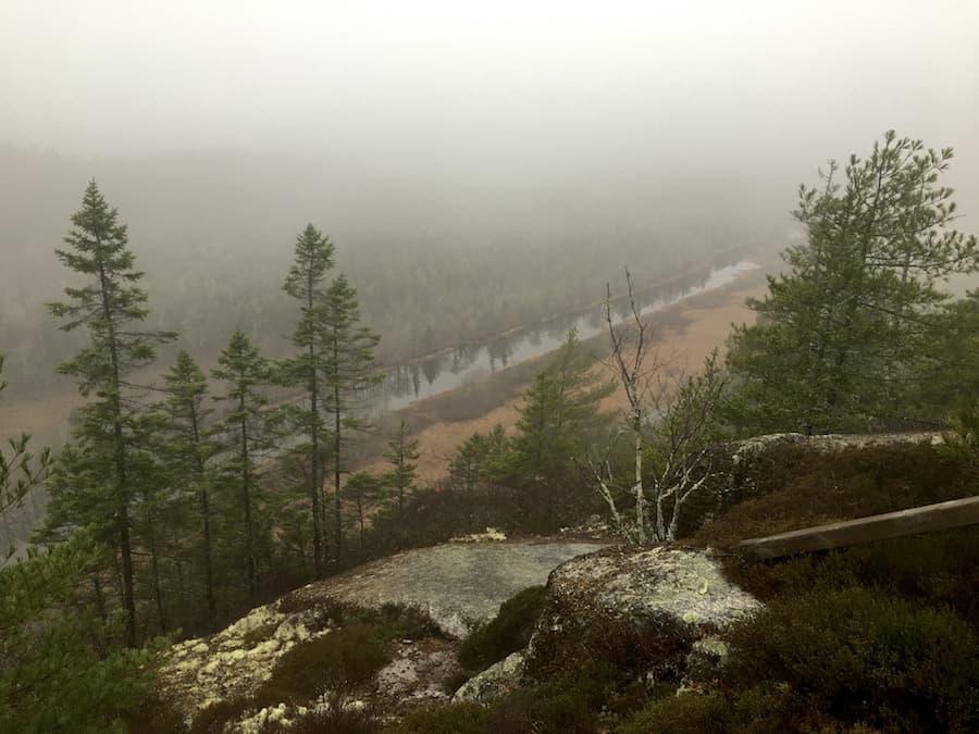
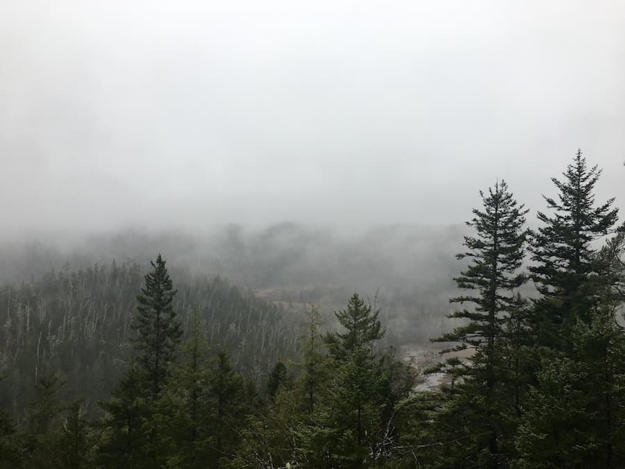
That being said, the day was pretty foggy with a bit of rain, so the look-offs were not as clear as they would have otherwise been. We apologize for the foggy photos. You’ll have to go check out the look-offs for yourself on a clear day!
The NGRT was the last major trail for us to complete in the system of trails off the Musquodoboit Trailway in the White Lake Wilderness Area. We had done the Admiral Lake Loop and the South Granite Ridge Trail in the same fall season.
We parked at the north side parking lot on route NS-357 rather than the main south side parking lot on Park Road for this hike. This added a bit of extra driving time but led to much less walking on the main Trailway before/after hiking the backcountry trails.
Our hike actually started on the shorter Gibraltar Rock Loop, which offers a short but intense 85-metre incline/decline with a single look-off. It’s a great option for a short loop if you’re in the area.
Shortly after the Gibraltar Rock look-off, there’s a junction where hikers can choose to return to the main Musquodoboit Trailway (the flat, groomed trail) or continue to the North Granite Ridge Trail. We continued onto the NGRT.
Here are a few shots from the Gibraltar Rock Loop. The first was taken near the entrance, and the second was taken at the look-off (note the fog).
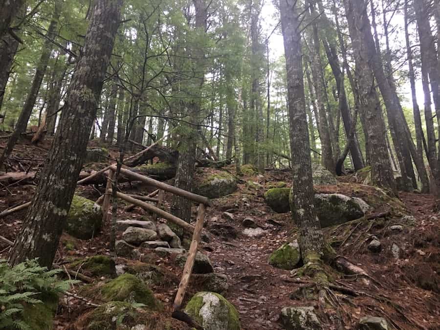
That initial incline would prove to be the steepest slope until the exit of the NGRT back onto the main Trailway. That’s not to say that there are no elevation differences along the trail (there are plenty of notable inclines and declines). We want to point out that the beginning and end are the most intense.
We had the pleasure of hiking with a friend of ours on this hike who is a practicing Biologist. There were plenty of times when we stopped to check out different fungi and plants along the trail side. Typically we would walk right by without noticing these small details. It was nice to take the time to check out nature more intently and learn about different species simultaneously.
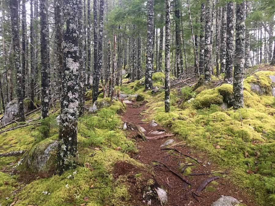
Like the South Granite Ridge Trail, the NGRT was very mossy throughout most of the terrain. This can be seen in the picture below:
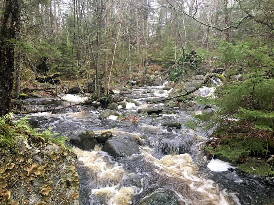
Compared to the other trails in the region, the NGRT also took us across many more brooks and streams. On hotter days, we could use these to our advantage, along with our water filter, to refill our bottles. On a cooler November day when we were only hiking one of the trails, we had packed enough water to last the entirety of the hike.
Many of the brooks could be crossed in a single step or by stepping on a few rocks. However, there were a few instances where bridges were constructed to get hikers safely to the other side of a brook.
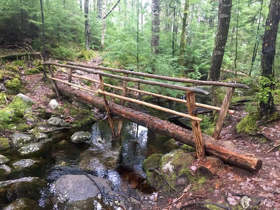
Shortly after the bridge picture above, we came to the junction that offered a path back to the main Trailway from the Gibraltar Rock Loop. We continued on to the NGRT.
The first look-off, named Bog View, would come only a kilometre after the junction. From there, the trail took us through the woods and across multiple streams of water.
The fallen leaves and light rain made the trail slippery, especially on the rockier parts. Fortunately, much of the trail up to this point was on the ground rather than rock.
The next look-off was called Wheddy’s Look-off. Here’s a shot from that location that depicts the mist more than the view:
A few notable inclines and declines would ensue, taking us to the Birchview, Crawfords Lookoff and Big Sky look-off points.
Much of the trail has moss to either side and, at the time, leaves dispersed throughout. The slopes were somewhat rocky, and we took our time ascending and descending due to the wet weather.
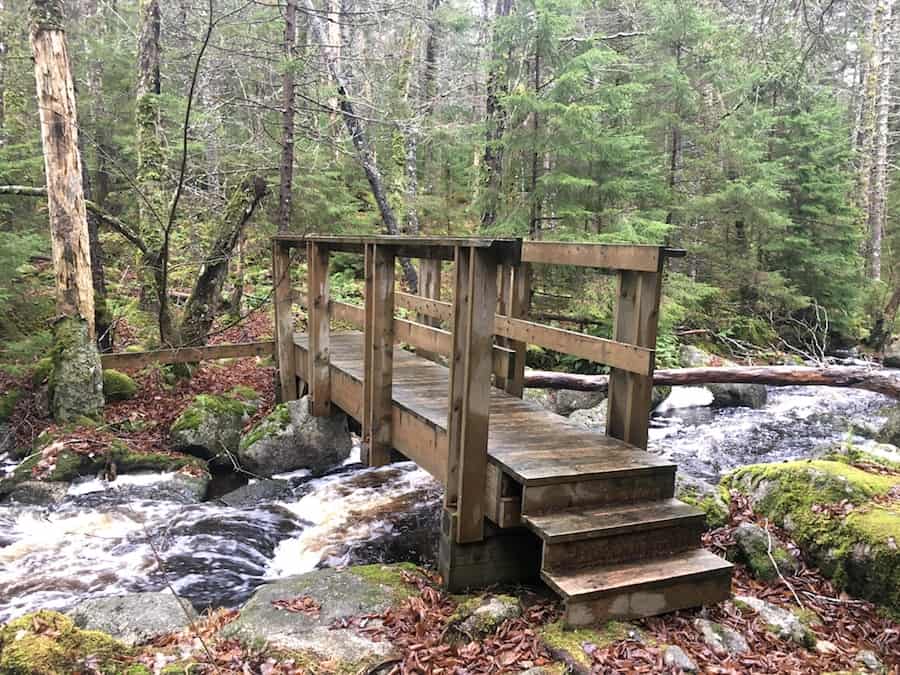
Of the many brooks on the trail, the most significant waterway came around 8.7 km into the hike. As you can see below, the water flows rather quickly. This brook ultimately connects White Lake to the Musquodoboit River. Luckily, there’s a solid bridge to help hikers across so they can continue on the trail!
The Kelly Meadow Lookoff was the last look-off point of the NGRT. The day hadn’t cleared up, so it was another foggy viewing from the spot.
About a kilometre after the Kelly Meadow Lookoff, we came to the Kelly Junction, which connects the North and South Granite Ridge Trails and offers a common path back to the main Trailway.
We made our way back down to the main Trailway (a decline of about 90 meters over 600 metres of the trail). This leads us to the halfway point of the Musquodoboit Trailway at Norma’s Place (a roofed picnic table).
Here’s a shot from the entrance point to the NRGT and SGRT via the Kelly Junction:
Being at the halfway point, we walked another 7.5 km on relatively easy terrain to return to the north side parking lot.
Though the weather wasn’t perfect, the hike was amazing!
Checklists And Recommended Gear
We recommend bringing some supplies with you regardless of how long you’ll be there, as the North Granite Ridge hike is difficult.
- Water bottle
- Hiking Shoes – Women’s // Men’s
- Camera/Phone to take photos
- Snacks and/or lunch
- Sunscreen
- Hat
- Insect repellent
- Water filter
- Cascade hiking poles
- Atlantick tick removal tool kit