Bayer Lake Loop Hike, Nova Scotia
The Bayer Lake Loop is a short but sweet hiking loop just off the Musquodoboit Trailway. It offers hikers rather pronounced inclines and declines with a great look-off to make the trek well worth the effort.
This hiking trail is one of many hiking trails to stem off from the well-groomed Musquodoboit Trailway. It actually shares some trail with the longer, more involved Admiral Lake Loop, which is also worth doing if you have the time and energy! If you’re up for a short but remarkable hike, be sure to check out the Bayer Lake Loop in Musquodoboit!
Difficulty: Moderate
Length: 5 km (out and back from the parking lot)
Suggested Duration: 1-2 hours
Signage: Maps, signs and red markers throughout the trail
Facilities: Large parking lot and vault toilets in the parking lot
Disclaimer: This article includes affiliate links. If you click one of them, we may receive a small percentage of the sale at no extra cost to you. Thank you for your support!
Key Features Of The Bayer Lake Loop
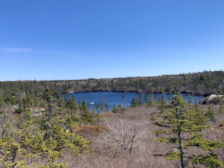
- Leads to view of Bayer Lake
- Located in Musquodoboit Harbour
- Part of the larger Trans Canada Trail network
- Offers opportunities for birdwatching and wildlife sightings
- Various lookout points
- Dog-friendly (on-leash)
Facilities And Services
- Parking lot
- Benches throughout Musquodoboit Trailway
- Restrooms at the entrance/parking lot
Before You Start Hiking The Bayer Lake Loop
We’re talking about Bayer Lake near Musquodoboit. This is not to be confused with the more popular Bayers Lake in Halifax, though there are some great trails in that region of the province as well!
Similar names aside, there are a few other things we feel you should know before completing the Bayer Lake Loop for yourself.
The first thing to note is that the trailhead of the Bayer Lake Loop trail is only accessible on foot.
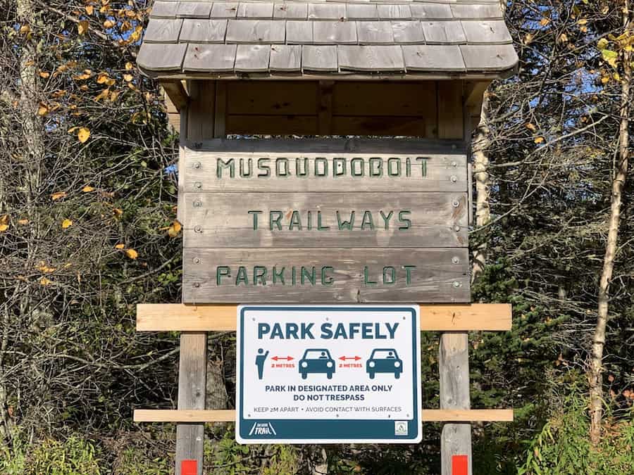
The designated parking lot is the main parking lot for the Musquodoboit Trailway on Park Road.
Here’s a picture from the main parking lot:
Park there and walk 1.7 km to the “start” of the Bayer Lake Loop or a bit longer to the “end” of the loop. The Bayer Lake Loop has two entrances, and they’re both on the main Musquodoboit Trailway.
Note that the first entrance you’ll reach is the same entrance to the larger Admiral Lake Loop we mentioned in the intro.
The map pictured below is posted at the beginning of the shared entrance. Note that the shorter Bayer Lake Loop is drawn in red:
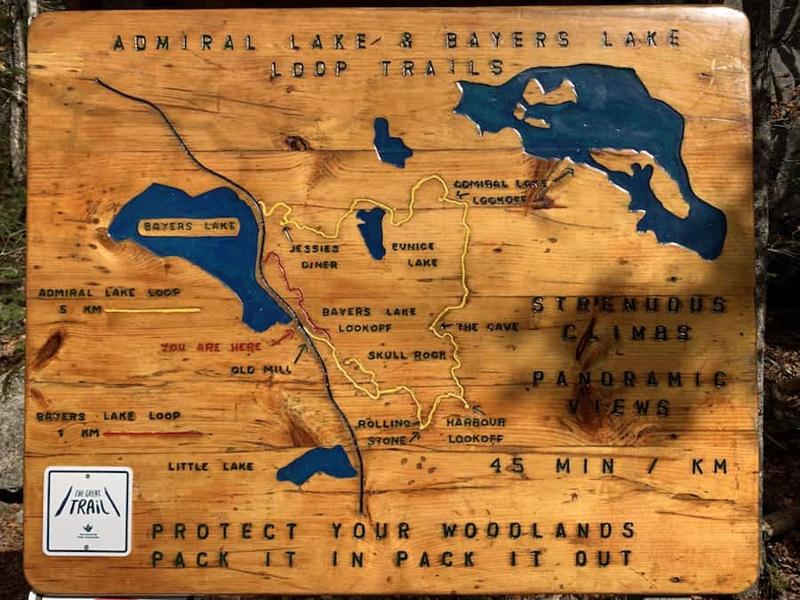
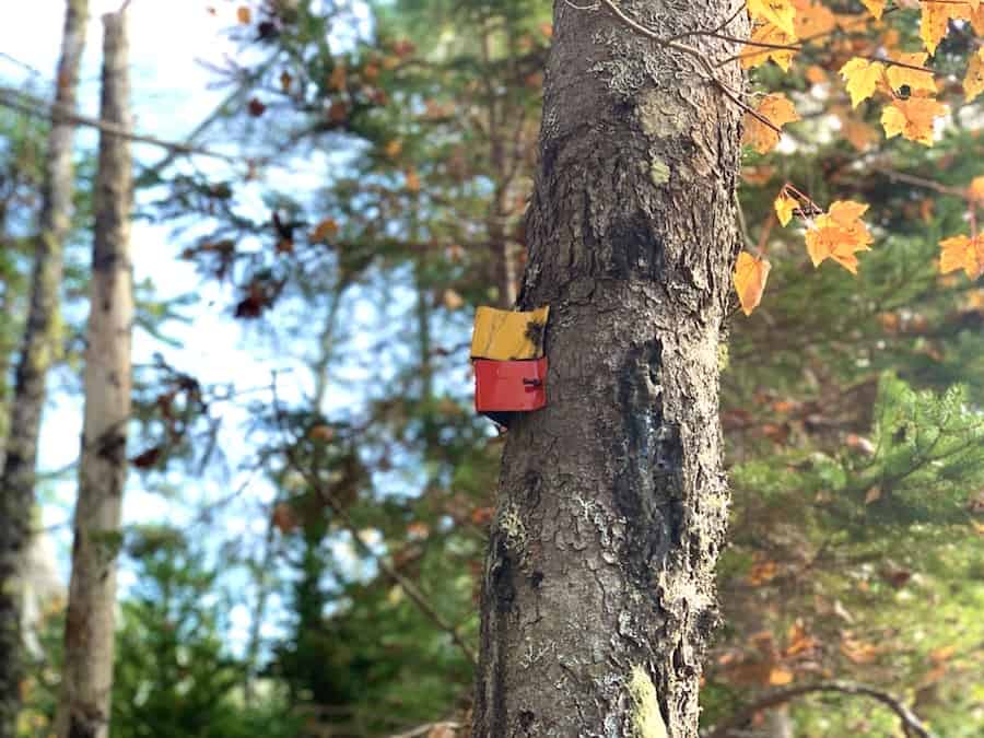
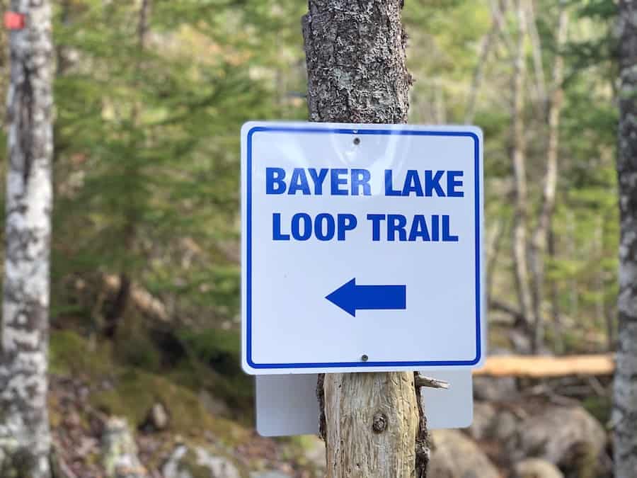
The beginning of the shared trail has both red and yellow markers. You’ll reach a breakoff point shortly after beginning the hike. The Bayer Lake Loop will be marked by red markers.
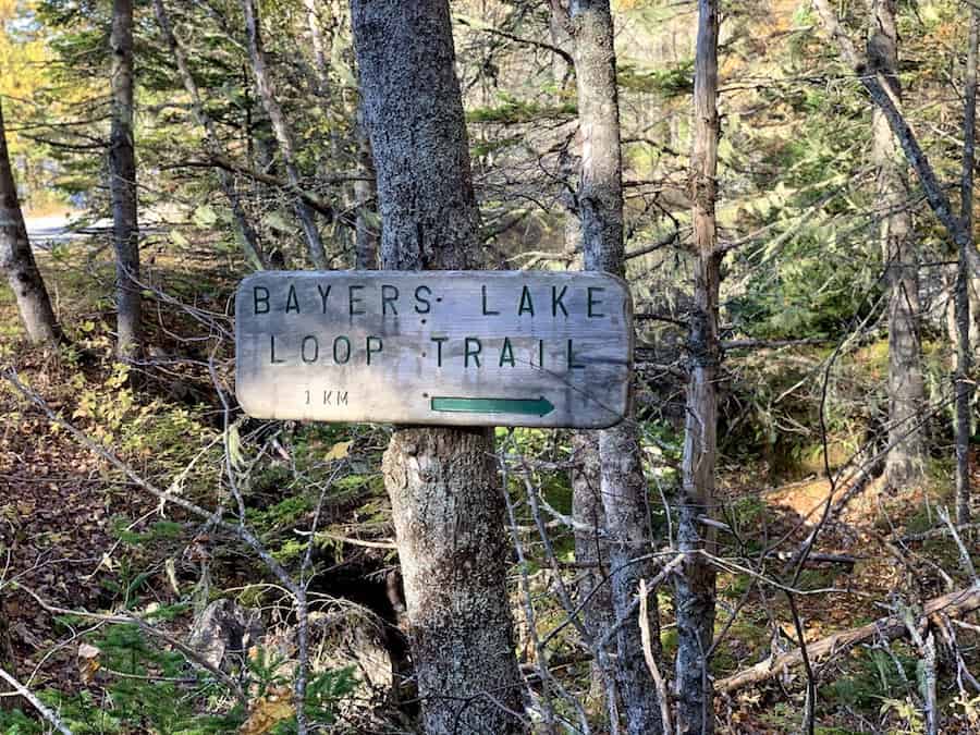
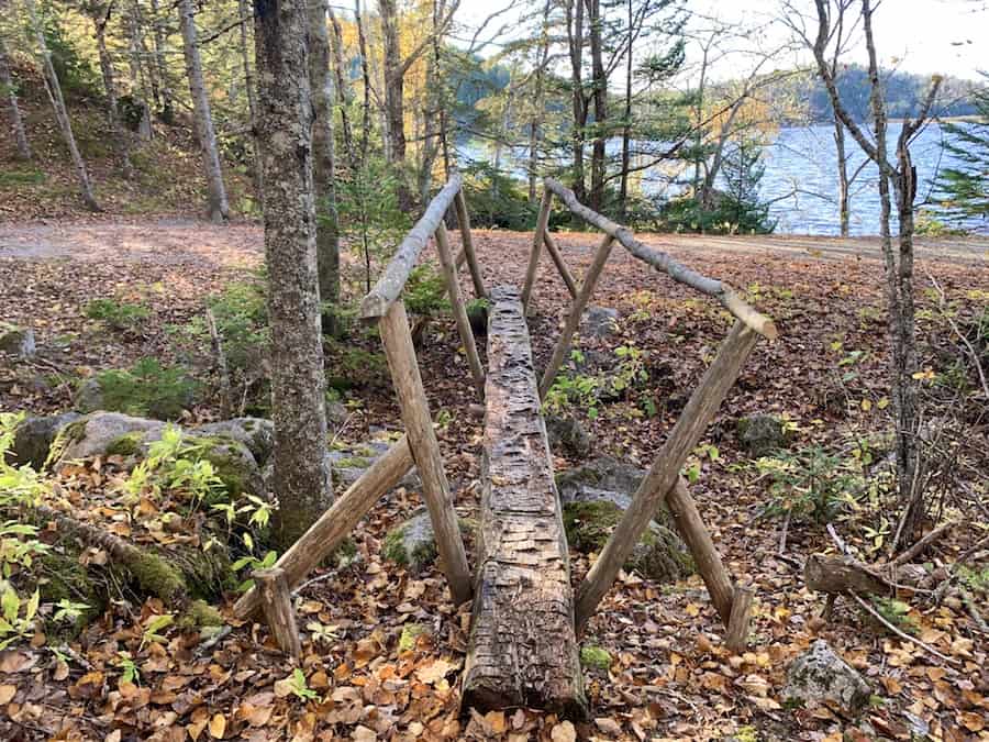
The other entrance is a bit less obvious. If you keep walking down the main trail, you’ll spot the thin wooden bridge and sign.
It doesn’t matter at which entrance you start. We just want you to know what to look for.
Next, let’s discuss a few rules and practices to follow:
The trail is dog-friendly, though it’s asked that dogs remain on a leash. It’s also important to practice pack-in/pack-out principles to keep the trail clean and free of litter. It helps the environment and makes it a more beautiful hike for everyone. No fires or no camping are permitted along the trail.
There’s quite a bit of rugged terrain on the trail. We recommend supportive hiking footwear and hiking poles if you benefit from them. In addition, we suggest bringing a tick removal tool and keeping an eye out for ticks.
And that’s pretty well all you need to know before embarking on this excellent hike!
Our Experience Hiking The Bayer Lake Loop
Our first experience hiking the Bayer Lake Loop came about when Julia remembered a “nice little hike” in Musquodoboit. This hike was the popular Skull Rock look-off hike.
It was mid-October, and we had left in the mid-afternoon, setting out to do the Skull Rock hike. Note that the Skull Rock look-off is part of the Admiral Lake Loop.
After making it to the top, we considered hiking the rest of the Admiral Lake Loop. However, it was later in the afternoon at this point, and the trail maps suggested 4 to 5 hours. We’d be pushing it and were not willing to risk hiking through the woods.
Rather, we found the shorter Bayer Lake Loop and decided it would be a great additional hike to the Skull Rock climb.
We would come back a few days later to complete the Admiral Lake Loop. We left much earlier in the day. Read about the Admiral Lake Loop by clicking here!
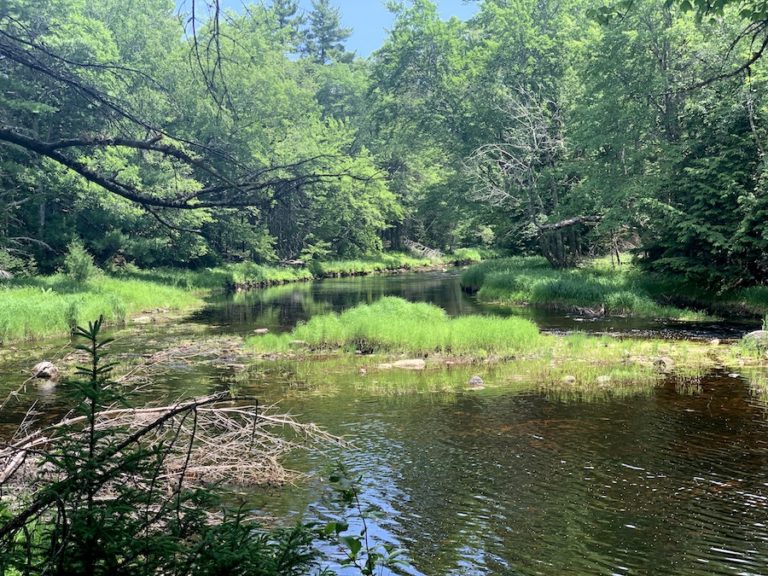
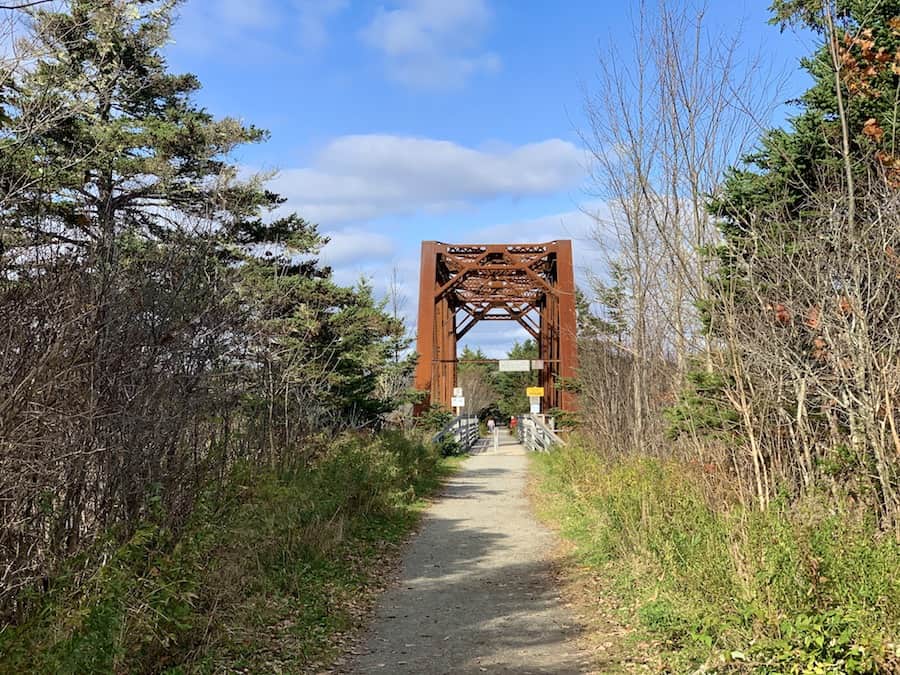
As is the case with all the hikes off the Musquodoboit Trailway, the journey started by walking on the well-groomed trail. Here’s a picture of the Trailway and the Trestle Bridge, which crosses the Musquodoboit River:
The hike starts on the map we showed above.
Again, we first went up to Skull Rock. On our way back down, we dipped off Admiral Lake Loop and onto Bayer Lake Loop. The trail split is well-marked with signs:
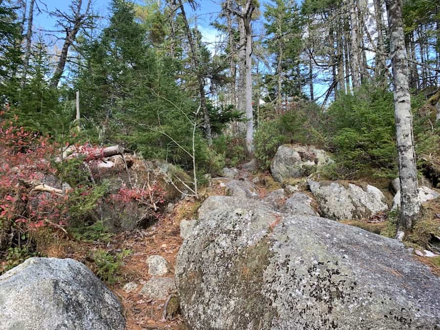
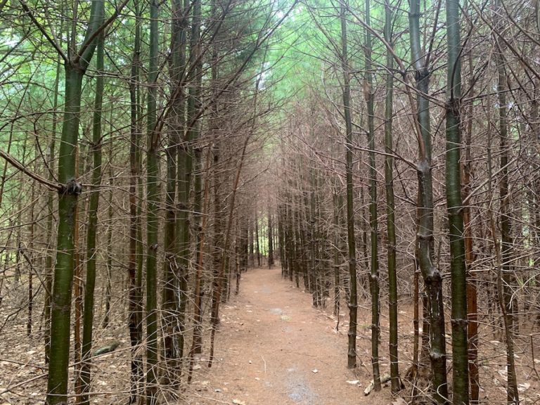
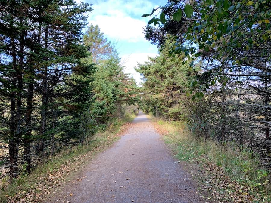
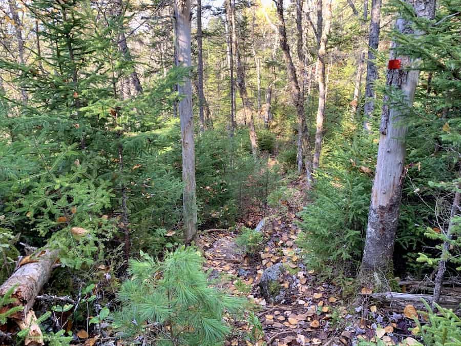
The terrain is certainly more rugged than the main Trailway. It’s a great hike through the Nova Scotian forest.
Here are a few shots of the terrain:
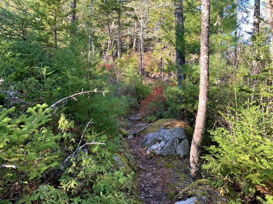
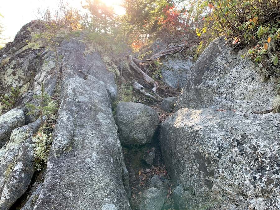
The hike is short, but the inclines, declines and ruggedness of the path certainly don’t make it easy.
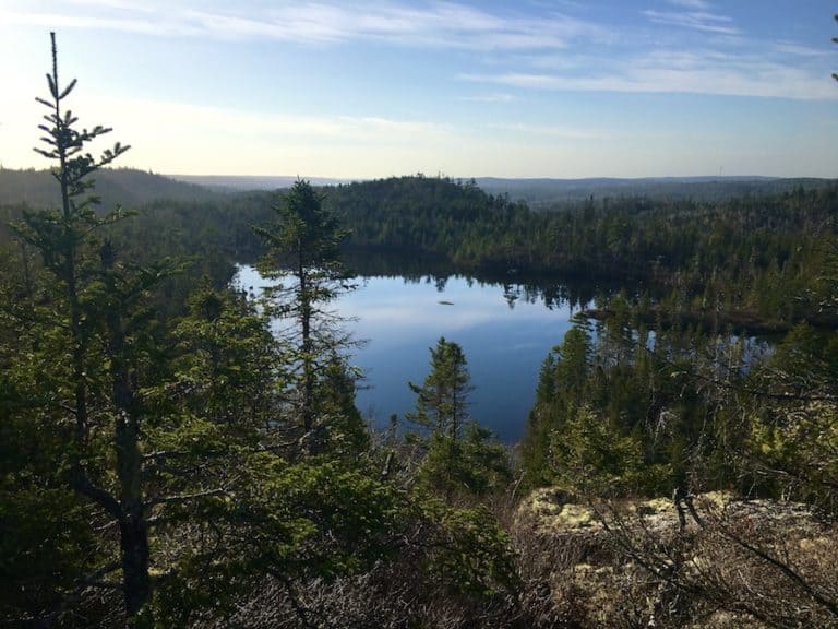
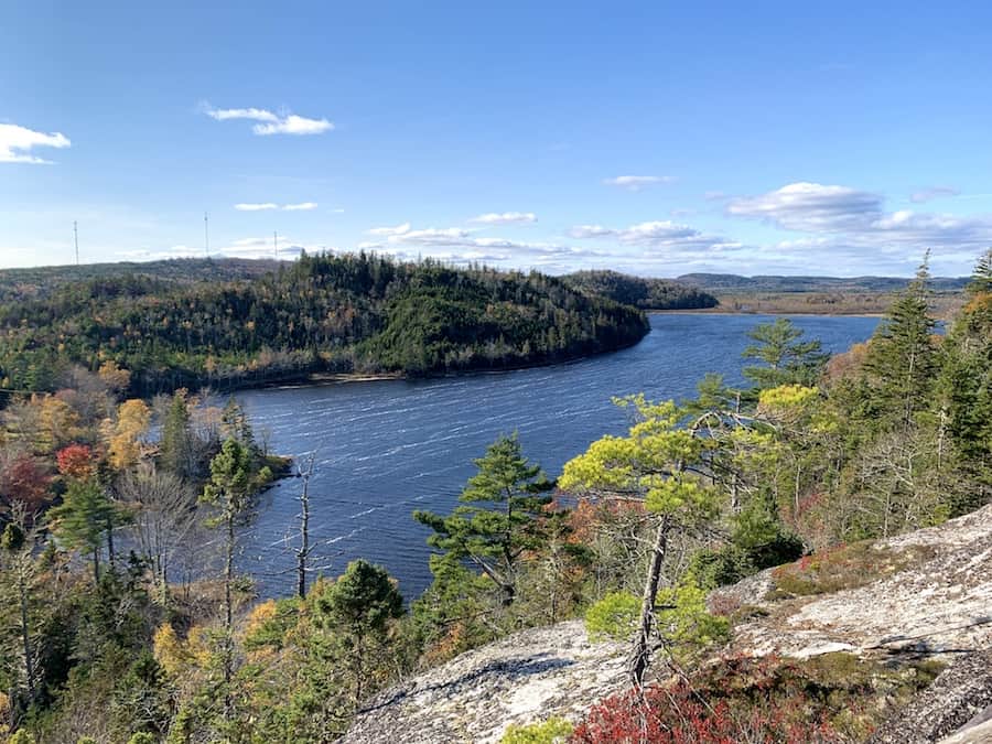
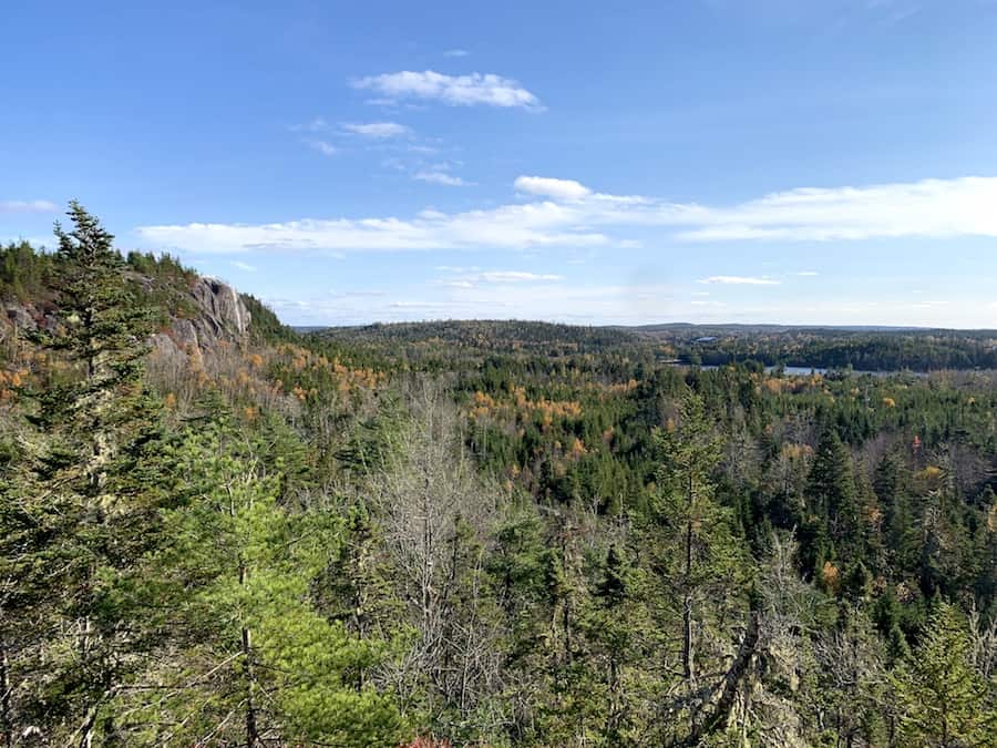
About halfway through the trail, we come across a look-off point. The photo below was taken from this look-off point. The cliff face to the left of the picture is Skull Rock.
The leaves that covered much of the trail made it rather slippery. We were hiking in our waterproof sneakers that don’t have the best grip. That same week, we were inspired to finally (after a few years of running a hiking blog) invest in a pair of hiking boots each.
We made it out of the Bayer Lake Loop, back to our car in the parking lot, and back home all before sundown. Another great hike was completed!
Checklists And Recommended Gear
The following is our recommended gear list for Bayer Lake Loop.
- Water bottle
- Hiking Shoes – Women’s // Men’s
- Camera/Phone to take photos
- Snacks and/or lunch
- Sunscreen
- Hat
- Insect repellent
- Water filter
- Cascade hiking poles
- Atlantick tick removal tool kit