Hiking Mount Carleton: The Highest Peak In The Maritimes
Mount Carleton Provincial Park is located in New Brunswick, Canada, just outside of Saint Quentin. The park is home to Mount Carlton, the highest peak in the Canadian maritime provinces, which stands at 820 meters (2690 feet). That may not seem overly tall (Canada’s highest point, Mount Logan, stands 5,959 m (19,551 ft) tall). Its elevation presents a series of challenging hikes with four different entrances around the mountain’s base. None of which take an overly long time to complete.
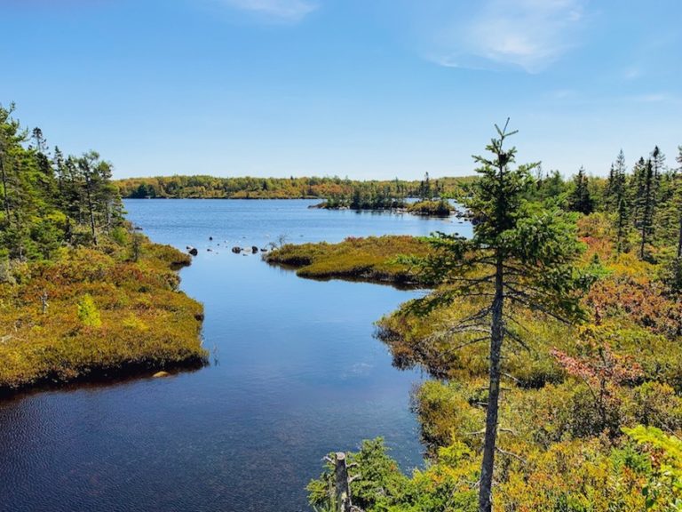
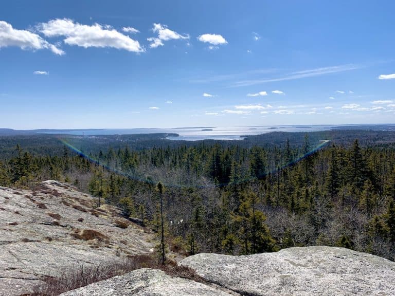
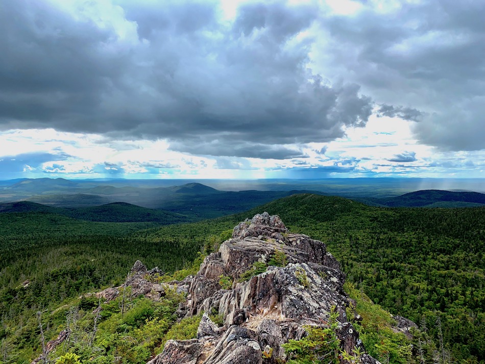
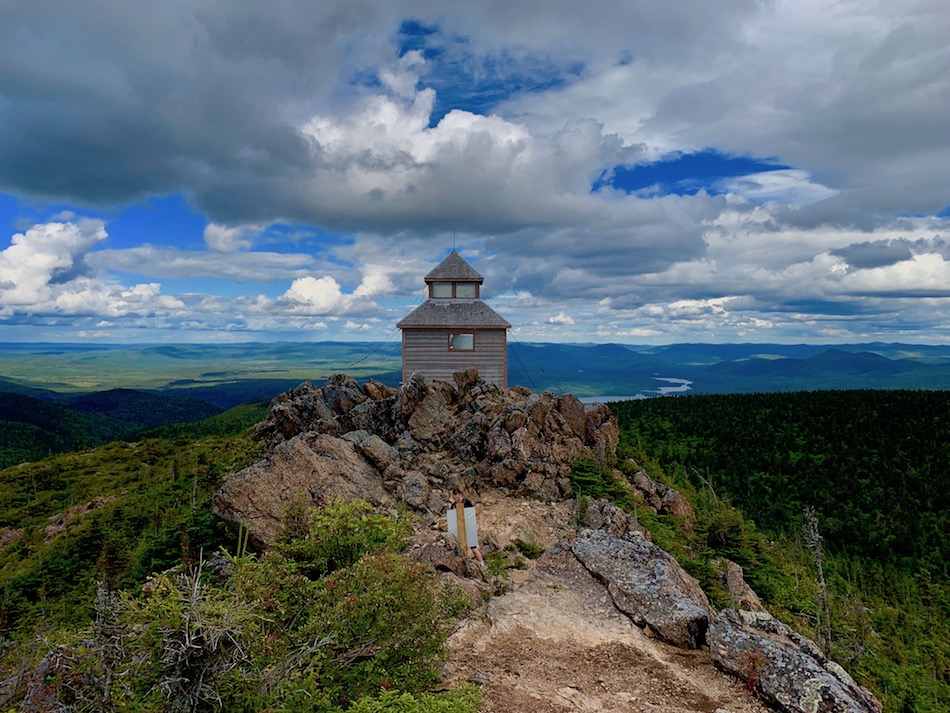
Once reaching the summit of Mount Carleton, you’ll find an incredible view of the lush hills of New Brunswick with untouched nature as far as the eye can see. You’ll also find a now-antiquated lookout tower formerly used to watch for forest fires and marks the highest point in the Maritime provinces.
Difficulty: Difficult
Length: 9.3km
Suggested Duration: 3-4 hours
Signage: Trail signage throughout
Facilities: Parking and campsites
Disclaimer: This article includes affiliate links. If you click one of them, we may receive a small percentage of the sale at no extra cost to you. Thank you for your support!
Mount Carleton Provincial Park Trails
As mentioned, Mount Carleton Provincial Park has multiple paths that can lead to Mount Carleton’s peak. The park also features many other trails, listed below:
- Bald Mountain Brook (4.7 km/2.9 mi.)
- Big Brook (11.7 km/6.8 mi.)
- Caribou Brook (5.2 km/3.2 mi.)
- Dry Brook (6.3 km/3.9 mi.)
- Mount Bailey (6.9 km/4.3 mi.)
- Mount Carleton (9.3 km/5.8 mi.)
- Mount Head (4.7 km/2.9 mi.)
- Mount Sagamook (6.1 km/3.8 mi.)
- Pine Point (2.5 km/1.6 mi.)
- Portage (4.1 km/2.5 mi.)
- Williams Falls (0.3 km/0.2 mi.)
Mount Carleton Provincial Park Map PDF
Key Features Of Mount Carleton
- Located in Mount Carleton Provincial Park
- The highest peak in the Maritimes, reaching 820 meters (2,690 feet)
- Various trails to the summit, including the Mount Carleton Trail
- Provides panoramic views of surrounding forests and lakes
- Opportunities for birdwatching and wildlife sightings
- Camping facilities are available in the park for overnight trips
- A chance to explore the natural beauty of northern New Brunswick
- Accessibility road around the base of the mountain
Facilities And Services
- Four campsites on trails with pit toilets and tree food storage as on-site amenities.
- Lakes
- Open during the winter months
- 11 cabins on two campsites (off-trail)
- Three big campsites for tents and trailers/campers (off-trail)
Before You Start Hiking Mount Carleton
Months of Operation
Open Year-Round
Hours Of Operation
Office hours 8:00 am-8:00 pm (subject to change)
Park gates are open during daylight hours from December 27 through the end of March.
Getting there
7612 Route 385, Saint-Quentin (Eldon), New Brunswick
Contact
Tel: 506-235-0793
Toll-Free: 1-800-561-0123
Email: mt.carleton@gnb.ca
Mount Carleton is the main hiking attraction in New Brunswick’s Mount Carleton Provincial Park. Because this is a Provincial Park, there is a front gate and entrance fee.
If you’re going for a day hike, it costs $10 per vehicle for a day pass.
The rates range if you plan on doing a multi-day hike or will be camping on the campgrounds.
It’s worth taking a look at the map before entering Mount Carleton Provincial Park. Here is a link once again.
As we can see, there are many trails. In this article, we’ll focus on hiking to the highest peak, Mount Carleton. This peak can be reached from 4 parking lot entrances around the base of the mountain.
The most common trails to get to the peak are as follows:
- Mount Carleton (9.3 km/5.8 mi.) loop
- Mount Sagamook (6.1 km/3.8 mi.) loop + Mount Head (4.7 km/2.9 mi.)
The Carleton trail is the shorter/easier of the two main hikes but still offers a challenging ascent. We suggest taking 3-4 and a half hours to complete this hike.
The trail that climbs up Mount Sagamook and crosses Mount Head to Mount Carleton offers a more challenging hike. This is particularly true due to the steeper incline when climbing Mt. Sagamook. We suggest taking 7-8 hours to get to the peak and back to the parking lot.
Hiking from the Carleton parking lot to the Sagamook parking lot is another less common hike that should take about 8 hours to complete.
With this length of the hike, it’s important to bring enough water (and food) that you’ll require for your own needs.
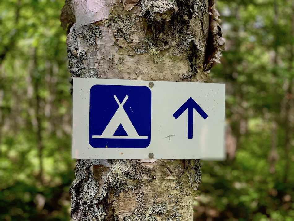
These trails are all backcountry and offer overnight groomed camping spots.
Lastly, whenever you are outdoors, it is important to keep an eye out for ticks and bring a tick removal tool. To learn more about how to avoid ticks when hiking, check out our article How To Avoid Ticks When Hiking.
To help you prepare for possible wildlife encounters, check out our article Wildlife Safety While Hiking In Atlantic Canada.
Our Experience Hiking Mount Carleton
When we hiked to the top of Mount Carleton together, we completed the Carleton trail after showing up a bit too late to hike through Sagamook. I (Arthur), when living in New Brunswick, had hiked to the peak via the Sagamook trail multiple times.
Therefore, we’ll focus on the Carleton trail but also mention the Sagamook trail later.
Hiking Up The Mount Carleton Trail
Upon arrival, we walked into the office, paid $10 for our single-vehicle day pass, and let the workers know where we’d be parking and where we’d be hiking.
After a slow but short drive on a dirt road toward the backside of the mountain, we parked and started our hike around 13h30 (1:30 PM). This parking lot started us at a generous 420 meters (1378 ft) above sea level, meaning that the overall ascent to the peak would only be 400 meters (1312 ft) above our starting point.
For this relatively short hike, we carried one smaller backpack with 5 litres of bottled water.
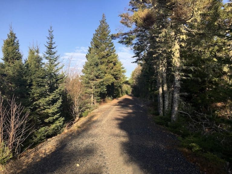
The hike started as we entered the forest beside the parking lot. The beginning was relatively flat as the trail took further around the mountain’s base before the incline began. This was a bit confusing, but ultimately, it was for our benefit as it allowed us time to warm up after a 2-hour drive.

About a kilometre and a half into the hike, the incline began to increase, and we began to make our way up toward the peak of Mount Carleton. Beside us, most of the way was a brook, which, along with the tree coverage, kept us cool on the 24°C (75°F) Summer day. We brought our water filter with us in case we ever needed more water, but did not end up using it.

Trees provided adequate sun coverage for the vast majority of the incline. After our experience hiking through Nova Scotia’s Bluff Wilderness Trail, we were delighted to have this extended shade!
Although challenging, there were no overly steep sections in the forested part of the Carleton trail.

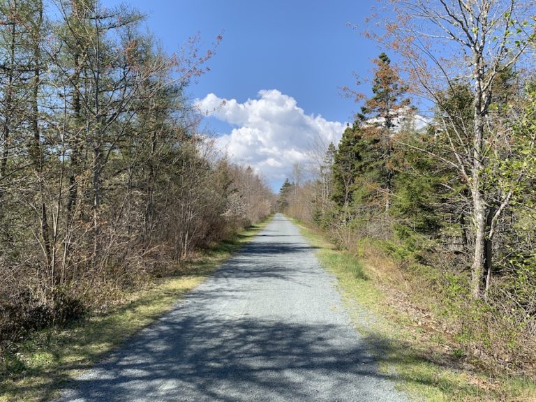
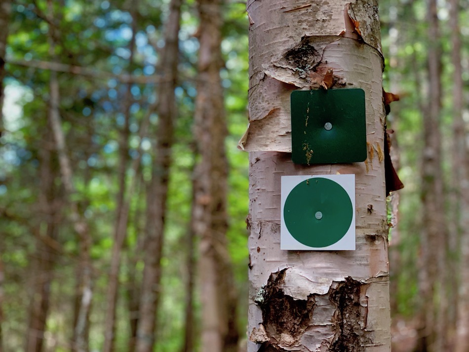
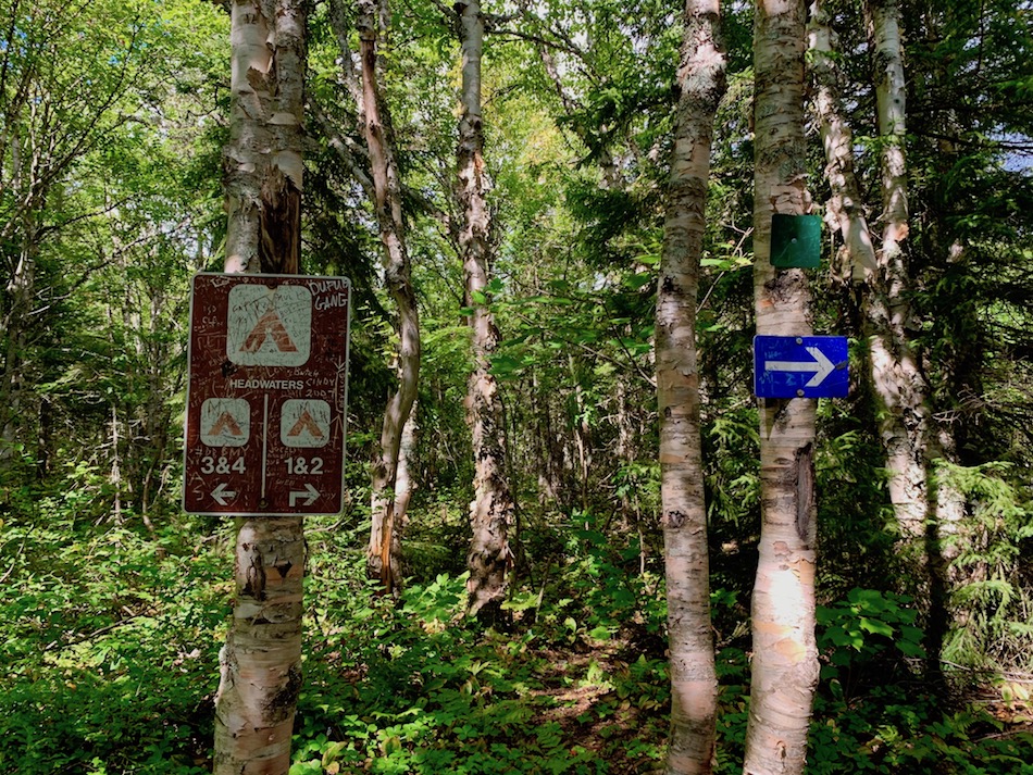
As we made our way up the clearly marked trail, we passed some signage and a groomed camping spot for overnight hikers. It’s worth mentioning that the trail is well taken care of, and the markers make it easy to find your way when the trail gets a bit open.
We also passed by a few instances of bear scat. Although the black bears in this part of the country are not overly aggressive, it’s still worth being prepared for wildlife when hiking in Atlantic Canada.
After hiking for about 1.5 hours and 4 km, we approached the peak, where the terrain changed drastically, which is no surprise for a mountain.
The tree coverage disappeared, and the root-filled dirt path was replaced largely with hard rock. The trail became less obvious, and we relied more heavily on the markers to tell us the best way to move forward.
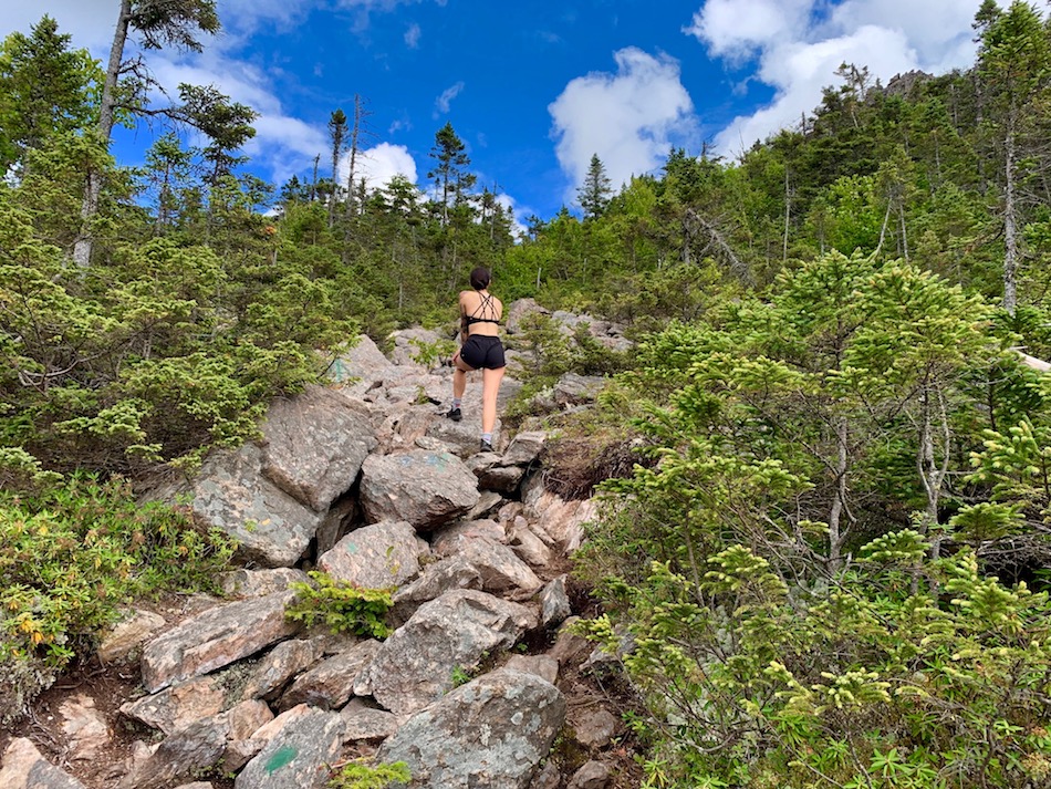
Climbing toward the peak is the most challenging part of this hike, but is by no means overly dangerous. Regular safety measures like three points of contact helped to get us up over the larger steps on the rocky trail.
This was my (Arthur’s) favourite part of the hike as it was the most challenging (and got us to our amazing view).
Coming from our trail, we reached the first peak and stopped to take in the incredible view. On this particular day, the rain clouds were circling the mountain, and we could see pockets of rain in a 360° panorama. Looking backward, we saw that we were still a short hike away from the very top of the mountain and the highest peak of the Maritimes.

Though we had gotten to see the view (and got to take the pictures for this blog!), we had to get to the peak to say we did it. After a short and rocky hike, we climbed the extra height and reached our goal.
At the very top of the mountain, there is an old fire watchtower. This small tower provides shelter from the wind and rain and gives hikers a roofed area to relax and recharge before moving on with their trek.
At this point, the rain and wind had begun upon us. This cooled us down but also got us back on the path toward the parking lot.
The rest of the trail was very similar to the rest of the wooded terrain, the obvious difference being that we were then descending.
Once completed, we drove back through the entrance gates and back to where we were staying. Mission accomplished!
Hiking Up The Mount Sagamook Trail
The Mount Sagamook Trail offers a steeper incline, a higher climb, and a longer, more challenging hike to the Carleton Peak.
The parking lot of Mount Sagamook Trail is about 280 metres above sea level. This is 140 metres below the starting point of Mount Carleton Trail.
Hiking from the parking lot to the peak of Mount Sagamook means swiftly ascending nearly 500 metres (1640 ft) over about 3 km (1.86 mi) total. Once you reach the peak of Mount Sagamook, it’s about a 5 km (3.10 mi) hike to get to Mount Carleton, with only 43 metres (141 ft) of net ascension (though the trail dips about 100 metres (328 ft) from Sagamook’s peak on the way).
For your information, here are the peak heights of the three highest summits in the Sagamook/Head Trail:
- Mount Sagamook: 777 m (2,549 ft)
- Mount Head: 792 m (2,589ft)
- Mount Carleton: 820 m (2,690 ft)
Hiking up the Mount Sagamook Trail to the peak of Mount Sagamook is quite a bit more difficult than hiking the Carleton Trail to the peak of Mount Carleton.
The most noticeable differences are the incline, rockier terrain, and lack of tree coverage.
For some steeper parts of the hike, zig-zagging is required to avoid climbing high shelves. There are also many instances where climbing, rather than hiking, is needed to continue on the trail.
Although the distance is less, Sagamook’s ascent makes it a much more challenging hike.
Once at the peak of Mount Sagamook, we enter the Mount Head trail, which is relatively flat. This trail is heavily wooded and provides a much less intense 4.7 km (2.9 mi) hike to the peak of Mount Carleton.
Midway through this hike, there is a short break-off trail that brings hikers to the peak of Mount Head, the second-highest peak in the park. This gives hikers the opportunity for another lookoff point and another accomplishment in their hiking experience.
Upon reaching Mount Carleton, the tree coverage once again dissipates, and the terrain turns very rocky. The hike gets a bit more difficult (about the same difficulty as the Sagamook ascent, though much shorter). This marks the end of the Mount Head Trail and brings us to the peak of Mount Carleton with the same watchtower mentioned before.
At this point, I’ve always turned around and gone back the same way I’ve come in. However, it’s common with larger groups to have a second vehicle parked at the other end of the mountain and continue hiking down Mount Carleton Trail.
In my experience, the descent of the Sagamook Trail is the most difficult part. This is mostly due to the accumulated stress on my knees. This stress announces itself as pain when taking larger downward steps.
That being said, the sense of accomplishment always outweighs the relatively mild stress on the joints!
Checklists And Recommended Gear
Click the highlighted items to view the prices of our recommended gear.
HIKING GEAR
- Hiking shoes – Women’s // Men’s
- Cascade hiking poles
- Water bottle
- Atlantick tick removal tool kit
- Poncho or rain jacket
- Lamp/Headlight
- Sunscreen
- Sun hat
- Camera
- Insect repellent
SLEEP AND SHELTER
- Tent
- Tarp
- Sleeping bag
- Sleeping pad
- Pillow
- Rope
SAFETY GEAR
- Emergency first aid kit
- Whistle
- Watch
- Knife or multi-tool
- Bear spray in a holster
- Repair kit for the tent
- A trip plan left with a friend or family member in case of emergency
KITCHEN ESSENTIALS
- Single-burner camping stove
- Fuel for stove
- Pot
- Aeropress coffee press
- Food
- Cutlery
- Lighter, matches, fire starters
- Water filter or purification tablets
- Dry bag for hanging food at night
PERSONAL ITEMS
- Socks (extra in case of rain)
- Hiking clothes
- Warmer attire for the evenings
- Ecofriendly hygiene products
- Wilderness wipes
- Toothbrush and toothpaste
- Phone or emergency communication device
- Feminine hygiene items
- Quick-dry towel
- Hand sanitizer
- Ecofriendly body soap
Related Hikes
MULTI-LOOP AND OVERNIGHT HIKES
- Cape Chignecto Coastal Trail (Nova Scotia, Canada)
- Crowbar Lake (Nova Scotia, Canada)
- The Bluff Wilderness Trail, (Nova Scotia, Canada)