Cape Chignecto Coastal Trail: A Complete Hiking Guide
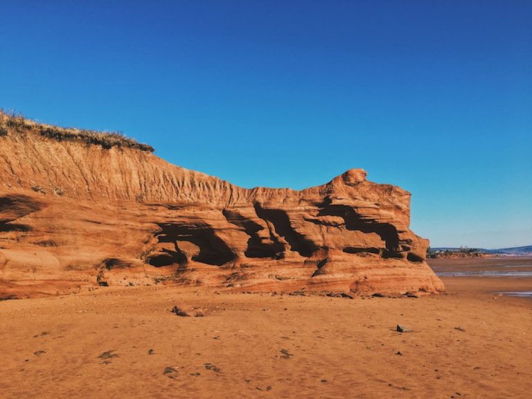
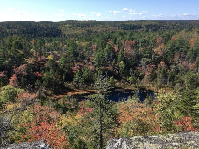
The Cape Chignecto Coastal Trail is located in the largest provincial park in Nova Scotia, Cape Chignecto National Park. It is a challenging 52-kilometre loop along the coastline of the Bay of Fundy, which features the world’s highest tides, with the cliffs reaching 180m (600 feet) high. The Cape Chignecto Coastal hike is one of the few multi-day backpacking trails in Nova Scotia, Canada (and one of the most rewarding)!
In addition, the Cape Chignecto National Park features eight trails, with the longest (and most difficult) being the Cape Chignecto Coastal Trail.
Difficulty: Difficult
Length: 52 km (loop)
Suggested Duration: 2-4 days
Signage: Signage and markers throughout the trail
Facilities: Large parking lot, vault washrooms and drinking water stations along the trail
Disclaimer: This article includes affiliate links. If you click one of them, we may receive a small percentage of the sale at no extra cost to you. Thank you for your support!
Cape Chignecto Trails
- Red Rocks Trail
- Christie Viewpoint Trail
- Fundy Viewpoint Trail
- McGahey Brook Canyon Trail
- Mill Brook Canyon Trail
- Eatonville Trail
- Refugee Cove Trail
- Cape Chignecto Coastal Trail
Key Features Of The Cape Chignecto Coastal Trail
- A challenging and remote multi-day hiking trail
- Along the Bay of Fundy – The highest tides in the world
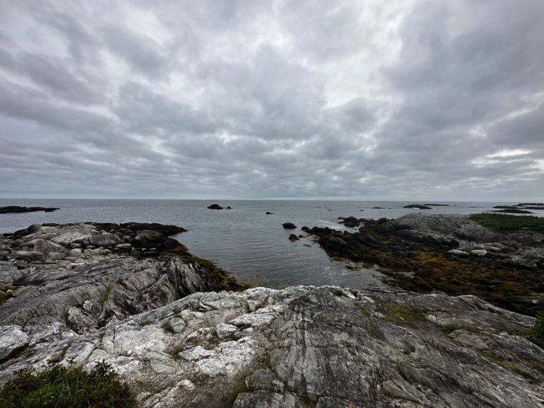
- Offers breathtaking coastal views and diverse landscapes
- Accessible by reservation through Nova Scotia Parks
- Beach access points throughout trails
- Lookoff points throughout
- Backcountry campsites and cabins
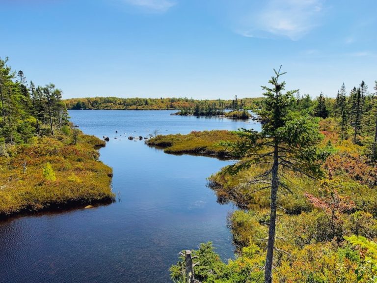
- Rivers throughout the trail and near each campsite
- Abundant wildlife and birdwatching opportunities along the trail
- Accessibility Trail – Eatonville location only
Facilities And Services
- Backcountry hiking sites
- 8 Walk-in campsites
- 3 Cabins
- 1 Bunkhouse (Eatonville Location)
- 5 Drinking-water sites
- Backcountry kayaking sites
- Beach Access (unsupervised)
- Vault toilets
Before You Start Hiking Cape Chignecto Coastal Trail
Months of Operation
May – October
Hours Of Operation
Office hours 8:30 am-8:30 pm (subject to change)
Getting there
1108 West Advocate Road, West Advocate, Nova Scotia
Contact
T: 902-392-2085
E: parkinfo@novascotia.ca
Cape Chignecto Coastal Trail is a demanding 52 km coastal and backcountry trail, camping, and kayaking experience. It is recommended to take at least three days to complete the entire loop. However, it can be completed in fewer or more days. It is important to know your capabilities and prepare for the weather, as it can change the terrain and the trail’s difficulty.
The majority of the hike is in the backcountry. If the weather is poor, this can wash out the trail leaving it muddy and messy to hike through. Be prepared for any terrain and weather. Supportive and water-resistant hiking boots are highly recommended.
There are a few options for your overnight stay. Hikers can either tent or rent out a cabin (or bunkhouse near Eatonville). The cabins do book up quite quickly. We suggest booking early if you choose to go with this option. Cabins cannot be booked on arrival and need to be booked in advance.
For the camping option, hikers will need to register with the front office and inform them of the campsites they intend to stay at. This helps keep track of where hikers are throughout the loop in case of an emergency while also helping to avoid overcrowding at each campsite.
At any point during your hike, you can call to change your campsite. Depending on the weather and your speed, you may need to stop sooner than planned, or perhaps you made it further along the trail before nightfall. Please note that the cell signal is spotty in the area, and you may lose service.
Depending on the type of overnight camping experience (tenting vs. cabin), you should consider the weight of your gear before hiking. The loop drops from sea level to 600 feet quickly and frequently. The weight of your gear will greatly change the difficulty of this hike. Opting for lightweight tents and gear will help reduce the amount of weight you will have to carry.
To help ease the weight and reduce tension on your knees, hiking poles are strongly encouraged! If you are on the fence about using hiking poles, check out our article Are Trekking Poles Worth Using, to gain more insight into how hiking poles could benefit you.
It is also important to be aware of the tide times if you intend on exploring or hiking along the seafloor, as they rise quickly and change daily. In case of emergency or if you get caught during rising tides, remain calm and call 911.
Although we did not encounter any large wildlife (e.g. bears) on the Cape Chignecto trail, we were warned of a black bear sighting at Refugee Cove a few days prior. Make sure to pack bear spray and keep it accessible at all times during your hike. In addition, tie your food in a tree away from where you are tenting to avoid drawing wildlife to your camp.
Lastly, leave no trace behind. Please pack out what you pack in, and do not leave garbage or food at the camps or on the trails.
For more information on wildlife safety, check out our article Wildlife Safety While Hiking In Atlantic Canada.
Our Experience Hiking The Cape Chignecto Coastal Trail
- Day 1: Red Rocks To Refugee Cove.
- Day 2: Refugee Cove To Eatonville.
- Day 3: Eatonville To Red Rocks.
Day 1: Red Rocks To Refugee Cove
Upon arrival, you will have to pay the $40 per person (as of July 2019) fee to hike the Cape Chignecto Coastal Trail and camping access. After that, you can decide if you would rather stay in a tent or a cabin. The cabins can be reserved before arrival to ensure that there is one available.
Once you register, you will get to decide the route direction of your hike. Here, you will have the option of hiking the coastal side first or the back forest. For hikers staying in tents, you will also have to decide which campsites you want to stay at throughout your hike and get a site number for each location.
This can be changed at any time by calling the front desk and letting them know where you would like to tent. Depending on the day, weather, and physical abilities, you may want to continue hiking or rest earlier. Keeping track of your overnight location is a safety measure. In case of an emergency, the front office will know where to locate hikers.
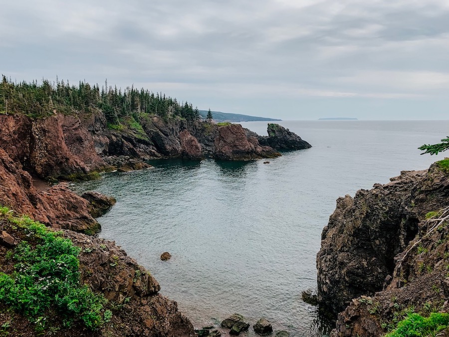
We decided to begin our hike, going clockwise on the loop. This portion of the trail is known for being the coastal side with more climatic views and challenging inclines and declines. The front office informed us that the coastal side was the most difficult part of this hike.
We did pass many hikers who went counter-clockwise to save the best view for the last day of their hike. Although this was a desirable option for us, we figured we would start with the most challenging part, especially since this was our first multi-day hike!
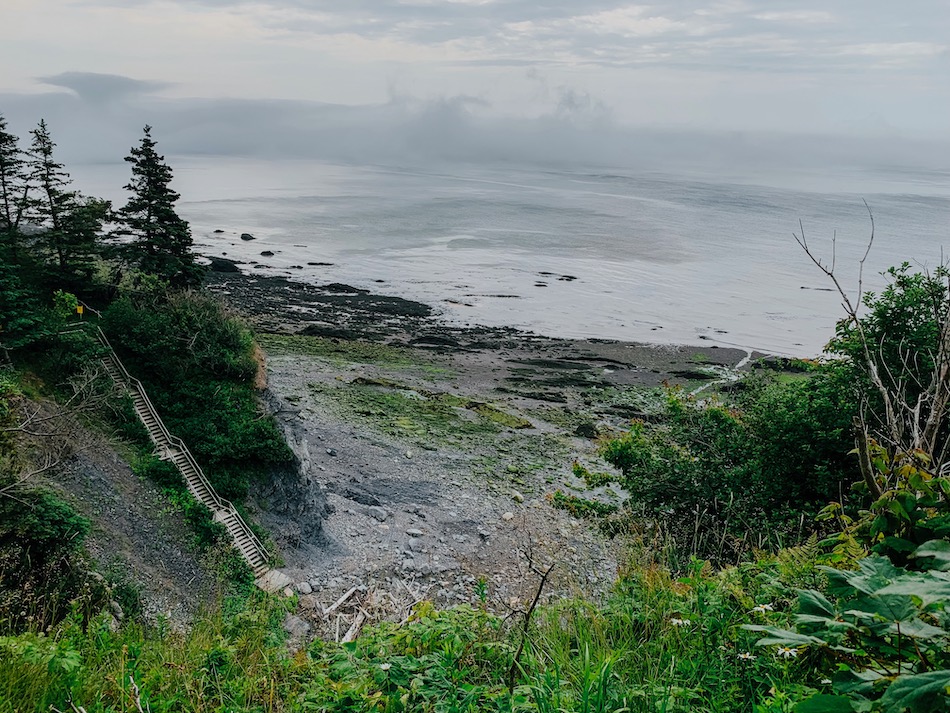
We were so excited on the first day that we almost did not mind the extra 30-60 pounds of gear on each of our backs. We started the hike at 11 a.m. at the Visitors Centre and decided to take the beach access path over the initial first hill in the forest trail.
The beach trail is entirely optional. This trail takes off around 1-2km from your hike and has a beautiful view of the ocean. At the end of the beach trail, there is a small waterfall and a staircase that takes you back up to the forest trail, where we began to hike the front country portion of the trail.
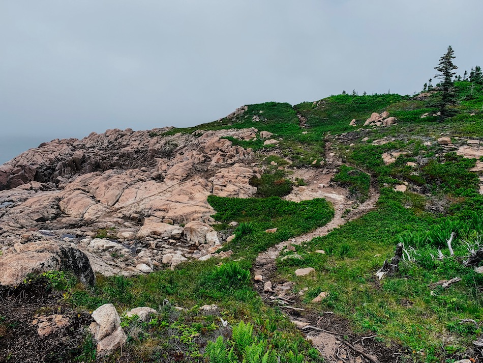
The Cape Chignecto loop is quite easy to follow as there are orange markers placed on trees, logs, etc., to help hikers keep on the right trail. There are a few areas where the trail splits off, and the orange markers are quite useful.
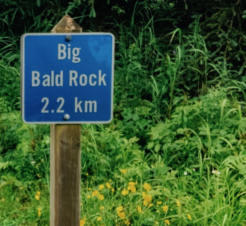
Along with markers, there are also signs placed throughout the trail to indicate where the cabins are located and distinguish how far away the next location is.
About an hour into our hike, we got caught in a torrential downpour that quickly shifted into a thunderstorm. We did not get too many photos from this point on as we were trying to get to Refugee Cove as quickly as possible.
While the rain could have been viewed as a setback, for us, this was liberating and made the hike that much more exciting. We told each other, “Well, this can’t get worse, so we may as well enjoy it”! Completely soaked, with wet gear, feet, and rain dripping in our eyes, we kept our spirits high and movements quick.
Getting from Mill Brook to Refugee Cove was the most challenging part of our day. Had the weather been better, this portion of the hike would not have been that bad.
The rain washed out the trail, leaving us with a difficult and steep 1km decline that had turned into a slippery, muddy hill with water rushing down it that was almost as strong as a river current. We had to be extremely careful during this part, as the slightest slip could have caused us to fall down the entire hill.
The best part about the thunderstorm is that the rain kept the bugs away while the air on our wet skin kept us cool.
When we finally arrived at Refugee Cove, we were surprised to see how groomed the campsites were. Our spot was located right beside the river, and the rain eased up just enough for us to set up our tarp and tent for the evening. While we wanted to cover more ground during the first day, the thunderstorm had us cutting our first day of hiking shorter than expected. But, we regret nothing.
Terrain And Views
Since we opted to take the beach trail on our first day, we had a lovely view of the ocean and seafloor. Since this was the first time carrying gear on a multi-day hike, we had time to adjust our gear and get comfortable before the hike.
An hour into the hike, the storm began. The sky had darkened, and we started to lose sight of our surroundings. The only thing we focused on was our feet and where we were stepping to avoid slipping.
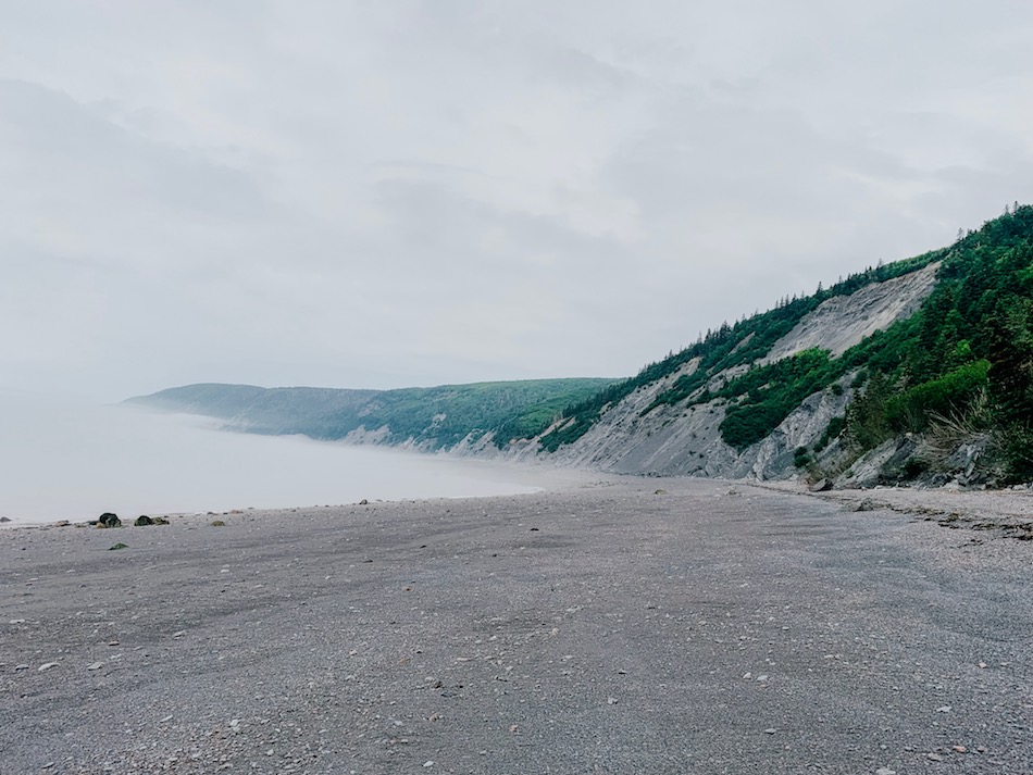
The beach was a good way to ease ourselves into the hike and a much-needed warmup for the hills to come, especially after having driven around three hours from Halifax to Advocate Harbour.
At the end of the beach is the 65-step staircase. Once you get past the staircase, it turns into a groomed front country trail until around Arch Gulch, where the backcountry trails begin for the rest of the loop.

There are many lookouts on this trail, and we tried to see as many as possible. However, the approaching storm cast a large sheer of fog over the ocean, hindering some of the views.
There are a few steep hills on the trail from Red Rocks to Refugee Cove, with the worst being Mill Brook, a 1km steep hill. For us, this was a muddy and slippery decline, and we were glad to get it out of the way on the first day.
For those hiking the trail counter-clockwise, keep in mind you will have to do this 1km hill on an incline.
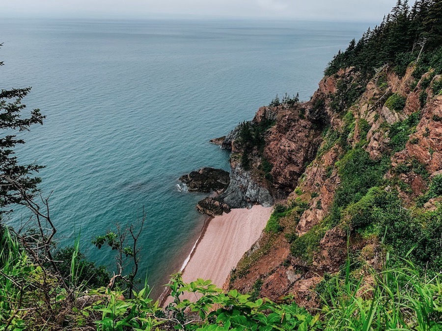
Right before reaching Refugee Cove, there is a breathtaking beach access point that leads into a cove. Had the rain let up, we would have spent more time here (and captured some photos). If you have time, we highly recommend spending some time on this beach, weather permitting.
Tenting At Refugee Cove
Refugee Cove is a well-groomed and maintained campsite. It contains 11 campsites, and there is one vault toilet nearby.
Our camping spot was flooded when we arrived, so we decided to camp in an ungroomed spot right beside it. Our assigned campsite did not have many sturdy trees nearby to hang our tarp. Luckily for us, the alternative spot we set up our tent had many large trees to help shield us from the rainfall.
While our campsite was beautiful and right beside the river, our sleep was not the greatest. The sound of the rushing river was relaxing. However, we underestimated how cold it would be sleeping along the riverside.
Since Nova Scotia was going through a heatwave, we assumed that it would be warmer throughout our hike. We decided to skip on our thick sleeping bags to save space. This was a bad idea. Despite bringing two smaller blankets, we were frozen during the evenings.
Overall, the air outside was not that cold. It was the breeze off the river and the ground that kept us shivering all night. At that moment, we wished we had brought sleeping bags. All in all, it all made for part of a fun adventure (and a good learning lesson: never skip the sleeping bags)!
Day 2: Refugee Cove To Eatonville
Barely having any sleep, we decided we would rise early with the sun and make some coffee to fuel the long day ahead. Sleeping next to the river does have some perks. We did not have to go far to filter our water for our morning coffee and hike. The water filter we brought with us was the perfect size for this type of hike and is fairly easy to use. If you are looking for an affordable and easy-to-use water filter that takes up little to no space in your pack, we highly recommend the Katadyn Befree water filter.
We brought with us a single-burner camper stove that is fuelled by twigs, bark, and wood with a match or lighter. This seemed like a great idea at first. However, we did not anticipate how the rain would affect this. Trying to use damp twigs was difficult. Luckily, we had packed some fire starters just in case!

We were told that it was going to rain again on Tuesday, so we decided we would try to cover as much ground as possible. Our goal was to hike 25 kilometres to Eatonville before nightfall.
The day’s hike started with one of the many steep climbs (about 600 ft) we would face that day. We moved slowly up this incline, warming up as we made it to one of the higher plateaus of the trail.
The morning part of the hike featured many ferns and other luscious greens that grew on either side of the trail. The rain from the day before remained on the plants, and we would not dry until later that day.
At intervals, there would be opportunities for lookoff points. With the dense fog still over the ocean, we couldn’t see the horizon. However, the views of the cliffs and beachfront were certainly worth stopping for.
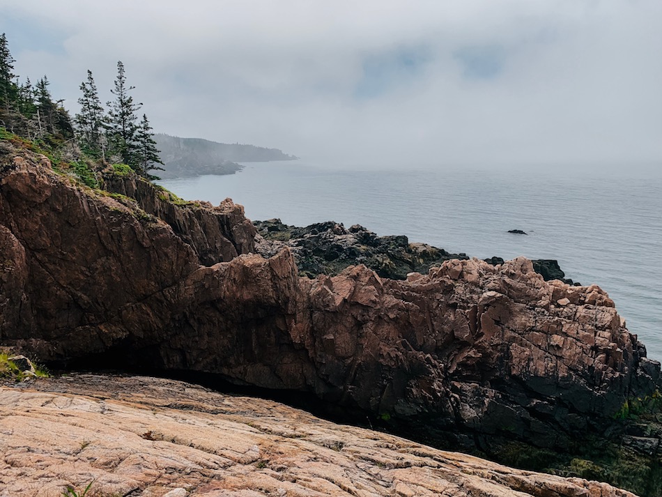
Toward noon, the sun began shining, the trail became wider, and we started drying off. At the same time, we reached the actual Cape Chignecto cape and caught our first clear glimpse of the Bay of Fundy without fog. It was a nice break and certainly a trip highlight.
The heavy rain from the previous day had really taken its toll on the trail near Cape Chigneto, making it extremely muddy. The muddiness of the trail was intermittent from just before Cape Chignecto to just after Green Point.
The swampiness of the trail made for slower hiking as we tried our best to walk around it rather than through it. We were not alone in our slowing down. Hiking poles would have made maneuvering around the puddles and finding supportive steps much easier.
The hike along the park’s eastern coast was challenging due to the mud and the many inclines and declines of the trail. A major motivation was knowing the inclines lead to breathtaking lookoff points while the declines lead to brooks, where we could cool down and filter water to stay hydrated.
After a quick food and coffee break at Big Bald Rock, we really started trekking. If we were to make it to Eatonville by nightfall, we had to pick up the pace.
Past Seal Cove, the slopes got gentler and further apart, which was a great way to end our longest day of hiking. After nearly 12 hours of hiking, we completed the big stretch and found ourselves in Eatonville!
Terrain And Views
This was the most beautiful part of the hike, with mixed terrains and breathtaking lookoff points. Because it was sunny, we were able to enjoy the hike and its scenery more.
Quite a few brooks lead high up on the cliffs, creating mini-waterfalls before reaching the ocean. These waterfalls were a nice extra visual on top of the already stunning high cliffs, beach, and ocean.
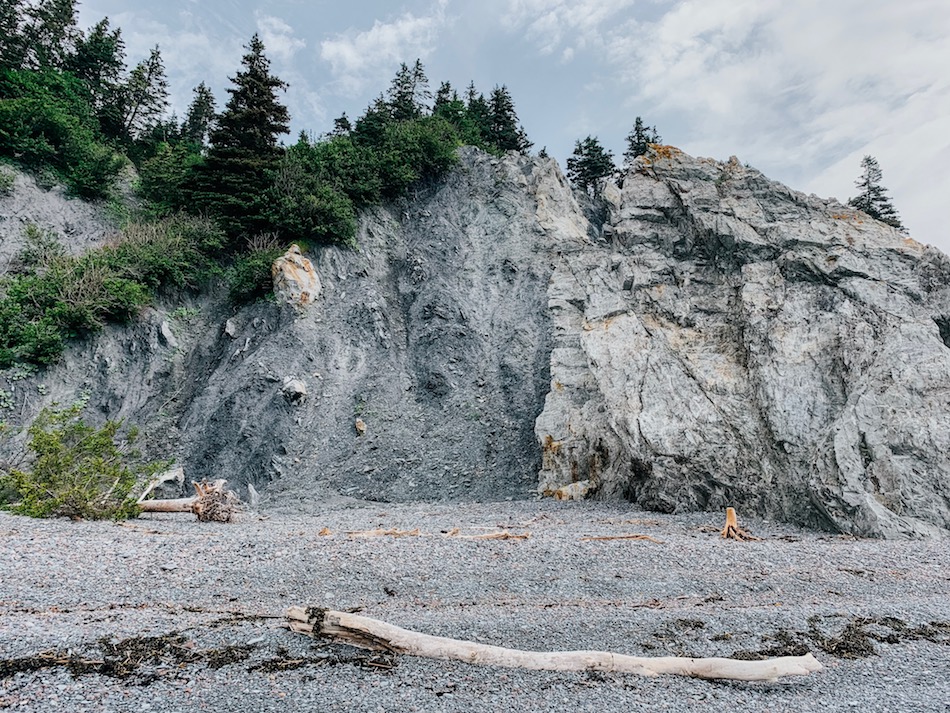
Near Cape Chignecto, there was an opportunity to hike off the large granite boulders that are a staple of Nova Scotian coastal hikes. We decided to stick to the regular terrain to keep things easier on our knees.
On this sunny day, we saw all of the wildlife we would see on the trip. We saw a few snakes, rabbits, plenty of birds, toads, and even an owl toward sunset during our Saturday portion of the hike.
The terrain in this portion of the hike was nearly all backcountry. There were a few manmade planks and bridges past Seal Cove, but before then, it was all-natural.
The mud and frequent inclines and declines made this part of the hike very difficult, but the nice weather and challenge made for an excellent day!

Tenting At Eatonville
Eatonville is a well-groomed yet smaller campsite compared to Refugee Cove.
There are not many trees surrounding the campsites, and we found it quite open. You can also see the parking lot close by from most of the campsites, as Eatonville is also home to a smaller day hike. This campsite also features two well-maintained portable washrooms.
The two most significant issues we had with this campsite were: lack of trees and mosquitoes.
Now, I know what you are thinking. Why was the lack of trees an issue?
Before starting our hike, we were told it would rain on Tuesday to prepare ourselves for rain when we arrived at Eatonville on Monday evening. We knew we had to set up our tarp before falling asleep to prevent our tent from flooding overnight. Unfortunately, upon arrival, we found we had little to tie our tarp to.
Due to the lack of trees near our campsite, we decided to drape our tarp directly over our tent for the evening (some rain protection was better than none). Unsure if this was going to work or not, we took the gamble. Draping the tarp over our tent turned out to be the best decision we could have made.
Not only did the tarp keep us dry, but it also acted as an insulator for our tent, keeping out the cold air from the river. The ground was still cold. However, it created a refreshing temperature since we no longer felt the chilling river breeze. Honestly, we were surprised to actually sleep that evening after having such a poor night’s sleep at Refugee Cove.
The second issue (and probably the biggest problem we had) was the mosquitoes.
The mosquitoes and black flies were quite bad over the entire trail, yet somehow became worse once we reached Eatonville. Not even bug spray kept them off of us. We spent most of our time inside our tent trying to avoid them. We started to joke about Eatonville actually being “Eaton-alive-ville.” I am sure it’s not that bad all the time. This was likely due to the time of year and the heavy rainfall the day before.
Day 3: Eatonville To Red Rocks
After a surprisingly decent sleep, we decided to wake up around 530 a.m. to try and beat the anticipated rainfall. While we were hoping to wake up and brew some coffee before our last day, we opted to skip it as the bugs were quite invasive.
We rushed to take our tent down to hit the trails early. But, to our luck, not even our quick movement from Eatonville back to the visitors center could keep them off of us. We barely stopped moving until we finally finished the last 14 km+ of the hike.
Around 1-2km outside of Eatonville, you will approach a bunkhouse. From the bunkhouse, there are two pathways you can take: the road or the trail. We heard about the road trail from some other hikers on day two and became curious about it. The Eatonville to Visitors Center backend trail is through the woods, and from what we heard, it is slightly underwhelming compared to the coastal line portion of the trail.
Because of this, we decided to hike the road back to the visitor center so we could see what all this talk was about. Now, it is important to note that this is not a paved hiking trail. In fact, it is a service road.
There are quite a few hills on this road. If you think taking the road is the easy way out, it is not. It offers a slight challenge as the terrain is not flat, and you are in the direct sun the entire time as there is no tree coverage. Looking back, we wish we had followed the main trail as it would have been much more enjoyable (there is always next time)!
They were doing some maintenance on the road during the first 5km, leaving the pathway full of tree branches and saw residue. In the last 10km, there was more of a straightforward, dirt road-style hike.

The last 1-2km of the road trail will take you to the main West Advocate Harbour road. This is the same road that you will drive up when you arrive to start your hike. Follow the nicely paved road until you reach the Cape Chignecto parking lot.
When we finally reached our car in the parking lot, we were ecstatic. Despite being covered in itchy bug bites and wet gear, we were beyond happy that we completed the entire hike in less than 48 hours (and before the rainfall started)!
Terrain And Views
Since we took the service road over the forest trail, we cannot comment on what the original trail terrain is like.
Based on the coastal trail and what we had heard, we assumed that it was surrounded by woods with a slightly washed-out trail due to the rain from the previous days. The road was uneventful, and had we known that prior, we would have taken the forest trail.
If you take the service road (which we advise not to, as it is not eventful), make sure you fill up on water before leaving Eatonville, as you will not be able to fill up your bottles until you arrive back at the Visitors Centre.
Checklist And Recommended Gear
Here is our recommended checklist for those taking on the entire Cape Chignecto Coastal Trail. If you are staying in a cabin rather than tenting, you can skip most of the gear listed.
HIKING GEAR
- Hiking shoes – Women’s // Men’s
- Cascade hiking poles
- Water bottle
- Atlantick Tick Removal Tool Kit
- Emergency poncho
- Rain jacket
- Lamp/Headlight
- Sunscreen
- Sun hat
- Camera
- Insect repellent
SLEEP AND SHELTER
- Tent
- Tarp
- Sleeping bag
- Sleeping pad
- Pillow
- Rope
SAFETY GEAR
- Emergency first aid kit
- Whistle
- Watch
- Knife or multi-tool
- Bear spray in a holster
- Repair kit for the tent
- A trip plan left with a friend or family member in case of emergency
KITCHEN ESSENTIALS
- Single-burner camping stove
- Fuel for stove
- Pot
- Aeropress Coffee Press
- Food
- Cutlery
- Lighter, matches, fire starters
- Water filter or purification tablets
- Dry bag for hanging food at night
PERSONAL ITEMS
- Socks (extra in case of rain)
- Hiking clothes
- Warmer attire for the evenings
- Ecofriendly hygiene products
- Wilderness wipes
- Toothbrush and toothpaste
- Phone or emergency communication device
- Feminine hygiene items
- Quick-dry towel
- Hand sanitizer
- Ecofriendly body soap
Related Hike
Overnight Hikes In Nova Scotia
Along The Bay Of Fundy
- Medford Beach (Nova Scotia, Canada)
- Cape Split (Nova Scotia, Canada)
- Five Islands Provincial Park (Nova Scotia, Canada)