The Top 11 Must-Do Hikes In Colorado, USA
Colorado is an intensely popular vacation destination for hikers, and rightfully so. The variety of trails offers routes for all fitness levels and beginners and expert hikers alike. There are countless well-marked trails, and many feature rewarding views and impressive biodiversity.
The vast number of varying landscapes can take you through forests and meadows and along lakes and creeks, all in one day. No matter what season, there are always stunning Colorado hikes to enjoy and fascinating wildlife to observe.
In this best-of article, you will find a broad selection of amazing Colorado hikes sorted in ascending order of difficulty. Whether you want to spend a nice day with your family and are looking for a trail to take your kids along, or you want a challenge, Colorado has trails for everyone.
Perkin’s Central Garden Loop
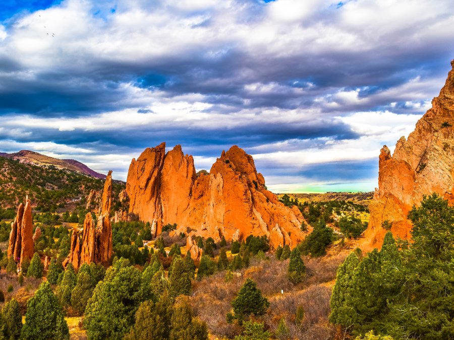
Garden of the Gods – Colorado Springs
Distance: 1.8 km // 1.1 mile (roundtrip)
Time: 30 minutes to 1 hour
Difficulty: Beginner
Dogs: Allowed on leash
With its well-maintained trails and paved paths, the Garden of the Gods park is accessible for wheelchairs and strollers, making it a great place for beginner hikers or spending a day out with the whole family. This trail is always superb for beginner and casual hikers and can be walked in sneakers rather than hiking boots (though we always encourage wearing supportive footwear)!
Access to the park is free and there even is a free shuttle from Colorado Springs. Due to its accessibility and breathtaking views, the park is quite popular, but there are enough trails to escape the crowds if that is what you want.
The inner loop is a must-see because, on a comparatively short route, it leads you past the park’s most stunning views and offers a great diversity of landscapes on just one trail.
You will start on the Perkin’s Central Garden Trail, and during your hike, you can either stay on that trail or make the decision to take a detour via the less accessible Sleeping Giant Trail: a dirt trail that will lead you to the base of the Sleeping Giant rock formation. This trail is not paved, and there are some steps, so it should rather be avoided by people in wheelchairs or pushing strollers.
A hike on the inner loop of the Garden of the Gods will offer you a view of the Kissing Camels rock formation, as well as Sentinel Rock, Three Graces, and South Gateway Rock. Of course, you can hike through additional trails inside the park to make your own adventure and increase the length and difficulty of this hiking excursion as you please.
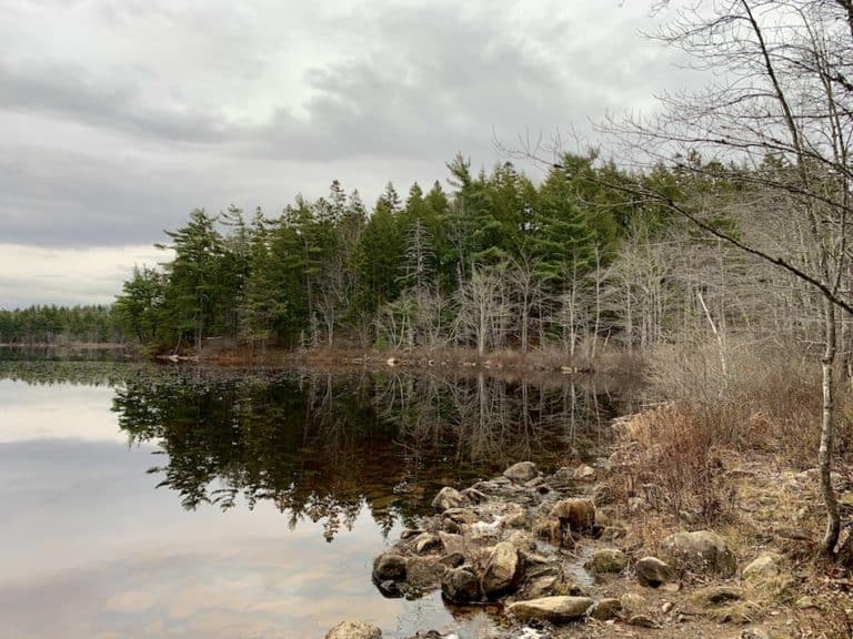
Emerald Lake Trail
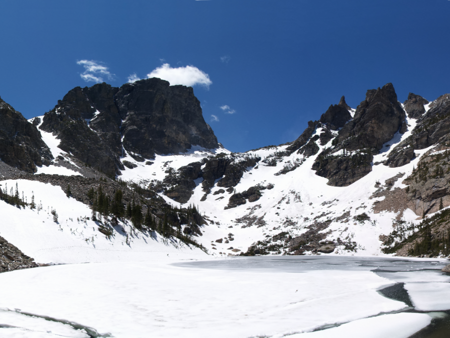
Rocky Mountain National Park
Distance: 5.3 km // 3.3 miles (roundtrip)
Time: 2 to 3 hours
Difficulty: Beginner to intermediate
Dogs: No dogs allowed
This trail can be accessed in the Rocky Mountain National Park, about an hour outside of Boulder. You will need either a park pass or to pay a fee to enter.
The route leads through spectacular scenery and past beautiful views, making it a truly beloved trail for locals and travellers alike. This also means that this trail can be overly busy at times, so it is best to arrive early, outside of the holiday season, or during a weekday if you can manage.
You will traverse pine and aspen forests on this trail and come across several breathtaking bodies of water. Start your journey at the Bear Lake trailhead and begin hiking on Dream Lake Trail, which will take you past Nymph Lake, Tyndall Gorge, and Tyndall Creek.
When you arrive at Dream Lake, you can take a well-deserved breath and admire the reflection of Hallett Peak and Flattop Mountain in the calm water. Your destination, Emerald Lake, is located just over 10,000 feet, and you will able to see snow on the top of the mountains even in summer.
If you do not feel like going the whole way, Bear Lake and Dream Lake are also wonderful locations to spend an afternoon with a picnic and a good book. This makes this trail an excellent choice when you want to have the ability to spontaneously decide whether you are up for a longer or shorter hike.
Matthews Winters Lollipop
Matthews Winters Park
Distance: 8.2 km // 5.1 miles (roundtrip)
Difficulty: Beginner to intermediate
Dogs: Allowed on leash
Located just 15 miles from Denver, this is a perfect location for a hike close to the big city. While you will still be able to hear some traffic noises on the trail, the views and the climb are still worth it, either as a short day hike or even as an after-work workout.
This trail is actually a combination of multiple shorter trails within Matthews Winters Park. The hike begins as an easy stroll on the flat and wide Village Walk Trail. There is a more challenging section with loose switchbacks and rocky stairs on the Morrison Slide Trail, making for a challenging ascent and descent, but the views from the top are a worthy reward.
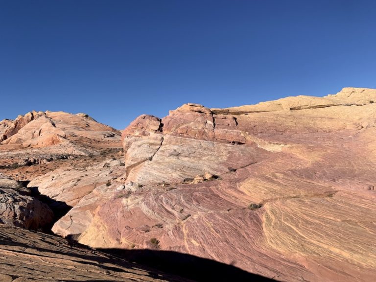
You can enjoy views of the distinctive Red Rocks on this trail, which present a stunning contrast between the red rock and green hillside. Just about midway through the hike, you will also get to see a view of Denver in the distance.
If you are interested in animal sightings, this trail also holds possibilities. You might get to see deer or coyotes, and if you are walking in dawn or dusk, keep an eye out for mountain lions. If you undertake this hike in the warm months, you need to beware of rattlesnakes.
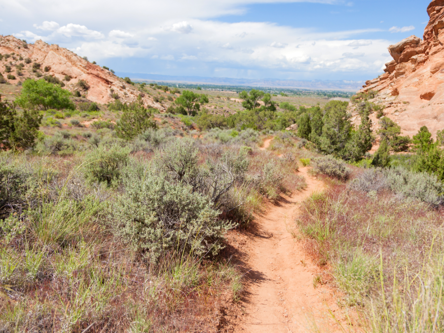
Sharkstooth Pass Trail
La Plata Mountains
Distance: 4.8 km // 3 miles (roundtrip)
Time: 2.5 to 4 hours
Difficulty: Intermediate
Dogs: Allowed on leash
The La Plata Mountains are usually accessed from the small town of Mancos in southern Colorado. You can drive up to the trailhead by heading north from Mancos on Country Road 42, which turns into Forest Road 561. From there on, you first follow the signs to Transfer Camp Ground and then Sharkstooth Trailhead.
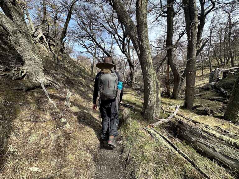
This trail takes you up to 12,000 feet (from about 11,000 feet) along a chain of mountain peaks, passing beautiful streams, vistas, and wildflowers. There are sections of moderate and steep climbing, especially in the rocky territory above the mountain range. Short and sweet, this hike will reward hikers with impressive views like the red and white stripes of Hesperus Mountain, a sacred Navajo mountain.
Lost Man Trail
Aspen
Distance: 14 km // 8.9 mile (roundtrip)
Time: 3 – 5 hours
Difficulty: Intermediate to difficult
Dogs: Allowed on leash
This trail begins at a bend in the road just off Highway 82. At the entrance to the trailhead, you will find a map and all the information about wilderness rules and regulations you need. Keep in mind that the road to the trailhead closes in the winter months, usually in late October, and opens up again in May.
A hike on this trail takes you through a rocky area full of glacial rock debris as well as beautiful wildflower meadows, and you will get to enjoy the views of surrounding mountain ranges and the calm surface of Independence Lake until you arrive at the impressive dark blue waters of Lost Man Lake.
Up to Independence Lake, this trail only goes uphill, but it is not too steep, and there is no climbing involved. Independence Lake itself is a beloved destination for anglers.
The whole hike takes place above the treeline. Aside from the occasional bushes, this means there will be no protection from the sun, so make sure to wear sunscreen and, ideally, long sleeves.
We recommend bringing a water filtration system with you as this is a longer hike in direct sunlight. There are a few streams along the trail that provide an ample amount of water.
Lastly, this hike is an out-and-back hike and can be shortened at any point if you wish to turn around.
Bridal Veil Falls
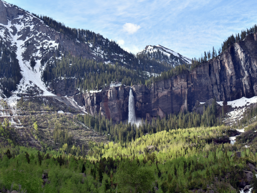
Telluride
Distance: 7.7 km // 4.8 miles (roundtrip)
Time: 1.5 to 3 hours
Difficulty: Intermediate
Dogs: Allowed on leash
This trail takes you through the Bridal Veil Basin and, past stunning views of the Telluride Valley, brings you close to the spectacular Bridal Veil Falls. At 365 feet tall, Bridal Veil Falls is the tallest free-falling falls in Colorado.
The trail covers a 2000 ft elevation range but is not steep. You can expect easy switchbacks along the trail all the way to the top.
Vehicles and mountain bikers frequent this area, and that you’ll be sharing the path with drivers. Being such an amazing sight, the falls are quite popular and busy throughout the day. If you are looking to avoid the crowd (and car traffic), we suggest hiking in the early mornings.
It is always good to check whether the trail is accessible before you go there; there may be seasonal closure due to avalanche danger.
Mount Sniktau Trail
Dillon
Distance: 6.4 km // 4 miles (roundtrip)
Time: 1.5 to 3 hours
Difficulty: Difficult
Dogs: Allowed on leash
While this popular trail is not overly long, it poses a superb challenge from start to finish. It begins with steep inclines that continue on all the way to the peak. The trail is well-defined and quite broad. Climbing or trail finding is not necessary, and the trail is well-used in any weather.
Due to its elevation, there might be some snow even in summer. Since you will be quite exposed when on the ridge, make sure to have packed warm layers no matter the weather. In the winter months, we recommend bringing crampons for extra traction.
On the mountain ridge, you can enjoy the scenery without trees blocking your view. The trail offers breathtaking views of the Rocky Mountains and the ski areas of the Loveland Pass. If you get lucky, you might catch a glimpse of small mountain animals like marmots or pikas.
Mount Bierstadt Trail
Mount Evans Wilderness
Distance: 11.4 km // 7.1 miles (roundtrip)
Time: 4.5 to 5.5 hours
Difficulty: Difficult
Dogs: Allowed on leash
Mount Bierstadt is a popular hike in Colorado, famous for its fourteeners, the 14,000 feet summits. While many hikers take on this hike for their first 14ers, it is not a beginner hike.
The West Slopes Route is the easiest and most popular way to arrive at the summit, meaning it is also one of the most popular routes and can become a bit crowded.
The trail takes you through various landscapes, from the willow trees at the beginning to swampland and mountain peaks later on. It is recommended to keep to the trails to avoid damaging the ample vegetation. There are possibilities for sightings of moose or mountain goats. You might also see some marmots.
If you’re interested in trekking this trail in the winter, expect heavy snow and bring microspikes/crampons and thermal layers with you. Additionally, finding the trail under the snow is not always easy, so there are opportunities to hire guides.
The last mile of this hike is just a steep incline, and the summit ridge gets very windy, which will have you arrive at the summit panting and sweating, but the panoramic views are more than worth the effort.
Grays and Torreys Peaks
Georgetown in the Roosevelt National Forest
Distance: 13.4 km // 8.3 miles (roundtrip)
Time: 7 to 8 hours
Difficulty: Intermediate to difficult
Dogs: Allowed on leash
Situated on the Continental Divide, these two fourteeners are connected by a saddle and are, therefore, commonly hiked together. Of course, you can stop after Grays if you do not feel like going the whole way.
It is recommended to start early to avoid the afternoon thunderstorms, which are common above the treeline. Make sure to pack enough food and water and do not forget sunscreen, and wear extra layers.
On the rocky slopes, there is some climbing involved. Other than that, the trail is well-maintained, and you will hike many switchbacks.
Hiking this trail in the winter months will add an extra level of difficulty. It is important to bring proper winter gear such as traction equipment and hiking poles.
Hanging Lake
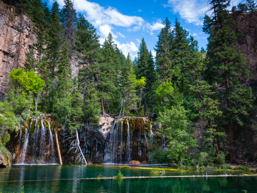
Near Glenwood Springs
Distance: 1.9 km // 1.2 miles
Time: 2 to 4 hours
Difficulty: Difficult
Dogs: No dogs allowed
This is a short but difficult hike through rocky terrain. The beautiful views and plant life along the route and the destination are more than worth the hard work. Hanging Lake is surrounded by a backdrop of waterfalls and provides a stunning spot for taking a rest.
Since the Hanging Lake route is a very popular trail through a sensitive ecosystem, you need to pay for reserving a spot on the trail and apply for a permit to access the lake itself.
Make sure to bring proper provisions and take breaks whenever you need them. There are several rest stops along the way. Unless you have the proper equipment and are experienced in winter hikes, this is not a route to hike in winter.
If you choose to hike in the winter, we highly recommend bringing crampons, a pair of snowshoes and hiking poles.
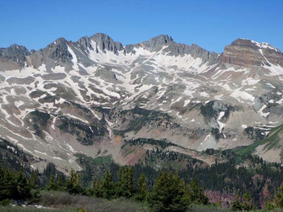
Lizard Head Peak
San Juan National Forest
Distance: 12.2 km – 18.8 km // 7.6 miles (out and back) or 11.7 miles (loop)
Time: 3.5 to 6 hours
Difficulty: Difficult
Dogs: Allowed on leash
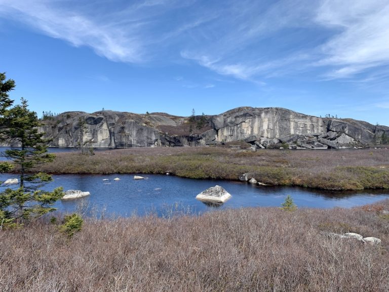
Lizard Head Trail starts at the top of Lizard Head Pass. It begins relatively flat and leads through beautiful dense forests and meadows full of wildflowers, and you can enjoy impressive views of the San Juan Mountains and the profile of the Wilson Massif.
The peak itself is known as Colorado’s hardest summit to reach. It is on top of a 400-foot vertical tower, an extinct volcanic pipe that requires 5.8-graded climbing.
There are two different trail options to reach Lizard Head. Hikers can either complete an in-and-out trail or the full loop. If you take the loop trail, be careful of the last 4 miles, as this is a dangerous place to be during a thunderstorm. Due to the difficulty of this hike, we highly recommend bringing hiking poles.
If that is not for you, you can walk around Lizard Head on any of the gentler trails the wilderness area has to offer and admire the views and wildlife.