Top 11 Must-Do Hikes In Alberta, Canada
The western Canadian province of Alberta is home to some of the most beautiful hikes in the country, many of which take hikers through the awe-inspiring Rocky Mountains. Expect picturesque mountains, turquoise glacial lakes, and abundant wildlife. Dress appropriately for the season, read up on wildlife safety for the region, and get ready for the greatest hikes Alberta has to offer!
Although there are plenty of superb hikes in Alberta, we’ve narrowed down what we believe to be the top 11 must-do hikes in the province. Whether you live in this part of the world or you’re only just visiting, these hikes are worth taking the time to experience.
The top 11 must-do hikes in Alberta, Canada are:
Note that over half the hikes mentioned are part of the Banff National Park, Canada’s first national park and the flagship of the nation’s park system. It offers more than 6,000 square kilometres of wilderness to explore and is home to 6 of the above 11 hikes.
To visit Banff National Park, you will have to purchase a National Park Pass. Passes can be purchased online, at the park’s gate, or one of the visitors center in Banff or Lake Louise.
Tunnel Mountain Trail
Banff National Park
Distance: 4.5 km (out and back)
Time: 1 – 2.5 hours
Difficulty: Moderate
Tunnel Mountain Trail is a short hike up Banff’s smallest summit (Tunnel Mountain’s peak is at 1,692 m with a prominence of 305 m). The trail is well-maintained and groomed, making it suitable for families and hikers of all experience levels.
The trail features steep switchbacks along the side of the mountain that goes through the forest and eventually leads to the summit. From the top, various lookout points will give you views of the Bow and Spray Rivers, Banff Springs Gold Course, and a panorama of the town of Banff.
This is a popular and busy trail that is open all year round. If you choose to hike Tunnel Mountain in the winter months, we recommend to bring crampons. It is also a great spot for snowshoeing during the winter.
Ptarmigan Cirque
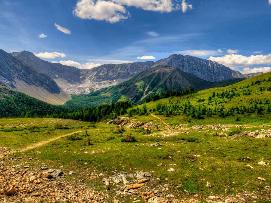
Peter Lougheed Provincial Park
Distance: 4.2 km (loop)
Time: 1 – 2.5 hours
Difficulty: Moderate
Ptarmigan Cirque loop trail is a short, family-friendly hike. The toughest incline is within the first kilometre. Past that, you will be rewarded with an easier terrain featuring alpine meadows, mountains, and a few small waterfalls.
The alpine meadows are fragile. Hikers should say on the trail to prevent further damage to the environment.
At the top of the Ptarmigan Cirque loop, you will approach a sign that leads hikers off the main trail. Following this direction takes visitors to a scramble up Mt. Rae. If you do not intend on heading up to Mt. Rae, continue to follow the signs to complete the Ptarmigan Cirque loop.
Though the scramble to Mt. Rae is not a part of the Ptarmigan Cirque trail, it’s an excellent hike in its own right. It’s much more difficult than the Ptarmigan Cirque, so be prepared if you choose to add this climb to your hiking itinerary. Mt. Rae has a peak of 3,218 m and a prominence of 1,330 m.
For the winter months, bring proper footwear such as crampons and/or hiking poles to help with icy areas and the ascend and descend.
For more information on hiking poles, feel free to check out our article Are Trekking Poles Worth Using? (Pros, Cons, Types, Tips).
Picklejar Lakes
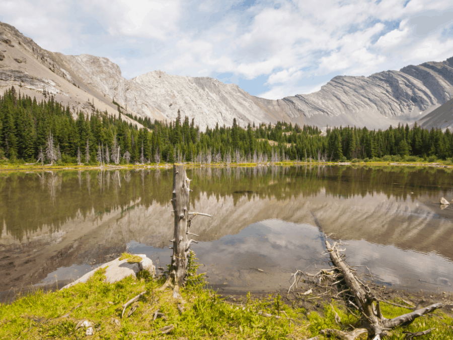
Sheep River Provincial Park
Distance: 11.6 km (out and back)
Time: 4 – 5 hours
Difficulty: Hard
The Picklejar Lakes hike is a popular out-and-back hike in Kananaskis that features four different lakes.
The lakes are not just popular with hikers. Many fly fishers frequent the Picklejar Lakes as the lakes are full of Cutthroat trout. Fishing is by permit only and is catch-and-release. It’s said that Picklejar Lakes got its name because it is as easy to catch trout there as it is to get a pickle out of a pickle jar. So don’t be surprised if you run into a few fishermen as you hike by the lakes.
The trail itself is quite difficult but certainly doable for in-shape, intermediate, and even beginning hikers. There are a few tough inclines that do not have much traction. Take your time, and you’ll get there. It is recommended to bring proper hiking shoes and trekking poles.
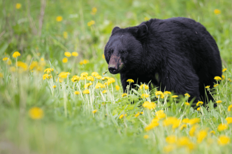
The trail starts pretty steep but levels off along the way. There are a few narrow parts but nothing out of the ordinary. Note that it is grizzly bear country so be sure to carry bear repellent spray with you.
Mist Mountain Springs Trail
Kananaskis Provincial Park
Distance: 6.4 km (out and back)
Time: 3 – 5 hours
Difficulty: Hard
Mist Mountain Springs Trail is a challenging out-and-back hike that leads to two small natural hot springs overlooking breathtaking mountains.
There are a few different routes that will take hikers to the springs and summit of Mist Mountain. The All Trails preferred route is rather steep and challenging. It will take you through scree, which can be quite taxing. If you decide to take this route, come prepared with trekking poles.
The springs are rather small and can only fit around two people in each but are totally worth the climb. Since Mist Mountain Springs has grown in popularity, there is a chance you will have to wait in line to get your time in the hot springs. We suggest going at a less busy time, such as during the weekdays or early mornings.
The hike also exposes you to high winds, especially after you reach the summit. Bring extra layers even if the forecast calls for high temperatures.
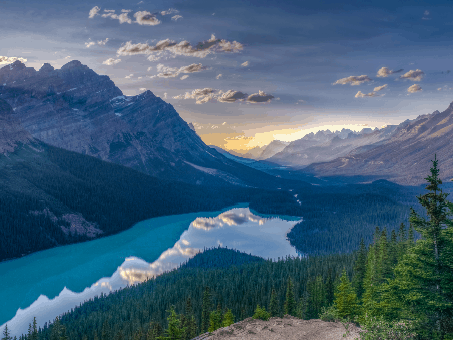
Peyto Lake Panorama
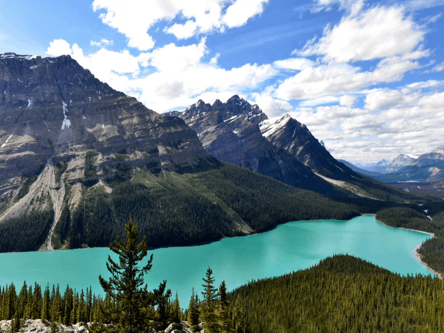
Banff National Park
Distance: 2.7 km (loop)
Time: 20-40 minutes
Difficulty: Easy
Petyo Lake Panorama Trail is one of the best lookouts Alberta has to offer of the Rocky Mountains. The view will leave you speechless as you marvel at the beautiful blue water fed from the Peyto Glacier.
This is an easy trail that all level hikers and families can do during their stay/visit to the beautiful town of Banff. While the hike may be short, the mountains, rich forest, and glacier water are something you do not want to miss out on.
There are two different routes to take for this hike.
The first is the original trail which leads to a wooden platform and offers an incredible view of Petyo Lake. However, this route tends to be full of tourists (for a good reason).
If you want to get away from the crowds, you can venture off to the Upper Petyo Lake viewpoint. This takes you through the forest to an open rock field that gives you an even better (less populated) view of Petyo Lake.
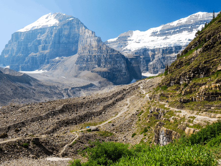
Plain Of The Six Glaciers Trail
Banff National Park
Distance: 14.6 km (out and back)
Time: 5 – 7 hours
Difficulty: Moderate
The first half of the Plain Of The Six Glaciers Trail is relatively easy and flat. The second half is where the elevation really begins.
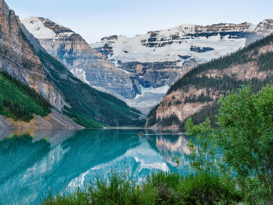
The incline is certainly challenging but entirely doable for beginner and intermediate hikers. Expert hikers shouldn’t have too much of an issue though the hike will definitely get the heart pumping. As you begin to ascend above the treelines, be sure to take a look behind you at Lake Louise and the Fairmont Chateau Hotel.
A little over 5 kilometres into the hike, you will reach the Plain Of The Six Glaciers Tea House. This is a popular spot and tends to get a bit crowded during the spring and summer. Grab a tea and snacks while you admire the beautiful views the Plain of Six Glaciers has to offer.
From here, you can turn around or continue to the Abbots Pass viewpoint. This is only an additional 1.5 kilometres from the Tea House. The trail is more narrow and a bit more challenging but well worth it.
To get back from Abbots Pass, simply retrace yours steps back from where you came from towards Lake Louise.
It is common to spot bears along this trail, especially around Louise Creek. Hikers should carry bear repellent spray and make noise while hiking as safety precautions, especially near the creek.
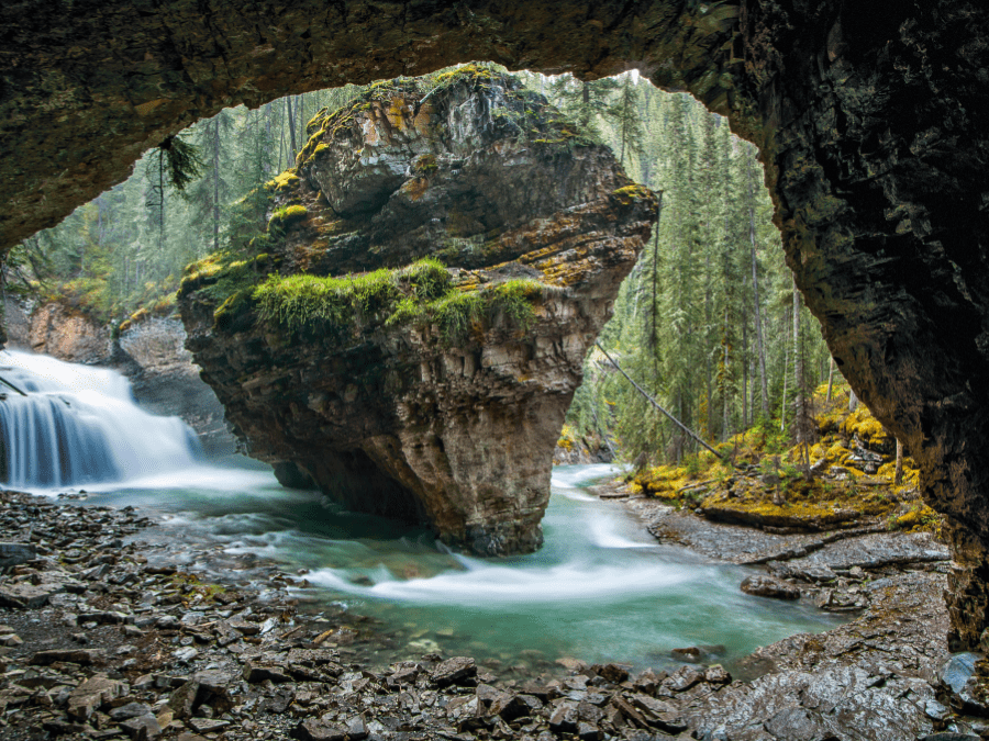
Johnston Canyon Upper And Lower Falls
Banff National Park
Distance: 2.4 km and 5 km (out and back)
Time: 1-2 hours
Difficulty: Easy
Johnston Canyon is one of the most popular hikes in Banff National Park. It actually consists of two different hikes: Johnston Canyon Lower Falls (1.2 km one way) and Johnston Canyon Upper Falls (2.5 km one way).
Both hikes are family-friendly, well-maintained and suitable for hikers of all experience levels. Johnston Canyon is also open all year long.
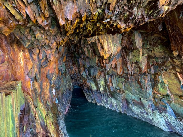
The Lower Falls is the easier of the two as there is minimal difference in elevation. The “trail” is mostly a footbridge, making it wheelchair and stroller-friendly. Both routes will lead to the falls, though the Lower Falls trail will take you through a natural tunnel to get an up-close view.
The Upper Falls takes you through the forest and has a higher elevation. From this trail, you can escape the crowds and venture 3 kilometres to the Ink Pots. The Ink Pots are several bubbling mineral springs that differ in colors based on the different rates at which each pool fills. This is the perfect spot to take a break and enjoy a picnic. Hikers should pack enough water and food for a potential 11 km hike to visit the Ink Pots.
Bald Hills Trail
Jasper National Park
Distance: 15 km (loop)
Time: 3-4.5 hours
Difficulty: Moderate
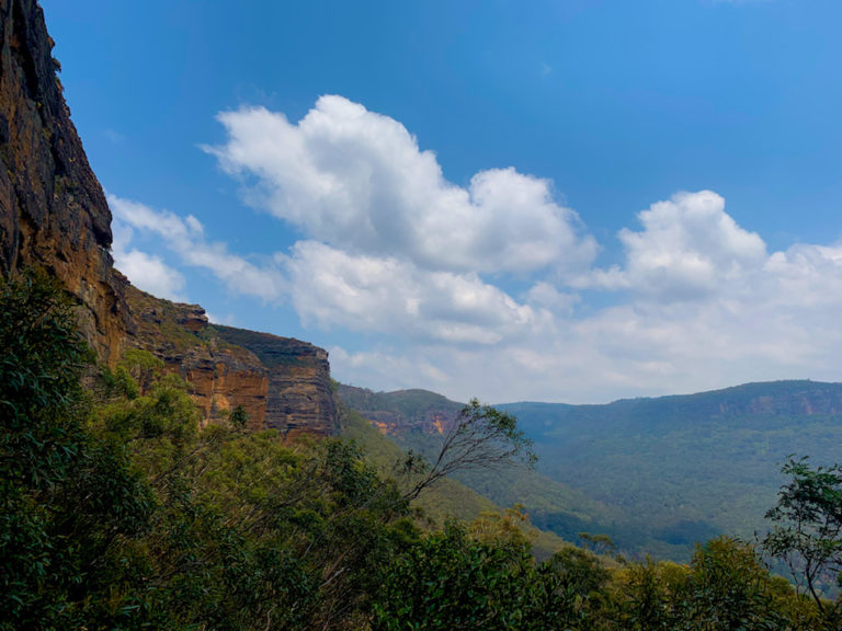
Bald Hills Trail is a steep and rewarding 15-kilometre loop located near Jasper, Alberta. The moderate hike offers the best panorama view of Maligne Lake.
The beginning of the hike is a little underwhelming as trees are covering the majority of the views. However, the view at the summit is well worth the steady ascension.
A few kilometres in, the trail splits into two paths that will eventually reconvene to finish the loop. The trail to the left is much steeper yet shorter in the distance. The trail on the right features a gradual ascent, though it may very well take you longer.
Personally, we prefer steeper inclines for the cardio and more gradual declines to ease the stress on our knees and ankles.
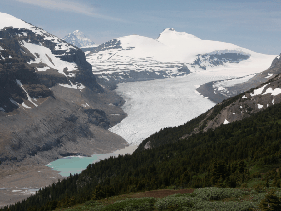
Parker Ridge
Banff National Park
Distance: 5.1 km (out and back)
Time: 1.5-2.5 hours
Difficulty: Moderate
Parker Ridge is a short out-and-back hike that offers remarkable views of the Saskatchewan Glacier.
The trail is relatively short and consists of many switchbacks. The hike will take you through a beautiful forest that opens to some of the most breathtaking views of the glacial valley. The glaciers are fed by the Columbia Icefield, which is the largest icefield in the Rocky Mountains.
From the top of Parker Ridge, you can see some of the highest peaks in Alberta. Some of the notable peaks you will see on the Parker Ridge trail are Mount Athabasca (3,491 m elevation), Hilda Peak (3,058 m), and Nigel Peak (3,211 m).
The best time to hike Parker Ridge is mid-July, as it tends to be covered in snow for most of the year. Hikers should be prepared with crampons, hiking poles, and warm layers as weather conditions may vary.
Ha Ling Trail To Ha Ling Peak
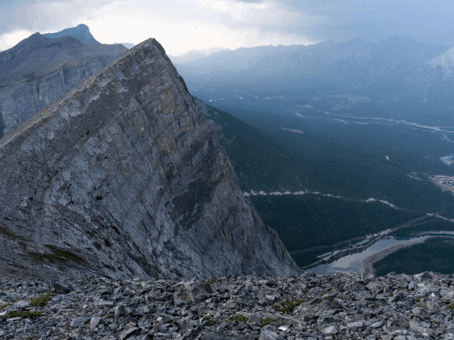
Bow Valley Provincial Park
Distance: 6 km (out and back)
Time: 3 – 4 hours
Difficulty: Hard
Ha Ling Trail to Ha Ling Peak is a challenging hike with a peak that overlooks the town of Canmore.
The majority of the hike is groomed and well-maintained. However, the last 400 meters is unmarked with rough, rocky terrain.
The Ha Ling Trail has gone through some improvements over the year. The terrain is still challenging but now features a slightly new route with a series of stairs.
The summit to Ha Ling Peak is often windy. We advise hikers to pack a jacket, even in the warmer months. We find that hats come in handy to keep the wind out of our ears (earmuffs would work as well).
During the winter months, this trail should only be attempted by experienced hikers. The conditions on the trail can be quite treacherous, and there is an avalanche hazard. Using crampons and trekking poles is highly recommended.
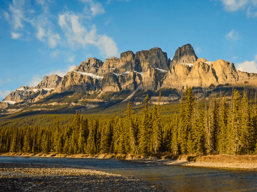
Castle Mountain Lookout Trail
Banff National Park
Distance: 6.4 km (out and back)
Time: 2-3.5 hours
Difficulty: Moderate
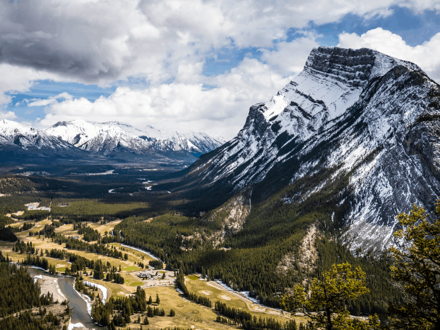
Castle Mountain is an incredible hike in Banff National Park. This trail is one of the first to open in the park each season (sometimes as early as mid-April, depending on the weather). Ideal for both hiking and snowshoeing, Castle Mountain draws in hikers of all levels.
Many folks recognize Castle Mountain from the Trans-Canada highway. It’s common for people to pull over and admire the breathtaking mountain. Be sure to keep an eye out. You will not want to miss that view!
As for the trail, it features a constant steep incline, beautiful wildflowers, picturesque mountains, and breathtaking views of the Bow Valley. It has an elevation gain of 520 metres.