Hiking To Myra Road Falls In Nova Scotia
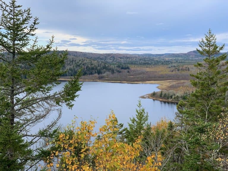
Myra Road Falls is an easy in-and-out hike along ATV trails off Myra Road near Porters Lake, Nova Scotia. The interconnected series of trails will lead to and beyond a narrow waterfall that feeds into Porters Lake.
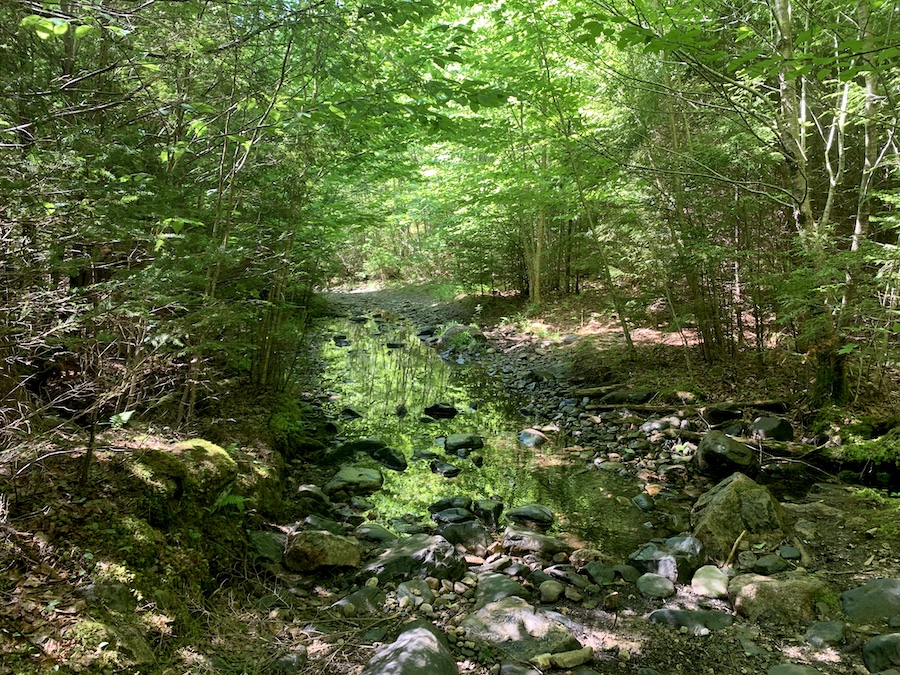
The width of the trails and relatively low gain elevation make this trail an easy hike for all skill levels, while the waterfall itself makes the short walk worthwhile. Much of the trail is along a river and is well-shaded in the summer months, thanks to the forest canopy overhead.
Difficulty: Easy
Length: 3.9 km (out and back)
Suggested Duration: 40 minutes to an hour
Signage: None
Facilities: Parking area
Disclaimer: This article includes affiliate links. If you click one of them, we may receive a small percentage of the sale at no extra cost to you. Thank you for your support!
Key Features Of Myra Road Falls
- An easy-to-hike ATV trail off Myra Road near Porters Lake
- Leads to a waterfall
- Dog friendly
Facilities And Services
- Parking lot
Before You Start Hiking Myra Road Falls
Although Myra Road Falls is a relatively short hike, there are still a few things to note before you begin exploring.
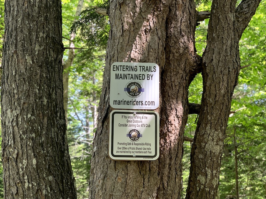
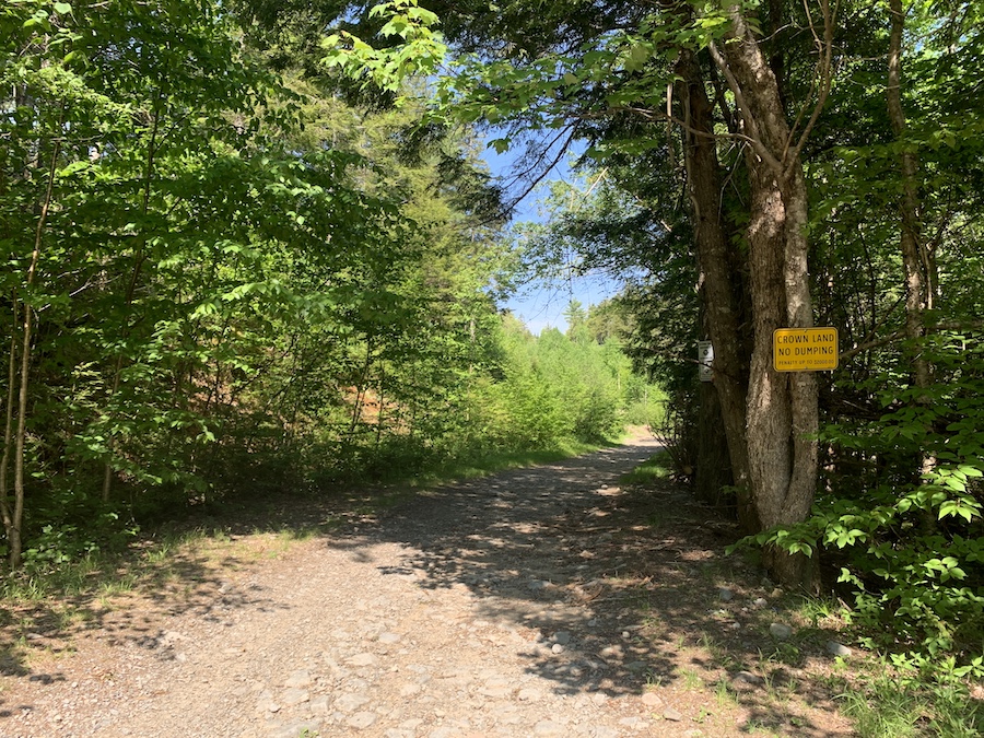
The Myra Road Falls Trail is used as both a hiking and ATV Trail. The Marine Riders ATV Club maintains the area. Be sure to share the trail and keep an eye out for other people who may be using it.
While the trail itself is moderately groomed, there are a few areas with small rocks and twigs, making it not accessible or stroller-friendly. There are also numerous large mud and water puddles along the way. For this reason, we suggest wearing waterproof footwear.
There are no trail markers or signs to point out Myra Falls. Hikers should come prepared with a downloaded offline map, as there is little to no service in the area.
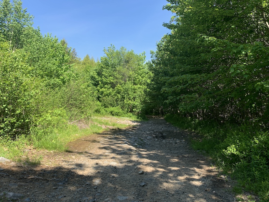
For the most part, the trail is rather straightforward. However, a few points divide into two separate trails. This is where the map comes in handy. If you do not bring a map, stick to the trail on the right-hand side; this is the main hiking trail to Myra Falls.
In addition, always remember to respect the area and leave no trace behind when you are outdoors. There are no garbage cans. Therefore, if you intend to bring snacks with you, opt for a reusable container and ensure you pack all of your garbage with you.
And lastly, make sure to pack insect repellent and a tick removal tool with you. The trail is quite buggy, especially since it is along a brook and has large puddles throughout. Check yourself and your dog (if you bring one) for ticks throughout the hike and upon finishing. Julia had found a tick in her hiking boot after this hike. Emphasizing the importance of doing a hike check before you get into your car. For more information on tick prevention, check out our article How To Avoid Ticks When Hiking.
Our Experience Hiking Myra Road Falls
Our experience hiking Myra Road Falls came during a June heatwave. We decided, on this 30+ºC day, to opt for a hike that covered three criteria:
- The trail would only be a relatively short distance
- There would be moving water nearby
- There would be ample shade
The Myra Road Falls trails hit all three of these characteristics perfectly, and so we made the trip out to Porters Lake.
Upon arrival, near the end of Myra Road, we found a rather large parking area. After finding a shady spot, we parked the car, laced up our hiking boots, sprayed ourselves with insect repellent, and made our way to the trail.
Near the trailhead, as was pictured earlier, we found out that the trails are maintained by the Marine Riders ATV Club. We didn’t happen to cross paths with any ATVs on this particular outing.
Part of the fun for riders (and hikers) is the interconnectedness of the trails in the area. For us, we kept to the most direct path that would lead us to the waterfall we wanted to see. Though cell service was spotty, we kept the All Trails map on our phone to help us avoid any wrong turns.
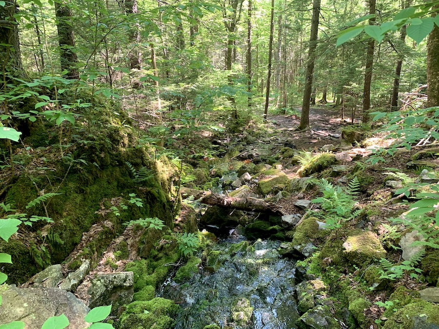
Here is a photo to show one of the split-offs of the trail (take a right at this fork).
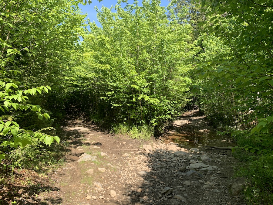
As we walked the trail along the river, the flowing water and shade made the day seem much cooler than expected.
Along with the river’s water, there were also significant portions of the trail that were relatively washed out. Fortunately, side-stepping into the woods made these parts easy to pass. On the negative side of things, the stagnant pools, combined with the heat, made the perfect breeding grounds for mosquitoes. Though we brought relatively effective insect repellent, it didn’t entirely protect us from the many mosquitoes on this day.
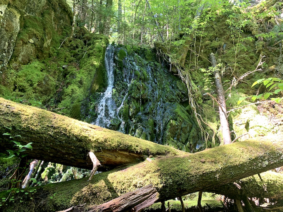
Before long, we made it to the small waterfall. We took a short break to drink water (more than usual since it was particularly hot and humid for the region) and to take photos.
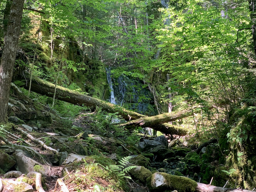
Sure, the waterfall isn’t overly impressive, but this made for a short and sweet adventure into Mother Nature. We quickly made our way back to parking, keeping cool and swatting insects, with another HRM hike to share with you all.
Checklists And Recommended Gear
- Water bottle
- Hiking Shoes – Women’s // Men’s
- Camera/Phone to take photos
- Sunscreen
- Hat
- Insect repellent
- Cascade hiking poles
- Atlantick tick removal tool kit
Related Hikes
NEARBY HIKES
WATERFALLS IN NOVA SCOTIA
- Baxters Harbour Falls & Black Hole Falls (Baxters Harbour, Nova Scotia)
- Liscomb River Trail (Liscomb Mills, Nova Scotia)
- Victoria Park (Truro, Nova Scotia)
- Phantom Falls (Fantum Falls) (Nova Scotia, Canada)
- Johnson River Falls Trail (Fall River, Nova Scotia)
- Dawson Brook Falls (Ellershouse, Nova Scotia)
- Uisge Ban Falls (Cape Breton, Nova Scotia)