Skull Rock Hike, Nova Scotia
The Skull Rock Look-off is a quick in-and-out trail that makes up part of the larger Admiral Lake Loop just off of the Musquodoboit Trailway. It offers hikers a rugged incline to a beautiful look-off point. This trail is a popular option for those wanting a shorter hike that is, at the same time, challenging. But, of course, if you’re up for it, continuing on the loop is well worth it.
Difficulty: Easy to Moderate
Length: 4.2 km (out-and-back)
Suggested Duration: 1-2 hours
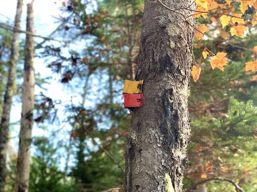
Signage: Maps, signs and yellow markers throughout the trail
Facilities: Large parking lot and vault toilets in the parking lot
Disclaimer: This article includes affiliate links. If you click one of them, we may receive a small percentage of the sale at no extra cost to you. Thank you for your support!
Key Features Of Skull Rock
- Leads to Skull Rock lookout with views of Little Lake
- Located in Musquodoboit Harbour
- Part of the larger Trans Canada Trail network
- Offers opportunities for birdwatching and wildlife sightings
- Dog-friendly (on-leash)
Facilities And Services
- Parking lot
- Benches throughout Musquodoboit Trailway
- Restrooms at the entrance/parking lot
Before You Start Hiking Skull Rock
There are only a few other things we think you should know before making your way up to Skull Rock.
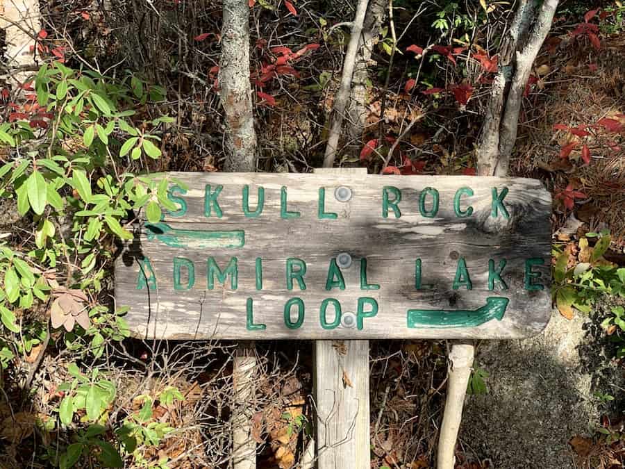
The first thing to note is that the trail to get to Skull Rock is technically part of the Admiral Lake Loop Trail. There’s a cut-away about a kilometre into the trail and signage to point you in the right direction.
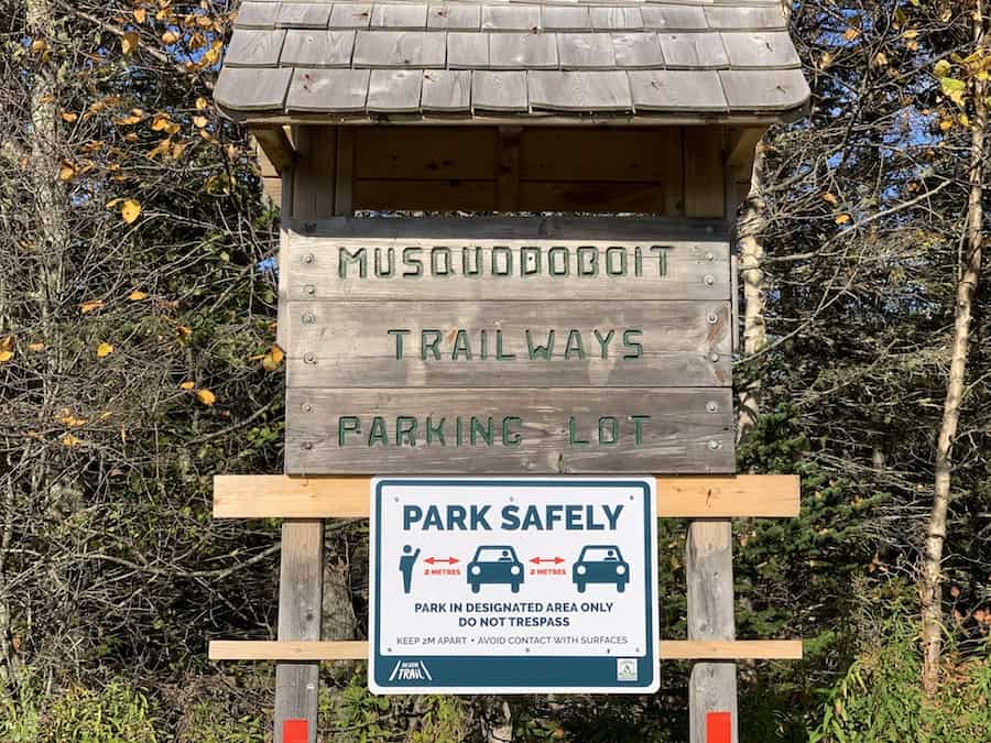
The designated parking lot is the main parking lot for the Musquodoboit Trailway on Park Road. Here’s a picture from the main parking lot:
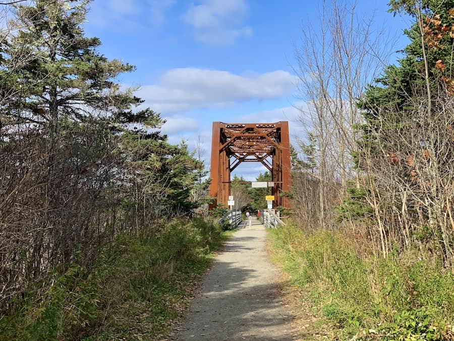
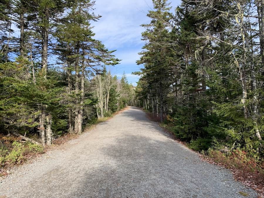
To get to the trailhead, there’s a 1.7 km walk on the main Musquodoboit Trailway. This walking path is flat and well-maintained. It’s a great warmup before the actual hike. It’s important to know that there is a short walk before this short hike. Here are a few pictures from this part of the journey:
The first entrance to the Admiral Lake Loop is the entrance to take to get to Skull Rock in the shortest amount of time. Walk down the Trailway until you reach this map/sign:
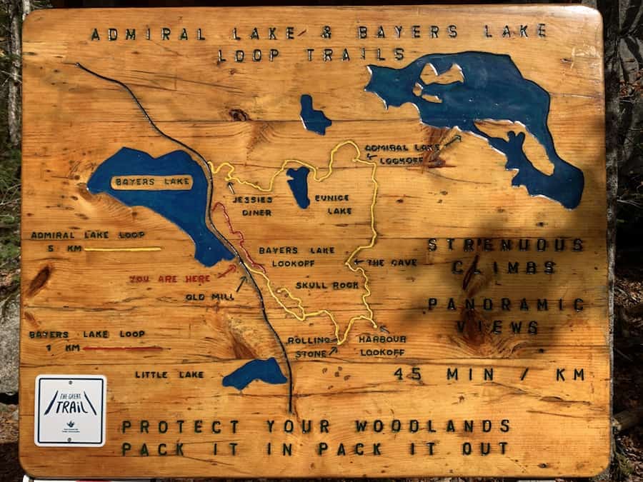
Note that the Skull Rock lookoff is the cutaway in yellow. Follow the yellow markers until you reach the sign that will point you toward the Skull Rock lookoff.
Avoid taking the path onto Bayer Lake Loop and continue on the Admiral Lake Loop until the aforementioned sign.
To learn more about the Bayer Lake Loop and the full Admiral Lake Loop trails, check out the following Hikers’ Movement articles, respectively:
• Hiking Bayer Lake Loop, Musquodoboit Harbour (NS, Canada)
• Hiking Admiral Lake Loop, Musquodoboit Harbour (NS, Canada)
The trail is dog-friendly, though it’s asked that dogs remain on a leash. It’s also important to practice pack-in/pack-out principles to keep the trail clean and free of litter. It helps the environment and makes it a more beautiful hike for everyone.
There’s also signage saying no fires and no camping.
There’s quite a bit of rugged terrain on the trail. We recommend having supportive hiking footwear and hiking poles.
Since you will be hiking through bushy terrain, you should keep an eye out for ticks and carry a tick removal tool.
And that’s pretty well all you need to know before embarking on this short but sweet hike!
Our Experience Hiking Skull Rock
Julia had done this hike before and mentioned it as a quick one with a great view. We did it together for the first time on a mid-October afternoon.
We started our adventure at the main parking lot and quickly made the 1.7 km walk to the trailhead on the main trail. Again, the main Musquodoboit Trailway is flat and well-groomed. It made for a great warm-up.
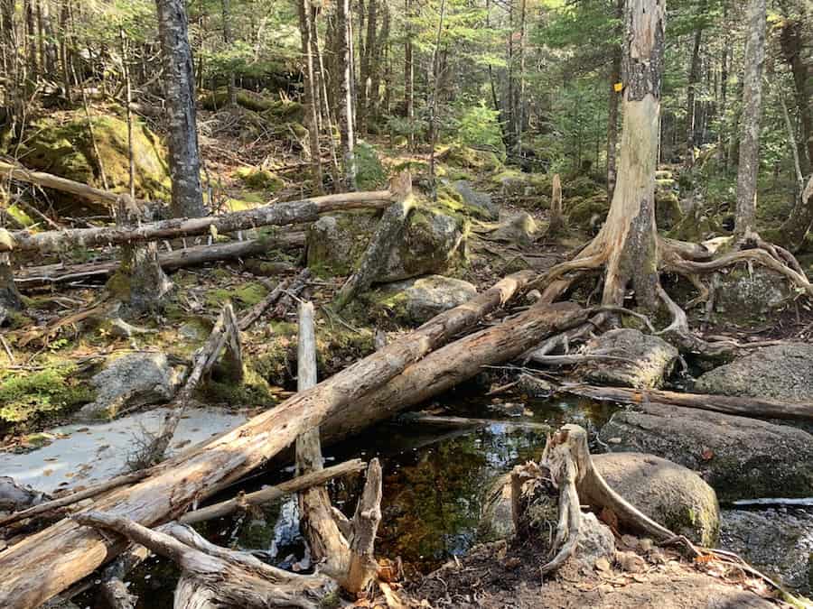
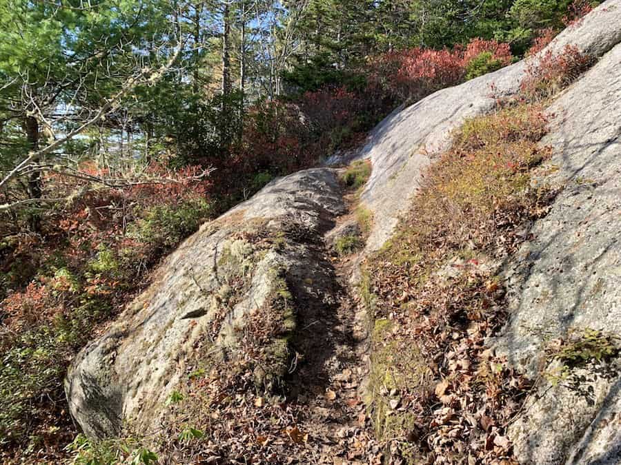
The terrain was surprisingly rugged, given the calm nature of the main trail. Leaves covered the ground, and large boulders were par for the course for much of the incline up to Skull Rock.
The signage was clean and concise, and the markers made it easy to follow the trail whenever there was any confusion about where to go. We made sure to stay on the Admiral Lake Look until we reached the cutoff for Skull Rock.


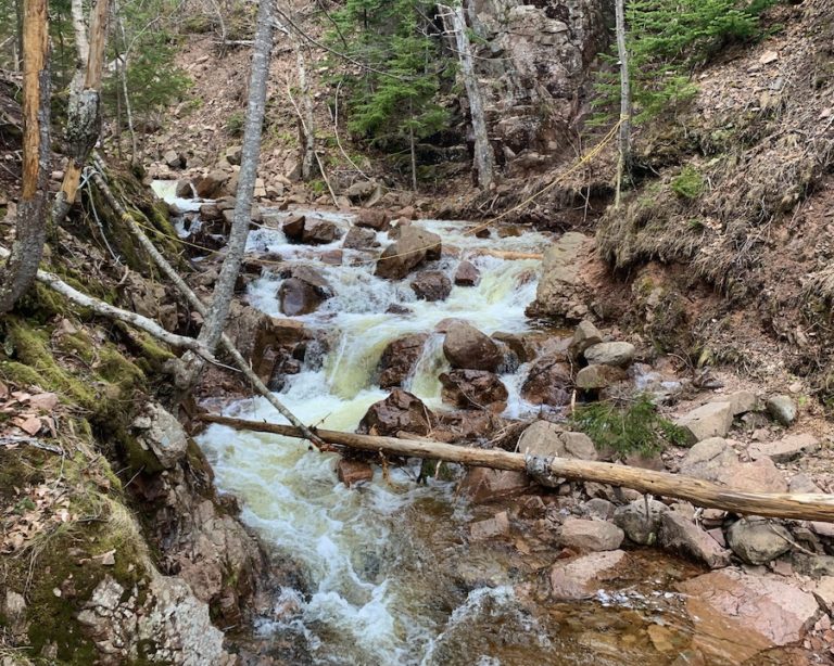
There is a small brook to cross, but there are plenty of options to make it across dry.
About halfway up to Skull Rock, there’s a crossroads. It’s well-marked, as you can see by the sign below:
The ruggedness of the trail made it all that much more enjoyable for us. It’s an extra challenge to be trekking over uneven ground, rocks, and roots. In a short distance, we covered lots of different terrains, keeping things visually and tactically interesting.
We did this hike with waterproof sneakers and had issues with the grip. The smooth rocks and wet leaves made for a slippery combination. That week, we both finally invested in some proper hiking boots (it was about time)!

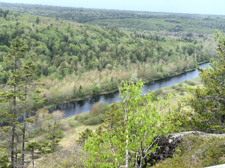
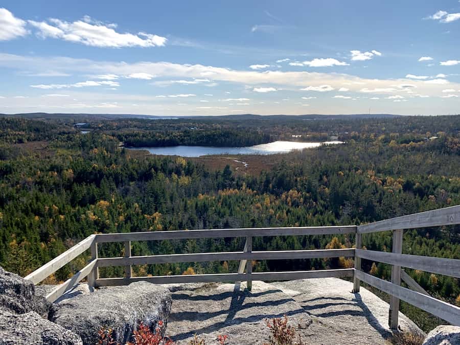
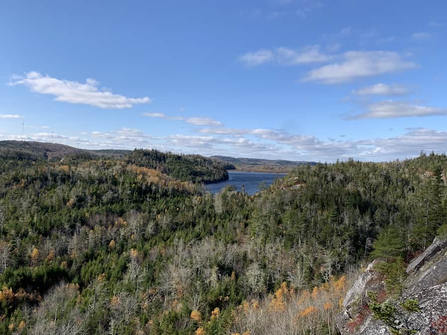
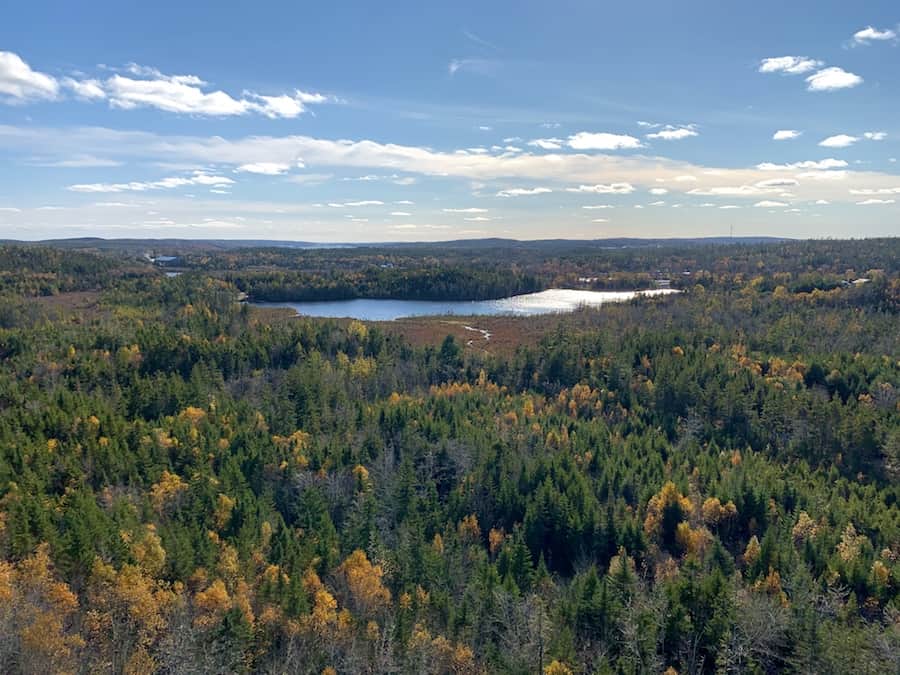
The big payoff came sooner than expected. Again, this is a short hike, but the view is well worth it. Here are a few shots from atop Skull Rock.
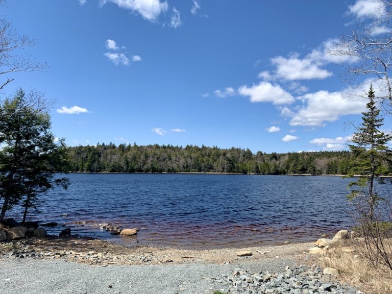
Here is a photo of Bayer Lake:
And here is Little Lake:
On our way back, we considered completing the full Admiral Lake Loop. However, it was about to get dark, and the signage recommended 4 to 5 hours. We instead made our way back down and ended up completing the short Bayer Lake Loop to get our hiking fix for the day.
We made it back to the parking lot and back home just as it was getting dark.
We would come back in the following days to do the entire Admiral Lake Loop during daylight hours!
Checklists And Recommended Gear
The following is our recommended gear list for Skull Rock.
- Water bottle
- Hiking Shoes – Women’s // Men’s
- Camera/Phone to take photos
- Snacks and/or lunch
- Sunscreen
- Hat
- Insect repellent
- Water filter
- Cascade hiking poles
- Atlantick tick removal tool kit